|
Kaédi
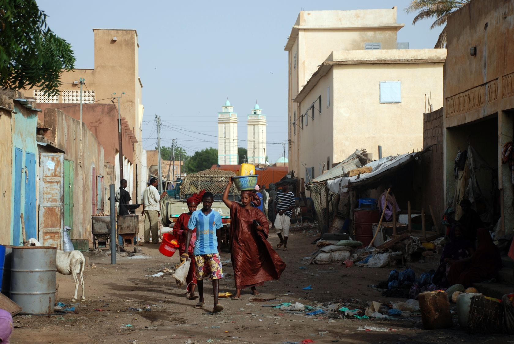
Kaédi ( ar, كيهيدي) is the largest city and administrative center of the Gorgol Region of Southern Mauritania, located on the border with Senegal. It is approximately 435 km from Mauritania's capital, Nouakchott. Overview The city sits within the " Chemama" Riverine zone along the north bank of the River Senegal where it connects with the Gorgol River. This region is one of the few areas of settled agriculture in the country. Culturally, the city is among the most diverse in Mauritania, consisting of ethnic "White Moors" (Arabic: البيضان) and "Black Moors" (Arabic: السودان), as well as Pulaar, and Soninke communities. It is known as a market town, a medical centre, and a centre for local farmers. The market reflects the sub-Saharan culture of neighboring Senegal somewhat more than the Moorish-Arabic culture found further north in the country. Most of the architecture consists of brown, flat-roofed buildings, undistinguished except that most are su ... [...More Info...] [...Related Items...] OR: [Wikipedia] [Google] [Baidu] |
Kaédi Regional Hospital
The Kaedi Regional Hospital is the largest health facility in the Gorgol Region in southern Mauritania, and one known for its innovative architecture. The new hospital (actually a large extension onto an existing concrete structure) involves the use of handfired locally made brick and a design based on a sequence of simple and complex dome structures. The structure was intended to be both to be naturally cool even while letting in significant light from the outdoors. The hospital was designed by :fr:Fabrizio Carola, Fabrizio Carola of ADAUA, the Association for the Development of Traditional African Urbanism and Architecture. ADUA also used the design and construction project to develop and disseminate both a new "urban vernacular" architecture for the region and to train workers in new, low-cost and locally appropriate techniques in construction. Workmen were trained on site in the new techniques The hospital won the Aga Khan Award for Architecture in 1995. Gallery KaediRe ... [...More Info...] [...Related Items...] OR: [Wikipedia] [Google] [Baidu] |
Gorgol Region
Gorgol ( ar, ولاية كركول) is a region in southern Mauritania. Its capital is Kaédi and the Gorgol River forms parts of the landscape. Other major cities/towns include Mbout and Maghama. The region borders the Mauritanian regions of Brakna and Assaba to the north, the Mauritanian region of Guidimaka to the south-east and Senegal to the south-west. The Senegal River runs along the region's border with Senegal. As of 2013, the population of the region was 335,917, compared to 310,656 in 2011. There were 48.23 per cent females and 51.77 per cent males. As of 2008, the activity rate was 48.90 and economic dependency ratio was 1.24. As of 2008, the literacy rate for people aged 15 years and over was 40.50. The location government is headed by an elected district representative, while the elections for the local government are conducted every five years. On account of the political instability, the last elections were held in 2006. Geography Mauritania is mostly covered ... [...More Info...] [...Related Items...] OR: [Wikipedia] [Google] [Baidu] |
Railway Stations In Mauritania
Citizens of Mauritania have various transportation methods. Railways and highways connect major cities in the country. Mauritania is a coastal country so there are many ports along its coast and there are a few big rivers that run through the country. Lastly, there are 26 airports spread out throughout the country. Railways *717 km total of single track (standard gauge), owned and operated by a government mining company, Société Nationale Industrielle et Minière (National Mining and Industrial Company, SNIM). The railway goes from the mines at Zouerat and El Rhein, passes another mine at Fderik, and ends at the port of Nouadhibou/Cansado. *One of the world's longest trains (up to 2.5 km long) runs here, with more than 200 wagons mainly transporting iron ore, and some carriages for passengers; alternatively, people sit on top of the iron piles. There are no rail links with adjacent countries. In 2008, a railway was proposed that would link Nouakchott with Tigu ... [...More Info...] [...Related Items...] OR: [Wikipedia] [Google] [Baidu] |
Transport In Mauritania
Citizens of Mauritania have various transportation methods. Railways and highways connect major cities in the country. Mauritania is a coastal country so there are many ports along its coast and there are a few big rivers that run through the country. Lastly, there are 26 airports spread out throughout the country. Railways *717 km total of single track ( standard gauge), owned and operated by a government mining company, Société Nationale Industrielle et Minière (National Mining and Industrial Company, SNIM). The railway goes from the mines at Zouerat and El Rhein, passes another mine at Fderik, and ends at the port of Nouadhibou/Cansado. *One of the world's longest trains (up to 2.5 km long) runs here, with more than 200 wagons mainly transporting iron ore, and some carriages for passengers; alternatively, people sit on top of the iron piles. There are no rail links with adjacent countries. In 2008, a railway was proposed that would link Nouakchott with T ... [...More Info...] [...Related Items...] OR: [Wikipedia] [Google] [Baidu] |
River Senegal
,french: Fleuve Sénégal) , name_etymology = , image = Senegal River Saint Louis.jpg , image_size = , image_caption = Fishermen on the bank of the Senegal River estuary at the outskirts of Saint-Louis, Senegal , map = Senegalrivermap.png , map_size = , map_caption = Map of the Senegal River drainage basin. , pushpin_map = , pushpin_map_size = , pushpin_map_caption= , subdivision_type1 = Country , subdivision_name1 = Senegal, Mauritania, Mali , subdivision_type2 = , subdivision_name2 = , subdivision_type3 = , subdivision_name3 = , subdivision_type4 = , subdivision_name4 = , subdivision_type5 = , subdivision_name5 = , length = , width_min = , width_avg = , width_max = , depth_min = , depth_avg = , depth_max = , discharge1_location= , discharge1_min = , discharge1_avg = , di ... [...More Info...] [...Related Items...] OR: [Wikipedia] [Google] [Baidu] |
Communes Of Mauritania
There are 216 administrative communes of Mauritania recognised by the Government of Mauritania. Urban Agricultural * Adel Bagrou * Aere Mbar * Aghchorguitt * Ain Ehel Taya * Aioun * Ajar * Aleg * Amourj * Aoueinat Zbel * Aoujeft * Arr * Atar * Azgueilem Tiyab * Bababe * Bagrou * Barkeol * Bassiknou * Bethet Meit * Boghé * Bokkol * Bou Lahrath * Bougadoum * Bouheida * Bouhdida * Boulenoir * Bouly * Boumdeid * Bousteila * Boutilimitt * Cheggar * Chinguitti * Dafor * Daghveg * Dar El Barka * Dionaba * Djeol * Djiguenni * El Ghabra * El Ghaire * Fassala * Foum Gleita * Ghabou * Gouraye * Gueller * Guerou * Hamod * Hassichegar * Jidr-El Mouhguen * Kaédi * Kamour * Kankossa * Keur-Macene * Kobeni * Koumbi Saleh * Lahraj * Legrane * Leouossy * Lexeiba * Maghama * Magta-Lahjar * Male * Mbagne * Mbalal * Mbout * Mederdra * Monguel * Moudjeria * Nbeika * Ndiago * Néma * Niabina * Noual * Ouad Naga * Ouadane * Oualata * Oueid Jrid * O ... [...More Info...] [...Related Items...] OR: [Wikipedia] [Google] [Baidu] |
Regions Of Mauritania
Mauritania is divided into 15 regions: During the Mauritanian occupation of Western Sahara (1975–79), its portion of the territory (roughly corresponding to the lower half of Río de Oro province) was named Tiris al-Gharbiyya. The regions are subdivided into 44 departments; see departments of Mauritania The Regions of Mauritania are subdivided into 44 departments. The departments are listed below, by region: Adrar Region * Atar Department * Chinguetti Department * Oujeft Department * Ouadane Department Assaba Region * Aftout Department ... for more information. See also * ISO 3166-2:MR {{Mauritania topics Mauritania 1 Regions, Mauritania Mauritania, Regions Mauritania geography-related lists Subdivisions of Mauritania * Mauritania ... [...More Info...] [...Related Items...] OR: [Wikipedia] [Google] [Baidu] |
Mauritania
Mauritania (; ar, موريتانيا, ', french: Mauritanie; Berber: ''Agawej'' or ''Cengit''; Pulaar: ''Moritani''; Wolof: ''Gànnaar''; Soninke:), officially the Islamic Republic of Mauritania ( ar, الجمهورية الإسلامية الموريتانية), is a sovereign country in West Africa. It is bordered by the Atlantic Ocean to the west, Western Sahara to the north and northwest, Algeria to the northeast, Mali to the east and southeast, and Senegal to the southwest. Mauritania is the 11th-largest country in Africa and the 28th-largest in the world, and 90% of its territory is situated in the Sahara. Most of its population of 4.4 million lives in the temperate south of the country, with roughly one-third concentrated in the capital and largest city, Nouakchott, located on the Atlantic coast. The country's name derives from the ancient Berber kingdom of Mauretania, located in North Africa within the ancient Maghreb. Berbers occupied what is now Mauritania ... [...More Info...] [...Related Items...] OR: [Wikipedia] [Google] [Baidu] |
Mauritania–Senegal Border
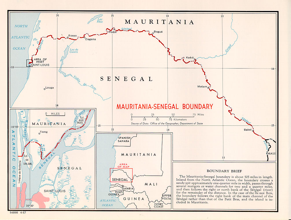
The Mauritania–Senegal border is 742 km (461 m) in length and runs from the Atlantic Ocean in the west along the Senegal River to the tripoint with Mali in the east. Description The border starts in the west at the Atlantic coast and then goes east, crossing the Langue de Barbarie spit, and then veers north, utilising the Marigot de Mambatio, before reaching the Senegal river. The border then follows this river eastwards in a broad arc, terminating at the Mali tripoint at the Senegal/Falémé confluence. History France had begun settling on the coasts of modern Mauritania and Senegal in the 17th-18th centuries, gradually extended their rule further inland as far as modern Mali during the 1850s-80s. As a result of the ‘Scramble for Africa’ in the 1880s, France gained control the upper valley of the Niger River (roughly equivalent to the areas of modern Mali and Niger). France occupied this area in 1900, followed by Mauritania in 1903–04. Mali (then referred to as Fren ... [...More Info...] [...Related Items...] OR: [Wikipedia] [Google] [Baidu] |
Gorgol River
The Gorgol River is a river of southern Mauritania that is a tributary of the Sénégal River. The river is formed by the confluence of the Gorgol Noir (194 km in length), with the Gorgol Blanc (345 km in length). The Gorgol joins the Sénégal River at Kaédi Kaédi ( ar, كيهيدي) is the largest city and administrative center of the Gorgol Region of Southern Mauritania, located on the border with Senegal. It is approximately 435 km from Mauritania's capital, Nouakchott. Overview The city ..... The river basin plays an important in role in Mauritanian economy facilated by investment in the 1970s.Jobin, William R., Negrón-Aponte, Henry and Michelson, Edward H., 1976, , Human Ecology Division, Puerto Rico Nuclear Center, Caparra Heights St ... [...More Info...] [...Related Items...] OR: [Wikipedia] [Google] [Baidu] |
Farmer
A farmer is a person engaged in agriculture, raising living organisms for food or raw materials. The term usually applies to people who do some combination of raising field crops, orchards, vineyards, poultry, or other livestock. A farmer might own the farm land or might work as a laborer on land owned by others. In most developed economies, a "farmer" is usually a farm owner (landowner), while employees of the farm are known as ''farm workers'' (or farmhands). However, in other older definitions a farmer was a person who promotes or improves the growth of plants, land or crops or raises animals (as livestock or fish) by labor and attention. Over half a billion farmers are smallholders, most of whom are in developing countries, and who economically support almost two billion people. Globally, women constitute more than 40% of agricultural employees. History Farming dates back as far as the Neolithic, being one of the defining characteristics of that era. By the Bronze Age, th ... [...More Info...] [...Related Items...] OR: [Wikipedia] [Google] [Baidu] |
Beehive
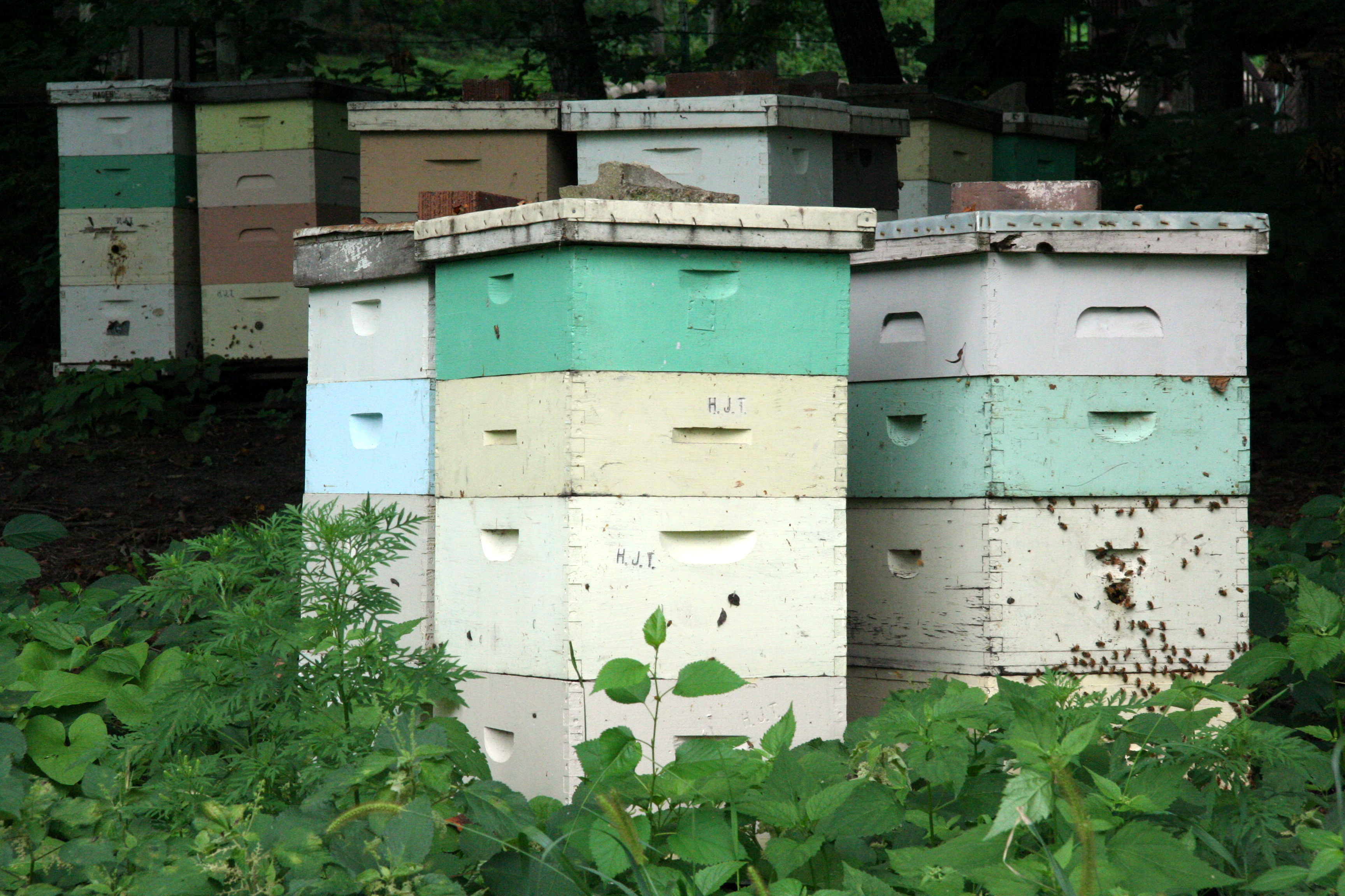
A beehive is an enclosed structure in which some honey bee species of the subgenus '' Apis'' live and raise their young. Though the word ''beehive'' is commonly used to describe the nest of any bee colony, scientific and professional literature distinguishes ''nest'' from ''hive''. ''Nest'' is used to discuss colonies that house themselves in natural or artificial cavities or are hanging and exposed. ''Hive'' is used to describe an artificial/man-made structure to house a honey bee nest. Several species of ''Apis'' live in colonies, but for honey production the western honey bee (''Apis mellifera'') and the eastern honey bee (''Apis cerana'') are the main species kept in hives. The nest's internal structure is a densely packed group of hexagonal prismatic cells made of beeswax, called a honeycomb. The bees use the cells to store food (honey and pollen) and to house the brood (eggs, larvae, and pupae). Beehives serve several purposes: production of honey, pollination of nearby ... [...More Info...] [...Related Items...] OR: [Wikipedia] [Google] [Baidu] |


