|
Karl Johan Andersson
Karl John (Karl Johan) Andersson (4 March 1827 in Norra Råda Värmland, Sweden – 9 July 1867 in Angola) was a Swedish explorer, hunter and trader as well as an amateur naturalist and ornithologist. He is most famous for the many books he published about his travels, and for being one of the most notable explorers of southern Africa, mostly in present-day Namibia. Biography Early life Karl Johan Andersson was born on 4 March 1827 in Värmland in Sweden. He was the illegitimate child of the British bear hunter Llewellyn Lloyd and Lloyd's Swedish servant. Andersson grew up in Sweden. Early in his life he went on hunting expeditions with his father, experienced Swedish nature and started a collection of biology specimens. In 1847 he started studies at the University of Lund. Explorations In 1849 he departed for London, intending to sell his collection to raise money for travels around the world. In London he met with the explorer Francis Galton, with whom he organ ... [...More Info...] [...Related Items...] OR: [Wikipedia] [Google] [Baidu] |
Värmland
Värmland () also known as Wermeland, is a '' landskap'' (historical province) in west-central Sweden. It borders Västergötland, Dalsland, Dalarna, Västmanland, and Närke, and is bounded by Norway in the west. Latin name versions are ''Varmelandia'', ''Vermelandia'', ''Wermelandia'', ''Værmalandia'', ''Værmolandia'', ''Virmolandia'' and ''Vermillandia''. Some of the Latinised forms show the origin of the name to come from the large local lake by the name of (from older ''*Virmil''); others from the river name ''*Værma'', the main outlet of that lake. The province was originally part of Götaland, and became part of Svealand in 1815. Geography The largest lake is Vänern. Most streams of importance lead to Vänern. However, the province is rich in small lakes, ponds and streams. The scenery, with mountains and lakes, is usually regarded as picturesque and has inspired painters and writers. Western Värmland There are several mountain plateaus in the western part of V ... [...More Info...] [...Related Items...] OR: [Wikipedia] [Google] [Baidu] |
Lake Ngami
Lake Ngami is an endorheic lake in Botswana north of the Kalahari Desert. It is seasonally filled by the Taughe River, an effluent of the Okavango River system flowing out of the western side of the Okavango Delta. It is one of the fragmented remnants of the ancient Lake Makgadikgadi. Although the lake has shrunk dramatically beginning from 1890, it remains an important habitat for birds and wildlife, especially in flood year Lake Ngami had many famous visitors during the 19th (and into the 20th) century. In 1849 David Livingstone described it as a "shimmering lake, some long and 20 [30 km] wide". Livingstone also made a few cultural notes about the people living in this area; he noticed they had a story similar to that of the Tower of Babel, except that the builders' heads were "cracked by the fall of the scaffolding" (''Missionary Travels'', chap. 26). One of the illustrations is known to have been made on the basis of a sketch by Mr. Alfred Ryder (1825-1850) son of Artist ... [...More Info...] [...Related Items...] OR: [Wikipedia] [Google] [Baidu] |
Cape Colony
The Cape Colony ( nl, Kaapkolonie), also known as the Cape of Good Hope, was a British Empire, British colony in present-day South Africa named after the Cape of Good Hope, which existed from 1795 to 1802, and again from 1806 to 1910, when it united with three other colonies to form the Union of South Africa. The British colony was preceded by an earlier corporate colony that became an Dutch Cape Colony, original Dutch colony of the same name, which was established in 1652 by the Dutch East India Company, Dutch East India Company (VOC). The Cape was under VOC rule from 1652 to 1795 and under rule of the Napoleonic Batavian Republic, Batavia Republic from 1803 to 1806. The VOC lost the colony to Kingdom of Great Britain, Great Britain following the 1795 Invasion of the Cape Colony, Battle of Muizenberg, but it was acceded to the Batavian Republic, Batavia Republic following the 1802 Treaty of Amiens. It was re-occupied by the British following the Battle of Blaauwberg in 1806 ... [...More Info...] [...Related Items...] OR: [Wikipedia] [Google] [Baidu] |
Axel Wilhelm Eriksson
Axel Wilhelm Eriksson (24 August 1846 – 5 May 1901) was a Swedish ornithologist, settler and trader in what is now Namibia. He was born in Vänersborg, in Sweden. Eriksson went to South West Africa in 1866 (before Germany had established its colony of German South West Africa in 1884) to serve out a three-year apprenticeship to Charles John Andersson. In 1871, with Swede Anders Ohlsson, he established a brewery at Omaruru. Eriksson established a trading post there, which flourished and by 1878 employed about forty whites. Eriksson's business was based upon long-distance trading between southern Angola and Cape Colony, which necessitated the establishment of regional trade routes. He also built up an extensive bird collection, specimens coming from South West Africa, Angola and the Transvaal (now Gauteng Province in South Africa), the bulk of which has since been donated to the municipal museum in Vänersborg. His activities gained much respect from a wide range of communities, ... [...More Info...] [...Related Items...] OR: [Wikipedia] [Google] [Baidu] |
Cunene River
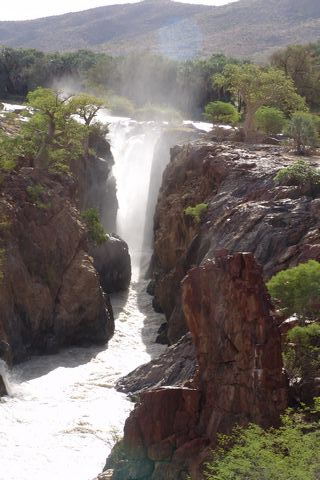
The Cunene (Portuguese spelling) or Kunene (common Namibian spelling) is a river in Southern Africa. It flows from the Angola highlands south to the border with Namibia. It then flows west along the border until it reaches the Atlantic Ocean. It is one of the few perennial rivers in the region. It is about long, with a drainage basin in area. Its mean annual discharge is 174 m3/s (6,145 cfs) at its mouth. The Epupa Falls lie on the river. Olushandja Dam dams a tributary of the river, the Etaka, and helps provide the Ruacana Power Station with water. Dam controversies The Namibian government proposed in the late 1990s to build the Epupa Dam, a controversial hydroelectric dam on the Cunene. In 2012 the Governments of Namibia and Angola announced plans to jointly build the Orokawe dam in the Baynes Mountains. According to the indigenous Himba who would have been most affected by the construction of the dam, the dam threatens the local ecosystem and therefore the economic bas ... [...More Info...] [...Related Items...] OR: [Wikipedia] [Google] [Baidu] |
Europe
Europe is a large peninsula conventionally considered a continent in its own right because of its great physical size and the weight of its history and traditions. Europe is also considered a Continent#Subcontinents, subcontinent of Eurasia and it is located entirely in the Northern Hemisphere and mostly in the Eastern Hemisphere. Comprising the westernmost peninsulas of Eurasia, it shares the continental landmass of Afro-Eurasia with both Africa and Asia. It is bordered by the Arctic Ocean to the north, the Atlantic Ocean to the west, the Mediterranean Sea to the south and Asia to the east. Europe is commonly considered to be Boundaries between the continents of Earth#Asia and Europe, separated from Asia by the drainage divide, watershed of the Ural Mountains, the Ural (river), Ural River, the Caspian Sea, the Greater Caucasus, the Black Sea and the waterways of the Turkish Straits. "Europe" (pp. 68–69); "Asia" (pp. 90–91): "A commonly accepted division between Asia and E ... [...More Info...] [...Related Items...] OR: [Wikipedia] [Google] [Baidu] |
Portugal
Portugal, officially the Portuguese Republic ( pt, República Portuguesa, links=yes ), is a country whose mainland is located on the Iberian Peninsula of Southwestern Europe, and whose territory also includes the Atlantic archipelagos of the Azores and Madeira. It features the westernmost point in continental Europe, and its Iberian portion is bordered to the west and south by the Atlantic Ocean and to the north and east by Spain, the sole country to have a land border with Portugal. Its two archipelagos form two autonomous regions with their own regional governments. Lisbon is the capital and largest city by population. Portugal is the oldest continuously existing nation state on the Iberian Peninsula and one of the oldest in Europe, its territory having been continuously settled, invaded and fought over since prehistoric times. It was inhabited by pre-Celtic and Celtic peoples who had contact with Phoenicians and Ancient Greek traders, it was ruled by the Ro ... [...More Info...] [...Related Items...] OR: [Wikipedia] [Google] [Baidu] |
Otjimbingwe
Otjimbingwe (also: Otjimbingue) is a settlement in the Erongo Region of central Namibia. It has approximately 8,000 inhabitants. History The area was already a temporary settlement of some Herero in the early 18th century. Their chief Tjiponda coined the name ''Otjizingue'' ( hz, refreshing place, referring to the natural spring) from which the settlement's name developed. The Rhenish Mission Society used Otjimbingwe as a central location for their Namibian mission in 1849. Johannes Rath and his family settled in the area on 11 July that year. In 1854, copper was found in the nearby Khomas highlands and the Walwich Bay Mining Company established its offices in the city. Miners and merchants flocked to the settlement, and the researcher and businessman Karl Johan Andersson bought the entire settlement in 1860. He sold it five years later to the Rhenish Missionary Society. However the supply had been exhausted by that time, and the mining operations ceded. The settlement was att ... [...More Info...] [...Related Items...] OR: [Wikipedia] [Google] [Baidu] |
Okavango River
The Okavango River (formerly spelled Okovango or Okovanggo), Also known as the Cubango River, is a river in southwest Africa. It is the fourth-longest river system in southern Africa, running southeastward for . It begins at an elevation of in the sandy highlands of Angola. Farther south, it forms part of the border between Angola and Namibia, and then flows into Botswana. The Okavango does not have an outlet to the sea. Instead, it discharges into the Okavango Delta or Okavango Alluvial Fan, in an endorheic basin in the Kalahari Desert. Flow In Angola, the upper reaches of the Cuito (a tributary river to the Okavango) suffers clogging due to controlled burns of the vegetation, reducing water flow downstream as the accumulated water instead flows into the sand. Before it enters Botswana, the river drops 4 m in a series of rapids known as Popa Falls, visible when the river is low, as during the dry season. In the rainy season, an outflow to the Boteti River in turn seaso ... [...More Info...] [...Related Items...] OR: [Wikipedia] [Google] [Baidu] |
Namaqualand
Namaqualand (khoekhoe: "Nama-kwa" meaning Nama Khoe people's land) is an arid region of Namibia and South Africa, extending along the west coast over and covering a total area of . It is divided by the lower course of the Orange River into two portions – Little Namaqualand to the south and Great Namaqualand to the north. Little Namaqualand is within the Namakwa District Municipality, forming part of Northern Cape Province, South Africa. It is geographically the largest district in the country, spanning over 26,836 km2. A typical municipality is Kamiesberg Local Municipality. The semidesert Succulent Karoo region experiences hot summers, sparse rainfall, and cold winters.Discover South Africa: Your Online Travel Directory. Discover Namakwa. Great Namaqualand in the Karas Region of Namibia, is sparsely populated by the Namaqua, a Khoikhoi people who have traditionally inhabited the Namaqualand region. Tourism The area’s landscape ranges from an unexploited coast ... [...More Info...] [...Related Items...] OR: [Wikipedia] [Google] [Baidu] |


.jpg)
