|
Kalpetta
Kalpetta is a major town and municipality in the Wayanad district, state of Kerala, India. Kalpetta is the headquarters of Wayanad district, as well as the headquarters of Vythiri taluk. It is a bustling town surrounded by dense coffee and tea plantations and mountains. It lies on the Kozhikode-Mysore National Highway NH 766 (formerly NH 212) at an altitude of about 780 m above sea level. Kalpetta is 72 km from Kozhikode and 140 km from Mysore. Apart from being the administrative capital of the district, Kalpetta is also the main hub of tourism activities in Wayanad due to its central location within the district and its proximity to most visited tourist sites. There is a good number of hotels and resorts within and surrounding the city of Kalpetta. Etymology It is believed that the early Jain residents who migrated from Karnataka had named the place "Kalpetta". In Kannada, the words "Kal" and "Pettah" mean "deposits of stones". Rocks, large and small, are found thro ... [...More Info...] [...Related Items...] OR: [Wikipedia] [Google] [Baidu] |
Wayanad District
Wayanad () is a district in the north-east of Indian state Kerala with administrative headquarters at the municipality of Kalpetta. It is the only plateau in Kerala. The Wayanad Plateau forms a continuation of the Mysore Plateau, the southern portion of Deccan Plateau. It is set high in the Western Ghats with altitudes ranging from 700 to 2100 meters. Vellari Mala, a high peak situated on the trijunction of Wayanad, Malappuram, and Kozhikode districts, is the highest point in Wayanad district. The district was formed on 1 November 1980 as the 12th district in Kerala, by carving out areas from Kozhikode and Kannur districts. An area of 885.92 km2 of the district is forested. Wayanad has three municipal towns—Kalpetta, Mananthavady and Sulthan Bathery. There are many indigenous tribes in this area. The Kabini River, a tributary of Kaveri River, originates at Wayanad. Wayanad district, along with the Chaliyar valley in neighbouring Nilambur (Eastern Eranad region) in Ma ... [...More Info...] [...Related Items...] OR: [Wikipedia] [Google] [Baidu] |
Vythiri Taluk
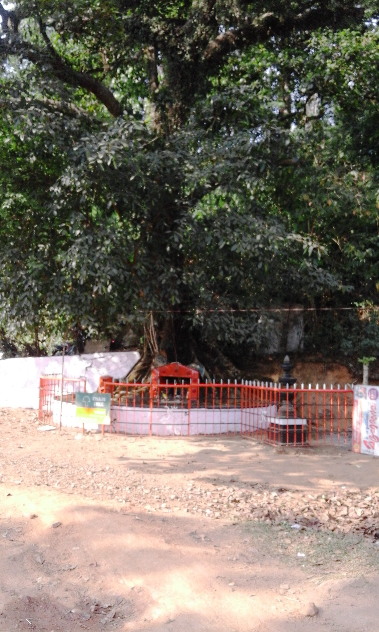
Vythiri is a small town and tourist destination located in the Wayanad district in the Indian state of Kerala. It is one of the three Taluks in the district with the other two being Mananthavady and Sulthan Bathery. Suburbs and villages Vythiri area has 18 villages. Towns in this taluk include Lakkidi, Vythiri, Chundale, Meppadi, Kalpetta, and Kaniyambetta. Vythiri is the headquarters of Vythiri Taluk. Vythiri as a favorite tourist destination The all season attractive weather, greenery and the terrain of this place makes Vythiri a major tourist destination in Kerala. Tourists from all parts of the world visits and stays in Vythiri to enjoy the beauty of Vythiri and other tourist destinations in Wayanad. The Chain Tree Legend According to the local legend, an English engineer built the Ghat road to Vythiri on the basis of the information given by a tribal youth. After getting the necessary guidance, the English people killed the tribal guide. The spirit of the tribal ... [...More Info...] [...Related Items...] OR: [Wikipedia] [Google] [Baidu] |
NH 766
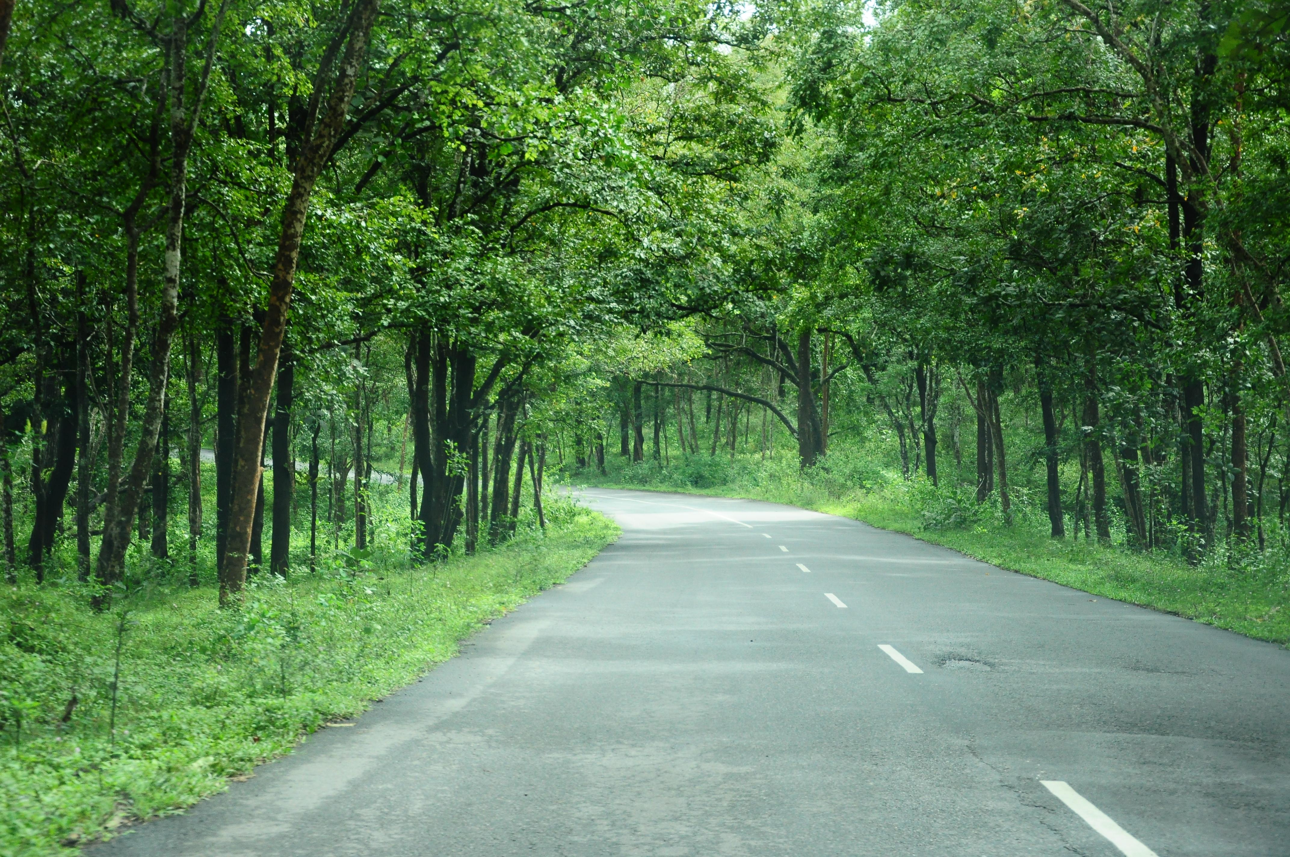
National Highway 766 (NH 766) (previously NH-212) is a National Highway in Southern India. NH 766 connects Kozhikode in Kerala with Kollegal in Karnataka via Mysore. Of the total distance of 272 km, 117 km is in Kerala and 155 is in Karnataka. At Kollegal, it joins National Highway 948, which connects Bengaluru and Coimbatore. The highway passes through dense forests of Western ghats of India. The NH-766 passes through 19.7 km Bandipur National Park and Wayanad wild life sanctuary. The section of the road from Lakkidi in Wayanad to Adivaram (Thamarassery) called as Thamarassery Churam (A hill highway with nine hairpin bends) offers a scenic drive. Route In Kerala * Kozhikode * Kunnamangalam * Koduvally * Thamarassery * Vythiri * Kalpetta * Meenangadi * Sultan Bathery * Muthanga In Karnataka * Gundlupete * Begur * Nanjangud * Mysore * T Narsipur * Kollegal Night Traffic ban at Bandipura The Karnataka government banned night traffic through the road passin ... [...More Info...] [...Related Items...] OR: [Wikipedia] [Google] [Baidu] |
List Of Districts Of India
A district ('' zila'') is an administrative division of an Indian state or territory. In some cases, districts are further subdivided into sub-divisions, and in others directly into ''tehsils'' or ''talukas''. , there are a total of 766 districts, up from the 640 in the 2011 Census of India and the 593 recorded in the 2001 Census of India. District officials include: *District Magistrate or Deputy Commissioner or District Collector, an officer of the Indian Administrative Service, in charge of administration and revenue collection *Superintendent of Police or Senior Superintendent of Police or Deputy Commissioner of Police, an officer belonging to the Indian Police Service, responsible for maintaining law and order *Deputy Conservator of Forests, an officer belonging to the Indian Forest Service, entrusted with the management of the forests, environment and wildlife of the district Each of these officials is aided by officers from the appropriate branch of the state governme ... [...More Info...] [...Related Items...] OR: [Wikipedia] [Google] [Baidu] |
Kozhikode
Kozhikode (), also known in English as Calicut, is a city along the Malabar Coast in the state of Kerala in India. It has a corporation limit population of 609,224 and a metropolitan population of more than 2 million, making it the second largest metropolitan area in Kerala and the 19th largest in India. Kozhikode is classified as a Tier 2 city by the Government of India. It is the largest city in the region known as the Malabar and was the capital of the British-era Malabar district. In antiquity and the medieval period, Kozhikode was dubbed the ''City of Spices'' for its role as the major trading point for Indian spices. It was the capital of an independent kingdom ruled by the Samoothiris (Zamorins). The port at Kozhikode acted as the gateway to medieval South Indian coast for the Chinese, the Persians, the Arabs and finally the Europeans. According to data compiled by economics research firm Indicus Analytics in 2009 on residences, earnings and investments, Kozhikode w ... [...More Info...] [...Related Items...] OR: [Wikipedia] [Google] [Baidu] |
Pazhassi Raja
Pazhassi Raja () (3 January 1753 – 30 November 1805) was known as Kerala Varma and was also known as Cotiote Rajah and Pychy Rajah. He was a warrior Hindu prince and de facto head of the kingdom of Kottayam, otherwise known as Cotiote, in Malabar, India, between 1774 and 1805. His struggles with the British East India Company is known as the Cotiote War. He earned the epithet ''"Kerala Simham"'' ("Lion of Kerala") on account of his martial exploits. Pazhassi Raja was a member of the western branch of the Kottayam royal clan Mattathil Kovilakom. When Hyder Ali of the Kingdom of Mysore occupied Malabar in 1773, the Raja of Kottayam found political asylum in Kallara near Vaikom in Kottayam district of Kerala. Pazhassi Raja, the fourth prince in line for succession to the throne during this period, became one of the ''de facto'' heads of state, surpassing several older royal contenders. He fought a war of resistance against the Mysorean army from 1774 to 1793. On account of h ... [...More Info...] [...Related Items...] OR: [Wikipedia] [Google] [Baidu] |
Taluks Of Kerala ...
In Kerala, the administrative divisions below the district are called taluks. There are 78 taluks with 1670 villages (including group villages).https://ildm.kerala.gov.in/wp-content/uploads/2018/01/Revenue-Guide-2018.pdf See also * Districts of Kerala References * {{Kerala topics Kerala Kerala ( ; ) is a state on the Malabar Coast of India. It was formed on 1 November 1956, following the passage of the States Reorganisation Act, by combining Malayalam-speaking regions of the erstwhile regions of Cochin, Malabar, South ... [...More Info...] [...Related Items...] OR: [Wikipedia] [Google] [Baidu] |
WikiProject Indian Cities
A WikiProject, or Wikiproject, is a Wikimedia movement affinity group for contributors with shared goals. WikiProjects are prevalent within the largest wiki, Wikipedia, and exist to varying degrees within sister projects such as Wiktionary, Wikiquote, Wikidata, and Wikisource. They also exist in different languages, and translation of articles is a form of their collaboration. During the COVID-19 pandemic, CBS News noted the role of Wikipedia's WikiProject Medicine in maintaining the accuracy of articles related to the disease. Another WikiProject that has drawn attention is WikiProject Women Scientists, which was profiled by '' Smithsonian'' for its efforts to improve coverage of women scientists which the profile noted had "helped increase the number of female scientists on Wikipedia from around 1,600 to over 5,000". On Wikipedia Some Wikipedia WikiProjects are substantial enough to engage in cooperative activities with outside organizations relevant to the field at issue. For ex ... [...More Info...] [...Related Items...] OR: [Wikipedia] [Google] [Baidu] |
Vijayanagara Empire
The Vijayanagara Empire, also called the Karnata Kingdom, was a Hinduism, Hindu empire based in the region of South India, which consisted the modern states of Karnataka, Andhra Pradesh, Tamil Nadu, Kerala, Goa and some parts of Telangana and Maharashtra. It was established in 1336 by the brothers Harihara I and Bukka Raya I of the Sangama dynasty, members of a pastoralist Herder, cowherd community that claimed Yadava lineage. The empire rose to prominence as a culmination of attempts by the southern powers to ward off Islamic invasions of India, Perso-Turkic Islamic invasions by the end of the 13th century. At its peak, it subjugated almost all of South India's ruling families and pushed the sultans of the Deccan beyond the Tungabhadra River, Tungabhadra-Krishna River, Krishna river doab region, in addition to annexing modern day Odisha (ancient Kalinga (historical region), Kalinga) from the Gajapati Empire, Gajapati Kingdom thus becoming a notable power. It lasted until 1646 ... [...More Info...] [...Related Items...] OR: [Wikipedia] [Google] [Baidu] |
Kingdom Of Mysore
The Kingdom of Mysore was a realm in South India, southern India, traditionally believed to have been founded in 1399 in the vicinity of the modern city of Mysore. From 1799 until 1950, it was a princely state, until 1947 in a subsidiary alliance with Presidencies and provinces of British India, British India. The British took Direct Control over the Princely state, Princely State in 1831.Rajakaryaprasakta Rao Bahadur (1936), p383 It then became Mysore State (later enlarged and renamed to Karnataka) with its ruler remaining as Rajapramukh until 1956, when he became the first Governor of the reformed state. The kingdom, which was founded and ruled for most part by the Hindu Wodeyar family, initially served as feudatories under the Vijayanagara Empire. The 17th century saw a steady expansion of its territory and during the rule of Kanthirava Narasaraja I, Narasaraja Wodeyar I and Chikka Devaraja, Chikka Devaraja Wodeyar, the kingdom annexed large expanses of what is now southern ... [...More Info...] [...Related Items...] OR: [Wikipedia] [Google] [Baidu] |
Mysorean Invasion Of Kerala
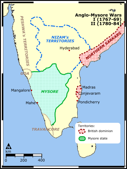
The Mysorean invasion of Malabar (1766 –1792) was the military invasion of the Malabar region of Kerala, including the territories of the Zamorin of Calicut, by the then-''de facto'' ruler of the Kingdom of Mysore, Hyder Ali. After the invasion, the Kingdom of Cochin to the south of Malabar became a tributary state of Mysore. The invasion of Malabar was motivated by a desire for access to the ports bordering the Indian Ocean. The Mysore invasion gave the East India Company the opportunity to tighten their grip on the ancient feudal principalities of Malabar and convert Travancore into only a protected ally. www.kerala.gov.in History By the late 18th century, the small kingdoms had been absorbed or subordinated by three large states: Travancore, Calicut (ruled by Zamorins), and the Kingdom of Cochin. The Kingdom of Mysore, ruled nominally by the Wodeyar family, rose to prominence in India after the decline of the Vijayanagara Empire and again after the Mughal Empire. In 1761 ... [...More Info...] [...Related Items...] OR: [Wikipedia] [Google] [Baidu] |
Western Ganga Dynasty
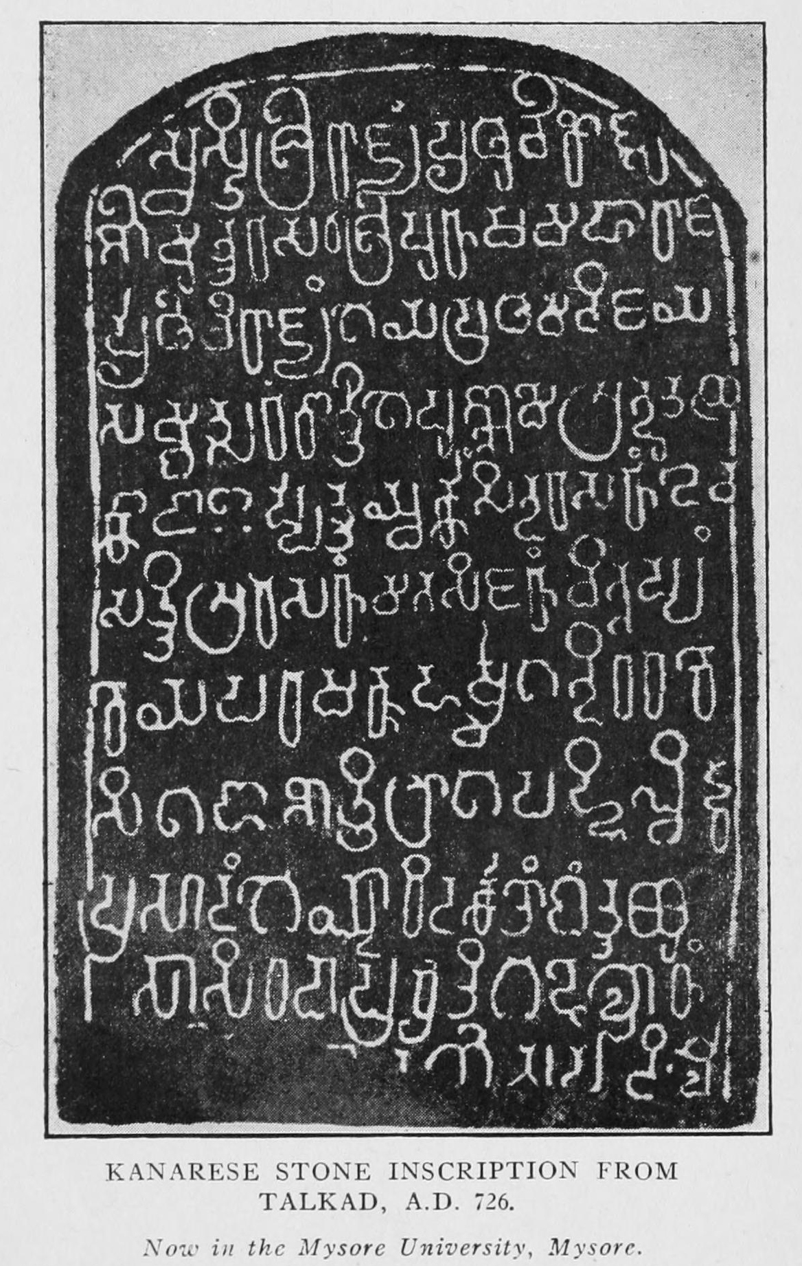
Western Ganga was an important ruling dynasty of ancient Karnataka in India which lasted from about 350 to 1000 CE. They are known as "Western Gangas" to distinguish them from the Eastern Gangas who in later centuries ruled over Kalinga (modern Odisha and Northern Andhra Pradesh). The general belief is that the Western Gangas began their rule during a time when multiple native clans asserted their freedom due to the weakening of the Pallava empire in South India, a geo-political event sometimes attributed to the southern conquests of Samudra Gupta. The Western Ganga sovereignty lasted from about 350 to 550 CE, initially ruling from Kolar and later, moving their capital to Talakadu on the banks of the Kaveri River in modern Mysore district. After the rise of the imperial Chalukyas of Badami, the Gangas accepted Chalukya overlordship and fought for the cause of their overlords against the Pallavas of Kanchi. The Chalukyas were replaced by the Rashtrakutas of Manyakheta in 75 ... [...More Info...] [...Related Items...] OR: [Wikipedia] [Google] [Baidu] |


.jpg)


