|
Kaduna, Nigeria
Kaduna is the capital city of Kaduna State, and the former political capital of Northern Nigeria. It is located in north-western Nigeria, on the Kaduna River. It is a trade Centre and a major transportation hub as the gateway to northern Nigeria, with its rail and important road network. The population of Kaduna was at 760,084 as of the 2006 Nigerian census. Rapid urbanization since 2005 has created an increasingly large population, now estimated to be around 1.3 million. The project population of people in Kaduna state as at 2021 is 8.9 million people. Etymology The etymology of the word ''Kaduna'' is said to be a corruption of the Hausa word for "crocodiles", ''Kaddani'' in the Hausa language (''kaduna'' being the plural form). Another version of the name proposes a link to the Gbagyi word/name 'Odna', meaning 'river'. History Kaduna was founded by British colonists in 1900. The first British governor of Northern Nigeria, Sir Frederick Lugard, chose the present site for deve ... [...More Info...] [...Related Items...] OR: [Wikipedia] [Google] [Baidu] |
Kaduna River
The Kaduna River is a tributary of the Niger River which flows for through Nigeria. It got its name from the crocodiles that lived in the river and surrounding area. Kaduna in the native dialect, Hausa, was the word for "crocodiles". It starts in Plateau State on the Jos Plateau southwest of Jos town, flows through its namesake Kaduna State and through its capital Kaduna, and meets the Niger River in Niger State. Most of its course passes through open savanna woodland, but its lower section has cut several gorges above its entrance into the extensive Niger floodplains. on britannica.com See also *Zungeru
Zungeru is a town in Niger State, Nigeria. It was the capital o ...
[...More Info...] [...Related Items...] OR: [Wikipedia] [Google] [Baidu] |
Fulani
The Fula, Fulani, or Fulɓe people ( ff, Fulɓe, ; french: Peul, links=no; ha, Fulani or Hilani; pt, Fula, links=no; wo, Pël; bm, Fulaw) are one of the largest ethnic groups in the Sahel and West Africa, widely dispersed across the region. Inhabiting many countries, they live mainly in West Africa and northern parts of Central Africa, South Sudan, Darfur, and regions near the Red Sea coast in Sudan. The approximate number of Fula people is unknown due to clashing definitions regarding Fula ethnicity. Various estimates put the figure between 25 and 40 million people worldwide. A significant proportion of the Fula – a third, or an estimated 12 to 13 million – are pastoralists, and their ethnic group has the largest nomadic pastoral community in the world., Quote: The Fulani form the largest pastoral nomadic group in the world. The Bororo'en are noted for the size of their cattle herds. In addition to fully nomadic groups, however, there are also semisedentary Fulani —F ... [...More Info...] [...Related Items...] OR: [Wikipedia] [Google] [Baidu] |
Frederick Lugard, 1st Baron Lugard
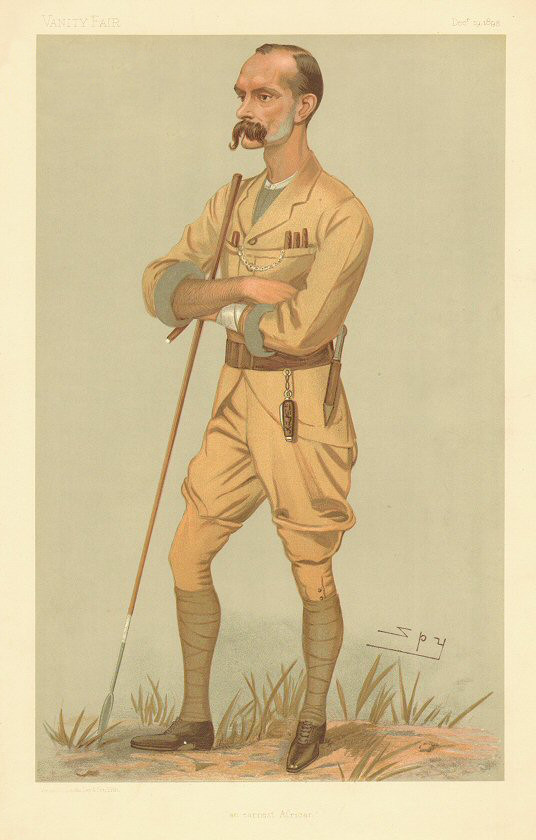
Frederick John Dealtry Lugard, 1st Baron Lugard (22 January 1858 – 11 April 1945), known as Sir Frederick Lugard between 1901 and 1928, was a British soldier, mercenary, explorer of Africa and colonial administrator. He was Governor of Hong Kong (1907–1912), the last Governor of Southern Nigeria Protectorate (1912–1914), the first High Commissioner (1900–1906) and last Governor (1912–1914) of Northern Nigeria Protectorate and the first Governor-General of Nigeria (1914–1919). Early life and education Lugard was born in Madras (now Chennai) in India, but was brought up in Worcester, England. He was the son of the Reverend Frederick Grueber Lugard, a British Army chaplain at Madras, and his third wife Mary Howard (1819–1865), the youngest daughter of Reverend John Garton Howard (1786–1862), a younger son of landed gentry from Thorne and Melbourne near York. His paternal uncle was Sir Edward Lugard, Adjutant-General in India from 1857 to 1858 and Permanent Under- ... [...More Info...] [...Related Items...] OR: [Wikipedia] [Google] [Baidu] |
British Empire
The British Empire was composed of the dominions, colonies, protectorates, mandates, and other territories ruled or administered by the United Kingdom and its predecessor states. It began with the overseas possessions and trading posts established by England between the late 16th and early 18th centuries. At its height it was the largest empire in history and, for over a century, was the foremost global power. By 1913, the British Empire held sway over 412 million people, of the world population at the time, and by 1920, it covered , of the Earth's total land area. As a result, its constitutional, legal, linguistic, and cultural legacy is widespread. At the peak of its power, it was described as "the empire on which the sun never sets", as the Sun was always shining on at least one of its territories. During the Age of Discovery in the 15th and 16th centuries, Portugal and Spain pioneered European exploration of the globe, and in the process established large overse ... [...More Info...] [...Related Items...] OR: [Wikipedia] [Google] [Baidu] |
Gbagyi Language
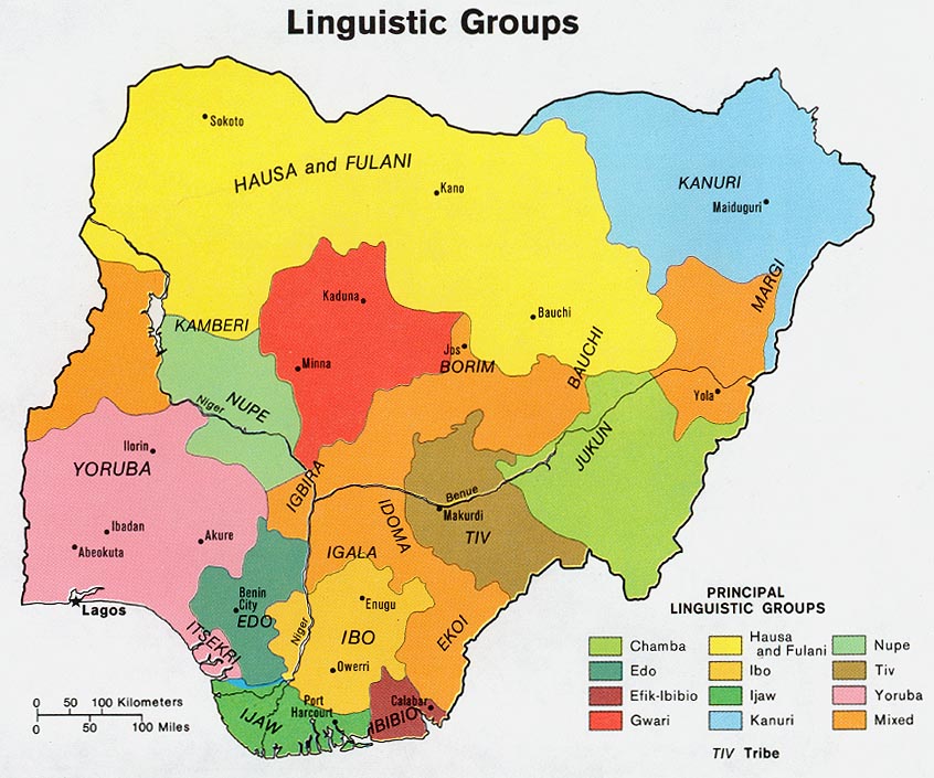
Gwari is a kwa language spoken by the Gbagyi people, which make up over a million people in Nigeria. There are two principal varieties, Gbari (West Gwari) and Gbagyi (East Gwari), which have some difficulty in communication; sociolinguistically they are distinct languages. Varieties Gbagye is also known as Gwari-Matai or Gwarin Ngenge, which are recently adopted cover terms.Blench, Roger. 2013. The Nupoid languages of west-central Nigeria: overview and comparative word list'. There are two separate Gbagyi groups living in: * Minna and Kuta (more prominent group) *around Diko, northeast of Suleja Gbagye is the only Nupoid language that has the bilabial implosive A voiced bilabial implosive is a type of consonantal sound, used in some spoken languages. The symbol in the International Phonetic Alphabet that represents this sound is , and the equivalent X-SAMPA symbol is b_<. Features Features of the ... /ɓ/. Gbagyi (also known as Gwari) is a cover term for all t ... [...More Info...] [...Related Items...] OR: [Wikipedia] [Google] [Baidu] |
Hausa Language
Hausa (; /; Ajami: ) is a Chadic language spoken by the Hausa people in the northern half of Nigeria, Ghana, Cameroon, Benin and Togo, and the southern half of Niger, Chad and Sudan, with significant minorities in Ivory Coast. Hausa is a member of the Afroasiatic languages, Afroasiatic language family and is the most widely spoken language within the Chadic languages, Chadic branch of that family. Ethnologue estimated that it was spoken as a first language by some 47 million people and as a second language by another 25 million, bringing the total number of Hausa speakers to an estimated 72 million. In Nigeria, the Hausa-speaking film industry is known as Hausa-language cinema, Kannywood. Classification Hausa belongs to the West Chadic languages subgroup of the Chadic languages group, which in turn is part of the Afroasiatic languages, Afroasiatic language family. Geographic distribution Native speakers of Hausa, the Hausa people, are mostly found in southern ... [...More Info...] [...Related Items...] OR: [Wikipedia] [Google] [Baidu] |
Northern Region, Nigeria
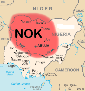
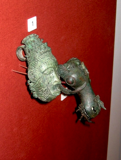
Northern Nigeria was an autonomous division within Nigeria, distinctly different from the southern part of the country, with independent customs, foreign relations and security structures. In 1962 it acquired the territory of the British Northern Cameroons, which voted to become a province within Northern Nigeria. In 1967, Northern Nigeria was divided into the North-Eastern State, North-Western State, Kano State, Kaduna State, Kwara State, and the Benue-Plateau State, each with its own Governor. History Prehistory The Nok culture, an ancient culture dominated most of what is now Northern Nigeria in prehistoric times, its legacy in the form of terracotta statues and megaliths have been discovered in Sokoto, Kano, Birinin Kudu, Nok and Zaria. The Kwatarkwashi culture, a variant of the Nok culture centred mostly around Zamfara in Sokoto Province is thought by some to be the same or an offshoot of the Nok. The Fourteen Kingdoms The Fourteen Kingdoms unified the diverse ... [...More Info...] [...Related Items...] OR: [Wikipedia] [Google] [Baidu] |
Tropical Savanna Climate
Tropical savanna climate or tropical wet and dry climate is a tropical climate sub-type that corresponds to the Köppen climate classification categories ''Aw'' (for a dry winter) and ''As'' (for a dry summer). The driest month has less than of precipitation and also less than 100-\left (\frac \right)mm of precipitation. This latter fact is in a direct contrast to a tropical monsoon climate, whose driest month sees less than of precipitation but has ''more'' than 100-\left (\frac \right) of precipitation. In essence, a tropical savanna climate tends to either see less overall rainfall than a tropical monsoon climate or have more pronounced dry season(s). In tropical savanna climates, the dry season can become severe, and often drought conditions prevail during the course of the year. Tropical savanna climates often feature tree-studded grasslands due to its dryness, rather than thick jungle. It is this widespread occurrence of tall, coarse grass (called savanna) which has led to ... [...More Info...] [...Related Items...] OR: [Wikipedia] [Google] [Baidu] |
Köppen Climate Classification
The Köppen climate classification is one of the most widely used climate classification systems. It was first published by German-Russian climatologist Wladimir Köppen (1846–1940) in 1884, with several later modifications by Köppen, notably in 1918 and 1936. Later, the climatologist Rudolf Geiger (1894–1981) introduced some changes to the classification system, which is thus sometimes called the Köppen–Geiger climate classification system. The Köppen climate classification divides climates into five main climate groups, with each group being divided based on seasonal precipitation and temperature patterns. The five main groups are ''A'' (tropical), ''B'' (arid), ''C'' (temperate), ''D'' (continental), and ''E'' (polar). Each group and subgroup is represented by a letter. All climates are assigned a main group (the first letter). All climates except for those in the ''E'' group are assigned a seasonal precipitation subgroup (the second letter). For example, ''Af'' indi ... [...More Info...] [...Related Items...] OR: [Wikipedia] [Google] [Baidu] |
Central European Summer Time
Central European Summer Time (CEST), sometimes referred to as Central European Daylight Time (CEDT), is the standard clock time observed during the period of summer daylight-saving in those European countries which observe Central European Time (CET; UTC+01:00) during the other part of the year. It corresponds to UTC+02:00, which makes it the same as Eastern European Time, Central Africa Time, South African Standard Time, Egypt Standard Time and Kaliningrad Time in Russia. Names Other names which have been applied to Central European Summer Time are Middle European Summer Time (MEST), Central European Daylight Saving Time (CEDT), and Bravo Time (after the second letter of the NATO phonetic alphabet). Period of observation Since 1996, European Summer Time has been observed between 01:00 UTC (02:00 CET and 03:00 CEST) on the last Sunday of March, and 01:00 UTC on the last Sunday of October; previously the rules were not uniform across the European Union. There were proposals ... [...More Info...] [...Related Items...] OR: [Wikipedia] [Google] [Baidu] |
Central European Time
Central European Time (CET) is a standard time which is 1 hour ahead of Coordinated Universal Time (UTC). The time offset from UTC can be written as UTC+01:00. It is used in most parts of Europe and in a few North African countries. CET is also known as Middle European Time (MET, German: MEZ) and by colloquial names such as Amsterdam Time, Berlin Time, Brussels Time, Madrid Time, Paris Time, Rome Time, Warsaw Time or even Romance Standard Time (RST). The 15th meridian east is the central axis for UTC+01:00 in the world system of time zones. As of 2011, all member states of the European Union observe summer time (daylight saving time), from the last Sunday in March to the last Sunday in October. States within the CET area switch to Central European Summer Time (CEST, UTC+02:00) for the summer. In Africa, UTC+01:00 is called West Africa Time (WAT), where it is used by several countries, year round. Algeria, Morocco, and Tunisia also refer to it as ''Central European ... [...More Info...] [...Related Items...] OR: [Wikipedia] [Google] [Baidu] |
Igbo People
The Igbo people ( , ; also spelled Ibo" and formerly also ''Iboe'', ''Ebo'', ''Eboe'', * * * ''Eboans'', ''Heebo''; natively ) are an ethnic group in Nigeria. They are primarily found in Abia, Anambra, Ebonyi, Enugu, and Imo States. A sizable Igbo population is also found in Delta and Rivers States. Large ethnic Igbo populations are found in Cameroon, Gabon, and Equatorial Guinea, as well as outside Africa. There has been much speculation about the origins of the Igbo people, which are largely unknown. Geographically, the Igbo homeland is divided into two unequal sections by the Niger River—an eastern (which is the larger of the two) and a western section. The Igbo people are one of the largest ethnic groups in Africa. The Igbo language is part of the Niger-Congo language family. Its regional dialects are somewhat mutually intelligible amidst the larger "Igboid" cluster. The Igbo homeland straddles the lower Niger River, east and south of the Edoid and Idomoid gr ... [...More Info...] [...Related Items...] OR: [Wikipedia] [Google] [Baidu] |


