|
Kyrtoni
Kyrtoni ( el, Κυρτώνη, before 1987: Κολάκα - ''Kolaka'') is a village in the southeastern part of Phthiotis, Greece. It is part of the municipality of Lokroi since 2010. It was an independent commune between the 1820s and 1907, and was part the municipality of Atalanti between 1907 and 2010. In 2011 its population was 445. It is situated at 480 m elevation on the southern slope of the Chlomo mountain. It is 8 km southeast of Atalanti and 12 km northeast of Orchomenos. Its main industry is agriculture. The village takes its name from the ancient town Cyrtone. History The area around Kyrtoni was already inhabited during the Neolithic era (7000-3200/3100 BC). The name of the Neolithic settlement is unknown. There was also activity around Kyrtoni during the Archaic period (800-480 BC). The main occupations of the inhabitants were agriculture, animal husbandry and pottery. In the 2nd century CE, Pausanias described Cyrtones, also Cyrtone, as a town of ancient ... [...More Info...] [...Related Items...] OR: [Wikipedia] [Google] [Baidu] |
Atalanti
Atalanti ( el, Αταλάντη '' Atalantē'') is the second largest town in Phthiotis, Greece. It is located southeast of Lamia, north of Livadeia and northwest of Chalcis. In 2011, it was incorporated into the municipality of Lokroi, of which it is the government seat and a municipal unit. Geography The town can be accessed via the Greek National Road 1 (Athens – Lamia – Thessaloniki). It is situated in central Greece, surrounded by Mt. Knimida to the north, Mt. Chlomo to the south, Mt. Parnassus to the west, and the northern Eubean Gulf to the east. The area is characterized by high concentrations of magnesium and iron in the soil. The municipal unit has an area of 304.141 km2. Economy Atalanti is known as a market town and was the capital of the former Locris Province. The town's geography has garnered it a reputation in Greece as a notable wine-producing hub. Subdivisions The municipal unit, Atalanti, is subdivided into the following communities ( ... [...More Info...] [...Related Items...] OR: [Wikipedia] [Google] [Baidu] |
Chlomo
Chlomo ( el, Χλωμό, ''Chlomó'') is a mountain in southeastern Phthiotis, Greece with an elevation of 1,081 m. Nearby mountains are Kallidromo to the northwest and Ptoo to the southeast. The plain of former Lake Copais lies to the south. Settlements situated near the mountain include Atalanti to the north, Kyrtoni Kyrtoni ( el, Κυρτώνη, before 1987: Κολάκα - ''Kolaka'') is a village in the southeastern part of Phthiotis, Greece. It is part of the municipality of Lokroi since 2010. It was an independent commune between the 1820s and 1907, and w ... to the southeast and Exarchos to the west. References Landforms of Phthiotis Landforms of Boeotia Mountains of Greece Mountains of Central Greece {{CentralGreece-geo-stub ... [...More Info...] [...Related Items...] OR: [Wikipedia] [Google] [Baidu] |
Cyrtone
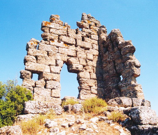
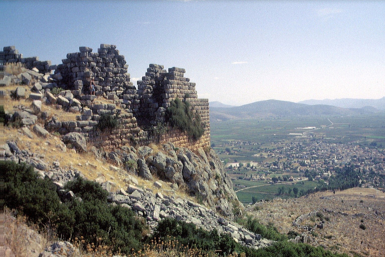
Cyrtones or Kyrtones ( grc, Κύρτωνες), anciently called Cyrtone or Kyrtone (Κυρτώνη), was a city of Boeotia, east of the Lake Copais, and 20 stadia from Hyettus, situated upon a lofty mountain, after crossing which the traveller arrived at Corsia. Cyrtones contained a grove and temple of Apollo, in which were statues of Apollo and Artemis, and a fountain of cold water, at the source of which was a chapel of the nymphs. The site of Cyrtones is tentatively located at Kastron Kolakas/Karaouli, near the modern village of Kyrtoni Kyrtoni ( el, Κυρτώνη, before 1987: Κολάκα - ''Kolaka'') is a village in the southeastern part of Phthiotis, Greece. It is part of the municipality of Lokroi since 2010. It was an independent commune between the 1820s and 1907, and w ..., which was renamed from Kolaka to reflect association with the ancient town. The remains of a walled enclosure, and of a building, possibly a temple, have been found. This ancient fortification h ... [...More Info...] [...Related Items...] OR: [Wikipedia] [Google] [Baidu] |
Cyrtones
Cyrtones or Kyrtones ( grc, Κύρτωνες), anciently called Cyrtone or Kyrtone (Κυρτώνη), was a city of Boeotia, east of the Lake Copais, and 20 stadia from Hyettus, situated upon a lofty mountain, after crossing which the traveller arrived at Corsia. Cyrtones contained a grove and temple of Apollo, in which were statues of Apollo and Artemis, and a fountain of cold water, at the source of which was a chapel of the nymphs. The site of Cyrtones is tentatively located at Kastron Kolakas/Karaouli, near the modern village of Kyrtoni Kyrtoni ( el, Κυρτώνη, before 1987: Κολάκα - ''Kolaka'') is a village in the southeastern part of Phthiotis, Greece. It is part of the municipality of Lokroi since 2010. It was an independent commune between the 1820s and 1907, and w ..., which was renamed from Kolaka to reflect association with the ancient town. The remains of a walled enclosure, and of a building, possibly a temple, have been found. This ancient fortification h ... [...More Info...] [...Related Items...] OR: [Wikipedia] [Google] [Baidu] |
Phthiotis
Phthiotis ( el, Φθιώτιδα, ''Fthiótida'', ; ancient Greek and Katharevousa: Φθιῶτις) is one of the regional units of Greece. It is part of the administrative region of Central Greece. The capital is the city of Lamia. It is bordered by the Malian Gulf to the east, Boeotia in the south, Phocis in the south, Aetolia-Acarnania in the southwest, Evrytania in the west, Karditsa regional unit in the north, Larissa regional unit in the north, and Magnesia in the northeast. The name dates back to ancient times. It is best known as the home of Achilles. Geography Phthiotis covers the northern and southern shorelines of the Malian Gulf, an inlet of the Aegean Sea. It stretches inland towards the west along the valley of the river Spercheios. In the south it covers the upper part of the Cephissus valley. There are several mountain ranges in Phthiotis, including the Othrys in the northeast, the Tymfristos in the west, the Vardousia in the southwest, Oeta in the south ... [...More Info...] [...Related Items...] OR: [Wikipedia] [Google] [Baidu] |
Lokroi (municipality)
Lokroi ( el, Λοκροί) is a municipality in the Phthiotis regional unit, Central Greece, Greece. The seat of the municipality is the town Atalanti. The municipal unit has an area of 614.761 km2. Municipality The municipality Lokroi was formed at the 2011 local government reform by the merger of the following 4 former municipalities, that became municipal units: * Atalanti * Dafnousia * Malesina *Opountioi Opountioi ( el, Οπούντιοι) is a former municipality in Phthiotis, Greece with an area 129.534 km2 and a population of 3,201 inhabitants (2011 census). It was established in 1997 from the former communities Larymna and Martino. The na ... References Municipalities of Central Greece Locris Populated places in Phthiotis {{CGreece-geo-stub ... [...More Info...] [...Related Items...] OR: [Wikipedia] [Google] [Baidu] |
Orchomenus (Boeotia)
Orchomenus ( grc, Ὀρχομενός ''Orchomenos''), the setting for many early Greek myths, is best known today as a rich archaeological site in Boeotia, Greece, that was inhabited from the Neolithic through the Hellenistic periods. It is often referred to as " Minyan Orchomenus", to distinguish it from a later city of the same name in Arcadia. Ancient history According to the founding myth of Orchomenos, its royal dynasty was established by the Minyans, who had followed their eponymous leader Minyas from coastal Thessaly to settle the site. In the Bronze Age, during the fourteenth and thirteenth centuries BCE, Orchomenos became a rich and important centre of civilisation in Mycenaean Greece and a rival to Thebes. The palace with its frescoed walls and the great beehive tomb show the power of Orchomenos in Mycenaean Greece. A massive hydraulic undertaking drained the marshes of Lake Kopaïs, making it a rich agricultural area. Like many sites around the Aegean Sea, Orcho ... [...More Info...] [...Related Items...] OR: [Wikipedia] [Google] [Baidu] |
Neolithic Era
The Neolithic period, or New Stone Age, is an Old World archaeological period and the final division of the Stone Age. It saw the Neolithic Revolution, a wide-ranging set of developments that appear to have arisen independently in several parts of the world. This "Neolithic package" included the History of agriculture, introduction of farming, domestication of animals, and change from a hunter-gatherer lifestyle to one of sedentism, settlement. It began about 12,000 years ago when farming appeared in the Epipalaeolithic Near East, and later in other parts of the world. The Neolithic lasted in the Near East until the transitional period of the Chalcolithic (Copper Age) from about 6,500 years ago (4500 BC), marked by the development of metallurgy, leading up to the Bronze Age and Iron Age. In other places the Neolithic followed the Mesolithic (Middle Stone Age) and then lasted until later. In Ancient Egypt, the Neolithic lasted until the Protodynastic Period of Egypt, Protodynast ... [...More Info...] [...Related Items...] OR: [Wikipedia] [Google] [Baidu] |
Archaic Greece
Archaic Greece was the period in Greek history lasting from circa 800 BC to the second Persian invasion of Greece in 480 BC, following the Greek Dark Ages and succeeded by the Classical period. In the archaic period, Greeks settled across the Mediterranean and the Black Seas, as far as Marseille in the west and Trapezus (Trebizond) in the east; and by the end of the archaic period, they were part of a trade network that spanned the entire Mediterranean. The archaic period began with a massive increase in the Greek population and of significant changes that rendered the Greek world at the end of the 8th century entirely unrecognisable from its beginning. According to Anthony Snodgrass, the archaic period was bounded by two revolutions in the Greek world. It began with a "structural revolution" that "drew the political map of the Greek world" and established the ''poleis'', the distinctively Greek city-states, and it ended with the intellectual revolution of the Classical peri ... [...More Info...] [...Related Items...] OR: [Wikipedia] [Google] [Baidu] |
Pausanias (geographer)
Pausanias ( /pɔːˈseɪniəs/; grc-gre, Παυσανίας; c. 110 – c. 180) was a Greek traveler and geographer of the second century AD. He is famous for his ''Description of Greece'' (, ), a lengthy work that describes ancient Greece from his firsthand observations. ''Description of Greece'' provides crucial information for making links between classical literature and modern archaeology. Biography Not much is known about Pausanias apart from what historians can piece together from his own writing. However, it is mostly certain that he was born c. 110 AD into a Greek family and was probably a native of Lydia in Asia Minor. From c. 150 until his death in 180, Pausanias travelled through the mainland of Greece, writing about various monuments, sacred spaces, and significant geographical sites along the way. In writing ''Description of Greece'', Pausanias sought to put together a lasting written account of "all things Greek", or ''panta ta hellenika''. Living in t ... [...More Info...] [...Related Items...] OR: [Wikipedia] [Google] [Baidu] |
Lake Copais
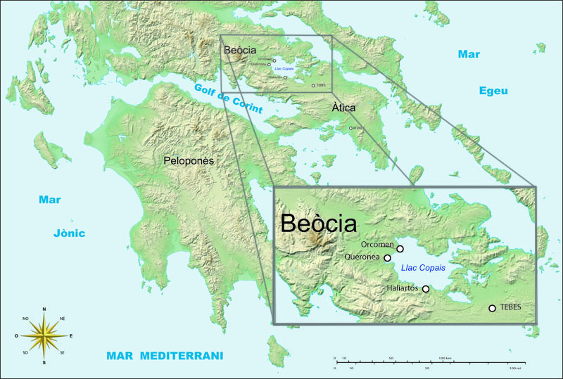
Lake Copais, also spelled Kopais or Kopaida ( grc, Κωπαΐς; ell, Κωπαΐδα), was a lake in the centre of Boeotia, Greece, west of Thebes. It was drained in the late 19th century. It is now flat dry land and is still known as Kopaida. A one-time island in the lake was modified in ancient times into a megalithic citadel, now called Gla, though its ancient name is not known. It may be the city of Arne mentioned by Homer. Drainage When the lake existed, the towns of Haliartus, Orchomenus, and Chaeronea were on its shores. Rivers feeding the lake included the Cephissus, Termessus and Triton. The lake was (and is) surrounded by fertile land, but the lake increasingly encroached on the surrounding land because of inadequate drainage. In response to this, in 1867–1887 Scots and French engineers reclaimed the land for the British Lake Copais Company, by building channels to drain water from the lake to the Cephissus and from there to Lake Yliki (Ylíki Limní, ancient Hy ... [...More Info...] [...Related Items...] OR: [Wikipedia] [Google] [Baidu] |


