|
Chlomo
Chlomo ( el, Χλωμό, ''Chlomó'') is a mountain in southeastern Phthiotis, Greece with an elevation of 1,081 m. Nearby mountains are Kallidromo to the northwest and Ptoo to the southeast. The plain of former Lake Copais lies to the south. Settlements situated near the mountain include Atalanti to the north, Kyrtoni Kyrtoni ( el, Κυρτώνη, before 1987: Κολάκα - ''Kolaka'') is a village in the southeastern part of Phthiotis, Greece. It is part of the municipality of Lokroi since 2010. It was an independent commune between the 1820s and 1907, and w ... to the southeast and Exarchos to the west. References Landforms of Phthiotis Landforms of Boeotia Mountains of Greece Mountains of Central Greece {{CentralGreece-geo-stub ... [...More Info...] [...Related Items...] OR: [Wikipedia] [Google] [Baidu] |
Atalanti
Atalanti ( el, Αταλάντη '' Atalantē'') is the second largest town in Phthiotis, Greece. It is located southeast of Lamia, north of Livadeia and northwest of Chalcis. In 2011, it was incorporated into the municipality of Lokroi, of which it is the government seat and a municipal unit. Geography The town can be accessed via the Greek National Road 1 (Athens – Lamia – Thessaloniki). It is situated in central Greece, surrounded by Mt. Knimida to the north, Mt. Chlomo to the south, Mt. Parnassus to the west, and the northern Eubean Gulf to the east. The area is characterized by high concentrations of magnesium and iron in the soil. The municipal unit has an area of 304.141 km2. Economy Atalanti is known as a market town and was the capital of the former Locris Province. The town's geography has garnered it a reputation in Greece as a notable wine-producing hub. Subdivisions The municipal unit, Atalanti, is subdivided into the following communities ( ... [...More Info...] [...Related Items...] OR: [Wikipedia] [Google] [Baidu] |
Kyrtoni
Kyrtoni ( el, Κυρτώνη, before 1987: Κολάκα - ''Kolaka'') is a village in the southeastern part of Phthiotis, Greece. It is part of the municipality of Lokroi since 2010. It was an independent commune between the 1820s and 1907, and was part the municipality of Atalanti between 1907 and 2010. In 2011 its population was 445. It is situated at 480 m elevation on the southern slope of the Chlomo mountain. It is 8 km southeast of Atalanti and 12 km northeast of Orchomenos. Its main industry is agriculture. The village takes its name from the ancient town Cyrtone. History The area around Kyrtoni was already inhabited during the Neolithic era (7000-3200/3100 BC). The name of the Neolithic settlement is unknown. There was also activity around Kyrtoni during the Archaic period (800-480 BC). The main occupations of the inhabitants were agriculture, animal husbandry and pottery. In the 2nd century CE, Pausanias described Cyrtones, also Cyrtone, as a town of ancient ... [...More Info...] [...Related Items...] OR: [Wikipedia] [Google] [Baidu] |
Exarchos, Phthiotis
Exarchos is a Greek village in Phthiotis prefecture. It is located in the southern part of Phthiotis, in Locris, 18 Km west of Atalanti. The village is located on the slope of Mount Chlomo at a height of about 300 meters. Its population is 699 inhabitants according to 2011 census. Exarchos belongs to Lokroi municipality. Most of the inhabitants of Exarchos are engaged in agriculture. The wider area of the village consists of agricultural lands and the majority of crops include cotton and cereals. History Near Exarchos, there are the ancient Phocian cities (Polis) Abae and Hyampolis. The cities flourished during Hellenistic and Roman times. Ruins of these cities are located in the north and west of Exarchos. The date of depopulation of two cities isn't known. Likely, it happened the late Roman period or the early Byzantine. The today village Exarchos was built after the dereliction of the ancient cities. The name possibly derived from someone Exarch, a bishop of the eastern churche ... [...More Info...] [...Related Items...] OR: [Wikipedia] [Google] [Baidu] |
Phthiotis
Phthiotis ( el, Φθιώτιδα, ''Fthiótida'', ; ancient Greek and Katharevousa: Φθιῶτις) is one of the regional units of Greece. It is part of the administrative region of Central Greece. The capital is the city of Lamia. It is bordered by the Malian Gulf to the east, Boeotia in the south, Phocis in the south, Aetolia-Acarnania in the southwest, Evrytania in the west, Karditsa regional unit in the north, Larissa regional unit in the north, and Magnesia in the northeast. The name dates back to ancient times. It is best known as the home of Achilles. Geography Phthiotis covers the northern and southern shorelines of the Malian Gulf, an inlet of the Aegean Sea. It stretches inland towards the west along the valley of the river Spercheios. In the south it covers the upper part of the Cephissus valley. There are several mountain ranges in Phthiotis, including the Othrys in the northeast, the Tymfristos in the west, the Vardousia in the southwest, Oeta in the south ... [...More Info...] [...Related Items...] OR: [Wikipedia] [Google] [Baidu] |
Greece
Greece,, or , romanized: ', officially the Hellenic Republic, is a country in Southeast Europe. It is situated on the southern tip of the Balkans, and is located at the crossroads of Europe, Asia, and Africa. Greece shares land borders with Albania to the northwest, North Macedonia and Bulgaria to the north, and Turkey to the northeast. The Aegean Sea lies to the east of the Geography of Greece, mainland, the Ionian Sea to the west, and the Sea of Crete and the Mediterranean Sea to the south. Greece has the longest coastline on the Mediterranean Basin, featuring List of islands of Greece, thousands of islands. The country consists of nine Geographic regions of Greece, traditional geographic regions, and has a population of approximately 10.4 million. Athens is the nation's capital and List of cities and towns in Greece, largest city, followed by Thessaloniki and Patras. Greece is considered the cradle of Western culture, Western civilization, being the birthplace of Athenian ... [...More Info...] [...Related Items...] OR: [Wikipedia] [Google] [Baidu] |
Kallidromo
Kallidromo ( el, Καλλίδρομο) is a mountain in southeastern Phthiotis and northeastern Phocis, in Central Greece. Its maximum elevation is 1,399 m. The Kallidromo lies south of the Malian Gulf, east of Mount Oeta and north of the Cephissus valley. The strategic site of Thermopylae lies north of the mountain. The village of Drymaia is on the mountain. Nearby places are Mendenitsa to the northeast and Amfikleia to the south. The Motorway 1 (Athens - Lamia - Thessaloniki) passes north of the mountain. The classic railway from Athens to Lamia and Thessaloniki passes south and west of the mountain, while the newer high-speed line passes through the mountain via a tunnel A tunnel is an underground passageway, dug through surrounding soil, earth or rock, and enclosed except for the entrance and exit, commonly at each end. A pipeline is not a tunnel, though some recent tunnels have used immersed tube cons .... References External links {{Authority control Lan ... [...More Info...] [...Related Items...] OR: [Wikipedia] [Google] [Baidu] |
Lake Copais
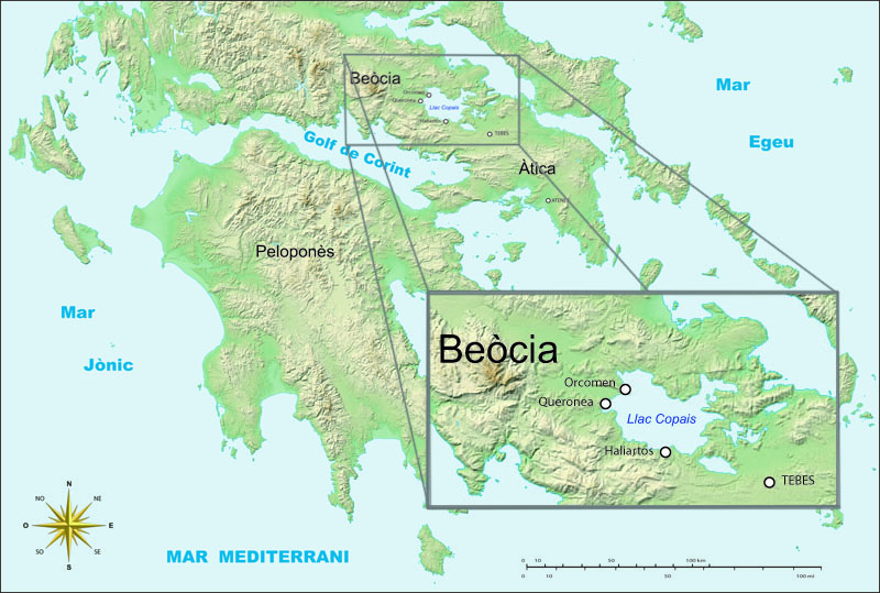
Lake Copais, also spelled Kopais or Kopaida ( grc, Κωπαΐς; ell, Κωπαΐδα), was a lake in the centre of Boeotia, Greece, west of Thebes. It was drained in the late 19th century. It is now flat dry land and is still known as Kopaida. A one-time island in the lake was modified in ancient times into a megalithic citadel, now called Gla, though its ancient name is not known. It may be the city of Arne mentioned by Homer. Drainage When the lake existed, the towns of Haliartus, Orchomenus, and Chaeronea were on its shores. Rivers feeding the lake included the Cephissus, Termessus and Triton. The lake was (and is) surrounded by fertile land, but the lake increasingly encroached on the surrounding land because of inadequate drainage. In response to this, in 1867–1887 Scots and French engineers reclaimed the land for the British Lake Copais Company, by building channels to drain water from the lake to the Cephissus and from there to Lake Yliki (Ylíki Limní, ancient Hy ... [...More Info...] [...Related Items...] OR: [Wikipedia] [Google] [Baidu] |
Landforms Of Phthiotis
A landform is a natural or anthropogenic land feature on the solid surface of the Earth or other planetary body. Landforms together make up a given terrain, and their arrangement in the landscape is known as topography. Landforms include hills, mountains, canyons, and valleys, as well as shoreline features such as bays, peninsulas, and seas, including submerged features such as mid-ocean ridges, volcanoes, and the great ocean basins. Physical characteristics Landforms are categorized by characteristic physical attributes such as elevation, slope, orientation, stratification, rock exposure and soil type. Gross physical features or landforms include intuitive elements such as berms, mounds, hills, ridges, cliffs, valleys, rivers, peninsulas, volcanoes, and numerous other structural and size-scaled (e.g. ponds vs. lakes, hills vs. mountains) elements including various kinds of inland and oceanic waterbodies and sub-surface features. Mountains, hills, plateaux, and plains are th ... [...More Info...] [...Related Items...] OR: [Wikipedia] [Google] [Baidu] |
Landforms Of Boeotia
A landform is a natural or anthropogenic land feature on the solid surface of the Earth or other planetary body. Landforms together make up a given terrain, and their arrangement in the landscape is known as topography. Landforms include hills, mountains, canyons, and valleys, as well as shoreline features such as bays, peninsulas, and seas, including submerged features such as mid-ocean ridges, volcanoes, and the great ocean basins. Physical characteristics Landforms are categorized by characteristic physical attributes such as elevation, slope, orientation, stratification, rock exposure and soil type. Gross physical features or landforms include intuitive elements such as berms, mounds, hills, ridges, cliffs, valleys, rivers, peninsulas, volcanoes, and numerous other structural and size-scaled (e.g. ponds vs. lakes, hills vs. mountains) elements including various kinds of inland and oceanic waterbodies and sub-surface features. Mountains, hills, plateaux, and plains are the fo ... [...More Info...] [...Related Items...] OR: [Wikipedia] [Google] [Baidu] |
Mountains Of Greece
A mountain is an elevated portion of the Earth's crust, generally with steep sides that show significant exposed bedrock. Although definitions vary, a mountain may differ from a plateau in having a limited summit area, and is usually higher than a hill, typically rising at least 300 metres (1,000 feet) above the surrounding land. A few mountains are isolated summits, but most occur in mountain ranges. Mountains are formed through tectonic forces, erosion, or volcanism, which act on time scales of up to tens of millions of years. Once mountain building ceases, mountains are slowly leveled through the action of weathering, through slumping and other forms of mass wasting, as well as through erosion by rivers and glaciers. High elevations on mountains produce colder climates than at sea level at similar latitude. These colder climates strongly affect the ecosystems of mountains: different elevations have different plants and animals. Because of the less hospitable terrain and ... [...More Info...] [...Related Items...] OR: [Wikipedia] [Google] [Baidu] |


.jpg)
