|
Kurkar
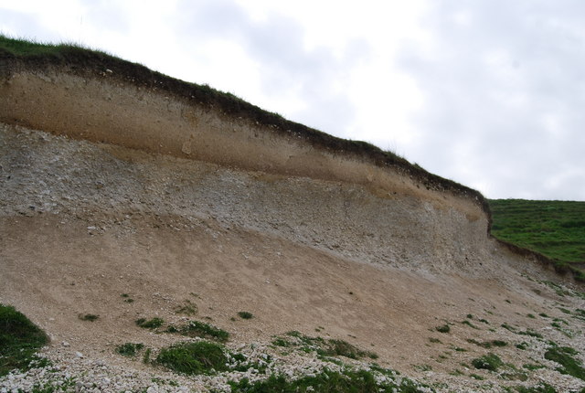
Kurkar ( ar, كركار / he, כורכר) is the term used in Palestinian Arabic and modern Hebrew for the rock type of which lithified sea sand dunes consist. The equivalent term used in Lebanon is ramleh.[Aharon Horowitz. ''The Quaternary of Israel.'' Page 109. Academic Press, New York, 1979. . https://books.google.com/books?id=uT-0BQAAQBAJ&pg=PA109&lpg=PA109&dq=arabic+kurkar&source=bl&ots=jsSFmx-BO4&sig=a7zcZmxiJAoUMrqxs2u7f9u6fPQ&hl=en&sa=X&ved=0ahUKEwjCx7ynisrKAhWFkg8KHQwHCssQ6AEIODAG#v=onepage&q=arabic%20kurkar&f=false] History Kurkar is the regional name for an aeolian quartz sandstone with carbonate cement, in other words an eolianite or a calcarenite (calcareous sandstone or grainstone), found on the Levantine coast of the Mediterranean Sea in Turkey, Palestine, Syria, Lebanon, Israel, Francisc Dov Por. ''The Legacy of Tethys: An Aquatic Biogeography of the Levant.'' Pages 46-48, 54. Springer, New York, 1989, Monographiae Biologicae (Book 63), . "... around Tel Aviv ri ... [...More Info...] [...Related Items...] OR: [Wikipedia] [Google] [Baidu] |
Sandstone
Sandstone is a clastic sedimentary rock composed mainly of sand-sized (0.0625 to 2 mm) silicate grains. Sandstones comprise about 20–25% of all sedimentary rocks. Most sandstone is composed of quartz or feldspar (both silicates) because they are the most resistant minerals to weathering processes at the Earth's surface. Like uncemented sand, sandstone may be any color due to impurities within the minerals, but the most common colors are tan, brown, yellow, red, grey, pink, white, and black. Since sandstone beds often form highly visible cliffs and other topographic features, certain colors of sandstone have been strongly identified with certain regions. Rock formations that are primarily composed of sandstone usually allow the percolation of water and other fluids and are porous enough to store large quantities, making them valuable aquifers and petroleum reservoirs. Quartz-bearing sandstone can be changed into quartzite through metamorphism, usually related to ... [...More Info...] [...Related Items...] OR: [Wikipedia] [Google] [Baidu] |
Calcareous Sandstone A Route 2 Near Zicron Jacov
Calcareous () is an adjective meaning "mostly or partly composed of calcium carbonate", in other words, containing lime or being chalky. The term is used in a wide variety of scientific disciplines. In zoology ''Calcareous'' is used as an adjectival term applied to anatomical structures which are made primarily of calcium carbonate, in animals such as gastropods, i.e., snails, specifically about such structures as the operculum, the clausilium, and the love dart. The term also applies to the calcium carbonate tests of often more or less microscopic Foraminifera. Not all tests are calcareous; diatoms and radiolaria have siliceous tests. The molluscs are calcareous, as are calcareous sponges (Porifera), that have spicules which are made of calcium carbonate. In botany ''Calcareous grassland'' is a form of grassland characteristic of soils containing much calcium carbonate from underlying chalk or limestone rock. In medicine The term is used in pathology, for example in ... [...More Info...] [...Related Items...] OR: [Wikipedia] [Google] [Baidu] |
Israel
Israel (; he, יִשְׂרָאֵל, ; ar, إِسْرَائِيل, ), officially the State of Israel ( he, מְדִינַת יִשְׂרָאֵל, label=none, translit=Medīnat Yīsrāʾēl; ), is a country in Western Asia. It is situated on the southeastern shore of the Mediterranean Sea and the northern shore of the Red Sea, and shares borders with Lebanon to the north, Syria to the northeast, Jordan to the east, and Egypt to the southwest. Israel also is bordered by the Palestinian territories of the West Bank and the Gaza Strip to the east and west, respectively. Tel Aviv is the economic and technological center of the country, while its seat of government is in its proclaimed capital of Jerusalem, although Israeli sovereignty over East Jerusalem is unrecognized internationally. The land held by present-day Israel witnessed some of the earliest human occupations outside Africa and was among the earliest known sites of agriculture. It was inhabited by the Canaanites ... [...More Info...] [...Related Items...] OR: [Wikipedia] [Google] [Baidu] |
Sonar
Sonar (sound navigation and ranging or sonic navigation and ranging) is a technique that uses sound propagation (usually underwater, as in submarine navigation) to navigation, navigate, measure distances (ranging), communicate with or detect objects on or under the surface of the water, such as other vessels. "Sonar" can refer to one of two types of technology: ''passive'' sonar means listening for the sound made by vessels; ''active'' sonar means emitting pulses of sounds and listening for echoes. Sonar may be used as a means of acoustic location and of measurement of the echo characteristics of "targets" in the water. Acoustic location in air was used before the introduction of radar. Sonar may also be used for robot navigation, and SODAR (an upward-looking in-air sonar) is used for atmospheric investigations. The term ''sonar'' is also used for the equipment used to generate and receive the sound. The acoustic frequencies used in sonar systems vary from very low (infrasonic ... [...More Info...] [...Related Items...] OR: [Wikipedia] [Google] [Baidu] |
Galilee
Galilee (; he, הַגָּלִיל, hagGālīl; ar, الجليل, al-jalīl) is a region located in northern Israel and southern Lebanon. Galilee traditionally refers to the mountainous part, divided into Upper Galilee (, ; , ) and Lower Galilee (, ; , ). ''Galilee'' refers to all of the area that is north of the Mount Carmel-Mount Gilboa ridge and south of the east–west section of the Litani River. It extends from the Israeli coastal plain and the shores of the Mediterranean Sea with Acre in the west, to the Jordan Rift Valley to the east; and from the Litani in the north plus a piece bordering on the Golan Heights all the way to Dan at the base of Mount Hermon in the northeast, to Mount Carmel and Mount Gilboa in the south. This definition includes the plains of the Jezreel Valley north of Jenin and the Beth Shean Valley, the valley containing the Sea of Galilee, and the Hula Valley, although it usually does not include Haifa's immediate northern suburbs. By this definiti ... [...More Info...] [...Related Items...] OR: [Wikipedia] [Google] [Baidu] |
Bee-eater
The bee-eaters are a group of non-passerine birds in the family Meropidae, containing three genera and thirty species. Most species are found in Africa and Asia, with a few in southern Europe, Australia, and New Guinea. They are characterised by richly coloured plumage, slender bodies, and usually elongated central tail feathers. All have long down-turned bills and medium to long wings, which may be pointed or round. Male and female plumages are usually similar. As their name suggests, bee-eaters predominantly eat flying insects, especially bees and wasps, which are caught on the wing from an open perch. The insect's stinger is removed by repeatedly hitting and rubbing the insect on a hard surface. During this process, pressure is applied to the insect's body, thereby discharging most of the venom. Most bee-eaters are gregarious. They form colonies, nesting in burrows tunnelled into vertical sandy banks, often at the side of a river or in flat ground. As they mostly live in col ... [...More Info...] [...Related Items...] OR: [Wikipedia] [Google] [Baidu] |
Crossbedding
In geology, cross-bedding, also known as cross-stratification, is layering within a stratum and at an angle to the main bedding plane. The sedimentary structures which result are roughly horizontal units composed of inclined layers. The original depositional layering is tilted, such tilting not being the result of post-depositional deformation. Cross-beds or "sets" are the groups of inclined layers, which are known as cross-strata. Cross-bedding forms during deposition on the inclined surfaces of bedforms such as ripples and dunes; it indicates that the depositional environment contained a flowing medium (typically water or wind). Examples of these bedforms are ripples, dunes, anti-dunes, sand waves, hummocks, bars, and delta slopes.Collinson, J.D., Thompson, D.B., 1989, Sedimentary Structures (2nd ed): Academic Division of Unwin Hyman Ltd, Winchester, MA, XXX p. Environments in which water movement is fast enough and deep enough to develop large-scale bed forms fall into three ... [...More Info...] [...Related Items...] OR: [Wikipedia] [Google] [Baidu] |
Arwad
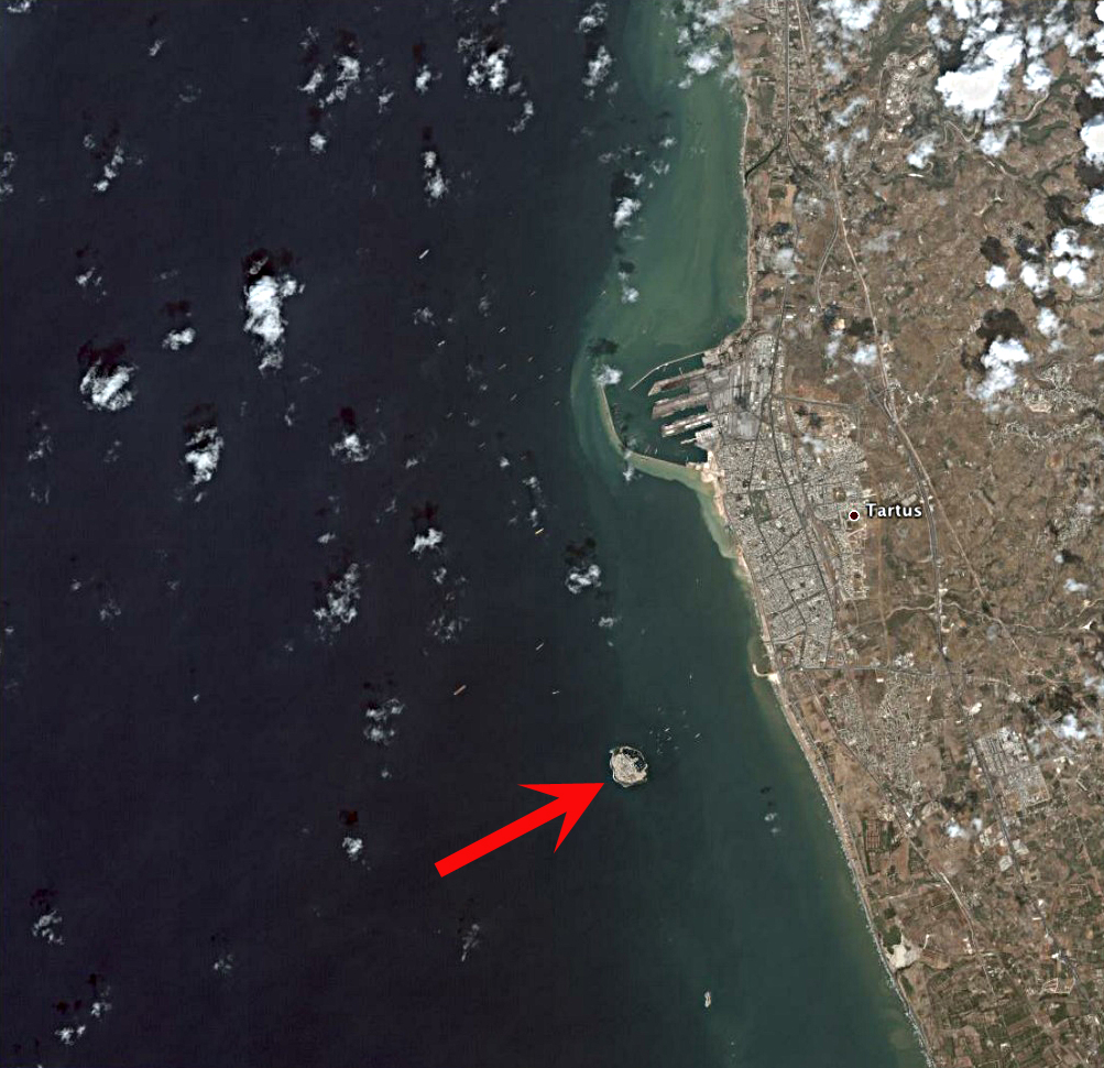
Arwad, the classical Aradus ( ar, أرواد), is a town in Syria on an eponymous island in the Mediterranean Sea. It is the administrative center of the Arwad Subdistrict (''nahiyah''), of which it is the only locality.General Census of Population and Housing 2004 Syria Central Bureau of Statistics (CBS). Latakia Governorate. It is the only inhabited island in Syria. It is located from (the ancient Tortosa), Syria's second-largest port. Today, Arwad is mainly a fishing tow ... [...More Info...] [...Related Items...] OR: [Wikipedia] [Google] [Baidu] |
Tripoli, Lebanon
Tripoli ( ar, طرابلس/ALA-LC: ''Ṭarābulus'', Lebanese Arabic: ''Ṭrablus'') is the largest city in northern Lebanon and the second-largest city in the country. Situated north of the capital Beirut, it is the capital of the North Governorate and the Tripoli District. Tripoli overlooks the eastern Mediterranean Sea, and it is the northernmost seaport in Lebanon. It holds a string of four small islands offshore. The Palm Islands were declared a protected area because of their status of haven for endangered loggerhead turtles (''Chelona mydas''), rare monk seals and migratory birds. Tripoli borders the city of El Mina, the port of the Tripoli District, which it is geographically conjoined with to form the greater Tripoli conurbation. The history of Tripoli dates back at least to the 14th century BCE. The city is well known for containing the Mansouri Great Mosque and the largest Crusader fortress in Lebanon, the Citadel of Raymond de Saint-Gilles. It has the second hig ... [...More Info...] [...Related Items...] OR: [Wikipedia] [Google] [Baidu] |
Sidon
Sidon ( ; he, צִידוֹן, ''Ṣīḏōn'') known locally as Sayda or Saida ( ar, صيدا ''Ṣaydā''), is the third-largest city in Lebanon. It is located in the South Governorate, of which it is the capital, on the Mediterranean coast. Tyre to the south and Lebanese capital Beirut to the north are both about away. Sidon has a population of about 80,000 within city limits, while its metropolitan area has more than a quarter-million inhabitants. Name The Phoenician name ''Ṣīdūn'' (, ) probably meant "fishery" or "fishing town". It is mentioned in Papyrus Anastasi I as Djedouna. It appears in Biblical Hebrew as ''Ṣīḏōn'' ( he, צִידוֹן) and in Syriac as ''Ṣidon'' (). This was Hellenised as ''Sidṓn'' ( grc-gre, Σιδών), which was Latinised as '. The name appears in Classical Arabic as ''Ṣaydūn'' () and in Modern Arabic as ''Ṣaydā'' (). As a Roman colony, it was notionally refounded and given the formal name ' to honour its imperial sp ... [...More Info...] [...Related Items...] OR: [Wikipedia] [Google] [Baidu] |
Pleistocene
The Pleistocene ( , often referred to as the ''Ice age'') is the geological Epoch (geology), epoch that lasted from about 2,580,000 to 11,700 years ago, spanning the Earth's most recent period of repeated glaciations. Before a change was finally confirmed in 2009 by the International Union of Geological Sciences, the cutoff of the Pleistocene and the preceding Pliocene was regarded as being 1.806 million years Before Present (BP). Publications from earlier years may use either definition of the period. The end of the Pleistocene corresponds with the end of the last glacial period and also with the end of the Paleolithic age used in archaeology. The name is a combination of Ancient Greek grc, label=none, πλεῖστος, pleīstos, most and grc, label=none, καινός, kainós (latinized as ), 'new'. At the end of the preceding Pliocene, the previously isolated North and South American continents were joined by the Isthmus of Panama, causing Great American Interchang ... [...More Info...] [...Related Items...] OR: [Wikipedia] [Google] [Baidu] |
Dunes
A dune is a landform composed of wind- or water-driven sand. It typically takes the form of a mound, ridge, or hill. An area with dunes is called a dune system or a dune complex. A large dune complex is called a dune field, while broad, flat regions covered with wind-swept sand or dunes with little or no vegetation are called ''ergs'' or ''sand seas''. Dunes occur in different shapes and sizes, but most kinds of dunes are longer on the stoss (upflow) side, where the sand is pushed up the dune, and have a shorter ''slip face'' in the lee side. The valley or trough between dunes is called a ''dune slack''. Dunes are most common in desert environments, where the lack of moisture hinders the growth of vegetation that would otherwise interfere with the development of dunes. However, sand deposits are not restricted to deserts, and dunes are also found along sea shores, along streams in semiarid climates, in areas of glacial outwash, and in other areas where poorly cemented san ... [...More Info...] [...Related Items...] OR: [Wikipedia] [Google] [Baidu] |

Saunders_Quarry-1.jpg)


