|
Kumara (Mali)
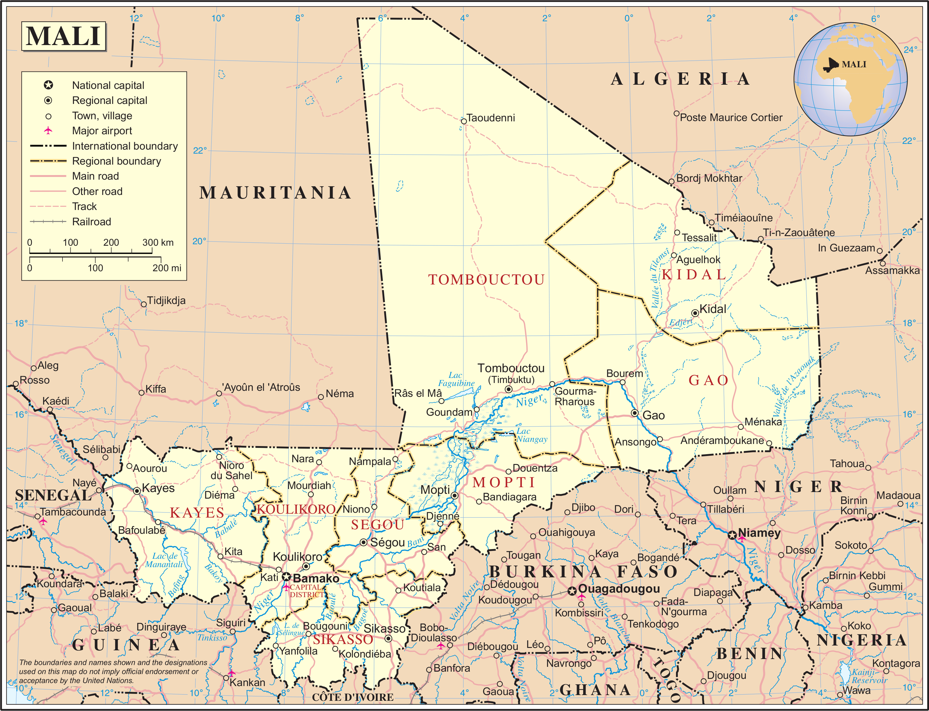
Kumara is a populated area in the Mopti Region of Mali Mali (; ), officially the Republic of Mali,, , ff, ׿ł×ż½×ż▓ןå׿Ż×żóןä׿▓׿Ż×żŁ ׿ā׿óןä׿ż×żŁ, Renndaandi Maali, italics=no, ar, ž¼┘ģ┘ć┘łž▒┘Ŗž® ┘ģž¦┘ä┘Ŗ, Jumh┼½riyy─üt M─ül─½ is a landlocked country in West Africa. Mali .... Geography *Latitude, longitude: 14.1167, -5.1500 (14┬░ 7' N, 5┬░ 9' W) *Altitude (feet): 823 *Altitude (meters): 250 *Time zone: UTC 0 Geography of Mali Populated places in Mopti Region {{Mopti-geo-stub ... [...More Info...] [...Related Items...] OR: [Wikipedia] [Google] [Baidu] |
UTC┬▒0
UTC+00:00 is an identifier for a time offset from UTC of +00:00. In ISO 8601, an example of the associated time would be written as 2019-02-07T23:28:34+00:00. It is also known by the following geographical or historical names: *Greenwich Mean Time *Western European Time *Azores Summer Time *Eastern Greenland Summer Time *Western Sahara Standard Time As standard time (Northern Hemisphere winter) ''Principal cities: London, Belfast, Glasgow, Cardiff, Dublin, Las Palmas de Gran Canaria, Santa Cruz de Tenerife, Lisbon, Porto'' Europe Western Europe *Portugal ( WET) *United Kingdom and the adjacent Crown Dependencies (Channel Islands and the Isle of Man) (GMT) ** (England, Wales, Scotland and Northern Ireland) *Faroe Islands ( WET) Atlantic islands *Portugal ** Madeira ( WET) *Spain ** Canary Islands ( WET) Notes: #The westernmost point where UTC with DST is applied is El Hierro, Canary Islands, Spain ( 18┬░00ŌĆ▓ W). Time used there is 2 hours and 12 minutes ahead of ph ... [...More Info...] [...Related Items...] OR: [Wikipedia] [Google] [Baidu] |
Mali
Mali (; ), officially the Republic of Mali,, , ff, ׿ł×ż½×ż▓ןå׿Ż×żóןä׿▓׿Ż×żŁ ׿ā׿óןä׿ż×żŁ, Renndaandi Maali, italics=no, ar, ž¼┘ģ┘ć┘łž▒┘Ŗž® ┘ģž¦┘ä┘Ŗ, Jumh┼½riyy─üt M─ül─½ is a landlocked country in West Africa. Mali is the eighth-largest country in Africa, with an area of over . The population of Mali is million. 67% of its population was estimated to be under the age of 25 in 2017. Its capital and largest city is Bamako. The sovereign state of Mali consists of eight regions and its borders on the north reach deep into the middle of the Sahara Desert. The country's southern part is in the Sudanian savanna, where the majority of inhabitants live, and both the Niger and Senegal rivers pass through. The country's economy centres on agriculture and mining. One of Mali's most prominent natural resources is gold, and the country is the third largest producer of gold on the African continent. It also exports salt. Present-day Mali was once part of t ... [...More Info...] [...Related Items...] OR: [Wikipedia] [Google] [Baidu] |
Geography Of Mali
Mali is a landlocked nation in West Africa, located southwest of Algeria, extending south-west from the southern Sahara Desert through the Sahel to the Sudanian savanna zone. Mali's size is 1,240,192 square kilometers. Desert or semi-desert covers about 65 percent of Mali's total area (1,240,192 square kilometers). The Niger River creates a large and fertile inland delta as it arcs northeast through Mali from Guinea before turning south and eventually emptying into the Gulf of Guinea. The territory encompasses three natural zones: the southern cultivated Sudanese zone, central semi-desert Sahelian zone, and northern desert Saharan zone. The terrain is primarily savanna in the south and flat to rolling plains or high plateau (200ŌĆō500 meters in elevation) in the north. There are rugged hills in the northeast, with elevations of up to 1,000 meters. The Niger (with 1,693 kilometers in Mali) and Senegal are Mali's two largest rivers. The Niger is generally described as Mali's l ... [...More Info...] [...Related Items...] OR: [Wikipedia] [Google] [Baidu] |

