|
Kruibeke
Kruibeke () is a municipality located in the Belgian province of East Flanders. The municipality comprises the towns of Bazel, Kruibeke proper and Rupelmonde. On 1 January 2018, Kruibeke had a total population of 16,657. The total area is 33.42 km². The oldest secular centre of the area is the feudal castle of Wissekerke at Bazel, which was inhabited by the ancient family Vilain until 1989. In March 2003, the mayor at that time Antoine Denert set up the Department of Tenderness to encourage residents to be nicer to each other. Denert worried that "people don't cuddle anymore and that's the reason why there are so many conflicts." and announced: "I will set an example and start in my own village by caressing, cuddling and kissing as many people as possible." He officially added Tenderness to his alderman portfolio of duties, until then Work, Environment and Budget. As of 26 August 2004, no other civic governments have adopted this idea. Jos Stassen has been the active mayor ... [...More Info...] [...Related Items...] OR: [Wikipedia] [Google] [Baidu] |
Bazel
Bazel is a village in Belgium, in the municipality of Kruibeke in the province of East Flanders. The village is home to the Wissekerke Castle. The municipality of Bazel merged into Kruibeke in 1977. Overview The parish church was founded in the early 10th century. The village was located on the medieval road from Lille to Antwerp. From 1640, the village started develop. The Wissekerke Castle is located in the village. The castle originates from the 10th century, however it burnt down, and was rebuilt in the 15th century. For two centuries, it was owned by the Vilain XIIII Vilain and Vilain XIIII (pronounced ''Vilain-Quatorze'' , sometimes written with the more standard Roman numerals Vilain XIV) is a Belgian noble family. Their coat of arms is basically "Sable, a chief argent" (french: sable, au chef d'argent), a ... family, who remodelled the castle in neo-Gothic style. The suspension bridge was constructed in 1824 and is one of the oldest suspension bridges in Belgium. In 1 ... [...More Info...] [...Related Items...] OR: [Wikipedia] [Google] [Baidu] |
Zwijndrecht, Belgium
Zwijndrecht () is both a village and a municipality located in the Flemish province of Antwerp, in Belgium. As well as Zwijndrecht proper, the municipality includes the village of Burcht. In 2021, Zwijndrecht had a total population of 19,263. History Origin of the name The name Zwijndrecht is derived from the old Germanic words “swina drifti.” The words “swina” and “drifti” are synonyms and both mean creek. “Drifti” evolved from to ; the suffix – appears frequently in place-names north of the river Scheldt, where streams and creeks are abundant. Early history While very little archaeological excavation has been done in the municipality of Zwijndrecht itself, numerous findings have been documented in the surrounding region, which is referred to as the Waasland. These have indicated occupation in the area from as early as the end of the Neolithic Period (c. 2200-1800 B.C.). Numerous indications of Roman occupation have also been uncovered in the Waasland area ... [...More Info...] [...Related Items...] OR: [Wikipedia] [Google] [Baidu] |
Rupelmonde
Rupelmonde is a village in the municipality of Kruibeke, in the Belgian province of East Flanders. It stands on the bank of the river Schelde opposite the confluence of the eponymous Rupel, and is famed for its sundials as well as having what is probably Belgium's only tidemill. It is the birthplace of Gerardus Mercator, the Flemish cartographer, who was imprisoned for several months in the castle there, a remnant of which today serves as a museum. The town holds a procession of civic giants on the first Sunday of August each year. Gallery Moerzeke
Moerzeke is a village located at the ...
[...More Info...] [...Related Items...] OR: [Wikipedia] [Google] [Baidu] |
Arrondissement Of Sint-Niklaas
{{EastFlanders-geo-stub ...
The Arrondissement of Sint-Niklaas (; ) is one of the six administrative arrondissements in the Province of East Flanders, Belgium. The Administrative Arrondissement of Sint-Niklaas consists of the following municipalities: * Beveren * Kruibeke * Lokeren * Sint-Gillis-Waas * Sint-Niklaas * Stekene * Temse Sint-Niklaas Sint-Niklaas (; french: Saint-Nicolas, ) is a Belgian city and municipality located in the Flemish province of East Flanders. The municipality comprises the city of Sint-Niklaas proper and the towns of Belsele, Nieuwkerken-Waas, and . Sint-Nikl ... [...More Info...] [...Related Items...] OR: [Wikipedia] [Google] [Baidu] |
Beveren
Beveren () is a municipality in the Belgian province of East Flanders which comprises the towns of Beveren, Doel, Haasdonk, Kallo, Kieldrecht, Melsele, Verrebroek and Vrasene. The port of the Waasland (Dutch: ''Waaslandhaven'') is in Beveren, on the left bank of the Schelde, facing the port of Antwerp on the other side of the river. History Roman origins In Roman times, the Beveren area was at the edge of the sea and heavily influenced by the tides. The earliest inhabitants erected primitive dams, which were later reinforced and built higher by the religious communities that sprang up in the region. The invasions of the Normans in the 9th century prompted the Counts of Flanders and their local vassals to defend this land even more. Among the local nobility were the lords of Beveren, whose territory was eventually ceded to Louis I of Flanders in 1334. Beveren thus became the oldest political centre of the Waasland region — the northeastern part of the historical Coun ... [...More Info...] [...Related Items...] OR: [Wikipedia] [Google] [Baidu] |
Waasland
The Waasland is a Belgian region. It is part of the Belgian provinces of East Flanders and Antwerp. The other borders of the Land van Waas are with the Scheldt and Durme rivers. The (informal) capital and major city of the region is Sint-Niklaas. It is also called the ''Land van Waas'' (Land of Waas); Waas most likely refers to the soggy soil of the region although the exact etymology is unknown. One possibility is a connection to the English word "wasteland". The swamps that characterized it have long been drained although many fields are still noticeably convex; the result of many years of plowing the topsoil towards the center to improve drainage. Historically, on account of its waterlogged, poor soils the region was thinly populated in comparison to the rest of Belgium and agriculture was by necessity based on holder farms using innovative techniques not usually applied elsewhere even if the farmers had ready markets nearby in the cities of Ghent and Antwerp. Charles Townshend ... [...More Info...] [...Related Items...] OR: [Wikipedia] [Google] [Baidu] |
Temse
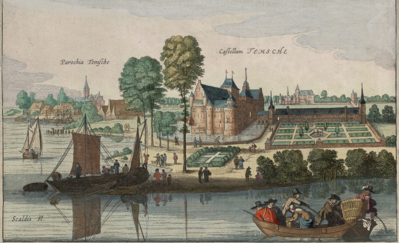
Temse (; french: Tamise ) is a municipality in East Flanders, Belgium. The name Temse is derived from the Gallo-Roman/Gaul Tamisiacum or Tamasiacum. This is also reflected in the French name for the town, Tamise. The main sights include the Church of Our Lady, whose steeple was designed by the famous sculptor Adriaan Nijs, who died in Temse, and who also sculpted the wooden pulpit. Inside the church the relics of Amalberga of Temse are venerated. Close by stands the old "Gemeentehuis" (town hall), built in Flemish Eclectic style, housing a carillon in its main tower. The municipality, which lies on the left side of the River Scheldt, comprises the towns of , , Temse and . On 1 January 2018, Temse had a population of 29,528. The total area is 39.92 km² which gives a population density of 740 inhabitants per km². Toponym Temse is first mentioned under the name ''Temsica''Gysseling, M. (1960)Temse In ''Toponymisch Woordenboek van België, Nederland, Luxemburg, Noord-Fra ... [...More Info...] [...Related Items...] OR: [Wikipedia] [Google] [Baidu] |
Bornem
Bornem (, old spelling: ''Bornhem'') is a municipality located in the Belgian province of Antwerp. The municipality comprises the village of Bornem proper, Hingene, and Weert, and . There are also the hamlets of Branst, Buitenland, Eikevliet and Wintam. In 2021, Bornem had a total population of 21,428. The total area is 45.76 km². Geography Heritage * Bornem Castle, Residence of the House Marnix de Sainte-Aldegonde. * Bornem Abbey, only Cistercian Abbey in Flanders: residence of former general Amadeus de Bie and Henricus Smeulders. Climate Bornem has a oceanic climate (Köppen: ''Cfb''). Notable people * Walter Boeykens (b. Bornem, 6 January 1938), clarinetist * Pedro Coloma, Baron of Bornhem, who purchased the lordship in 1586 and renovated the castle * Jan Hammenecker (Mariekerke, 2 October 1878 – Westrode, 13 June 1932), writer and priest * Marc Van Ranst (b. Bornem, 20 June 1965), virologist * Dries De Bondt (b. Bornem, 4 July 1991), cyclist. 2020 Belgian ... [...More Info...] [...Related Items...] OR: [Wikipedia] [Google] [Baidu] |
Schelle
:''Schelle is also the German name for Šaľa, Slovakia.'' Schelle () is a municipality located in the Belgian province of Antwerp. The municipality only comprises the town of Schelle proper. In 2021, Schelle had a total population of 8,559. The total area is 7.80 km². Notable people * Hugo Coveliers (born 1947), retired Belgian politician and lawyer * Felix De Smedt Felix De Smedt (16 August 1923, Schelle, Belgium – 2 August 2012, Mechelen, Belgium) was Belgian judoka who is credited with introducing the sport to Belgium. In January 1941, he studied judo formally in Berlin, and was the first Belgian to ... (1923–2012), judoka who is credited with introducing the sport to Belgium. Gallery File:Schelle, parochiekerk Sint-Petrus en Paulus oeg14075 IMG 9977 2019-06-22 14.04.jpg, Schelle, church: parochiekerk Sint-Petrus en Paulus File:Elektriciteitscentrale Ebes Intercom - 345442 - onroerenderfgoed.jpg, Power plant File:Hoeve "Klooster-Kapucienen-hoeve" (°XVII) ... [...More Info...] [...Related Items...] OR: [Wikipedia] [Google] [Baidu] |
Hemiksem
Hemiksem (, historical spellings ''Heymissen'' and ''Hemixem'') is a municipality located in the Belgian province of Antwerp. The municipality only comprises the town of Hemiksem proper. In 2021, Hemiksem had a total population of 11,722. The total area is 5.44 km². History The village was first mentioned in 1155 as Hamincsem. In 1246, Cistercian monks established St. Bernard's Abbey, Hemiksem near the Scheldt, and became Lords of the ''heerlijkheid'' (landed estate) Hemiksem. The area used to be heavily forest. In 1358, the first brickworks was established, but it was an agricultural area until the 19th century. During the 19th century, Hemiksem started to industrialise and grow. Sights The most notable sight in Hemiksem is the 13th century St. Bernard's Abbey, which now houses the town hall and police headquarters, after having undergone extensive renovations in the past decade. Gallery Image:Hemiksem Abdij westgevel1.JPG, Former St. Bernards Abbey Image:Scheldehem ... [...More Info...] [...Related Items...] OR: [Wikipedia] [Google] [Baidu] |
Antwerp
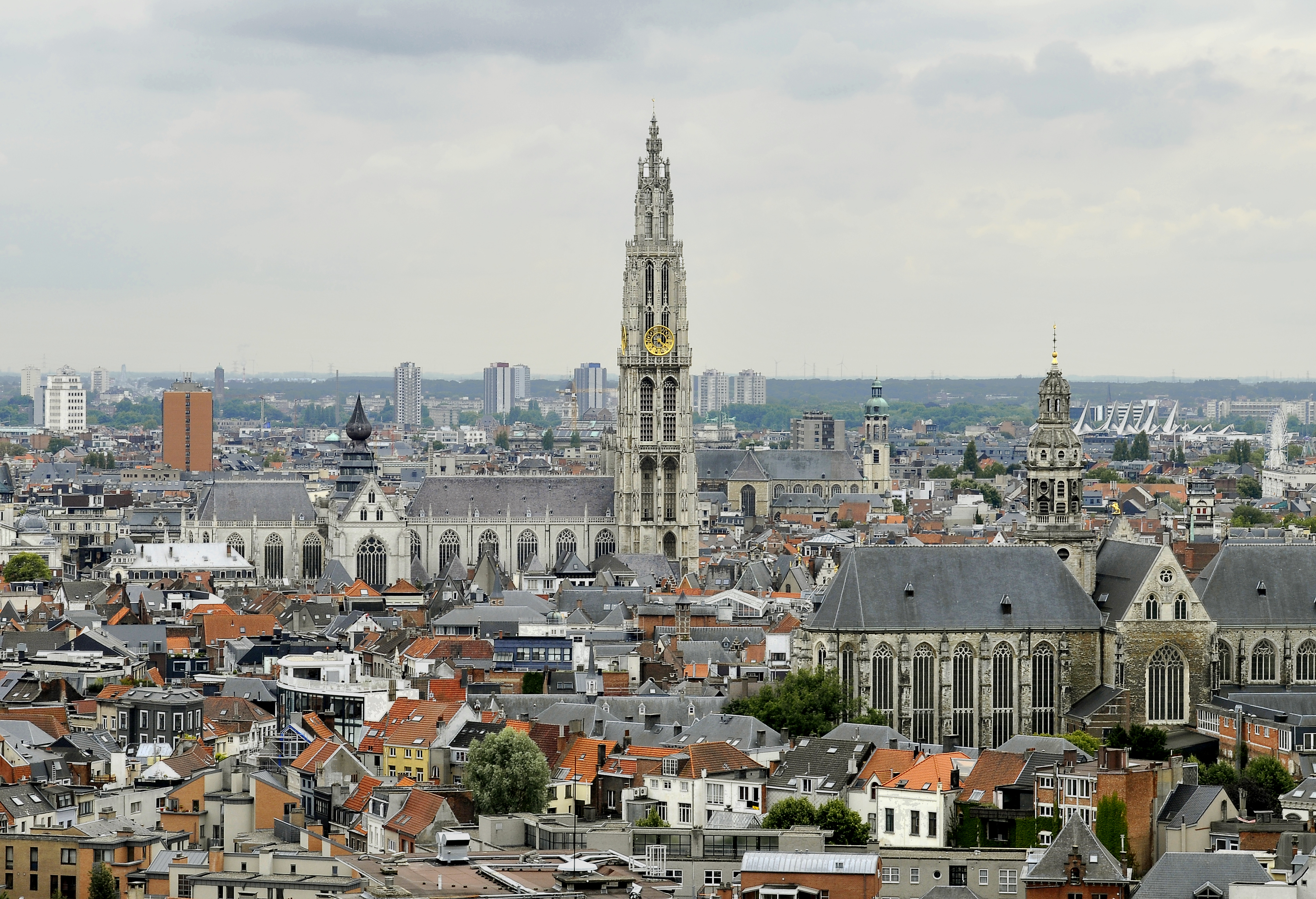
Antwerp (; nl, Antwerpen ; french: Anvers ; es, Amberes) is the largest city in Belgium by area at and the capital of Antwerp Province in the Flemish Region. With a population of 520,504,Statistics Belgium; ''Loop van de bevolking per gemeente'' (Excel file) Population of all municipalities in Belgium, . Retrieved 1 November 2017. it is the most populous municipality in Belgium, and with a metropolitan population of around 1,200,000 people, it is the second-largest metrop ... [...More Info...] [...Related Items...] OR: [Wikipedia] [Google] [Baidu] |
Gerardus Mercator
Gerardus Mercator (; 5 March 1512 – 2 December 1594) was a 16th-century geographer, cosmographer and cartographer from the County of Flanders. He is most renowned for creating the 1569 world map based on a new projection which represented sailing courses of constant bearing ( rhumb lines) as straight lines—an innovation that is still employed in nautical charts. Mercator was a highly influential pioneer in the history of cartography. Monmonier, Mark: ''Rhumb Lines and Map Wars: A Social History of the Mercator Projection''. (Chicago: University of Chicago Press, 2004)Van der Krogt, Peter (2015), 'Chapter 6: Gerhard Mercator and his Cosmography: How the 'Atlas' became an Atlas,'; in: Gerhard Holzer, et al. (eds.), ''A World of Innovation: Cartography in the Time of Gerhard Mercator''. (Newcastle upon Tyne: Cambridge Scholars Publishing, 2015), pp. 112–130 Along with Gemma Frisius and Abraham Ortelius, he is generally considered one of the founders of the Netherlandish ... [...More Info...] [...Related Items...] OR: [Wikipedia] [Google] [Baidu] |


