|
Kournas
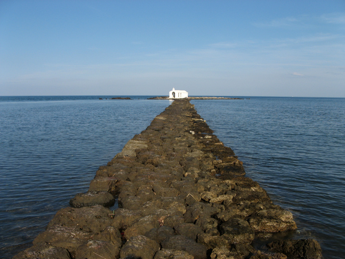
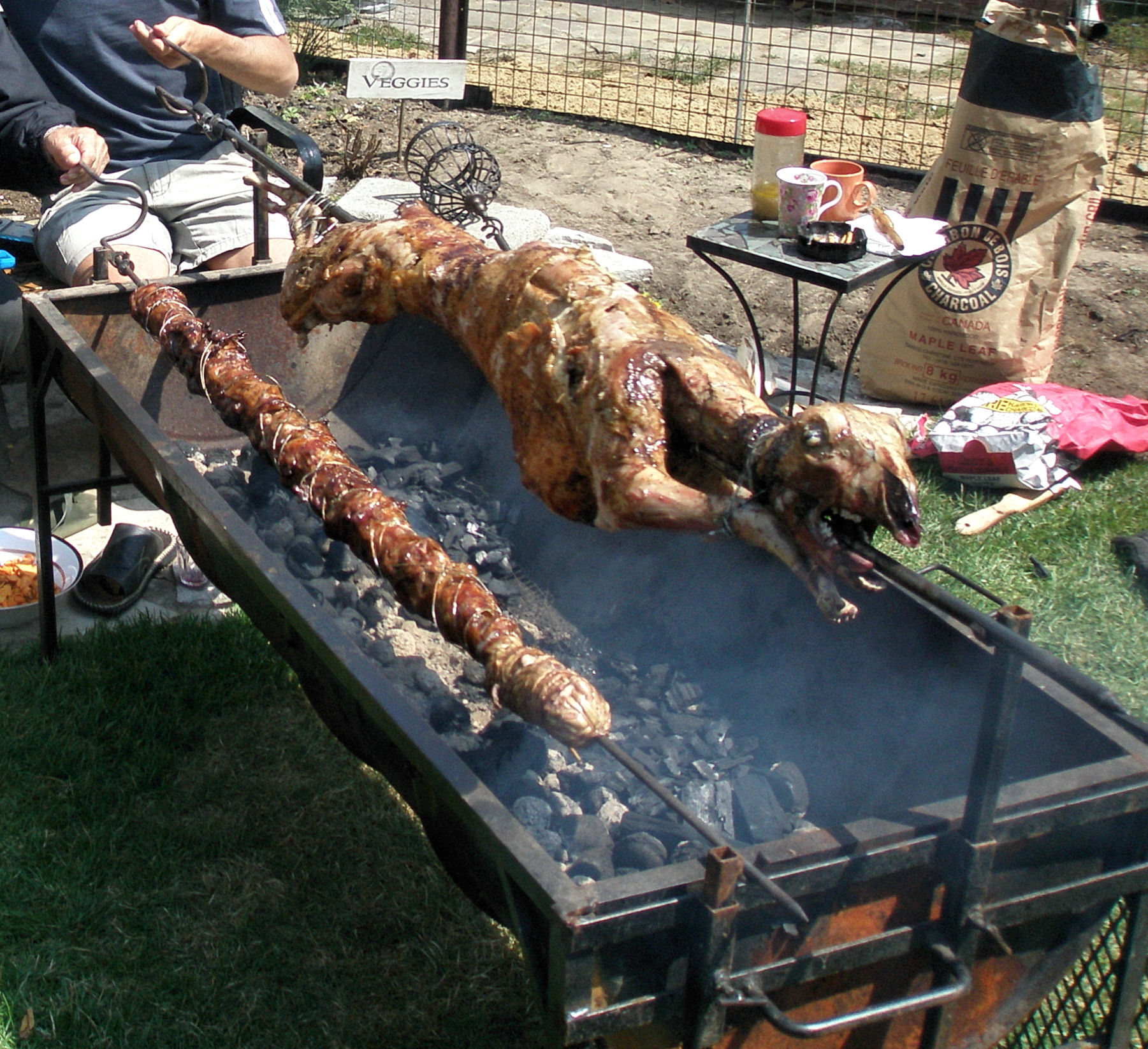
Kournas is a mountainous village of Municipality of Apokoronas, Chania, on the Greek island of Crete. It has a population of 500 citizens. It is located at 200 meters altitude and south-east of the mountain named Dafnomadara (1680 meters). Kournas is a fairly large village perched on a hill overlooking Lake Kournas. It was in the former Georgioupoli municipality, not far from the town of the same name. A working village which has seen less depopulation than some of its neighbours, Kournas is known for its pottery and many popular taverns. The taverna's seats are largely in the road - it is popular for its specialties of 'kokoretsi Kokoretsi or kokoreç is a dish of the Balkans and Anatolia (Asia Minor), consisting of lamb or goat intestines wrapped around seasoned offal, including sweetbreads, hearts, lungs, or kidneys, and typically grilled; a variant consists of chopp ...' (grilled offal) and 'galaktoboureko' (custard and orange tart). Populated places in Chania (re ... [...More Info...] [...Related Items...] OR: [Wikipedia] [Google] [Baidu] |
Lake Kournas
Lake Kournas is a lake on the island of Crete, Greece, near the village of Kournas. It is in the Apokoronas municipality of Chania regional unit close to the border with Rethymno regional unit, 47 km from the town of Chania. Kournas is a fairly large village perched on a hill overlooking the lake. Crete's only freshwater lake, Lake Kournas, is relatively large, with a perimeter of 3.5 km. There is a nature preserve on the Southwest side of the lake. There is a rustic road from the North of the lake to the Hills on the West of the lake. The lake used to be called ''Koresia'' after ancient Korion, a city thought to be in the area with a temple to Athena. The lake used to contain eels but now is better known for its terrapins and tourism. Tavernas and pedalo A pedalo (British English) or paddle boat (U.S., Canadian, and Australian English) is a human-powered watercraft propelled by the action of pedals turning a paddle wheel. Description A pedalo is a human ... [...More Info...] [...Related Items...] OR: [Wikipedia] [Google] [Baidu] |
Georgioupoli
Georgioupoli ( el, Γεωργιούπολη) is a resort village and former municipality in the Chania regional unit, Crete, Greece. Since the 2011 local government reform it is part of the municipality Apokoronas, of which it is a municipal unit. The municipal unit has an area of . It is located east of Chania, about west of Rethymno and about west of Heraklio. It was named after Prince George of Greece, high commissioner of the island in the last years of Ottoman occupation. Geography Georgioupolis is found at the apex of Almiros Bay on the Sea of Crete, with Cape Drapano and its rocky coast to the north and the long sandy beaches towards Rethimno in the east, just away. Three rivers meet the sea at the village; the largest, Almiros, creates a small harbour for fishing and tourist boats. The entrance to the village on the old road from Vrisses is a long avenue of eucalyptus trees. Formerly a small fishing village, Georgioupolis is very much a tourist town now, with many ... [...More Info...] [...Related Items...] OR: [Wikipedia] [Google] [Baidu] |
Chania (regional Unit)
Chania ( el, Περιφερειακή ενότητα Χανίων) is one of the four regional units of Greece, regional units of Crete; it covers the westernmost quarter of the island. Its capital is the city of Chania. Chania borders only one other regional unit: that of Rethymno (regional unit), Rethymno to the east. The western part of Crete is bounded to the north by the Sea of Crete, Cretan Sea, and to the west and south by the Mediterranean Sea. The regional unit also includes the southernmost island of Europe, Gavdos. Geography Chania regional unit, often informally termed 'Western Crete', is a part of the island which includes the districts of Apokoronas, Sfakia, and Selino in the far South West corner. Other towns in the Chania prefecture include Sfakia#Hora Sfakion, Hora Sfakion, Kastelli-Kissamos, Kissamos, Palaiochora, Maleme, Vryses, Vamos, Georgioupolis and Kalives. The natural park of Samariá Gorge, a tourist attraction and a refuge for the rare Cretan wild goat ... [...More Info...] [...Related Items...] OR: [Wikipedia] [Google] [Baidu] |
Crete
Crete ( el, Κρήτη, translit=, Modern: , Ancient: ) is the largest and most populous of the Greek islands, the 88th largest island in the world and the fifth largest island in the Mediterranean Sea, after Sicily, Sardinia, Cyprus, and Corsica. Crete rests about south of the Greek mainland, and about southwest of Anatolia. Crete has an area of and a coastline of 1,046 km (650 mi). It bounds the southern border of the Aegean Sea, with the Sea of Crete (or North Cretan Sea) to the north and the Libyan Sea (or South Cretan Sea) to the south. Crete and a number of islands and islets that surround it constitute the Region of Crete ( el, Περιφέρεια Κρήτης, links=no), which is the southernmost of the 13 top-level administrative units of Greece, and the fifth most populous of Greece's regions. Its capital and largest city is Heraklion, on the north shore of the island. , the region had a population of 636,504. The Dodecanese are located to the no ... [...More Info...] [...Related Items...] OR: [Wikipedia] [Google] [Baidu] |
Apokoronas
Apokoronas ( el, Αποκόρωνας) is a municipality and a former province (επαρχία) in the Chania regional unit, north-west Crete, Greece. It is situated on the north coast of Crete, to the east of Chania itself. The seat of the municipality is the village Vryses. The municipality has an area of . Geography Apokoronas extends from the foothills of the White Mountains north to the coast, in a wide plain with rolling hills. To the east, Cape Drapanon rises above the plain and extends out into the Sea of Crete. The area is very green and fertile, unusual for rocky Crete. The Kiliaris river, known in antiquity as 'Pyknos', runs through the region. Robert Pashley suggested that the name 'Apokoronas' came from the ancient city of Ippokoronas or Ippokoronion, also cited by Strabo. This city may have been located near modern Nipos, or on the site of the Venetian fortress, Castel Apicorono, on an outcrop between Kalyves and Almyrida. The major towns of Apokoronas are Va ... [...More Info...] [...Related Items...] OR: [Wikipedia] [Google] [Baidu] |
Kokoretsi
Kokoretsi or kokoreç is a dish of the Balkans and Anatolia (Asia Minor), consisting of lamb or goat intestines wrapped around seasoned offal, including sweetbreads, hearts, lungs, or kidneys, and typically grilled; a variant consists of chopped innards cooked on a griddle. The intestines of suckling lambs are preferred. Names A dish identical to modern kokoretsi is first attested in the cuisine of the Byzantines. They called it (''plektín''), (''koilióchorda''), or (''chordókoila''); the latter two are preserved with the meaning of wrapped intestines in the Greek idioms of Corfu as (''tsoilíchourda''), of Plovdiv as (''chordókoila''), of Chios as (''soilígourda''), of Pontians as (''chordógkoila''), and in part, of Zagori and Argyrades as (''chordí''), of Thessaly as (''chourdí''), of northern Peloponnese as (''kordiá'') or (''kórda''), and of Vogatsiko as (''kourdí''). Other names found in medieval texts are (''gardoúmion'') and (''gardoúmenon''), ... [...More Info...] [...Related Items...] OR: [Wikipedia] [Google] [Baidu] |


