|
Kostiantynivka, Mykolaiv Oblast
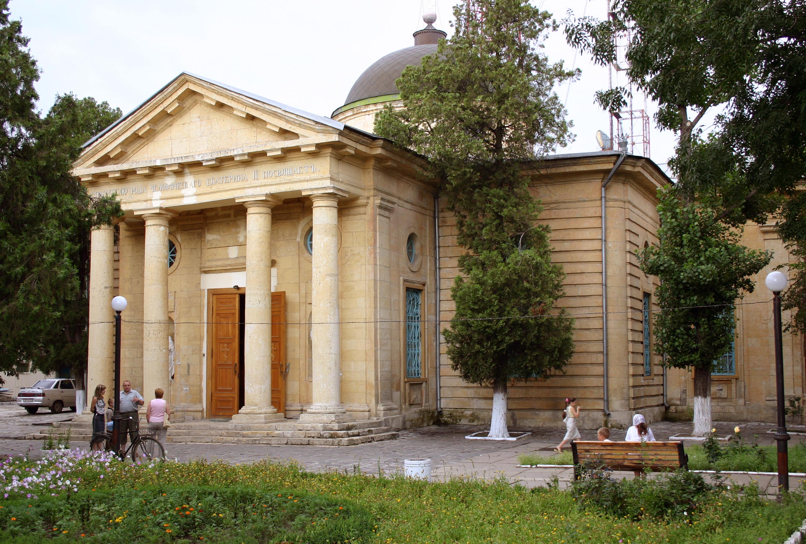
Kostiantynivka ( uk, Костянтинівка; russian: Константиновка) is an urban-type settlement in Voznesensk Raion in the north of Mykolaiv Oblast, Ukraine. It belongs to Yuzhnoukrainsk urban hromada, one of the hromadas of Ukraine. Population: Kostiantynivka is located on the left bank of the Southern Bug and is adjacent to the city of Yuzhnoukrainsk. History Kostiantynivka was founded before 1775 by Zaporozhian Cossacks. It was a settlement guarding a ford across the Southern Bug. In 1816, Kostiantynivka became a military settlement which belonged to Yelisavetgradsky Uyezd of Kherson Governorate. It was a part of the 2rd Bug Uhlan Regiment, which later was renamed Odessa Uhlan Regiment. In 1828, Yelisavetgradsky Uyezd was merged with Olviopolsky Uyezd into Bobrinetsky Uyezd. In 1857, military settlements were abolished. In 1865, the administrative center of Bobrinetsky Uyezd was moved to Yelisavetgrad, and the uyezd was renamed Yelisavetgradsky. Kos ... [...More Info...] [...Related Items...] OR: [Wikipedia] [Google] [Baidu] |
List Of Urban-type Settlements In Ukraine
On 1 January 2006 there were 885 urban-type settlements ( uk, селище міського типу, translit.: ''selysche mis'koho typu'') in Ukraine. Below is the list of ''all'' urban-type settlements by subdivisions and population, which is given according to the 2001 Ukrainian Census. __TOC__ Urban-type settlements in Ukraine (by subdivisions) Autonomous Republic of Crimea , Cherkasy Oblast , Chernihiv Oblast , Chernivtsi Oblast , Dnipropetrovsk Oblast , Donetsk Oblast , Ivano-Frankivsk Oblast , Kharkiv Oblast , Kherson Oblast , Khmelnytskyi Oblast , Kyiv Oblast , Kirovohrad Oblast , Luhansk Oblast , Lviv Oblast , Mykolaiv Oblast , Odessa Oblast , Poltava Oblast , Rivne Oblast , Sevastopol , Sumy Oblast , Ternopil Oblast , Vinnytsia Oblast , Volyn Oblast , Zakarpattia Oblast , Zaporizhzhia Oblast , Zhytomyr Oblast See also * List of places named after people#Ukraine * Administrative divisions of Ukraine * Raio ... [...More Info...] [...Related Items...] OR: [Wikipedia] [Google] [Baidu] |
Kherson Governorate
The Kherson Governorate (1802–1922; russian: Херсонская губерния, translit.: ''Khersonskaya guberniya''; uk, Херсонська губернія, translit=Khersonska huberniia), was an administrative territorial unit (also translated ''gubernia'', ''province'', or ''government''), of the Russian Empire located between the Dnieper and Dniester Rivers. It was one of three governorates created in 1802 when the Novorossiya guberniya was abolished. It was known as the Mykolaiv or Nikolayev Governorate () until 1803, when Nikolayev was separated into a special Nikolayev War Governorate as a center of the Black Sea Fleet and the governor seat was moved to Kherson. The economy of the governorate was mainly based on agriculture. During the grain harvest, thousands of agricultural laborers from the parts of the Empire found work in the area. The industrial part of the economy, consisting primarily of flour milling, distilling, metalworking industry, iron mining, ... [...More Info...] [...Related Items...] OR: [Wikipedia] [Google] [Baidu] |
Odessa Oblast
Odesa Oblast ( uk, Оде́ська о́бласть, translit=Odeska oblast), also referred to as Odeshchyna ( uk, Оде́щина) is an administrative divisions of Ukraine, oblast (province) of southwestern Ukraine, located along the northern coast of the Black Sea. Its administrative centre is the city of Odesa ( uk, Одеса). Population: The length of coastline (sea-coast and estuaries) reaches , while the state border stretches for .Tell about Ukraine. Odessa Oblast 24 Kanal (youtube). The region has eight seaports, over of vineyards, and five of the biggest lakes in Ukraine. One of the largest, Yalpuh Lake, is as large as the city of Odesa itself. History Evidence of the earliest inhabitants in this area comes from the settlements a ...[...More Info...] [...Related Items...] OR: [Wikipedia] [Google] [Baidu] |
Arbuzynka
Arbuzynka (until 1946 as Harbuzynka; uk, Арбузинка, russian: Арбузи́нка) is an urban-type settlement in Pervomaisk Raion in the north of Mykolaiv Oblast, Ukraine. It hosts the administration of Arbuzynka settlement hromada, one of the hromadas of Ukraine. Population: Arbuzynka is located on the banks of the Arbuzynka (river), Arbuzynka, a right tributary of the Mertvovid, in the drainage basin of the Southern Bug. History Arbuzynka was founded as Haidamatske by Zaporozhian Cossacks before 1775. In 1816, Arbuzynka (Harbuzynka) became a military settlement which belonged to Yelisavetgradsky Uyezd of Kherson Governorate. It was a part of the 3rd Bug Uhlan Regiment, which later was renamed Voznesensk Uhlan Regiment. In 1828, Yelisavetgradsky Uyezd was merged with Olviopolsky Uyezd into Bobrinetsky Uyezd. In 1857, military settlements were abolished. In 1865, the administrative center of Bobrinetsky Uyezd was moved to Kropyvnytskyi, Yelisavetgrad, and the uyezd was ... [...More Info...] [...Related Items...] OR: [Wikipedia] [Google] [Baidu] |
Arbuzynka Raion
Arbuzynka Raion ( uk, Арбузинський район) was a subdivision of Mykolaiv Oblast of Ukraine. Its administrative center was the urban-type settlement of Arbuzynka. The raion was abolished on 18 July 2020 as part of the administrative reform of Ukraine, which reduced the number of raions of Mykolaiv Oblast to four. The area of Arbuzynka Raion was merged into Pervomaisk Raion. The last estimate of the raion population was History In the beginning of the 19th century, the current area of the district belonged to Yelisavetgradsky Uyezd of Kherson Governorate. In 1816, the areas of Konstantinovskaya and Blagodatnovskaya Volosts were made military settlements. In 1828, Yelisavetgradsky Uyezd was merged with Olviopolsky Uyezd into Bobrinetsky Uyezd. In 1857, military settlements were abolished. In 1865, the administrative center of Bobrinetsky Uyezd was moved to Yelisavetgrad, and the uyezd was renamed Yelisavetgradsky. On 16 April 1920, Kherson Governorate was renamed ... [...More Info...] [...Related Items...] OR: [Wikipedia] [Google] [Baidu] |
Okruhas Of The Ukrainian SSR
An okruha ( uk, округа) is an historical administrative division of the Ukrainian Soviet Socialist Republic that existed between 1923 and 1930. The system was intended as a transitional system between the Russian Imperial division of governorates and the modern equivalent of oblasts. As a literal translation, the word ''okruha'' means vicinity or neighborhood (sharing a root with the words "circle" and "around", a close equivalent is the German term ). This level of subdivision is roughly equivalent to that of a county, parish, or borough. Okruhas were first established in 1918 when the Polissya Okruha and Taurida Okruha were created as temporary territories of the Ukrainian State of 1918. History Formation First okruhas, created just before 1918, were Polissya Okruha centered in Mozyr and Taurida Okruha centered in Berdyansk. Okruhas were first introduced on a widespread scale on April 12, 1923, at the 2nd session of the Central Executive Committee of Ukraine which a ... [...More Info...] [...Related Items...] OR: [Wikipedia] [Google] [Baidu] |
Ukrainian Soviet Socialist Republic
The Ukrainian Soviet Socialist Republic ( uk, Украї́нська Радя́нська Соціалісти́чна Респу́бліка, ; russian: Украи́нская Сове́тская Социалисти́ческая Респу́блика, group=note), abbreviated as the Ukrainian SSR, UkrSSR, or UkSSR, and also known as Soviet Ukraine, was one of the Republics of the Soviet Union, constituent republics of the Soviet Union from 1922 until 1991. In the anthem of the Ukrainian Soviet Socialist Republic, anthem of the Ukrainian SSR, it was referred to simply as ''History of Ukraine, Ukraine''. Under the Soviet One-party state, one-party model, the Ukrainian SSR was governed by the Communist Party of the Soviet Union through its Soviet democracy, republican branch: the Communist Party of Ukraine (Soviet Union), Communist Party of Ukraine. The first iterations of the Ukrainian SSR were established during the Russian Revolution, particularly after the October Revol ... [...More Info...] [...Related Items...] OR: [Wikipedia] [Google] [Baidu] |
Odessa Governorate
Odesa Governorate (), was a territorial division of the Ukrainian SSR (Ukraine) that was created in January 1920 by a decision of the All-Ukrainian Revolutionary Committee (Soviet regime). The new governorate was initially created from the western part of the Kherson Governorate (which was later renamed Mykolaiv Governorate, and then merged with the rest of Odesa Governorate). The western parts of the Odesa Governorate would serve as the foundation for the Moldavian Autonomous Soviet Socialist Republic * ro, Proletari din toate țările, uniți-vă! (Moldovan Cyrillic: ) * uk, Пролетарі всіх країн, єднайтеся! * russian: Пролетарии всех стран, соединяйтесь! , title_leader = First Secr ... in 1924. In 1925 Odesa Governorate was dissolved during the administrative reform of 1925. Subdivisions A governorate was divided into counties (Russian ''uezd''; Ukrainian ''povit''). * Ananiv county (1920–21) * Balta county ( ... [...More Info...] [...Related Items...] OR: [Wikipedia] [Google] [Baidu] |
Konstantinovskaya Volost
Konstantinovsky (masculine), Konstantinovskaya (feminine), or Konstantinovskoye (neuter) may refer to: * Konstantinovsky District, several districts in Russia *Konstantinovskoye Urban Settlement, an administrative division and a municipal formation which the town of Konstantinovsk and five rural localities in Konstantinovsky District of Rostov Oblast, Russia are incorporated as * Konstantinovsky (inhabited locality) (''Konstantinovskaya'', ''Konstantinovskoye''), several inhabited localities in Russia *Constantine Palace (''Konstantinovsky dvorets''), a palace in Strelna, Russia * Konstantinovskoye Municipal Okrug, a municipal okrug of Krasnoselsky District Krasnoselsky District is the name of several administrative and municipal districts in Russia. *Krasnoselsky District, Moscow, a district in Central Administrative Okrug of the federal city of Moscow * Krasnoselsky District, Saint Petersburg, an ... in the federal city of St. Petersburg, Russia * Vyacheslav Leonidovych Kon ... [...More Info...] [...Related Items...] OR: [Wikipedia] [Google] [Baidu] |
Village
A village is a clustered human settlement or community, larger than a hamlet but smaller than a town (although the word is often used to describe both hamlets and smaller towns), with a population typically ranging from a few hundred to a few thousand. Though villages are often located in rural areas, the term urban village is also applied to certain urban neighborhoods. Villages are normally permanent, with fixed dwellings; however, transient villages can occur. Further, the dwellings of a village are fairly close to one another, not scattered broadly over the landscape, as a dispersed settlement. In the past, villages were a usual form of community for societies that practice subsistence agriculture, and also for some non-agricultural societies. In Great Britain, a hamlet earned the right to be called a village when it built a church. [...More Info...] [...Related Items...] OR: [Wikipedia] [Google] [Baidu] |
Uyezd
An uezd (also spelled uyezd; rus, уе́зд, p=ʊˈjest), or povit in a Ukrainian context ( uk, повіт), or Kreis in Baltic-German context, was a type of administrative subdivision of the Grand Duchy of Moscow, the Russian Empire, and the early Russian SFSR, which was in use from the 13th century. For most of Russian history, uezds were a second-level administrative division. By sense, but not by etymology, ''uezd'' approximately corresponds to the English "county". General description Originally describing groups of several volosts, they formed around the most important cities. Uezds were ruled by the appointees ('' namestniki'') of a knyaz and, starting from the 17th century, by voyevodas. In 1708, an administrative reform was carried out by Peter the Great, dividing Russia into governorates. The subdivision into uyezds was abolished at that time but was reinstated in 1727, as a result of Catherine I's administrative reform. By the Soviet administrative reform of 1923 ... [...More Info...] [...Related Items...] OR: [Wikipedia] [Google] [Baidu] |
Kropyvnytskyi
Kropyvnytskyi ( uk, Кропивницький, Kropyvnytskyi ) is a city in central Ukraine on the Inhul river with a population of . It is an administrative center of the Kirovohrad Oblast. Over its history, Kropyvnytskyi has changed its name several times. The settlement was known as Yelysavethrad ( uk, Єлисаветград, links=no ) after Empress Elizabeth of Russia () from 1752 to 1924 as well as simply Elysavet. In 1924 it became Zinovievsk ( uk, Зінов'євськ, links=no, ) in honour of the Bolshevik revolutionary and Politburo member Grigory Zinoviev (1883-1936), who was born there. Following the assassination of the First Secretary of the Leningrad City Committee of the All-Union Communist Party (Bolsheviks) Sergei Kirov (in office 1926–1934), the town was renamed Kirovo ( uk, Кірово, links=no ) in Kirov's honour on 7 December, 1934—a name-change similar to those of numerous other localities throughout the USSR (including present-day Kirov in Kir ... [...More Info...] [...Related Items...] OR: [Wikipedia] [Google] [Baidu] |


.jpg)