|
Konkordiaplatz
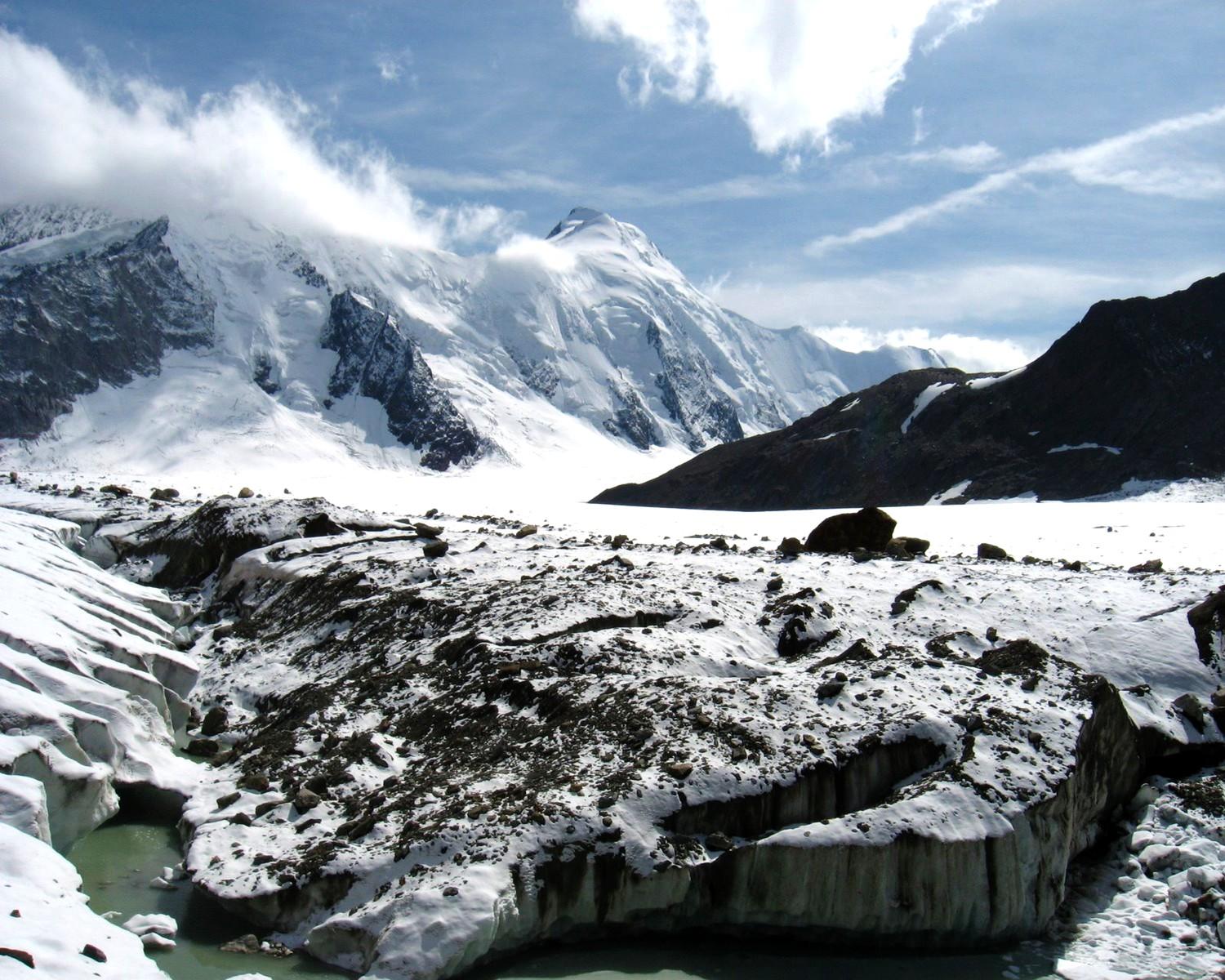
The Konkordiaplatz or Concordia Place (French: Place de la Concorde), is a flat area of snow and ice lying just to the south of the Jungfrau in the Bernese Alps in the Swiss canton of Valais. It is the junction of four large glaciers coming down from the ''Aletschfirn'', the ''Jungfraufirn'', the ''Ewigschneefäld'' and the ''Grüneggfirn''. The main Aletsch Glacier originates from Konkordiaplatz. The ''Konkordiaplatz Charter'' was signed by the municipalities located in the Jungfrau-Aletsch Protected Area UNESCO World Heritage site, vowing to retain the aesthetic beauty of the region. Naming '' Concordia'' is the Latin word for harmony, literally "with (one) heart". It was the name of the Roman goddess of agreement, understanding, and marital harmony. British mountaineer John Frederick Hardy dubbed the location at the convergence of the several glaciers ''Place de la Concorde of Nature''. The name ''Concordia'' was then given to other places where two or more glaciers meet, o ... [...More Info...] [...Related Items...] OR: [Wikipedia] [Google] [Baidu] |
Aletsch Glacier
The Aletsch Glacier (german: Aletschgletscher, ) or Great Aletsch Glacier () is the largest glacier in the Alps. It has a length of about (2014), has about a volume of (2011), and covers about (2011) in the eastern Bernese Alps in the Swiss canton of Valais. The Aletsch Glacier is composed of four smaller glaciers converging at Konkordiaplatz, where its thickness was measured by the ETH to be still near . It then continues towards the valley before giving birth to the Massa. The Aletsch Glacier is – like most glaciers in the world today – a retreating glacier. As of 2016, since 1980 it lost of its length, since 1870 , and lost also more than of its thickness. The whole area, including other glaciers is part of the Protected Area, which was declared a UNESCO World Heritage Site in 2001. Geography The Aletsch Glacier is one of the many glaciers located between the cantons of Bern and Valais on the Bernese Alps located east of the Gemmi Pass. The whole area is consider ... [...More Info...] [...Related Items...] OR: [Wikipedia] [Google] [Baidu] |
Jungfrau
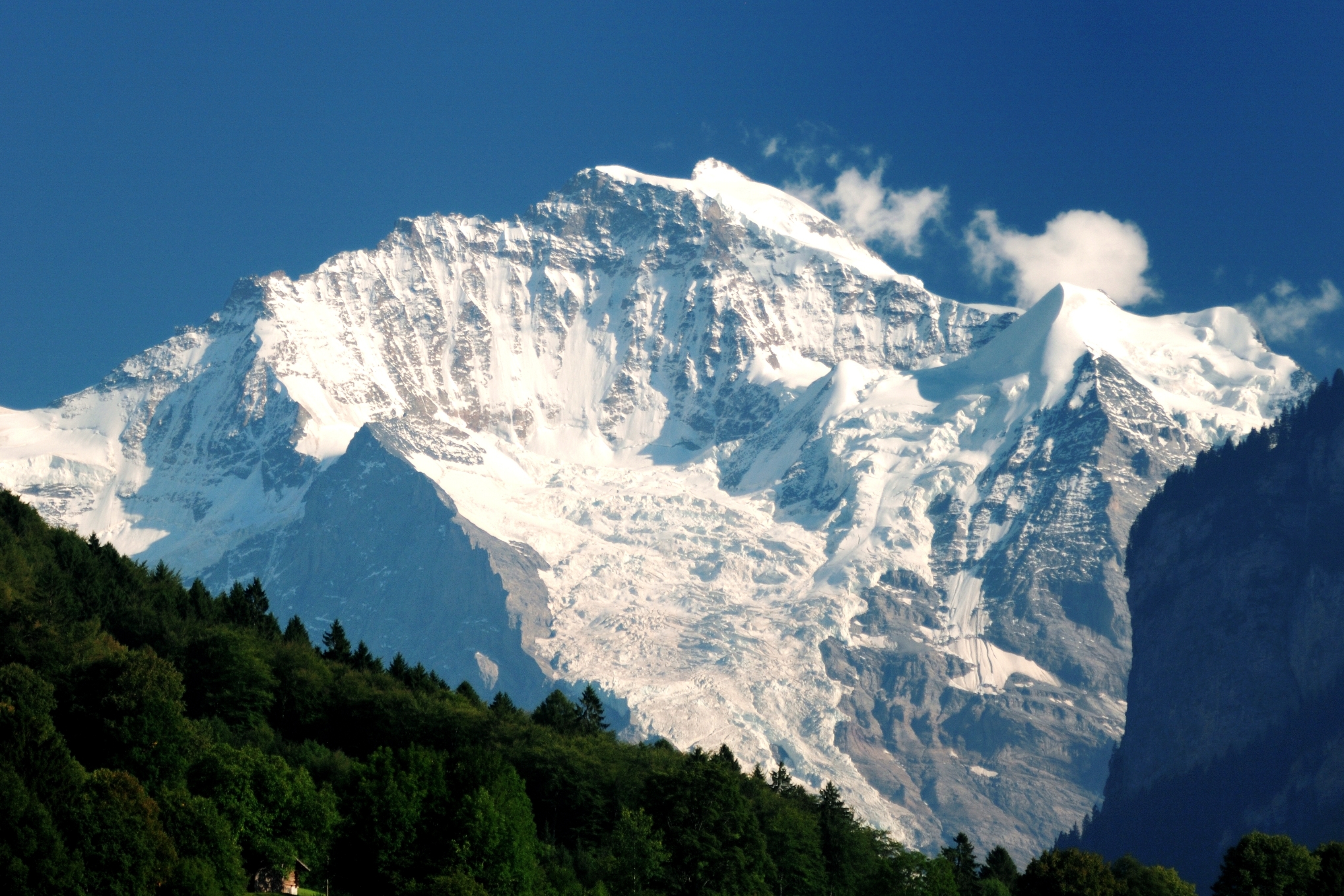
The Jungfrau ( "maiden, virgin"), at is one of the main summits of the Bernese Alps, located between the northern canton of Bern and the southern canton of Valais, halfway between Interlaken and Fiesch. Together with the Eiger and Mönch, the Jungfrau forms a massive wall of mountains overlooking the Bernese Oberland and the Swiss Plateau, one of the most distinctive sights of the Swiss Alps. The summit was first reached on August 3, 1811, by the Meyer brothers of Aarau and two chamois hunters from Valais. The ascent followed a long expedition over the glaciers and high passes of the Bernese Alps. It was not until 1865 that a more direct route on the northern side was opened. The construction of the Jungfrau Railway in the early 20th century, which connects Kleine Scheidegg to the Jungfraujoch, the saddle between the Mönch and the Jungfrau, made the area one of the most-visited places in the Alps. Along with the Aletsch Glacier to the south, the Jungfrau is part of the Jungf ... [...More Info...] [...Related Items...] OR: [Wikipedia] [Google] [Baidu] |
Concordia (Karakoram)
Concordia ( ur, کونکورڈیا) is the confluence of the Baltoro Glacier and the Godwin-Austen Glacier in the Karakoram mountain range of Pakistan. It is located in the Baltistan region of Pakistan, at above sea level. The area is often used as a base camp for mountaineering expeditions on K2 and other nearby peaks, and is also a popular destination for trekkers and backpackers. The name was first applied by English mountaineer Aleister Crowley during the 1902 Eckenstein/Crowley attempt on K2, and comes from the location's similarity to another glacial confluence, also named Concordia, in the Bernese Oberland of the Central Alps. Robert Lerco was the first person to report reaching Concordia, in 1890, followed by William Martin Conway William Martin Conway, 1st Baron Conway of Allington (12 April 1856 – 19 April 1937), known between 1895 and 1931 as Sir Martin Conway, was an English art critic, politician, cartographer and mountaineer, who made expeditions in Europ ... [...More Info...] [...Related Items...] OR: [Wikipedia] [Google] [Baidu] |
Konkordia Hut
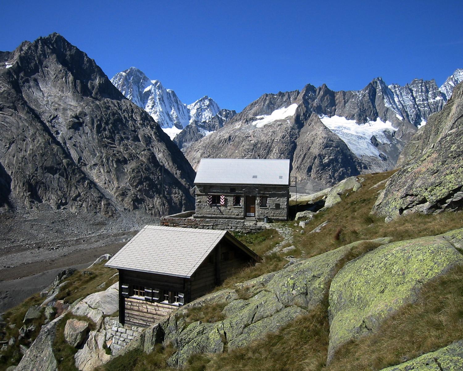
The Konkordia Hut (German: ''Konkordiahütte'') is a mountain hut of the Swiss Alpine Club, located north of Fieschertal in the canton of Valais. The hut lies above Konkordiaplatz, the point of convergence of several glaciers in the great Aletsch Glacier system of the Bernese Alps. It is located at a height of 2,850 metres above sea level, at the foot of the Fülbärg. Access Because of its location, the hut is long way from villages (6 hours from Fiescheralp, 10 hours from Fafleralp). The shortest way starts at the Jungfraujoch railway station (4 hours). All access routes are via the Aletsch Glacier. The hut lies approximately 150 metres above the level of the ice. The hut can be reached by stairs or via an unsecured steep path from the level of ice. References *Swisstopo Swisstopo is the official name for the Swiss Federal Office of Topography (in German language, German: ''Bundesamt für Landestopografie''; French language, French: ''Office fédéral de topographie' ... [...More Info...] [...Related Items...] OR: [Wikipedia] [Google] [Baidu] |
Trugberg
The Trugberg is a mountain in the Bernese Alps, located south of the Mönch in the canton of Valais, Switzerland. It is located above the Konkordiaplatz where the névé of the Jungfraufirn on the west side and the Ewigschneefeld on the east side converge to form the Aletsch Glacier. Debris accumulating on both sides of the mountain form one of the two important supraglacial moraines of the Aletsch Glacier. During their ascent of the Jungfrau in 1841, a group of explorers including Pierre Jean Édouard Desor and Louis Agassiz for a while thought that the Trugberg, hiding the Jungfrau from sight, was their destination. Eventually, they realized their error and decided to name the mountain ''Trugberg'', meaning ''Deceitful Mountain''. www.swissworld.org. Retrieved 2010-04-05 The Trugberg ... [...More Info...] [...Related Items...] OR: [Wikipedia] [Google] [Baidu] |
Jungfrau-Aletsch Protected Area
The Jungfrau-Aletsch protected area (officially Swiss Alps Jungfrau-Aletsch) is located in south-western Switzerland between the cantons of Berne and Valais. It is a mountainous region in the easternmost side of the Bernese Alps, containing the northern wall of Jungfrau and Eiger, and the largest glaciated area in western Eurasia, comprising the Aletsch Glacier. The Jungfrau-Aletsch protected area is the first World Natural Heritage site in the Alps; it was inscribed in 2001. . Retrieved on 2009-10-18 Geography and climate The Jungfrau-Aletsch protected area is located in the |
Fiescher Gabelhorn
The Fiescher Gabelhorn is a mountain of the Bernese Alps, overlooking Konkordiaplatz in the canton of Valais Valais ( , , ; frp, Valês; german: Wallis ), more formally the Canton of Valais,; german: Kanton Wallis; in other official Swiss languages outside Valais: it, (Canton) Vallese ; rm, (Chantun) Vallais. is one of the cantons of Switzerland, 26 .... References External links Fiescher Gabelhorn on Hikr Mountains of the Alps Alpine three-thousanders Mountains of Switzerland Mountains of Valais Bernese Alps Three-thousanders of Switzerland {{Valais-mountain-stub ... [...More Info...] [...Related Items...] OR: [Wikipedia] [Google] [Baidu] |
Dreieckhorn
The Dreieckhorn is a mountain of the Bernese Alps, overlooking Konkordiaplatz in the canton of Valais Valais ( , , ; frp, Valês; german: Wallis ), more formally the Canton of Valais,; german: Kanton Wallis; in other official Swiss languages outside Valais: it, (Canton) Vallese ; rm, (Chantun) Vallais. is one of the cantons of Switzerland, 26 .... References External links Dreieckhorn on Hikr Mountains of the Alps Alpine three-thousanders Mountains of Switzerland Mountains of Valais Bernese Alps {{Valais-mountain-stub ... [...More Info...] [...Related Items...] OR: [Wikipedia] [Google] [Baidu] |
Gletscherhorn Aerial View
The Gletscherhorn (3,983 m) is a mountain of the Bernese Alps, located on the border between the Swiss cantons of Bern and Valais. It forms the eastern edge of the Lauterbrunnen Wall, south of the Jungfrau. See also *List of mountains of the Alps above 3000 m *List of mountains of Switzerland This article contains a sortable table of many of the major mountains and hills of Switzerland. The table only includes those summits that have a topographic prominence of at least above other points, and ranks them by height and prominence. The ... References External linksGletscherhorn on Hikr Mountains of Switzerland Mountains of the Alps Alpine three-thousanders Bernese Alps Mountains of Valais Mountains of the canton of Bern Bern–Valais border Three-thousanders of Switzerland {{Valais-mountain-stub ... [...More Info...] [...Related Items...] OR: [Wikipedia] [Google] [Baidu] |
Glaciers Of The Alps
A glacier (; ) is a persistent body of dense ice that is constantly moving under its own weight. A glacier forms where the accumulation of snow exceeds its ablation over many years, often centuries. It acquires distinguishing features, such as crevasses and seracs, as it slowly flows and deforms under stresses induced by its weight. As it moves, it abrades rock and debris from its substrate to create landforms such as cirques, moraines, or fjords. Although a glacier may flow into a body of water, it forms only on land and is distinct from the much thinner sea ice and lake ice that form on the surface of bodies of water. On Earth, 99% of glacial ice is contained within vast ice sheets (also known as "continental glaciers") in the polar regions, but glaciers may be found in mountain ranges on every continent other than the Australian mainland, including Oceania's high-latitude oceanic island countries such as New Zealand. Between latitudes 35°N and 35°S, glaciers occur only in ... [...More Info...] [...Related Items...] OR: [Wikipedia] [Google] [Baidu] |
Gross Wannenhorn
The Grosses Wannenhorn is a 3906-metre mountain in the Bernese Alps, in the Swiss canton of Valais near the village of Fiesch. It is part of the Walliser Fiescherhörner. The mountain separates the Aletsch Glacier to the west from the Fiescher Glacier to the east. The Grosses Wannenhorn is rocky, while its southern counterpart, the Kleines Wannenhorn, is somewhat flatter. The mountain's east side is heavily glaciated, while the west side is a steep slope intermittently broken by ice fields. The mountain was first climbed by Gottlieb Studer and team in 1864. See also *List of mountains of the Alps above 3000 m *List of mountains of Switzerland This article contains a sortable table of many of the major mountains and hills of Switzerland. The table only includes those summits that have a topographic prominence of at least above other points, and ranks them by height and prominence. The ... References External linksThe Grosses Wannenhorn on Hikr Mountains of the Alps ... [...More Info...] [...Related Items...] OR: [Wikipedia] [Google] [Baidu] |
Grünhorn
The Grünhorn (or ''Gross Grünhorn'') (4,044 m) is a mountain in the Bernese Alps range of the Swiss Alps. It is located on the ridge between the two largest glaciers of the Alps: the Aletsch Glacier to the west and the Fiescher Glacier to the east. To the south lies the Gross Wannenhorn and, to the north, the Gross Fiescherhorn. The starting point for the normal route via the ''Grünegghorn'' and the south-west ridge is the Konkordiahütte at , which can be reached from Fiesch (1,049 m; 3,442 ft). Climbing history The first ascent was made on August 7, 1865 by the Bernese mineralogist Edmund von Fellenberg with guides Peter Michel, Peter Egger and Peter Inäbnit. They climbed the mountain from the west side, starting at the ''Ewigschneefeld'', a tributary glacier of the Aletsch Glacier. They successfully reached the summit despite very bad weather conditions. The same climbers had made an attempt on the peak in the previous year, but they could only reach a lower promine ... [...More Info...] [...Related Items...] OR: [Wikipedia] [Google] [Baidu] |


