|
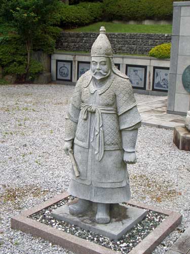
Koma Shrine
is a Shinto shrine located in the city of Hidaka, Saitama. The work "Koma", pronounced in Japanese as "Koryō" is the ancient Japanese name for Korea, specifically the ancient Korean kingdom of Goguryeo, and the main temple ''kami'' of this shrine is the deified Prince Go Yak'gwang (高若光), son of the last king of independent Goguryeo. History Goguryeo (; ), was a Korean kingdom located in the northern and central parts of the Korean Peninsula and the southern and central parts of Manchuria. At its peak of power, Goguryeo controlled most of the Korean peninsula, large parts of Manchuria and parts of eastern Inner Mongolia. Along with Baekje and Silla, Goguryeo was one of the Three Kingdoms of Korea. In the late 6th and early 7th centuries, Goguryeo was often in military conflict with the Sui and Tang dynasties of China. Its relations with Baekje and Silla were complex and alternated between alliances and enmity. In the summer of 666, King Yeon Gaesomun died and Goguryeo was ... [...More Info...] [...Related Items...] OR: [Wikipedia] [Google] [Baidu] |
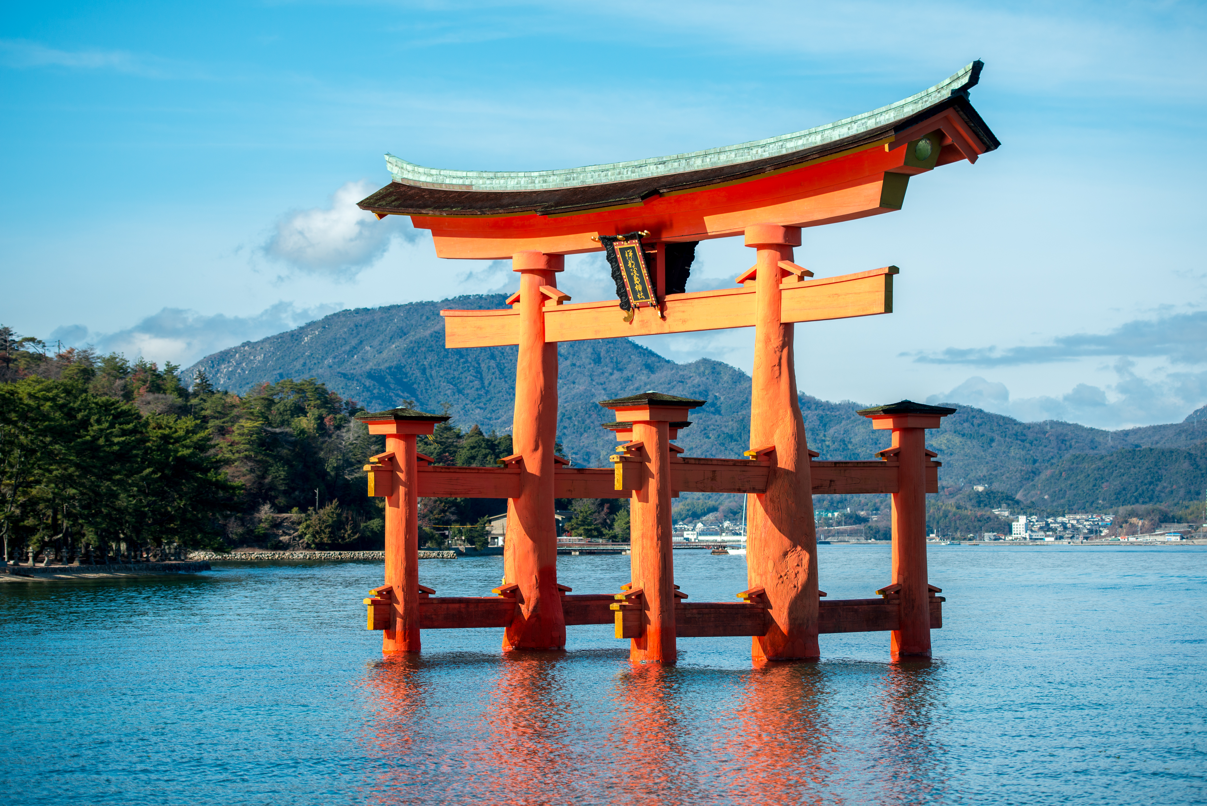
Shinto
Shinto () is a religion from Japan. Classified as an East Asian religion by scholars of religion, its practitioners often regard it as Japan's indigenous religion and as a nature religion. Scholars sometimes call its practitioners ''Shintoists'', although adherents rarely use that term themselves. There is no central authority in control of Shinto, with much diversity of belief and practice evident among practitioners. A polytheistic and animistic religion, Shinto revolves around supernatural entities called the . The are believed to inhabit all things, including forces of nature and prominent landscape locations. The are worshiped at household shrines, family shrines, and ''jinja'' public shrines. The latter are staffed by priests, known as , who oversee offerings of food and drink to the specific enshrined at that location. This is done to cultivate harmony between humans and and to solicit the latter's blessing. Other common rituals include the dances, rites of pass ... [...More Info...] [...Related Items...] OR: [Wikipedia] [Google] [Baidu] |
Emperor Gaozong Of Tang
Emperor Gaozong of Tang (21 July 628 – 27 December 683), personal name Li Zhi, was the third emperor of the Tang dynasty in China, ruling from 649 to 683; after January 665, he handed power over the empire to his second wife Empress Wu (the future Wu Zetian), and her decrees were carried out with greater force than the decrees of Emperor Gaozong's. Emperor Gaozong was the youngest son of Emperor Taizong and Empress Zhangsun; his elder brothers were Li Chengqian and Li Tai. Emperor Gaozong's reign saw the primacy of Empress Wu, who became the effective power behind the Tang rule. Emperor Gaozong was aided in his rule by Empress Wu during the later years of his reign after a series of strokes left him incapacitated. Emperor Gaozong effectively after January 665 delegated all matters of state to his strong wife; After that Empress Wu acted as the power behind the emperor, "hanging the curtain and listening to politics" (''Chuílián tīngzhèng'' 垂簾聼政). Gaozong's person ... [...More Info...] [...Related Items...] OR: [Wikipedia] [Google] [Baidu] |
Kamakura Period
The is a period of Japanese history that marks the governance by the Kamakura shogunate, officially established in 1192 in Kamakura by the first ''shōgun'' Minamoto no Yoritomo after the conclusion of the Genpei War, which saw the struggle between the Taira and Minamoto clans. The period is known for the emergence of the samurai, the warrior caste, and for the establishment of feudalism in Japan. During the early Kamakura period, the shogunate continued warfare against the Northern Fujiwara which was only defeated in 1189. Then, the authority to the Kamakura rulers waned in the 1190s and power was transferred to the powerful Hōjō clan in the early 13th century with the head of the clan as regent (Shikken) under the shogun which became a powerless figurehead. The later Kamakura period saw the invasions of the Mongols in 1274 and again in 1281. To reduce the amount of chaos, the Hōjō rulers decided to decentralize power by allowing two imperial lines – Northern and Southern ... [...More Info...] [...Related Items...] OR: [Wikipedia] [Google] [Baidu] |
Koma Clan
The was an immigrant royal family descended from Goguryeo Prince Go Yak'gwang (高若光) who became known as "''Genbu Jakkō''" (玄武若光) and later as "''Koma no Jakkō''" (高麗若光). He was a son of the 28th and last King of Goguryeo, Bojang. In 666, after a power struggle with his brothers or as refuge from Tang's attack (opinion in dispute), he came to the old capital of Asuka in Japan during the reign of Emperor Tenji. Goguryeo fell to Tang in 668 and in 699 his brother Go Deokmu (高德武) founded Lesser Goguryeo. The characters "高麗" can also be read as "''Goryeo''" (abbreviation of Goguryeo) instead of Koma. In 703 he was given the court rank of Junior Fifth Rank, Lower Grade (''ju go-i no ge'', 従五位下) by Emperor Monmu and became a lower ranking official (''Zaichokanin''). In 716 A.D., Jakkō was instructed to gather the 1,799 Goguryeo refugees, who initially came with him, from all over Japan and settle them in the wilderness of the Musashino Plai ... [...More Info...] [...Related Items...] OR: [Wikipedia] [Google] [Baidu] |
Sayama, Saitama
is a Cities of Japan, city located in Saitama Prefecture, Japan. , the city had an estimated population of 149,826 in 69,859 households and a population density of 3100 persons per km². The total area of the city is . Geography Sayama is located in south-central Saitama Prefecture, on the alluvial lowland of the Iruma River, which flows through the city towards the northeast (toward Kawagoe) . The Japan Air Self-Defense Force's Iruma Air Base is located in the south of the city hall, 90% of which is in Sayama city area (and only 10% in Iruma city area). Surrounding municipalities Saitama Prefecture * Kawagoe, Saitama, Kawagoe * Hannō, Saitama, Hannō * Tokorozawa, Saitama, Tokorozawa * Hidaka, Saitama, Hidaka * Iruma, Saitama, Iruma Climate Sayama has a humid subtropical climate (Köppen ''Cfa'') characterized by warm summers and cool winters with light to no snowfall. The average annual temperature in Sayama is 14.3 °C. The average annual rainfall is 1485 mm with ... [...More Info...] [...Related Items...] OR: [Wikipedia] [Google] [Baidu] |
Iruma, Saitama
260px, Tea fields in Iruma 260px, Kasumi River in Iruma is a city located in Saitama Prefecture, Japan. , the city had an estimated population of 147,166 in 66,516 households and a population density of 3300 persons per km². The total area of the city is . Geography Located in the Sayama Highlands of far southern Saitama Prefecture, Iruma is bordered by Tokyo to the south. The Iruma River flows through the city. Surrounding municipalities Saitama Prefecture * Sayama * Hannō * Tokorozawa Tokyo Metropolis * Oume * Mizuho Climate Iruma has a humid subtropical climate (Köppen ''Cfa'') characterized by warm summers and cool winters with light to no snowfall. The average annual temperature in Iruma is 14.1 °C. The average annual rainfall is 1481 mm with September as the wettest month. The temperatures are highest on average in August, at around 25.9 °C, and lowest in January, at around 3.2 °C. Demographics Per Japanese census data, the population of Iru ... [...More Info...] [...Related Items...] OR: [Wikipedia] [Google] [Baidu] |
Kawagoe, Saitama
is a city in Saitama Prefecture, Japan. , the city had an estimated population of 353,214 in 162,210 households and a population density of 3200 persons per km². The total area of the city is . The city is known locally as after the old name for Tokyo, due to its many historic buildings. Geography Located in the Musashino Terrace of central Saitama Prefecture, both the Arakawa and the Iruma Rivers flow through the city, which is approximately 30 kilometers from downtown Tokyo. The city area is approximately 16.3 km east–west and approximately 13.8 km north–south. The altitude is 18.5 meters above sea level in Motomachi, the highest at the southern end of the city is 50.7 meters, the lowest in the eastern part is 6.9 meters. Surrounding municipalities Saitama Prefecture * Ageo * Saitama * Sakado * Tsurugashima * Tokorozawa * Hidaka * Fujimi * Fujimino * Miyoshi * Kawajima * Sayama Climate Kawagoe has a humid subtropical climate (Köppen ''Cfa'') char ... [...More Info...] [...Related Items...] OR: [Wikipedia] [Google] [Baidu] |
Hannō
is a city located in Saitama Prefecture, Japan. , the city had an estimated population of 79,123 in 35,440 households and a population density of 410 persons per km². The total area of the city is . Geography Hannō is located on the southern border of Saitama Prefecture, bordered by the Tokyo to the south and the Chichibu region to the west. Both the Iruma River and the Koma River flow through the city. Hannō is mainly made up of urban and suburban areas, surrounded by mountains and rivers. Surrounding municipalities Saitama Prefecture * Iruma * Sayama * Hidaka * Chichibu * Tokigawa * Yokoze * Ogose * Moroyama Tokyo Metropolis * Oume * Okutama Climate Hannō has a Humid subtropical climate (Köppen ''Cfa'') characterized by warm summers and cool winters with light to no snowfall. The average annual temperature in Hannō is 12.6 °C. The average annual rainfall is 1408 mm with September as the wettest month. The temperatures are highest on average in August, ... [...More Info...] [...Related Items...] OR: [Wikipedia] [Google] [Baidu] |
Tsurugashima, Saitama
is a city in Saitama Prefecture, Japan. On January 1, 2021, the city had an estimated population of 69,937 in 31,890 households and a population density of . The total area of the city is . Geography Tsurugashima is located in the geographic center of Saitama Prefecture. Tsurugashima Station is approximately 40 minutes from Ikebukuro Station in Tokyo on the Tōbu Tōjō Line by direct express train. Tsurugashima is located at the tip of the Iruma Plateau, and the elevation is about 30 to 50 meters above sea level, gently descending from the southwest to the northeast. Surrounding municipalities * Saitama Prefecture ** Kawagoe ** Sakado ** Hidaka Climate Tsurugashima has a humid subtropical climate (Köppen ''Cfa'') characterized by warm summers and cool winters with light to no snowfall. The average annual temperature in Tsurugashima is 13.9 °C. The average annual rainfall is 1448 mm with September as the wettest month. The temperatures are highest on average in ... [...More Info...] [...Related Items...] OR: [Wikipedia] [Google] [Baidu] |
Korea Foundation
The Korea Foundation (Korean: 한국국제교류재단, Hanja: 韓國國際交流財團) is a non-profit public diplomacy organization established in 1991 to promote a better understanding of Korea and strengthen friendships in the international community. The foundation carries out various projects for exchange between the South Korea and foreign countries to cultivate mutual understanding. History Amid the Republic of Korea's rapid economic growth from the late 1970s to the 1980s as well as the country's concomitant democratization and the upheaval in the international community after the Cold War, an overhaul of Korea's foreign policy strategy became inevitable. Having demonstrated its enhanced capabilities by successfully hosting the 10th Asian Games in 1986 and the 24th Summer Olympics in 1988 in Seoul had a lasting impact on how the world viewed Korea. Subsequently, the idea for an international exchange organization was born that would serve as a single point of cont ... [...More Info...] [...Related Items...] OR: [Wikipedia] [Google] [Baidu] |
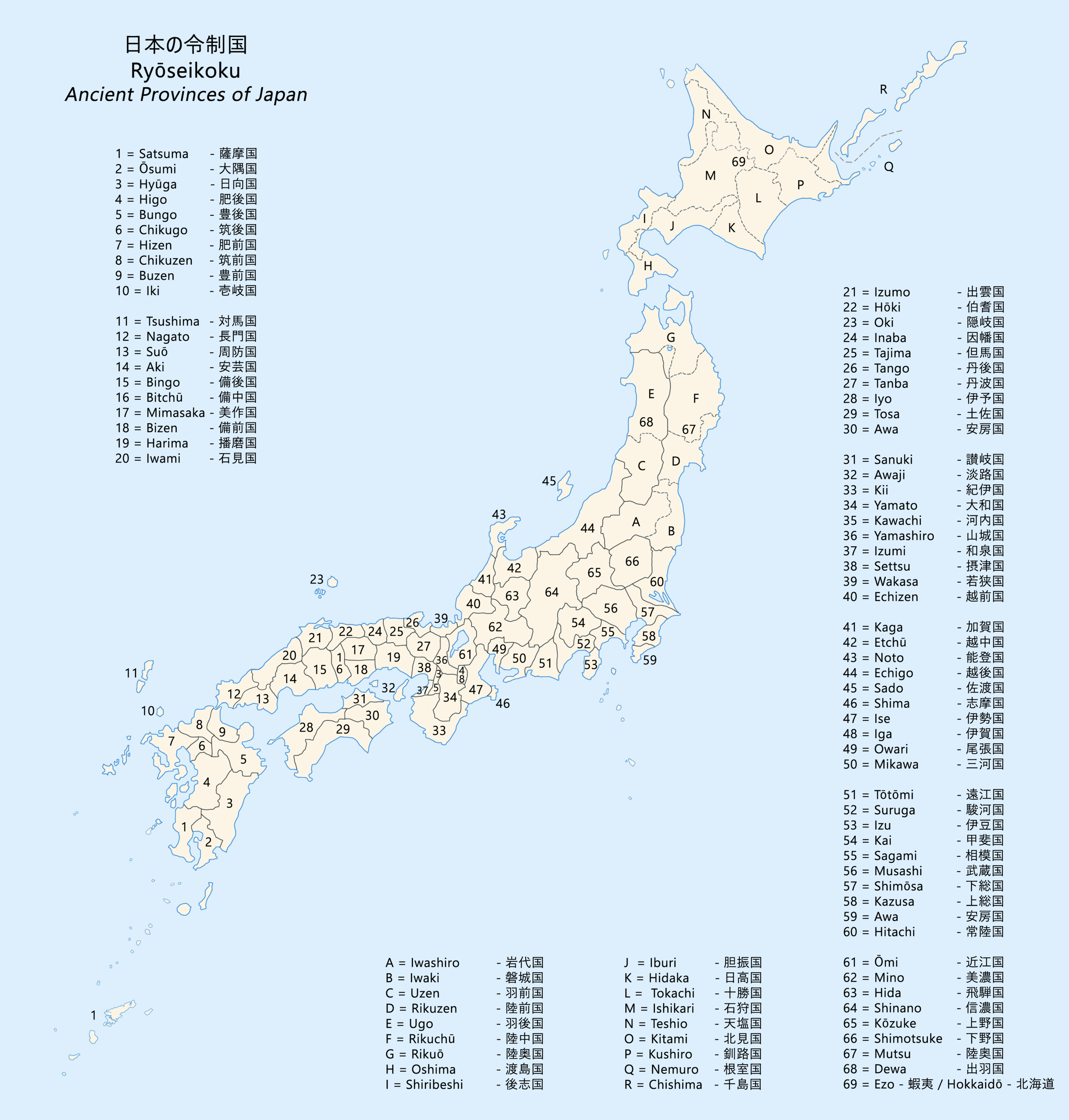
Suruga Province
was an old province in the area that is today the central part of Shizuoka Prefecture. Suruga bordered on Izu, Kai, Sagami, Shinano, and Tōtōmi provinces; and was bordered by the Pacific Ocean through Suruga Bay to the south. Its abbreviated form name was . History Early period Suruga was one of the original provinces of Japan established in the Nara period under the Taihō Code. The original capital of the province was located in what is now Numazu, which also had the ''Kokubun-ji'' and the Ichinomiya ( Mishima Taisha) of the province. Under the ''Engishiki'' classification system, Suruga was ranked as a "major country" (上国), and was governed by a ''Kuni no miyatsuko'' and under the ''ritsuryō'' system was classed as a "middle country" (中国) In a 680 AD cadastral reform, the districts forming Izu Province were administratively separated from Suruga, and the provincial capital was relocated to the right bank of the Abe River in what is now Shizuoka City. Medi ... [...More Info...] [...Related Items...] OR: [Wikipedia] [Google] [Baidu] |
Musashi Province
was a province of Japan, which today comprises Tokyo Metropolis, most of Saitama Prefecture and part of Kanagawa Prefecture. It was sometimes called . The province encompassed Kawasaki and Yokohama. Musashi bordered on Kai, Kōzuke, Sagami, Shimōsa, and Shimotsuke Provinces. Musashi was the largest province in the Kantō region. History Musashi had its ancient capital in modern Fuchū, Tokyo, and its provincial temple in what is now Kokubunji, Tokyo. By the Sengoku period, the main city was Edo, which became the dominant city of eastern Japan. Edo Castle was the headquarters of Tokugawa Ieyasu before the Battle of Sekigahara and became the dominant city of Japan during the Edo period, being renamed Tokyo during the Meiji Restoration. ''Hikawa-jinja'' was designated as the chief Shinto shrine (''ichinomiya'') of the province; and there are many branch shrines. The former province gave its name to the battleship of the Second World War. Timeline of important events * ... [...More Info...] [...Related Items...] OR: [Wikipedia] [Google] [Baidu] |


