|
Kolkata Monorail
Kolkata Monorail was a rail-based transit project planned for the city of Kolkata, West Bengal, India. This was the first proposed monorail in the country. History 2004 & 2008 The initial plan regarding the monorail was floated in 2004. In November that 2008, the first corridor (Budge Budge to Taratala) was finalised and the project was awarded to Andromeda Technologies, at a total cost of Rs. 1,200 crore, along with a German company, Derap AG & Helbling Technik AG and Fernmeldewerk Munchen Aubing, as technology and signalling partners, respectively. It was a build-own-operate public-private partnership model between Government of West Bengal and Andromeda Technologies Pvt. Ltd. The coaches were supposed to be initially imported from Germany, and later locally produced at Titagarh Wagons, Jessop and Texmaco. It was targeted that the phase 1 corridor would be operational by the next 4–5 years. The 2nd phase was a 52 km long route from Taratala to Rajarhat. But, the p ... [...More Info...] [...Related Items...] OR: [Wikipedia] [Google] [Baidu] |
Kolkata Metropolitan Area
Kolkata Metropolitan Area (abbreviated KMA; formerly Calcutta Metropolitan Area), also known as Greater Kolkata, is the urban agglomeration of the city of Kolkata in the Indian state of West Bengal. It is the third most populous metropolitan area in India after Delhi and Mumbai. The area is administered by the Kolkata Metropolitan Development Authority (KMDA). The area covers four municipal corporations along with 37 municipalities.''Kolkata'' . Metropolis.org. Kolkata metropolitan district was legally defined in the schedule of the ''Calcutta Metropolitan Planning Area (Use and Development of Land) Control Act, 1965'' (West Bengal Act XIV of 1965), and, after repeal of that Act, redefined as Kolkata metropolitan area in the first schedule of ''West Bengal Town and Country (Planning and Devel ... [...More Info...] [...Related Items...] OR: [Wikipedia] [Google] [Baidu] |
South 24 Parganas
South 24 Parganas (Pron: pɔrɡɔnɔs; abbr. 24 PGS (S)), or sometimes South Twenty Four Parganas and Dakshin 24 Parganas, is a district in the Indian state of West Bengal, headquartered in Alipore. It is the largest district of West Bengal by area and second largest by population. It is the sixth most populous district in India (out of 640). On one side of the district there is the urban fringe of Kolkata, and on the other the remote riverine villages in the Sundarbans. History Originally, the capital of Raja Bikramaditya and Maharaja Pratapaditya was at Dhumghat. Later it was transferred to Ishwaripur (Originated from the name Jeshoreshwaripur). Maharaja Pratapaditya declared the independence of South Bengal from the Mughal Empire. Pratapaditya's father Shrihari (Shridhar), a Kayastha, was an influential officer in the service of Daud Khan Karrani. Upon the fall of Daud, he fled with the government treasure in his custody. He then, in 1574, set up a kingdom for himself in t ... [...More Info...] [...Related Items...] OR: [Wikipedia] [Google] [Baidu] |
Transport In Kolkata
The transport system of Kolkata, a city in India, is a mix of modern mass rapid transport and old transport modalities like rickshaws. Kolkata is connected to the rest of India by the National Highways, the extensive network of the Indian Railways, National Waterways and by air. The most traffic to Northeast India route via Kolkata. Roads Howrah Bridge (also known as Rabindra Setu) and Vidyasagar Setu (also known as Second Hooghly Bridge) are two bridges connecting Kolkata with Howrah over the Ganges. Bally Bridge (also known as Vivekandanda Setu) is the third bridge over the river at the northern reach of the city near Dakshineswar from Howrah.It is a road cum rail bridge. The fourth and the newest one is Nivedita Setu which is a toll bridge beside Vivekananda Setu. Since Kolkata suffers from traffic congestion like other Indian cities, a network of expressways like Kona Expressway, Kalyani Expressway, Belghoria Expressway, flyovers and widening of southern stretch of ... [...More Info...] [...Related Items...] OR: [Wikipedia] [Google] [Baidu] |
Trams In Kolkata
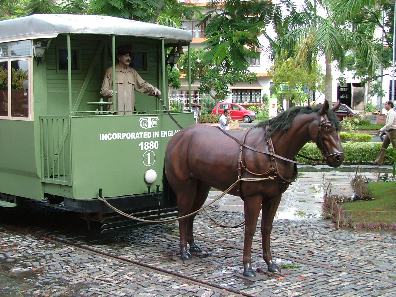
The tram system in the city of Kolkata, West Bengal, India, operated by West Bengal Transport Corporation (WBTC) after Calcutta Tramways Company (CTC) was dissolved, is the oldest existing tram network operating in India, and oldest operating tramway in Asia. Started in 1902, it is the second oldest electric tramway in India (the Madras electric street tramway being the first). The network initially had up to 37 lines in the 1960s, but has gradually reduced over the years with only six lines currently operating due to financial struggles, poor maintenance, low ridership, addition of road flyovers, expansion of the Kolkata Metro, slow tram speed and perceptions that the trams are outdated and occupy too much road space. Since January 2022. presently only two routes (24/29 and 25) is running regulargly, and some irregular service as route 22, 24/30 and 29/30 is running as a very limited service. Due to these issues, there have been occasional talks of either shutting down the net ... [...More Info...] [...Related Items...] OR: [Wikipedia] [Google] [Baidu] |
Kolkata Light Rail Transit
Kolkata Light Rail Transit (KLRT) is a mass rapid transit system proposed for the city of Kolkata in India. The Government of West Bengal and SREI Infrastructure Finance signed a memorandum of understanding (MoU) to set up the light rail transit (LRT) system. A special purpose vehicle, Kolkata Mass Rapid Transit Pvt Ltd has been formed to execute this Rs.6000 crore project. History April 2002: The Master Plan for Kolkata Metropolitan Area (KMA) for 2025 was submitted for the approval by the Metropolitan Planning Committee. It was proposed to be executed soon after securing agreement from the Chief Minister of West Bengal, Buddhadeb Bhattacharjee. It was suggested in the feasibility report that it will work well as an intermediate system for some selected corridors. The search for funding started and it did not sound much in public. 2004: The Kolkata government wanted assistance from the central government which agreed to provide assistance for one major transit system project. ... [...More Info...] [...Related Items...] OR: [Wikipedia] [Google] [Baidu] |
Kolkata Suburban Railway
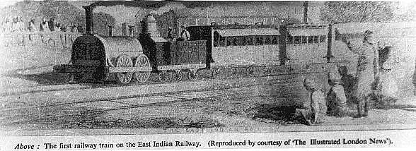
The Kolkata Suburban Railway is a suburban rail system serving the Kolkata metropolitan area and its surroundings in India. It is the largest suburban railway network in the country with the highest number of stations. It is also the 7th largest suburban rail system in the world. There are five main lines and nineteen branch lines. The suburban railway operates more than 1,500 services, carrying 3.5 million people daily and 1.2 billion people every year. It runs from 03:00 am until 02:00 am and the fares range from Rs.5 to Rs.25. The system uses power supply and runs on broad gauge track. It has interchange stations with the Kolkata Metro at various locations. The Kolkata Suburban Railway is part of the second passenger railway constructed in British India during the mid 19th century. The first train ran between Howrah and Hooghly stations. A hundred years after the initial run, Electric Multiple Unit (EMU) services began. It is the largest suburban railway network in India ... [...More Info...] [...Related Items...] OR: [Wikipedia] [Google] [Baidu] |
Kolkata Metro
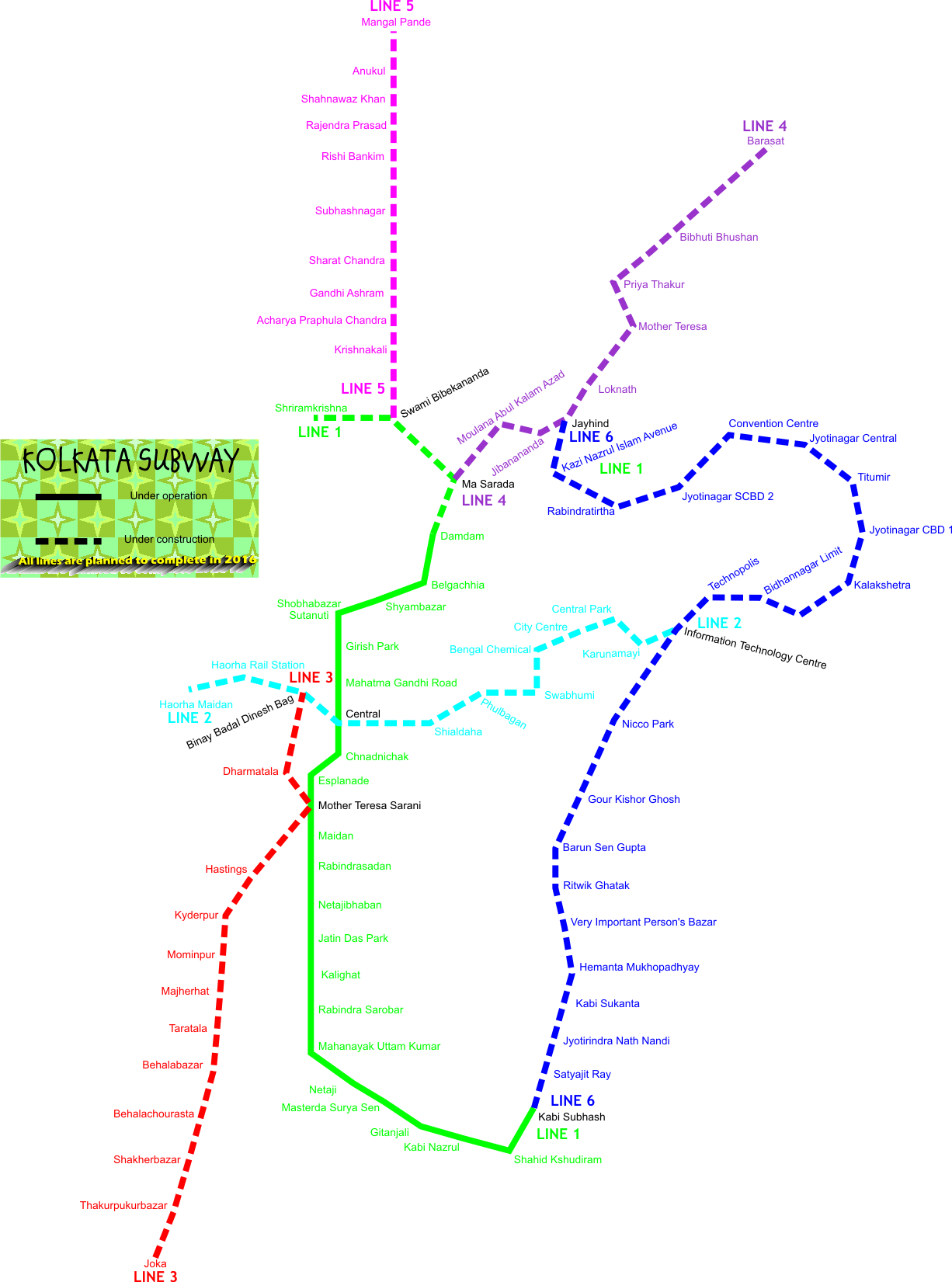
The Kolkata Metro is a rapid transit system serving the city of Kolkata in West Bengal, India. , it has two operational lines, a line from Dakshineswar to Kavi Subhash and a line from Salt Lake Sector V to Sealdah, for a total of . Four other lines are in various phases of construction. The system has a mix of underground, at-grade and elevated stations using both broad-gauge and standard-gauge tracks. Trains operate between 06:55 and 22:30 IST and the fares range from ₹5 to ₹25. The Kolkata Metro is the first planned and operational rapid transit system in India. It was initially planned in the 1920s, but construction started in the 1970s. The first underground stretch, from Bhawanipore (now Netaji Bhawan) to Esplanade, opened in 1984. Line 2, or the East–West Corridor, opened in 2020. It is the fifth-longest operational metro network in India after the Delhi Metro, Hyderabad Metro, Namma Metro and Chennai Metro. Metro Railway, Kolkata and Kolkata Metro Rail Corpor ... [...More Info...] [...Related Items...] OR: [Wikipedia] [Google] [Baidu] |
Ultadanga
Ultadanga is one of the most crowded junctions in Kolkata. The place is located at the north-eastern fringe of the city and marks the limit of Kolkata district. Prominent places in Ultadanga are Telenga Bagan and Muchi Bazar. Etymology Ultadanga lay outside the Maratha Ditch, beyond Halsibagan, where the Sikh billionaire Umichand had a garden. It was the land on the opposite bank (''ulta'' in Bengali).Nair, P.Thankappan, ''The Growth and Development of Old Calcutta'', in ''Calcutta, the Living City'', Vol. I, pp. 14-15, Edited by Sukanta Chaudhuri, Oxford University Press, 1995 edition. History The East India Company obtained from the Mughal emperor Farrukhsiyar, in 1717, the right to rent from 38 villages surrounding their settlement. Of these 5 lay across the Hooghly in what is now Howrah district. The remaining 33 villages were on the Calcutta side. After the fall of Siraj-ud-daulah, the last independent Nawab of Bengal, it purchased these villages in 1758 from Mir Jaf ... [...More Info...] [...Related Items...] OR: [Wikipedia] [Google] [Baidu] |
Kasba, Kolkata
Kasba is a upscale and standard locality of South Kolkata, in Kolkata District, West Bengal, India. It is situated in the southern part of the city encircled by the Sealdah South section of the Eastern Railways to the west, Dhakuria and Haltu to the south, the Eastern Metropolitan Bypass to the east and the locality of Tiljala to the north. History 'Kasba' means hamlet in Bengali and that was what it was - a hamlet for the people working in the nearby leather and allied factories of Tiljala and Tangra and also for the people working in various capacities for the residents of their highly prosperous neighbouring locality of Ballygunge just across the railway track to the west. (Incidentally, the word 'kasba', which means the same in Hindi and Bengali, also means the same as the Arabic 'casbah'.) The locality is served by the Ballygunge Junction railway station on Sealdah South lines, giving a boost to its accessibility. The first breakthrough for the locality came with the const ... [...More Info...] [...Related Items...] OR: [Wikipedia] [Google] [Baidu] |
Titagarh
Titagarh is a city and a municipality of North 24 Parganas district in the Indian state of West Bengal. It is close to Kolkata and also a part of the area covered by Kolkata Metropolitan Development Authority (KMDA). Geography Location Titagarh is located at . It has an average elevation of 15 metres (49 feet). 96% of the population of Barrackpore subdivision (partly presented in the map alongside, all places marked in the map are linked in the full screen map) lives in urban areas. In 2011, it had a population density of 10,967 per km2. The subdivision has 16 municipalities and 24 census towns. For most of the cities/ towns information regarding density of population is available in the Infobox. Population data is not available for neighbourhoods. It is available for the entire Municipal area and thereafter ward-wise. Titagarh is bounded by Barrackpore on the north, Khardaha on the east and south and Hooghly River on the west. Demographics Population As per th ... [...More Info...] [...Related Items...] OR: [Wikipedia] [Google] [Baidu] |
Sealdah
Sealdah is a neighbourhood of Central Kolkata in Kolkata district in the Indian state of West Bengal. Etymology Jackals (''sheal'' in Bengali) howled around Sealdah. Antiquarians identify it as Shrigaldwipa (Jackal Island). Nearby Beliaghata was a port in the Salt Lakes.Nair, P. Thankappan, ''The Growth and Development of Old Calcutta'', in ''Calcutta, the Living City'', Vol. I, edited by Sukanta Chaudhuri, pp. 12-19j, Oxford University Press, . History The East India Company obtained from the Mughal emperor Farrukhsiyar, in 1717, the right to rent from 38 villages surrounding their settlement. Of these 5 lay across the Hooghly in what is now Howrah district. The remaining 33 villages were on the Calcutta side. After the fall of Siraj-ud-daulah, the last independent Nawab of Bengal, it purchased these villages in 1758 from Mir Jafar and reorganised them. These villages were known en-bloc as ''Dihi Panchannagram'' and Shealdah was one of them. Sealdah was described in 1757 as a ... [...More Info...] [...Related Items...] OR: [Wikipedia] [Google] [Baidu] |
Braithwaite & Co
Braithwaite is a village in the northern Lake District, in Cumbria, England. Historically in Cumberland, it lies just to the west of Keswick and to the east of the Grisedale Pike ridge, in the Borough of Allerdale. It forms part of the civil parish of Above Derwent. The eastern end of the Whinlatter Pass road is in the village. The A66 road bypasses Braithwaite, but does not enter the village. Braithwaite is situated around Coledale Beck, a brook which joins Newlands Beck shortly after passing through the village. Newlands Beck (coming from the Newlands Valley) then flows north towards Bassenthwaite Lake. Braithwaite has a Village Shop by the Low Bridge, several pubs, including the Coledale Inn, the Royal Oak and the Middle Ruddings Hotel. Braithwaite is easily accessible due to its close proximity to the A66. It has a campsite with a caravan park, B + Bs, pubs and guest houses. It has a wide range of sports including sailing, climbing, abseiling, canoeing, hang-gliding, ... [...More Info...] [...Related Items...] OR: [Wikipedia] [Google] [Baidu] |


