|
Koderma District
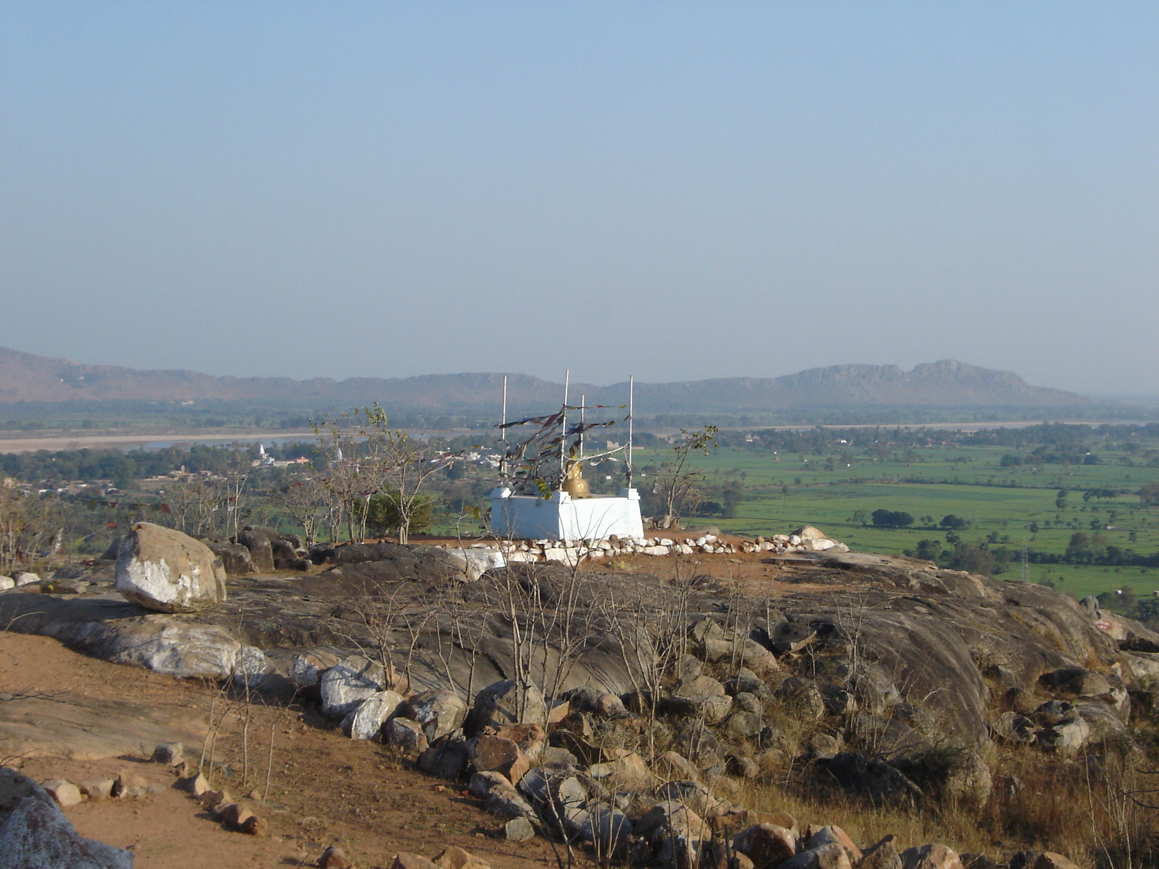
Koderma district is one of the twenty-four districts of Jharkhand state, India, and Koderma is the administrative headquarters of this district. Koderma district was created on 10 April 1994, after being carved out of the original Hazaribagh district. It is currently a part of the Red Corridor. Geography Koderma is bordered by Nawada district of Bihar on the north, the Gaya district of Bihar on the west, the Giridih district of Jharkhand on the east, and the Hazaribagh district of Jharkhand on the south. Koderma is surrounded by forests. The main rivers of the district are Barakar, Barsoi and Sakri. Dhawajadhari Pahar is a hill dedicated to lord Shiva, where at Mahashivratri many devotees assemble to worship the god. Chanchal dham (hill) which is located from Nawadih railway station and from Koderma junction railway station, is dedicated to Maa Chanchalni. Many devotees gather here for the festivals of durga pooja, ramnavmi, akhari pooja, etc to worship Chanchalni Maa to ful ... [...More Info...] [...Related Items...] OR: [Wikipedia] [Google] [Baidu] |
Districts Of Jharkhand
Jharkhand, a state of India, has twenty-four administrative districts. Administration A district of an Indian state is an administrative geographical unit, headed by a district magistrate or a deputy commissioner, an officer belonging to the Indian Administrative Service. The district magistrate or the deputy commissioner is assisted by a number of officials belonging to different wings of the administrative services of the state. A superintendent of Police, an officer belonging to Indian Police Service is entrusted with the responsibility of maintaining law and order and related issues. History At the time of formation, Jharkhand state had 18 districts. Later, six more districts were carved out by reorganizing these districts. The 23rd and 24th districts- Khunti and Ramgarh (carved out of erstwhile Ranchi and Hazaribagh District respectively) were made a district on 12 September 2007. Administrative Divisions and District There are 24 districts of Jharkhand, which are grouped ... [...More Info...] [...Related Items...] OR: [Wikipedia] [Google] [Baidu] |
Gaya, India
Gaya ( IAST: ) is a city, municipal corporation and the administrative headquarters of Gaya district and Magadh division of the Indian state of Bihar. Gaya is south of Patna and is the state's second-largest city, with a population of 470,839. The city is surrounded on three sides by small, rocky hills ( Mangla-Gauri, Shringa-Sthan, Ram-Shila, and Brahmayoni), with the Phalgu River on its eastern side. It is a city of historical significance and is one of the major tourist attractions in India. Gaya is sanctified in the Jain, Hindu, and Buddhist religions. Gaya district is mentioned in the great epics, the ''Ramayana'' and the ''Mahabharata''. It is the place where Rama, with Sita and Lakshmana, came to offer pind-daan for their father, Dasharath, and continues to be a major Hindu pilgrimage site for the pind-daan ritual. Bodh Gaya, where Buddha is said to have attained enlightenment, is one of the four holy sites of Buddhism. Gaya was chosen as one of twelve heritage ci ... [...More Info...] [...Related Items...] OR: [Wikipedia] [Google] [Baidu] |
Domchanch (community Development Block)
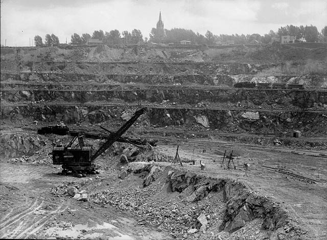
Domchanch is a community development block (CD block) that forms an administrative division in the Koderma subdivision of the Koderma district, Jharkhand state, India. Overview Koderma district occupies the northern end of the Chota Nagpur Plateau. The average altitude is 397 m above sea level. The topography is hilly and the area mostly has laterite soil with patches of clay. Monsoon dependent agriculture supports majority of the population. Forest area covers 43% of the total area. Koderma Reserve Forest occupies the northern part of the district. Density of population in the district was 282 persons per km2. Koderma district was once famous for its mica production but low quality of mica ore and high cost of production led to closure of many units. Geography Domchanch is located at . The Barakar River flows in the southern part of the district and supports the multi-purpose Tilaiya Dam. Poanchkhara, Keso, Akto, Gurio, Gukhana Nadi are the main tributaries of the Barakar in t ... [...More Info...] [...Related Items...] OR: [Wikipedia] [Google] [Baidu] |
Markacho (community Development Block)
Markacho is a community development block (CD block) that forms an administrative division in the Koderma subdivision of the Koderma district, Jharkhand state, India. Overview Koderma district occupies the northern end of the Chota Nagpur Plateau. The average altitude is above sea level. The topography is hilly and the area mostly has laterite soil with patches of clay. Monsoon dependent agriculture supports majority of the population. Forest area covers 43% of the total area. Koderma Reserve Forest occupies the northern part of the district. Density of population in the district was 282 persons per km2. Koderma district was once famous for its mica production but low quality of mica ore and high cost of production led to closure of many units. Geography Markacho is located at . It has an average elevation of . The Barakar River flows in the southern part of the district and supports the multi-purpose Tilaiya Dam, Panchkhero Dam, Akto, Gurio, Gukhana Nadi are the main tributari ... [...More Info...] [...Related Items...] OR: [Wikipedia] [Google] [Baidu] |
Chandwara (community Development Block)
Chandwara is a community development block (CD block) that forms an administrative division in the Koderma subdivision of the Koderma district, Jharkhand state, India. Overview Koderma district occupies the northern end of the Chota Nagpur Plateau. The average altitude is 397 m above sea level. The topography is hilly and the area mostly has laterite soil with patches of clay. Monsoon dependent agriculture supports majority of the population. Forest area covers 43% of the total area. Koderma Reserve Forest occupies the northern part of the district. Density of population in the district was 282 persons per km2. Koderma district was once famous for its mica production but low quality of mica ore and high cost of production led to closure of many units. Geography Chandwara is located at . The Barakar River flows in the southern part of the district and supports the multi-purpose Tilaiya Dam. Poanchkhara, Keso, Akto, Gurio, Gukhana Nadi are the main tributaries of the Barakar i ... [...More Info...] [...Related Items...] OR: [Wikipedia] [Google] [Baidu] |
Jainagar (community Development Block)
Jainagar is a community development block (CD block) that forms an administrative division in the Koderma subdivision of the Koderma district, Jharkhand state, India. Overview Koderma district occupies the northern end of the Chota Nagpur Plateau. The average altitude is 397 m above sea level. The topography is hilly and the area mostly has laterite soil with patches of clay. Monsoon dependent agriculture supports majority of the population. Forest area covers 43% of the total area. Koderma Reserve Forest occupies the northern part of the district. Density of population in the district was 282 persons per km2. Koderma district was once famous for its mica production but low quality of mica ore and high cost of production led to closure of many units. Geography Jainagar is located at . The Barakar River flows in the southern part of the district and supports the multi-purpose Tilaiya Dam. Poanchkhara, Keso, Akto, Gurio, Gukhana Nadi are the main tributaries of the Barakar in the ... [...More Info...] [...Related Items...] OR: [Wikipedia] [Google] [Baidu] |
Giridih District
Giridih district is one of the twenty-four districts of Jharkhand state, India, and Giridih is the administrative headquarters of this district. As of 2011 it is the third most populous district of Jharkhand (out of 24), after Ranchi and Dhanbad. History Giridh district was a part of Kharagdiha estate till late 18th century. During the British Raj Giridih became a part of Jungle Terry. After Kol Uprising in 1831, the parganas of Ramgarh, Kharagdiha, Kendi and Kunda became parts of the South-West Frontier Agency and were formed into a division named Hazaribag as the administrative headquarters. The Kharagdiha Rajas were settled as Rajas of Raj Dhanwar in 1809, and the Kharagdiha gadis were separately settled as zamindari estates. Some of the notable Kharagdiha Zamindari estates were Koderma, Gadi Palganj, Ledo Gadi, Gande Gadi, Ghoranji Gadi and Gadi Sirsia. Giridih district was created on 6 December 1972 by carving some parts of Hazaribagh district. In 1999 part of it became ... [...More Info...] [...Related Items...] OR: [Wikipedia] [Google] [Baidu] |
Gaya District
} Gaya district is one of the thirty-eight districts of the Indian state of Bihar. It was officially established on 3 October 1865. The district has a common boundary with the state of Jharkhand to the south. Gaya city is both the district headquarters and the second-largest city in Bihar. History Gaya finds mention in the great epics, Ramayana and Mahabharata. Ram along with Sita and Lakshman visited Gaya for offering ''Pind-Daan'' to their father Dasharath. In Mahabharata, the place has been identified as Gayapuri. About the origin of the name ‘Gaya' as referred to in Vayu Purana is that Gaya was the name of a demon (Asura) whose body was pious after he performed rigid penance and secured blessings from Vishnu. It was said that the Gayasura's body would continue to be known as Gaya Kshetra. Gaya has experienced the rise and fall of many dynasties in the Magadh Region. From the 6th century BC to the 18th century AD, about 2300–2400 years, Gaya has been occupying an importa ... [...More Info...] [...Related Items...] OR: [Wikipedia] [Google] [Baidu] |
Mica
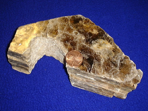
Micas ( ) are a group of silicate minerals whose outstanding physical characteristic is that individual mica crystals can easily be split into extremely thin elastic plates. This characteristic is described as perfect basal cleavage. Mica is common in igneous and metamorphic rock and is occasionally found as small flakes in sedimentary rock. It is particularly prominent in many granites, pegmatites, and schists, and "books" (large individual crystals) of mica several feet across have been found in some pegmatites. Micas are used in products such as drywalls, paints, fillers, especially in parts for automobiles, roofing and shingles, as well as in electronics. The mineral is used in cosmetics and food to add "shimmer" or "frost." Properties and structure The mica group is composed of 37 phyllosilicate minerals. All crystallize in the monoclinic system, with a tendency towards pseudohexagonal crystals, and are similar in structure but vary in chemical composition. Micas are ... [...More Info...] [...Related Items...] OR: [Wikipedia] [Google] [Baidu] |
Asbestos
Asbestos () is a naturally occurring fibrous silicate mineral. There are six types, all of which are composed of long and thin fibrous crystals, each fibre being composed of many microscopic "fibrils" that can be released into the atmosphere by abrasion and other processes. Inhalation of asbestos fibres can lead to various dangerous lung conditions, including mesothelioma, asbestosis, and lung cancer, so it is now notorious as a serious health and safety hazard. Archaeological studies have found evidence of asbestos being used as far back as the Stone Age to strengthen ceramic pots, but large-scale mining began at the end of the 19th century when manufacturers and builders began using asbestos for its desirable physical properties. Asbestos is an excellent electrical insulator and is highly fire-resistant, so for much of the 20th century it was very commonly used across the world as a building material, until its adverse effects on human health were more widely acknowledged ... [...More Info...] [...Related Items...] OR: [Wikipedia] [Google] [Baidu] |
Feldspar
Feldspars are a group of rock-forming aluminium tectosilicate minerals, also containing other cations such as sodium, calcium, potassium, or barium. The most common members of the feldspar group are the ''plagioclase'' (sodium-calcium) feldspars and the ''alkali'' (potassium-sodium) feldspars. Feldspars make up about 60% of the Earth's crust, and 41% of the Earth's continental crust by weight. Feldspars crystalize from magma as both intrusive and extrusive igneous rocks and are also present in many types of metamorphic rock. Rock formed almost entirely of calcic plagioclase feldspar is known as anorthosite. Feldspars are also found in many types of sedimentary rocks. Compositions The feldspar group of minerals consists of tectosilicates, silicate minerals in which silicon ions are linked by shared oxygen ions to form a three-dimensional network. Compositions of major elements in common feldspars can be expressed in terms of three endmembers: * potassium feldspar (K-spar) ... [...More Info...] [...Related Items...] OR: [Wikipedia] [Google] [Baidu] |
Quartz
Quartz is a hard, crystalline mineral composed of silica (silicon dioxide). The atoms are linked in a continuous framework of SiO4 silicon-oxygen tetrahedra, with each oxygen being shared between two tetrahedra, giving an overall chemical formula of SiO2. Quartz is the second most abundant mineral in Earth's continental crust, behind feldspar. Quartz exists in two forms, the normal α-quartz and the high-temperature β-quartz, both of which are chiral. The transformation from α-quartz to β-quartz takes place abruptly at . Since the transformation is accompanied by a significant change in volume, it can easily induce microfracturing of ceramics or rocks passing through this temperature threshold. There are many different varieties of quartz, several of which are classified as gemstones. Since antiquity, varieties of quartz have been the most commonly used minerals in the making of jewelry and hardstone carvings, especially in Eurasia. Quartz is the mineral defining the val ... [...More Info...] [...Related Items...] OR: [Wikipedia] [Google] [Baidu] |


