|
Klaudyán Map Of Bohemia
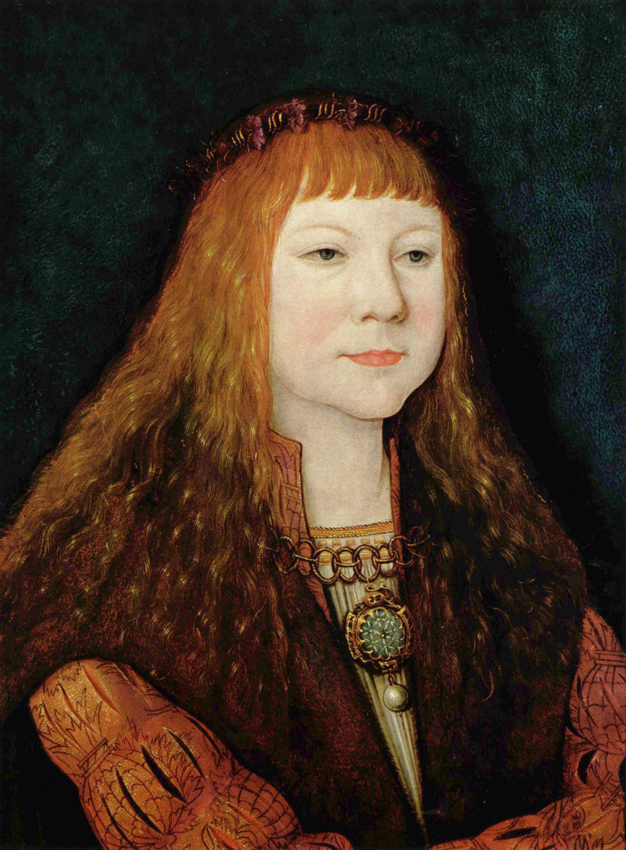
Klaudyán map (1518) is the earliest map of Bohemia (and earliest map to cover a country‘s area on a one sheet map ever). It was printed by Mikuláš Klaudyán, a printer from Mladá Boleslav. The ratio scale is 1:685000. Description The upper part consists of the picture of the King Louis II of Hungary and Bohemia with the emblems of his lands, the allegory of justice, coats of arms of highest Czech dignities and three important royal cities - Prague, Kutná Hora and Žatec Žatec (; german: Saaz) is a town in Louny District in the Ústí nad Labem Region of the Czech Republic. It has about 19,000 inhabitants. It lies on the Ohře river. The town centre is well preserved and is protected by law as an urban monumen .... In the middle of the map sheet is a picture symbolizing Czech religious disunion - a carriage drawn by horse couples to opposite directions. The map itself, which is south-up, records about 280 towns and castles, and depicts also forests, mountains, rive ... [...More Info...] [...Related Items...] OR: [Wikipedia] [Google] [Baidu] |
Bohemia
Bohemia ( ; cs, Čechy ; ; hsb, Čěska; szl, Czechy) is the westernmost and largest historical region of the Czech Republic. Bohemia can also refer to a wider area consisting of the historical Lands of the Bohemian Crown ruled by the Bohemian kings, including Moravia and Czech Silesia, in which case the smaller region is referred to as Bohemia proper as a means of distinction. Bohemia was a duchy of Great Moravia, later an independent principality, a kingdom in the Holy Roman Empire, and subsequently a part of the Habsburg monarchy and the Austrian Empire. After World War I and the establishment of an independent Czechoslovak state, the whole of Bohemia became a part of Czechoslovakia, defying claims of the German-speaking inhabitants that regions with German-speaking majority should be included in the Republic of German-Austria. Between 1938 and 1945, these border regions were joined to Nazi Germany as the Sudetenland. The remainder of Czech territory became the Second ... [...More Info...] [...Related Items...] OR: [Wikipedia] [Google] [Baidu] |
Mikuláš Klaudyán
Mikuláš Klaudyán (died 1521/1522) was a physician and scholar in Mladá Boleslav, Bohemia and member of the Unity of the Brethren. He printed the oldest map of Bohemia (1518). He was in close contact with printers in Nürnberg Nuremberg ( ; german: link=no, Nürnberg ; in the local East Franconian dialect: ''Nämberch'' ) is the second-largest city of the German state of Bavaria after its capital Munich, and its 518,370 (2019) inhabitants make it the 14th-largest ci .... References * 1522 deaths Czech printers Year of birth unknown {{cartography-stub ... [...More Info...] [...Related Items...] OR: [Wikipedia] [Google] [Baidu] |
Mladá Boleslav
Mladá Boleslav (; german: Jungbunzlau) is a city in the Central Bohemian Region of the Czech Republic. It has about 42,000 inhabitants. Mladá Boleslav is the second most populated city in the region and a major centre of the Czech automotive industry (Škoda Auto) and therefore the Czech industry as a whole. The historic city centre is well preserved and is protected by law as an urban monument zone. Administrative parts Mladá Boleslav is made up of city parts and villages of Mladá Boleslav I (locally called ''Staré Město'', i.e. "Old Town"), Mladá Boleslav II (locally called ''Nové Město'', i.e. "New Town"), Mladá Boleslav III (locally called ''Podolec''), Mladá Boleslav IV (locally called ''Pták''), Bezděčín, Čejetice, Čejetičky, Chrást, Debř, Jemníky, Michalovice, Podchlumí and Podlázky. Etymology Mladá Boleslav was named after its founder, Duke Boleslaus II, who was called "The Young One" to distinguish him from his father. Because there already was ... [...More Info...] [...Related Items...] OR: [Wikipedia] [Google] [Baidu] |
Louis II Of Hungary And Bohemia
Louis II ( cs, Ludvík, hr, Ludovik , hu, Lajos, sk, Ľudovít; 1 July 1506 – 29 August 1526) was King of Hungary, Croatia and Bohemia from 1516 to 1526. He was killed during the Battle of Mohács fighting the Ottomans, whose victory led to the Ottoman annexation of large parts of Hungary. Early life At his premature birth in Buda on 1 July 1506, the court doctors kept him alive by slaying animals and wrapping him in their warm carcasses as a primitive incubator. He was the only son of Vladislaus II Jagiellon and his third wife, Anne of Foix-Candale. Coronation Vladislaus II took steps to ensure a smooth succession by arranging for the boy to be crowned in his own lifetime; the coronation of Louis as king of Hungary took place on 4 June 1508 in Székesfehérvár Basilica, and his coronation as king of Bohemia was held on 11 March 1509 in St. Vitus Cathedral in Prague. King of Hungary and Croatia In 1515 Louis II was married to Mary of Austria, granddaughter of Empe ... [...More Info...] [...Related Items...] OR: [Wikipedia] [Google] [Baidu] |
Prague
Prague ( ; cs, Praha ; german: Prag, ; la, Praga) is the capital and largest city in the Czech Republic, and the historical capital of Bohemia. On the Vltava river, Prague is home to about 1.3 million people. The city has a temperate oceanic climate, with relatively warm summers and chilly winters. Prague is a political, cultural, and economic hub of central Europe, with a rich history and Romanesque, Gothic, Renaissance and Baroque architectures. It was the capital of the Kingdom of Bohemia and residence of several Holy Roman Emperors, most notably Charles IV (r. 1346–1378). It was an important city to the Habsburg monarchy and Austro-Hungarian Empire. The city played major roles in the Bohemian and the Protestant Reformations, the Thirty Years' War and in 20th-century history as the capital of Czechoslovakia between the World Wars and the post-war Communist era. Prague is home to a number of well-known cultural attractions, many of which survived the ... [...More Info...] [...Related Items...] OR: [Wikipedia] [Google] [Baidu] |
Kutná Hora
Kutná Hora (; medieval Czech: ''Hory Kutné''; german: Kuttenberg) is a town in the Central Bohemian Region of the Czech Republic. It has about 20,000 inhabitants. The centre of Kutná Hora, including the Sedlec Abbey and its ossuary, was designated a UNESCO World Heritage Site in 1995 because of its outstanding architecture and its influence on subsequent architectural developments in other Central European city centres. Since 1961, the town centre is also protected by law as an urban monument reservation, the fourth largest in the country. Administrative parts The town is made up of twelve town parts and villages: *Kutná Hora-Vnitřní Město *Hlouška *Kaňk *Karlov *Malín *Neškaredice *Perštejnec *Poličany *Sedlec *Šipší *Vrchlice *Žižkov Geography Kutná Hora is located about east of Prague. It lies on the Vrchlice stream. The eastern part of the municipal territory lies in a flat agricultural landscape of the Central Elbe Table lowland. The western part lies i ... [...More Info...] [...Related Items...] OR: [Wikipedia] [Google] [Baidu] |
Žatec
Žatec (; german: Saaz) is a town in Louny District in the Ústí nad Labem Region of the Czech Republic. It has about 19,000 inhabitants. It lies on the Ohře river. The town centre is well preserved and is protected by law as an urban monument reservation and partly as an urban monument zone. Žatec is famous for an over-700-year-long tradition of growing Saaz noble hops used by several breweries. Administrative parts Villages of Bezděkov, Milčeves, Radíčeves, Trnovany, Velichov and Záhoří are administrative parts of Žatec. History The first written mention of Žatec is in the Latin chronicle of Thietmar of Merseburg of 1004. In 1248, Žatec is firstly titled as a town. In 1265, it received the privileges of a royal town from King Ottokar II of Bohemia. In the 16th century, Žatec had around 5,000 inhabitants and was one of the most populous towns in the kingdom. In 1827, a chain bridge over the Ohře, the first chain bridge in Bohemia, was built. From the outbre ... [...More Info...] [...Related Items...] OR: [Wikipedia] [Google] [Baidu] |
South-up Map Orientation
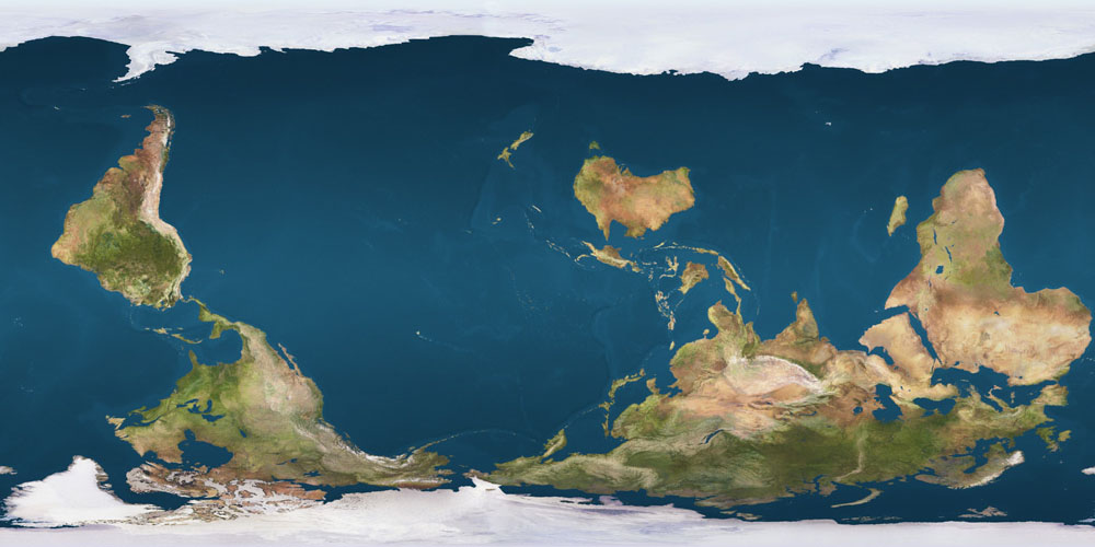
South-up map orientation is the orientation of a map with south up, at the top of the map, amounting to a 180-degree rotation of the map from the standard convention of north-up. Maps in this orientation are sometimes called upside down maps or reversed maps. Other maps with non-standard orientation include T and O maps, polar maps, and Dymaxion maps. Psychological significance Research suggests that north-south positions on maps have psychological consequences. In general, north is associated with richer people, more expensive real estate, and higher altitude, while south is associated with poorer people, cheaper prices, and lower altitude (the "north-south bias"). When participants were presented with south-up oriented maps, this north-south bias disappeared. Researchers posit the observed association between map-position and goodness/badness (north=good; south=bad) is caused by the combination of (i) the convention of consistently placing north at the top of maps, and ( ... [...More Info...] [...Related Items...] OR: [Wikipedia] [Google] [Baidu] |
1518 Works
__NOTOC__ Year 1518 ( MDXVIII) was a common year starting on Friday (link will display the full calendar) of the Julian calendar. Exceptions France In France, the year 1518 lasted from 4 April 1518 to 23 April 1519. Since Constantine (around year 325) and until the year 1565, the year was reckoned as beginning at Easter. For instance, the will of Leonardo da Vinci, drafted in Amboise on 23 April 1519, shows the legend "Given on the 23rd of April of 1518, before Easter". * See Wikisource "1911 Encyclopædia Britannica/Easter" Events January–June * April 18 – The widowed Sigismund I the Old, King of Poland and Grand Duke of Lithuania, marries Milanese noblewoman Bona Sforza in Wawel Cathedral and she is crowned as Queen consort of Poland. * May 26 – A transit of Venus occurs. July–December * July – Dancing plague of 1518: A case of dancing mania breaks out in Strasbourg, in which many people die from constant dancing. * August – ... [...More Info...] [...Related Items...] OR: [Wikipedia] [Google] [Baidu] |
Historic Maps Of Europe
History (derived ) is the systematic study and the documentation of the human activity. The time period of event before the invention of writing systems is considered prehistory. "History" is an umbrella term comprising past events as well as the memory, discovery, collection, organization, presentation, and interpretation of these events. Historians seek knowledge of the past using historical sources such as written documents, oral accounts, art and material artifacts, and ecological markers. History is not complete and still has debatable mysteries. History is also an academic discipline which uses narrative to describe, examine, question, and analyze past events, and investigate their patterns of cause and effect. Historians often debate which narrative best explains an event, as well as the significance of different causes and effects. Historians also debate the nature of history as an end in itself, as well as its usefulness to give perspective on the problems of the p ... [...More Info...] [...Related Items...] OR: [Wikipedia] [Google] [Baidu] |


.jpg)