|
Kiyose
is a city located in Tokyo Metropolis, Japan. , the city had an estimated population of 74,972 in 36,376 households, and a population density of 7300 persons per km2. The total area of the city was . Geography Kiyose City is roughly in the shape of a wedge, bordered by Saitama Prefecture to the north, east and south and separated from the city of Tokorozawa by the Yanase River. The city has considerable green space, with around 46% of its area remaining rural. Kiyose is located on a flat tableland about 15 km from the northeastern edge of Musashino Plateau. The city measures approximately 6.5 km northeast to southwest and 2 km northwest to southeast, with the west side slightly higher than the east. Average altitude above sea level ranges from 65 meters at Takeoka in the west to 20 meters at Shitajuku in the northeastern side. The city area is mostly diluvial soil except for a small area of alluvial soil by Yanase River, which runs on the edge of the region. S ... [...More Info...] [...Related Items...] OR: [Wikipedia] [Google] [Baidu] |
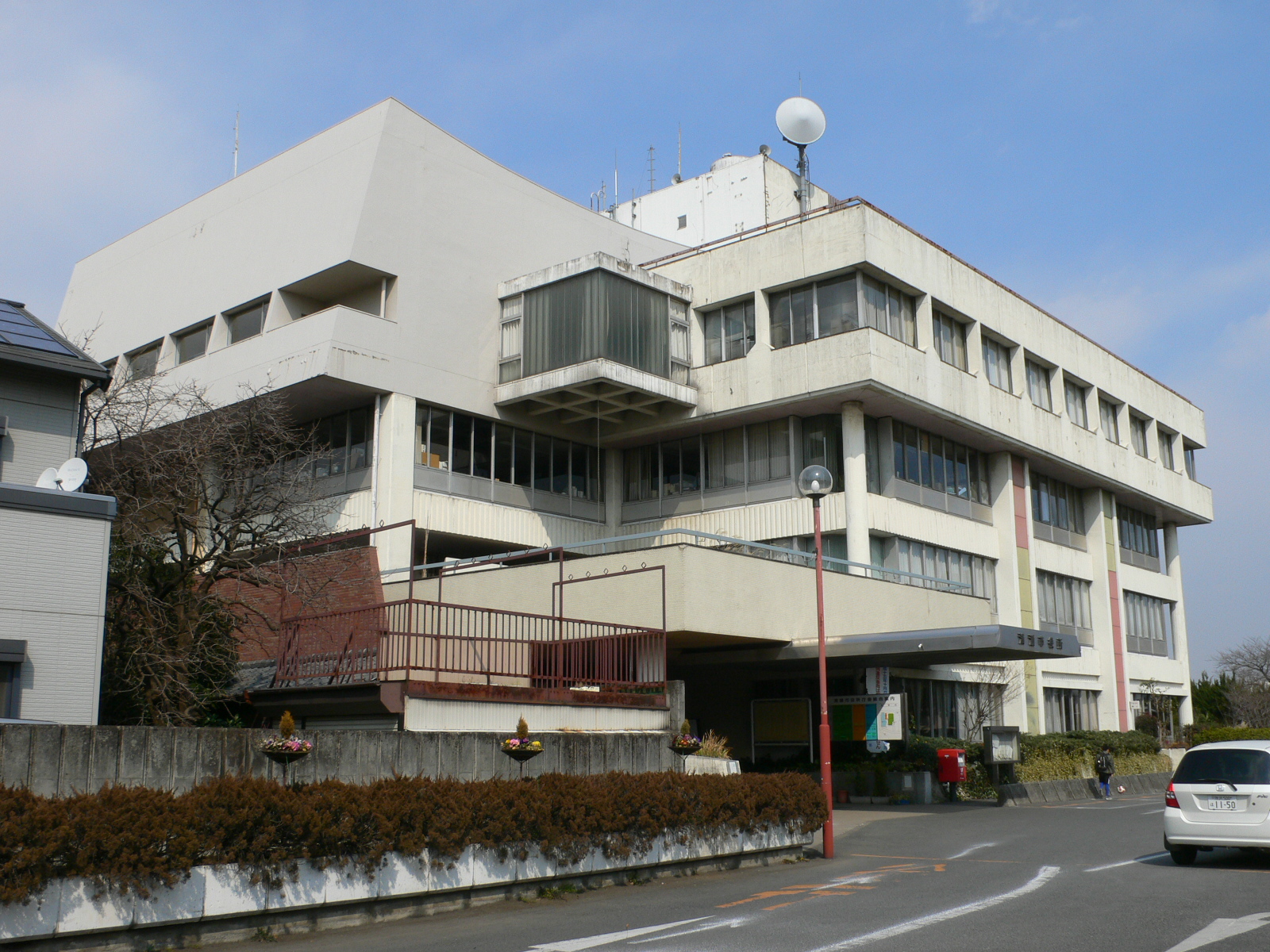
Kiyose City Hall 20080223
is a city located in Tokyo Metropolis, Japan. , the city had an estimated population of 74,972 in 36,376 households, and a population density of 7300 persons per km2. The total area of the city was . Geography Kiyose City is roughly in the shape of a wedge, bordered by Saitama Prefecture to the north, east and south and separated from the city of Tokorozawa by the Yanase River. The city has considerable green space, with around 46% of its area remaining rural. Kiyose is located on a flat tableland about 15 km from the northeastern edge of Musashino Plateau. The city measures approximately 6.5 km northeast to southwest and 2 km northwest to southeast, with the west side slightly higher than the east. Average altitude above sea level ranges from 65 meters at Takeoka in the west to 20 meters at Shitajuku in the northeastern side. The city area is mostly diluvial soil except for a small area of alluvial soil by Yanase River, which runs on the edge of the region. S ... [...More Info...] [...Related Items...] OR: [Wikipedia] [Google] [Baidu] |
Kiyose Station
is a passenger railway station on the Seibu Ikebukuro Line located in the city of Kiyose, Tokyo, Japan, operated by the private railway operator Seibu Railway. Lines Kiyose Station is served by the Seibu Ikebukuro Line from in Tokyo, with some services inter-running via the Tokyo Metro Yurakucho Line to and the Tokyo Metro Fukutoshin Line to and onward via the Tokyu Toyoko Line and Minato Mirai Line to . Located between and , it is 19.6 km from the Ikebukuro terminus. Station layout The station has two ground-level island platforms serving four tracks. A siding between the running tracks is located to the west of the station for services terminating and reversing at Kiyose. Platforms History The station opened on June 11, 1924. Station numbering was introduced on all Seibu Railway lines during fiscal 2012, with Kiyose Station becoming "SI15". Through-running to and from and via the Tokyu Toyoko Line and Minatomirai Line commenced on 16 March 2013. Passenger st ... [...More Info...] [...Related Items...] OR: [Wikipedia] [Google] [Baidu] |
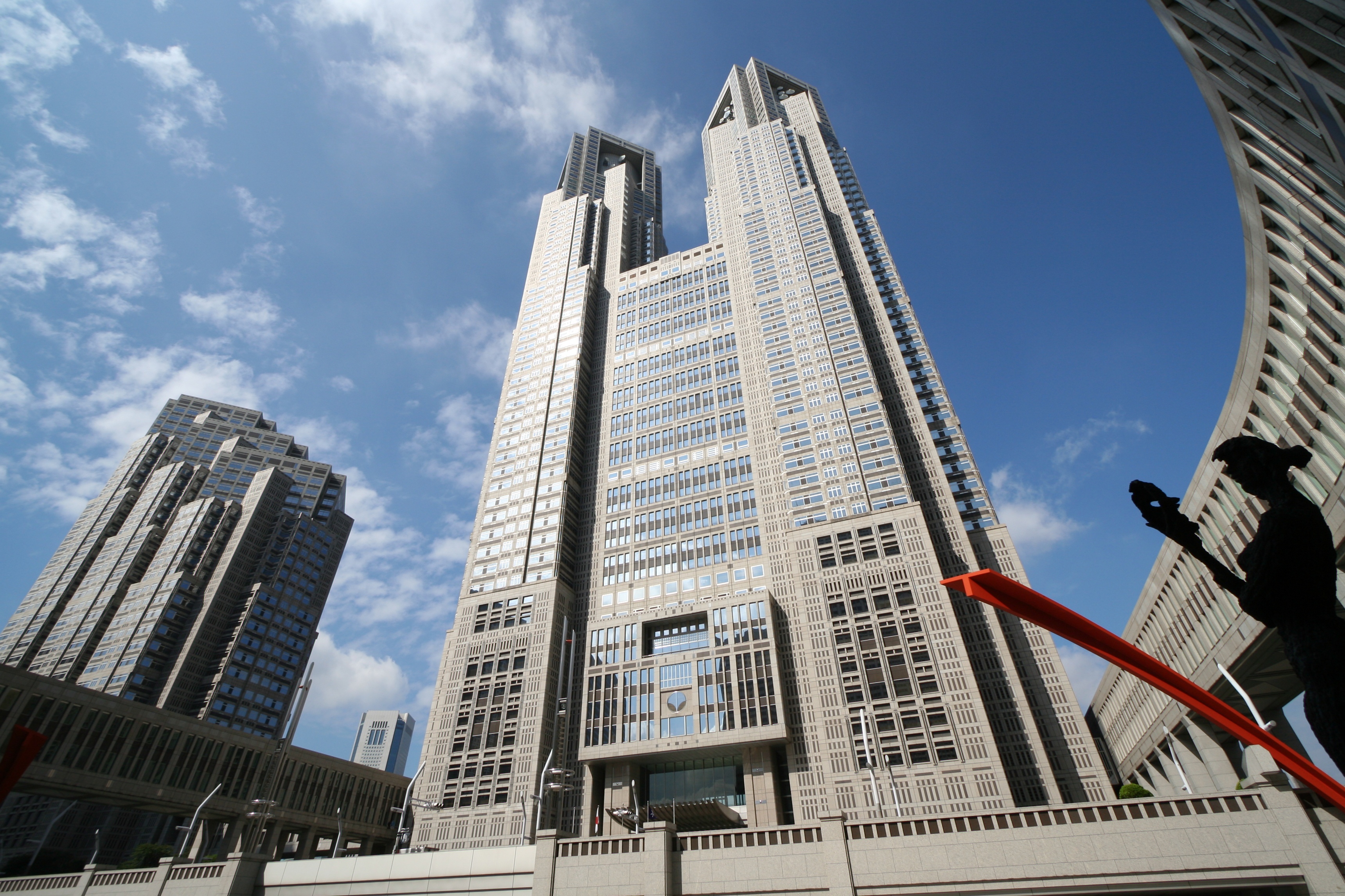
Tokyo Metropolis
Tokyo (; ja, 東京, , ), officially the Tokyo Metropolis ( ja, 東京都, label=none, ), is the capital and List of cities in Japan, largest city of Japan. Formerly known as Edo, its metropolitan area () is the most populous in the world, with an estimated 37.468 million residents ; the city proper has a population of 13.99 million people. Located at the head of Tokyo Bay, the prefecture forms part of the Kantō region on the central coast of Honshu, Japan's largest island. Tokyo serves as Economy of Japan, Japan's economic center and is the seat of both the Government of Japan, Japanese government and the Emperor of Japan. Originally a fishing village named Edo, the city became politically prominent in 1603, when it became the seat of the Tokugawa shogunate. By the mid-18th century, Edo was one of the most populous cities in the world with a population of over one million people. Following the Meiji Restoration of 1868, the imperial capital in Kyoto was mov ... [...More Info...] [...Related Items...] OR: [Wikipedia] [Google] [Baidu] |
Tokyo
Tokyo (; ja, 東京, , ), officially the Tokyo Metropolis ( ja, 東京都, label=none, ), is the capital and largest city of Japan. Formerly known as Edo, its metropolitan area () is the most populous in the world, with an estimated 37.468 million residents ; the city proper has a population of 13.99 million people. Located at the head of Tokyo Bay, the prefecture forms part of the Kantō region on the central coast of Honshu, Japan's largest island. Tokyo serves as Japan's economic center and is the seat of both the Japanese government and the Emperor of Japan. Originally a fishing village named Edo, the city became politically prominent in 1603, when it became the seat of the Tokugawa shogunate. By the mid-18th century, Edo was one of the most populous cities in the world with a population of over one million people. Following the Meiji Restoration of 1868, the imperial capital in Kyoto was moved to Edo, which was renamed "Tokyo" (). Tokyo was devastate ... [...More Info...] [...Related Items...] OR: [Wikipedia] [Google] [Baidu] |
Kitatama District, Kanagawa
was a district located in the Japanese Prefecture of Kanagawa from 1878 to 1893 and then in the Prefecture of Tokyo until 1970. In 1878, the Meiji government made the first step to introduce modern administrative divisions on the municipal level: The districts (''gun'') were created from the pre-modern districts (''gun'' or ''kōri'') with their towns and villages. The old Tama District of Musashi Province was divided into four parts: Eastern Tama ( Higashitama) became part of Tokyo Prefecture and the three other districts of Northern Tama (Kitatama), Southern Tama ( Minamitama) and Western Tama ( Nishitama) part of Kanagawa Prefecture. In 1889 when the modern cities, towns and villages were incorporated, the communities of Northern Tama were organized into 39 municipalities: the town (initially ''-eki'', became ''machi'' in 1893) of Fuchū where the district government was set up, the towns of Chōfu and Tanashi and 37 villages. Four years later, in 1893, the three Western Tam ... [...More Info...] [...Related Items...] OR: [Wikipedia] [Google] [Baidu] |
Higashikurume, Tokyo
is a city located in the western portion of Tokyo Metropolis, Japan. , the city had an estimated population of 117,020, and a population density of 9100 persons per km². The total area of the city was . Geography Higashikurume is in the north-center of Tokyo Metropolis, on the Musashino Terrace, approximately 25 kilometers from downtown Tokyo. The Kurome River flows through the western end of the city, and the Ochiai River flows through the center of the city. The land slopes gently from west to east. Surrounding municipalities Tokyo Metropolis *Kiyose *Higashimurayama *Kodaira *Nishitokyo Saitama Prefecture * Niiza Climate Higashikurume has a Humid subtropical climate (Köppen ''Cfa'') characterized by warm summers and cool winters with light to no snowfall. The average annual temperature in Higashikurume is 14.0 °C. The average annual rainfall is 1647 mm with September as the wettest month. The temperatures are highest on average in August, at around 25.7 � ... [...More Info...] [...Related Items...] OR: [Wikipedia] [Google] [Baidu] |
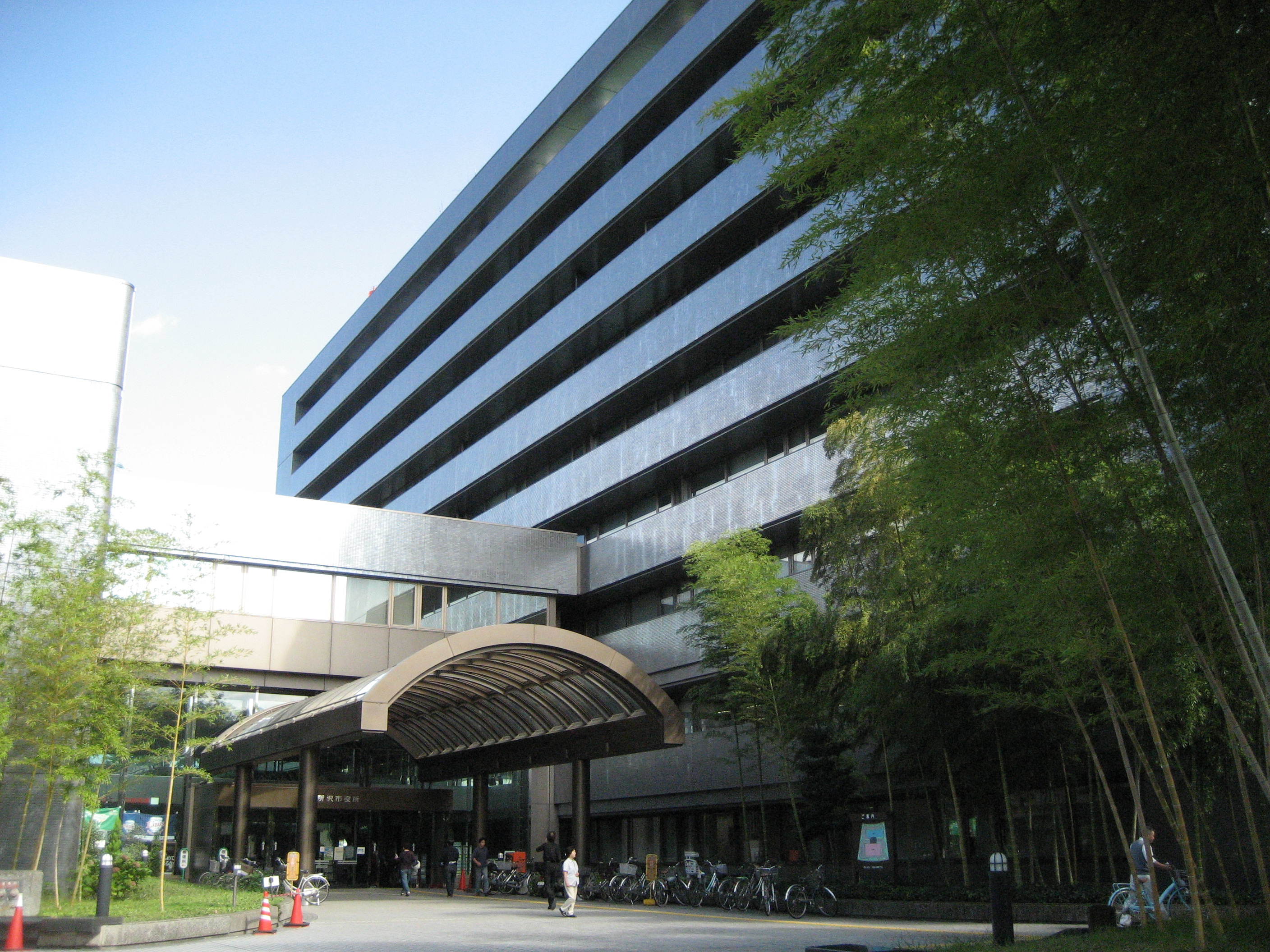
Tokorozawa, Saitama
is a city located in Saitama Prefecture, Japan. , the city had an estimated population of 344,194 in 163,675 households and a population density of 4800 persons per km². The total area of the city is . Geography Tokorozawa is located in the central part of the Musashino Terrace in southern Saitama, about 30 km west of central Tokyo. Tokorozawa can be considered part of the greater Tokyo area; its proximity to the latter and lower housing costs make it a popular bedroom community. The Higashikawa and Yanasegawa rivers that flow from the Sayama Hills flow to the eastern part of the city, and finally reach the Arakawa River. The Yamaguchi Reservoir (commonly known as Lake Sayama) is mostly located within city boundaries; Lake Tama also touches the south-western part of the city. The area around Tokorozawa Station's west exit is built up as a shopping district with several department stores. Prope Street is a popular shopping arcade. Surrounding municipalities * Saitama Pr ... [...More Info...] [...Related Items...] OR: [Wikipedia] [Google] [Baidu] |
Higashimurayama, Tokyo
is a city located in the western portion of Tokyo Metropolis, Japan. , the city had an estimated population of 148,275, and a population density of 8700 persons per km2. The total area of the city is . Geography Higashimurayama is located on the eastern edge of the Sayama Hills, almost in the center of the Musashino Terrace. Most of the city area is flat, except for the northwestern hills. Surrounding municipalities Tokyo Metropolis *Higashikurume * Kiyose * Higashiyamato *Kodaira Saitama Prefecture *Tokorozawa Climate Higashimurayama has a Humid subtropical climate (Köppen ''Cfa'') characterized by warm summers and cool winters with light to no snowfall. The average annual temperature in Higashimurayama is 14.0 °C. The average annual rainfall is 1647 mm with September as the wettest month. The temperatures are highest on average in August, at around 25.7 °C, and lowest in January, at around 2.3 °C. Demographics Per Japanese census data, the population ... [...More Info...] [...Related Items...] OR: [Wikipedia] [Google] [Baidu] |
Niiza, Saitama
is a city in Saitama Prefecture, Japan. , the city had an estimated population of 166,208 in 76,639 households and a population density of 7300 persons per km2. The total area of the city is . Geography Niiza is located at the southernmost tip of Saitama Prefecture, and is essentially a suburb of the Tokyo conurbation. The entire city is located on the Musashino Plateau, with the Yanase River running through the western part of the city, and the Kurome River running through the eastern part of the city. Niiza includes the southest point of Saitama Prefecture, which faces Nishitōkyō of Tokyo. Surrounding municipalities Saitama Prefecture * Asaka * Shiki * Tokorozawa * Miyoshi Tokyo Metropolis * Nerima * Kiyose * Nishitokyo * Higashikurume Climate Niiza has a humid subtropical climate (Köppen ''Cfa'') characterized by warm summers and cool winters with light to no snowfall. The average annual temperature in Niiza is 14.9 °C. The average annual rainfall is 1449 mm ... [...More Info...] [...Related Items...] OR: [Wikipedia] [Google] [Baidu] |
Humid Subtropical Climate
A humid subtropical climate is a zone of climate characterized by hot and humid summers, and cool to mild winters. These climates normally lie on the southeast side of all continents (except Antarctica), generally between latitudes 25° and 40° and are located poleward from adjacent tropical climates. It is also known as warm temperate climate in some climate classifications. Under the Köppen climate classification, ''Cfa'' and ''Cwa'' climates are either described as humid subtropical climates or warm temperate climates. This climate features mean temperature in the coldest month between (or ) and and mean temperature in the warmest month or higher. However, while some climatologists have opted to describe this climate type as a "humid subtropical climate", Köppen himself never used this term. The humid subtropical climate classification was officially created under the Trewartha climate classification. In this classification, climates are termed humid subtropical when the ... [...More Info...] [...Related Items...] OR: [Wikipedia] [Google] [Baidu] |
Cities Of Japan
A is a local administrative unit in Japan. Cities are ranked on the same level as and , with the difference that they are not a component of . Like other contemporary administrative units, they are defined by the Local Autonomy Law of 1947. City status Article 8 of the Local Autonomy Law sets the following conditions for a municipality to be designated as a city: *Population must generally be 50,000 or greater (原則として人口5万人以上) *At least 60% of households must be established in a central urban area (中心市街地の戸数が全戸数の6割以上) *At least 60% of households must be employed in commerce, industry or other urban occupations (商工業等の都市的業態に従事する世帯人口が全人口の6割以上) *Any other conditions set by prefectural ordinance must be satisfied (他に当該都道府県の条例で定める要件を満たしていること) The designation is approved by the prefectural governor and the Minister for Internal ... [...More Info...] [...Related Items...] OR: [Wikipedia] [Google] [Baidu] |
Last Glacial Maximum
The Last Glacial Maximum (LGM), also referred to as the Late Glacial Maximum, was the most recent time during the Last Glacial Period that ice sheets were at their greatest extent. Ice sheets covered much of Northern North America, Northern Europe, and Asia and profoundly affected Earth's climate by causing drought, desertification, and a large drop in sea levels. Based on changes in position of ice sheet margins dated via terrestrial cosmogenic nuclides and radiocarbon dating, growth of ice sheets commenced 33,000 years ago and maximum coverage was between 26,500 years and 19–20,000 years ago, when deglaciation commenced in the Northern Hemisphere, causing an abrupt rise in sea level. Decline of the West Antarctica ice sheet occurred between 14,000 and 15,000 years ago, consistent with evidence for another abrupt rise in the sea level about 14,500 years ago. Glacier fluctuations around the Strait of Magellan suggest the peak in glacial surface area was constrained to betwee ... [...More Info...] [...Related Items...] OR: [Wikipedia] [Google] [Baidu] |


