|
Kittery
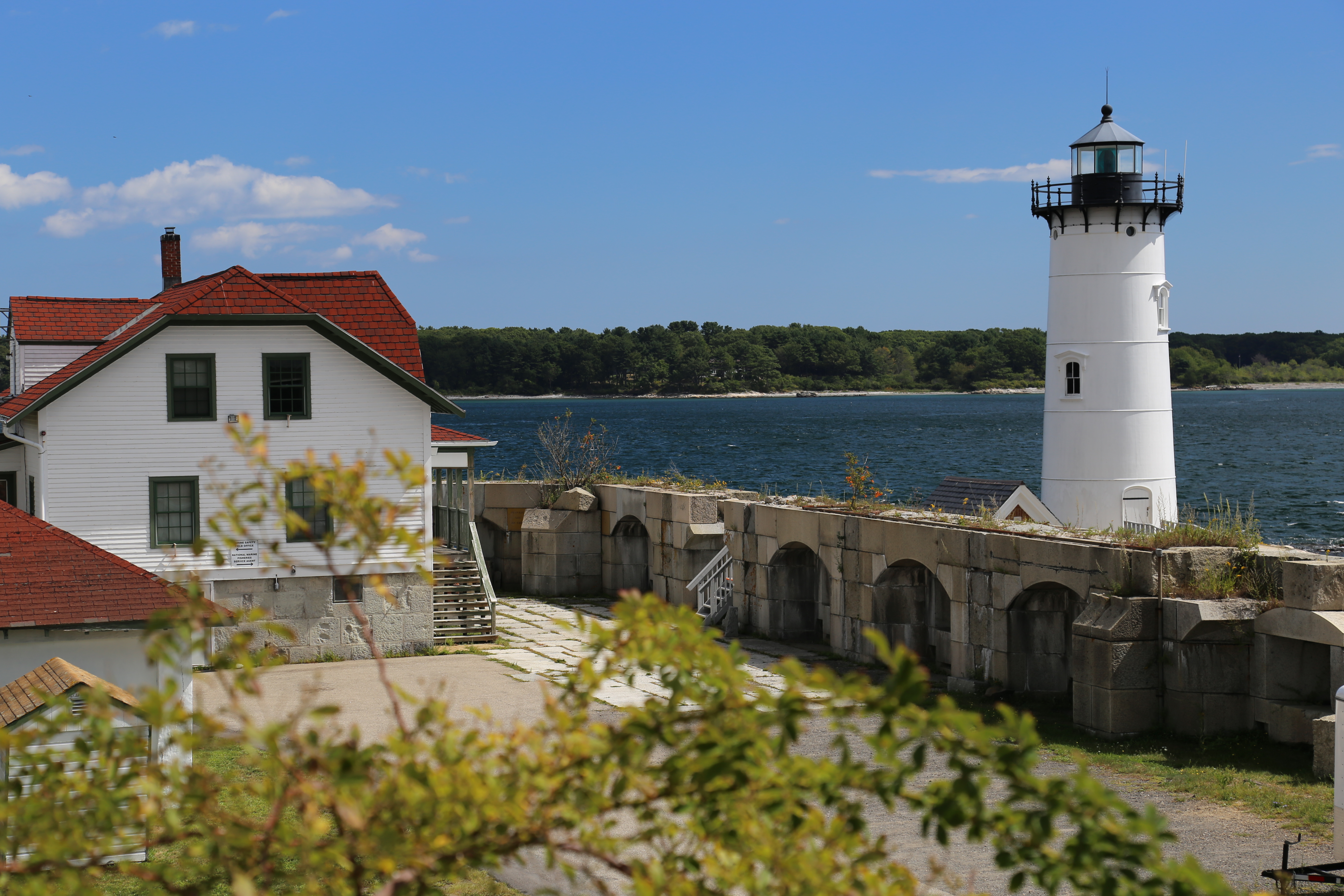
Kittery is a town in York County, Maine, United States. Home to the Portsmouth Naval Shipyard on Seavey's Island, Kittery includes Badger's Island, the seaside district of Kittery Point, and part of the Isles of Shoals. The southernmost town in the state, it is a tourist destination known for its many outlet stores. Kittery is part of the Portland– South Portland–Biddeford, Maine metropolitan statistical area. The town's population was 10,070 at the 2020 census. History English settlement around the natural harbor of the Piscataqua River estuary began about 1623. By 1632 the community was protected by Fort William and Mary on today's New Hampshire side of the river; in 1689 defensive works that later became Fort McClary in Kittery Point were added on today's Maine side to the north. Kittery was incorporated in 1647, staking a claim as the "oldest incorporated town in Maine." It was named after the birthplace of a founder, Alexander Shapleigh, from his manor of Kitt ... [...More Info...] [...Related Items...] OR: [Wikipedia] [Google] [Baidu] |
Kittery Point, Maine
Kittery Point is a census-designated place (CDP) in the town of Kittery, York County, Maine, United States. First settled in 1623, Kittery Point traces its history to the first seafarers who colonized the shore of what became Massachusetts Bay Colony and later the State of Maine. Located beside the Atlantic Ocean, it is home to Fort McClary State Historic Site, and Fort Foster Park on Gerrish Island. Cutts Island is home to Seapoint Beach and the Brave Boat Harbor Division of the Rachel Carson National Wildlife Refuge. Kittery Point is part of the Portland– South Portland–Biddeford, Maine Metropolitan Statistical Area. The population was 1,012 at the 2010 census. History Settled as early as 1623, the southern part of Kittery was once called Champernowne's after Sir Francis Champernowne, a prominent merchant adventurer and cousin of Sir Ferdinando Gorges, the prime mover behind settlement north of the Massachusetts Bay Colony. Nicholas Shapleigh built the first hou ... [...More Info...] [...Related Items...] OR: [Wikipedia] [Google] [Baidu] |
Area Code 207
Area code 207 is the sole telephone area code in the North American Numbering Plan (NANP) for the U.S. state of Maine. Area code 207 was created as one of the original North American area codes in 1947. The numbering plan area still retains its original boundaries, having never been split or overlaid. , area code 207 is not threatened by office code exhaustion until the first quarter of 2025. The deadline has been extended several times due to technical changes and number pooling. Some small Maine communities near the Canadian border are not serviced by area code 207. For example, the northernmost village of Estcourt Station has local routing infrastructure into Canada. It is included in Quebec's 418, 581 and 367 overlay plan Overlay may refer to: Computers *Overlay network, a computer network which is built on top of another network *Hardware overlay, one type of video overlay that uses memory dedicated to the application *Another term for exec, replacing one process .... ... [...More Info...] [...Related Items...] OR: [Wikipedia] [Google] [Baidu] |
Badger's Island
Badger's Island is located in the Piscataqua River at Kittery, Maine, directly opposite Portsmouth, New Hampshire. It carries U.S. Route 1 between the states, connecting to the Kittery mainland by the Badger's Island Bridge, and to New Hampshire by the Memorial Bridge. Now largely a suburb of Portsmouth, the island features houses, condominiums, restaurants and marinas. History Shipbuilding center Prior to the Civil War, Badger's Island was famous for shipbuilding. Eastern white pine for masts, together with lumber for hulls, arrived down the Piscataqua River from inland forests. Only two tenths of a mile (322 m) from Portsmouth's busy wharves, the island's gradual slope into the deep channel between was ideal for launching vessels. First called Rising Castle Island, it changed to Langdon's Island when John Langdon established his shipyard. The first U. S. Navy ships commissioned by the Continental Congress were built here by master shipbuilder James Hackett, including USS ... [...More Info...] [...Related Items...] OR: [Wikipedia] [Google] [Baidu] |
York County, Maine
York County is the southwesternmost county in the U.S. state of Maine, along the state of New Hampshire's eastern border. It is divided from Strafford County, New Hampshire, by the Salmon Falls River, and the connected tidal estuary—the Piscataqua River. York County was permanently established in 1639. It is the state's oldest county and one of the oldest in the United States. Several of Maine's earliest colonial settlements are found in the county. As of the 2020 census, its population was 211,972, making it Maine's second-most populous county. Its county seat is Alfred. York County is part of the Portland– South Portland, Maine Metropolitan Statistical Area. History 1622 patent The first patent establishing the Province of Maine was granted on August 10, 1622, to Ferdinando Gorges and John Mason by the Plymouth Council for New England, which itself had been granted a royal patent by James I to the coast of North America between the 40th and the 48th parallels "from ... [...More Info...] [...Related Items...] OR: [Wikipedia] [Google] [Baidu] |
Fort McClary
Fort McClary is a former defensive fortification of the United States military located along the southern coast at Kittery Point, Maine at the mouth of the Piscataqua River. It was used throughout the 19th century to protect approaches to the harbor of Portsmouth, New Hampshire and the Portsmouth Naval Shipyard in Kittery. The property and its surviving structures are now owned and operated by the State of Maine as Fort McClary State Historic Site, including a blockhouse dating from 1844. History Colonial period Coastal defenses on the site date to the late 17th century when shipbuilder William Pepperell (father of William Pepperrell) acquired the property and erected crude defense works in 1689. Prior to that, the village was protected by Fort William and Mary at New Castle. The Province of Massachusetts Bay voted in 1715 to erect a permanent breastwork of six guns for the defense of the Piscataqua River, during the lead-up to Father Rale's War. Some sources state that it was i ... [...More Info...] [...Related Items...] OR: [Wikipedia] [Google] [Baidu] |
Portsmouth Naval Shipyard
The Portsmouth Naval Shipyard, often called the Portsmouth Navy Yard, is a United States Navy shipyard in Kittery on the southern boundary of Maine near the city of Portsmouth, New Hampshire. Founded in 1800, PNS is U.S. Navy's oldest continuously operating shipyard. Today, most of its work concerns the overhaul, repair, and modernization of submarines. As of November 2021, the shipyard employed more than 6,500 federal employees. As well, some of the work is performed by private corporations (e.g., Delphinius Engineering of Eddystone, Pennsylvania; Oceaneering International of Chesapeake, Virginia; Orbis Sibro of Mount Pleasant, South Carolina; and Q.E.D. Systems Inc. of Virginia Beach, Virginia). History The Portsmouth Naval Shipyard was established on June 12, 1800, during the administration of President John Adams. It sits on a cluster of conjoined islands called Seavey's Island in the Piscataqua River, whose swift tidal current prevents ice from blocking navigation to ... [...More Info...] [...Related Items...] OR: [Wikipedia] [Google] [Baidu] |
Portland-South Portland-Biddeford Metropolitan Area
The city of Portland, Maine, is the hub city of a metropolitan area in southern Maine, United States. The region is commonly known as Greater Portland or the Portland metropolitan area. For statistical purposes, the U.S. federal government defines three different representations of the Portland metropolitan area. The Portland–South Portland–Biddeford, Maine, metropolitan statistical area is a region consisting of three counties in Maine, anchored by the city of Portland and the smaller cities of South Portland and Biddeford. As of the 2010 census, the MSA had a population of 514,098. A larger combined statistical area (CSA), the Portland–Lewiston–South Portland combined statistical area, is defined as the combination of this metropolitan statistical area (MSA) with the adjacent Lewiston–Auburn MSA. The CSA comprises four counties in southern Maine. The Portland–South Portland metropolitan New England city and town area is defined on the basis of cities and towns rather ... [...More Info...] [...Related Items...] OR: [Wikipedia] [Google] [Baidu] |
Piscataqua River
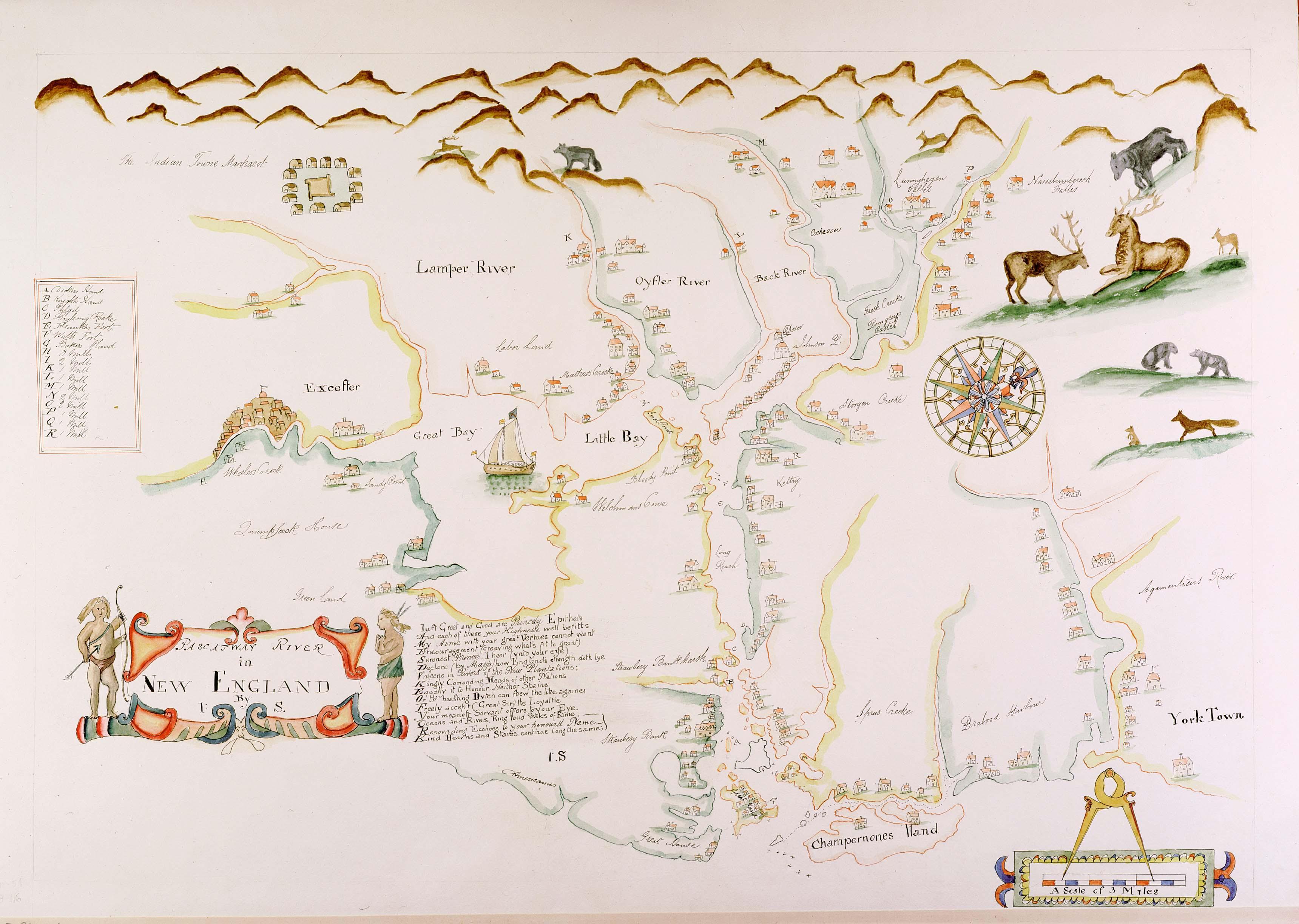
The Piscataqua River (Abenaki: ''Pskehtekwis'') is a tidal river forming the boundary of the U.S. states of New Hampshire and Maine from its origin at the confluence of the Salmon Falls River and Cochecho River. The drainage basin of the river is approximately , including the subwatersheds of the Great Works River and the five rivers flowing into Great Bay: the Bellamy, Oyster, Lamprey, Squamscott, and Winnicut. The river runs southeastward, with New Hampshire to the south and west and Maine to the north and east, and empties into the Gulf of Maine east of Portsmouth, New Hampshire. The last before the sea are known as Portsmouth Harbor and have a tidal current of around . The cities/towns of Portsmouth, New Castle, Newington, Kittery and Eliot have developed around the harbor. History Named by the area's original Abenaki inhabitants, the word ''Piscataqua'' is believed to be a combination of ''peske'' (branch) with ''tegwe'' (a river with a strong current, possibl ... [...More Info...] [...Related Items...] OR: [Wikipedia] [Google] [Baidu] |
Seavey's Island
Seavey's Island, site of the Portsmouth Naval Shipyard, is located in the Piscataqua River in Kittery, Maine, opposite Portsmouth, New Hampshire. It encompasses . History What is today called Seavey's Island was originally five separate islands conjoined to accommodate the Portsmouth Naval Shipyard. Colonists originally used the rocky islands for collecting wild berries or drying fish on fish flakes. When Secretary of the Navy Benjamin Stoddert decided to create the first federal shipyard in 1800, he authorized the purchase for $5,500 of Fernald's Island (also called Dennett's Island). The largest of the five, Seavey's Island, would be annexed in 1866 and give the grouping its familiar name. Approved by Congress in 1900, a granite drydock was built in the former gut between Fernald's and Seavey's islands. Clark's, Jamaica and another island were attached to Seavey's. Atop a hill on the southern end of Seavey's Island stood an earthwork defense called Fort Sullivan, built in 17 ... [...More Info...] [...Related Items...] OR: [Wikipedia] [Google] [Baidu] |
Isles Of Shoals
The Isles of Shoals are a group of small islands and tidal ledges situated approximately off the east coast of the United States, straddling the border of the states of Maine and New Hampshire. They have been occupied for more than 400 years, first by fishing communities and more recently as the site of private homes, a large seasonal hotel and a marine research facility. History Some of the islands were used for seasonal fishing camps by Indigenous peoples and first settled by Europeans in the early 17th century. They became one of the many fishing areas for the young British and French colonies. This was one of the most northern fishing ports, the closest one to the south being Rockport, Massachusetts. The Isles of Shoals were named the "Smith Iles" by English explorer Capt. John Smith after sighting them in 1614. This name did not last once colonization of New England by the British began. The first recorded landfall of an Englishman was that of explorer Captain Christopher ... [...More Info...] [...Related Items...] OR: [Wikipedia] [Google] [Baidu] |
Kingswear
Kingswear is a village and civil parish in the South Hams area of the English county of Devon. The village is located on the east bank of the tidal River Dart, close to the river's mouth and opposite the small town of Dartmouth. It lies within the South Devon Area of Outstanding Natural Beauty, and has a population of 1,332, reducing to 1,217 at the 2011 census. Kingswear is noted for being the railhead for Dartmouth, a role continued to this day by the presence of the Paignton and Dartmouth Steam Railway in the village. Two vehicle ferries and one pedestrian ferry provide links to Dartmouth. The village itself contains several small tourist-oriented shops and public houses, and is home to the Royal Dart Yacht Club. Kingswear Castle, a privately owned 15th century artillery tower, is situated on the outskirts. Kingswear also contains the Church of St Thomas, which is a member of the Anglican Diocese of Exeter and whose patron saint is Saint Thomas of Canterbury. History ... [...More Info...] [...Related Items...] OR: [Wikipedia] [Google] [Baidu] |
Fort William And Mary
Fort William and Mary was a colonial fortification in Britain's worldwide system of defenses, defended by soldiers of the Province of New Hampshire who reported directly to the royal governor. The fort, originally known as "The Castle," was situated on the island of New Castle, New Hampshire, at the mouth of the Piscataqua River estuary. It was renamed Fort William and Mary circa 1692, after the accession of the monarchs William III and Mary II to the British throne.Roberts, pp. 498-499 It was captured by Patriot forces, recaptured, and later abandoned by the British in the Revolutionary War. The fort was renamed Fort Constitution in 1808 following rebuilding. The fort was further rebuilt and expanded through 1899 and served actively through World War II. Colonial period First fortified by the British prior to 1632, the fort guarded access to the harbor at Portsmouth and served as the colony's main munitions depot. The fort also served to protect Kittery, Maine, on the oppo ... [...More Info...] [...Related Items...] OR: [Wikipedia] [Google] [Baidu] |


