|
Kisoro Airport
Kisoro Airport is an airport serving the town of Kisoro in Uganda and nearby Bwindi Impenetrable National Park and Mgahinga Gorilla National Park. It is in extreme southwestern Uganda, north of the Rwanda border, and approximately by air southwest of Entebbe International Airport, the country's largest civilian and military airport. It is one of twelve upcountry airports administered by the Civil Aviation Authority of Uganda. The airport is mainly used by small planes flying tourists on a daily basis to Mgahinga Gorilla National Park, the southern side of Bwindi Impenetrable National Park, as well as connecting onto Queen Elizabeth National Park. As of 2017, the airport does not accommodate international flights. The Civil Aviation Authority of Uganda has hinted on plans of upgrading the Kisoro Airport. The Kisoro non-directional beacon (Ident: KS) is located on the field. Airlines and destinations See also *Transport in Uganda *List of airports in Uganda This is a list o ... [...More Info...] [...Related Items...] OR: [Wikipedia] [Google] [Baidu] |
Civil Aviation Authority Of Uganda
The Uganda Civil Aviation Authority (UCAA) is the government agency responsible for licensing, monitoring, and regulating civil aviation matters. It is administered by the Uganda Ministry of Works and Transport. Location The authority's head offices are at Entebbe International Airport, approximately , by road, south of Kampala, the capital and largest city of Uganda. The coordinates of the CAA headquarters are 0°02'23.0"N, 32°26'53.0"E (Latitude:0.039722; Longitude:32.448056). Overview The agency was created by an Act of Parliament in 1994 as a state agency of the Ministry of Transport, Housing and Communication. As of October 2016, it was under the Ministry of Works and Transport. The mandate of the UCAA is to coordinate and oversee Uganda's aviation industry, including licensing, regulation, air search and rescue, air traffic control, ownership of airports and aerodromes, and Ugandan and international aviation law. It also represents Uganda in an international capacity w ... [...More Info...] [...Related Items...] OR: [Wikipedia] [Google] [Baidu] |
Kisoro
Kisoro is a town in the Western Region of Uganda. It is the chief town of Kisoro District and the site of the district headquarters. Location Kisoro is approximately , by road, west of Kabale, the largest city in the Kigezi sub-region. This is approximately , by road, southwest of Kampala, the capital of Uganda and the country's largest city. Kisoro is east of Rumangabo and the Virunga Mountains in the Democratic Republic of the Congo (DRC). The geographical coordinates of Kisoro are 1°17'06.0"S, 29°41'06.0"E (Latitude:-1.2850; Longitude:29.6850). Kisoro Town Council sits at an average elevation of , above mean sea level. Overview Kisoro is located under the peaks of the Mufumbiro Mountains, which are part of the Virunga Mountains and home to rare mountain gorillas. Mountain scenery, Lake Mutanda, colorful markets, and volcano trekking also are available for visitors to Kisoro. It is the nearest town to the Mgahinga Gorilla National Park and is an access town for those travel ... [...More Info...] [...Related Items...] OR: [Wikipedia] [Google] [Baidu] |
Uganda
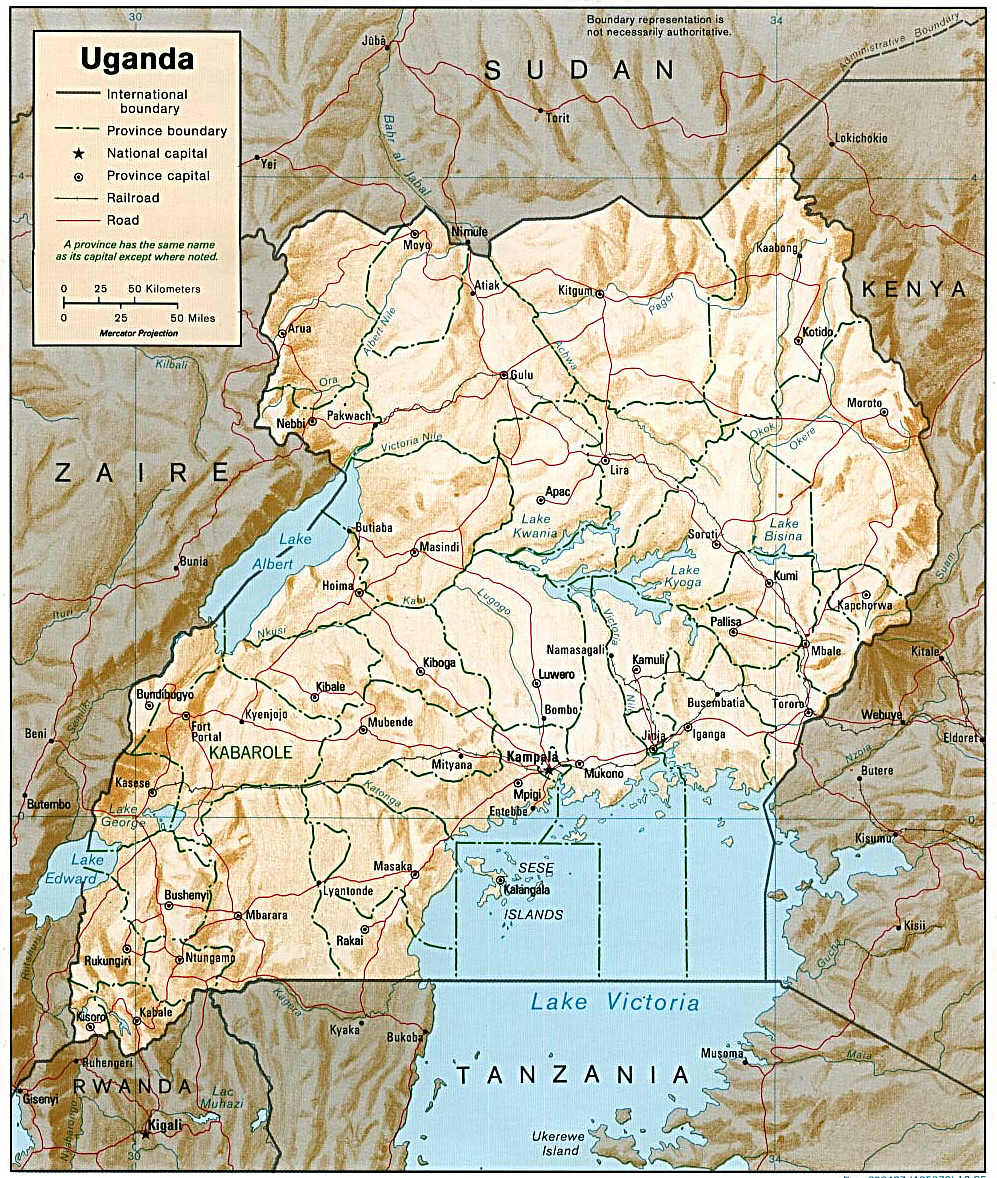
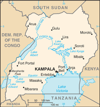
}), is a landlocked country in East Africa East Africa, Eastern Africa, or East of Africa, is the eastern subregion of the African continent. In the United Nations Statistics Division scheme of geographic regions, 10-11-(16*) territories make up Eastern Africa: Due to the historical .... The country is bordered to the east by Kenya, to the north by South Sudan, to the west by the Democratic Republic of the Congo, to the south-west by Rwanda, and to the south by Tanzania. The southern part of the country includes a substantial portion of Lake Victoria, shared with Kenya and Tanzania. Uganda is in the African Great Lakes region. Uganda also lies within the Nile, Nile basin and has a varied but generally a modified equatorial climate. It has a population of around 49 million, of which 8.5 million live in the Capital city, capital and largest city of Kampala. Uganda is named after the Buganda kingdom, which encompasses a large portion of the south of the country, includi ... [...More Info...] [...Related Items...] OR: [Wikipedia] [Google] [Baidu] |
Bwindi Impenetrable National Park
The Bwindi Impenetrable National Park (BINP) is in southwestern Uganda. The park is part of the Bwindi Impenetrable Forest and is situated along the Democratic Republic of the Congo (DRC) border next to the Virunga National Park and on the edge of the Albertine Rift. Composed of of both montane and lowland forest, it is accessible only on foot. BINP is a United Nations Educational, Scientific and Cultural Organization-designated World Heritage Site. Species diversity is a feature of the park. It provides habitat for 120 species of mammals, 348 species of birds, 220 species of butterflies, 27 species of frogs, chameleons, geckos, and many endangered species. Floristically, the park is among the most diverse forests in East Africa, with more than 1,000 flowering plant species, including 163 species of trees and 104 species of ferns. The northern (low elevation) sector has many species of Guineo-Congolian flora, including two endangered species, the brown mahogany and ''Brazzeia lo ... [...More Info...] [...Related Items...] OR: [Wikipedia] [Google] [Baidu] |
Mgahinga Gorilla National Park
Mgahinga Gorilla National Park is a national park in southwestern Uganda. It was created in 1991 and covers an area of . Geography Mgahinga Gorilla National Park is located in the Virunga Mountains and encompasses three inactive volcanoes, namely Mount Muhabura, Mount Gahinga, and Mount Sabyinyo. In altitude the national park ranges from and is part of the Nile River watershed area. It is contiguous with Rwanda's Volcanoes National Park and the southern sector of Virunga National Park in the Democratic Republic of the Congo. The park is about by road south of the town of Kisoro and approximately by road west of Kabale, the largest city in the sub-region. Climate The area experiences two wet rainy seasons: February to May; and September to December. The average monthly rainfall varies from in October to in July. Biodiversity The national park encompasses bamboo forest, Albertine Rift montane forests, Ruwenzori-Virunga montane moorlands with tree heath, and an alpine ... [...More Info...] [...Related Items...] OR: [Wikipedia] [Google] [Baidu] |
Rwanda
Rwanda (; rw, u Rwanda ), officially the Republic of Rwanda, is a landlocked country in the Great Rift Valley of Central Africa, where the African Great Lakes region and Southeast Africa converge. Located a few degrees south of the Equator, Rwanda is bordered by Uganda, Tanzania, Burundi, and the Democratic Republic of the Congo. It is highly elevated, giving it the soubriquet "land of a thousand hills", with its geography dominated by mountains in the west and savanna to the southeast, with numerous lakes throughout the country. The climate is temperate to subtropical, with two rainy seasons and two dry seasons each year. Rwanda has a population of over 12.6 million living on of land, and is the most densely populated mainland African country; among countries larger than 10,000 km2, it is the fifth most densely populated country in the world. One million people live in the Capital city, capital and largest city Kigali. Hunter-gatherers settled the territory in the St ... [...More Info...] [...Related Items...] OR: [Wikipedia] [Google] [Baidu] |
Entebbe International Airport
Entebbe International Airport is the only international airport in Uganda. It is located about southwest of the town of Entebbe, on the northern shores of Lake Victoria. This is approximately by road south-west of the central business district of Kampala, the capital city of Uganda. The headquarters of the Civil Aviation Authority of Uganda have been relocated to a new block off the airport highway (Entebbe–Kampala Expressway and Tunnel Road), but adjacent to the airport terminals. History The airport was opened by the British Colonial authorities. On 10 November 1951, the airport was formally reopened after its facilities had been extended. Runway 12/30 was now , in preparation for services by the de Havilland Comet. The new main terminal building of the airport was designed by Yugoslav Montenegrin architect Aleksandar Keković and built by Energoprojekt holding in 1972-1973 period. The Old Entebbe airport is used by Uganda's military forces. It was the scene of a host ... [...More Info...] [...Related Items...] OR: [Wikipedia] [Google] [Baidu] |
Queen Elizabeth National Park
Queen Elizabeth National Park is a national park in Uganda. Location Queen Elizabeth National Park (QENP) is in the Western Region of Uganda, spanning the districts of Kasese, Kamwenge, Rubirizi, and Rukungiri. The park is approximately by road south-west of Kampala, Uganda's capital and largest city. The city of Kasese lies to the northeast of the park, while the town of Rubirizi is to the southeast. The park adjoins Kyambura Game Reserve to the east, which itself adjoins the Kigezi Game Reserve (including the Maramagambo Forest) and thus the Kibale National Park to the northeast. The Virunga National Park in the Democratic Republic of the Congo lies across the border to the west. Together, these protected places completely encircle Lake Edward. The Rwenzori Mountains National Park in Uganda lies not far to the northwest. Confusingly, during the 1970s and 1980s, Western conservationists usually referred to the park as Rwenzori National Park. History In 1921, a rinderpest ... [...More Info...] [...Related Items...] OR: [Wikipedia] [Google] [Baidu] |
Non-directional Beacon
A non-directional beacon (NDB) or non-directional radio beacon is a radio beacon which does not include directional information. Radio beacons are radio transmitters at a known location, used as an aviation or marine navigational aid. NDB are in contrast to directional radio beacons and other navigational aids, such as low-frequency radio range, VHF omnidirectional range (VOR) and tactical air navigation system (TACAN). NDB signals follow the curvature of the Earth, so they can be received at much greater distances at lower altitudes, a major advantage over VOR. However, NDB signals are also affected more by atmospheric conditions, mountainous terrain, coastal refraction and electrical storms, particularly at long range. The system, developed by United States Air Force (USAF) Captain Albert Francis Hegenberger, was used to fly the world's first instrument approach on May 9, 1932. Types of NDBs NDBs used for aviation are standardised by International Civil Aviation Organizat ... [...More Info...] [...Related Items...] OR: [Wikipedia] [Google] [Baidu] |
Aerolink Uganda
Aerolink Uganda is a privately owned airline in Uganda, licensed by the Uganda Civil Aviation Authority with an air operator's certificate. It specializes in transporting tourists to Uganda's National Parks, saving their time and allowing them to see more. Location The headquarters of Aerolink Uganda are located inside Entebbe International Airport, Uganda's largest civilian airport. The geographical coordinates of the airline's headquarters are: 0°02'40.0"N, 32°26'34.0"E (Latitude:0.044444; Longitude:32.442778). Overview Aerolink Uganda, whose owners are based in neighboring Kenya, was established in 2012. The airline flies tourists between Entebbe and Uganda's national parks. Daily scheduled flights are available to Kisoro Airport, Kihihi Airstrip, Kasese Airport, and Mweya Airport, all in the Western Region of Uganda. Flights are available three days a week, with minimum passenger numbers to airfields Murchison Falls National Park and Kidepo Valley National Park, both in ... [...More Info...] [...Related Items...] OR: [Wikipedia] [Google] [Baidu] |
Transport In Uganda
Transport in Uganda refers to the transportation structure in Uganda. The country has an extensive network of paved and unpaved roads. Roadways As of 2017, according to the Uganda Ministry of Works and Transport, Uganda had about of roads, with approximately (4 percent) paved. Most paved roads radiate from Kampala, the country's capital and largest city. International highways The Lagos-Mombasa Highway, part of the Trans-Africa Highway and aiming to link East Africa and West Africa, passes through Uganda. This is complete only eastwards from the Uganda– DR Congo border to Mombasa, linking the African Great Lakes region to the sea. In East Africa, this roadway is part of the Northern Corridor. It cannot be used to reach West Africa because the route westwards across DR Congo to Bangui in the Central African Republic (CAR) is impassable after the Second Congo War and requires reconstruction. An alternative route (not part of the Trans-African network) to Bangui base ... [...More Info...] [...Related Items...] OR: [Wikipedia] [Google] [Baidu] |
List Of Airports In Uganda
This is a list of airports in Uganda, sorted by location. Uganda is a landlocked country in East Africa. It is bordered on the east by Kenya, on the north by South Sudan, on the west by the Democratic Republic of the Congo, on the southwest by Rwanda, and on the south by Tanzania. The southern part of the country includes a substantial portion of Lake Victoria, which is also bordered by Kenya and Tanzania. Uganda's capital and largest city is Kampala. __TOC__ Airports Names shown in bold indicate the airport has scheduled passenger service on commercial airlines. These include Entebbe International Airport, plus three domestic airports where Kampala-based Eagle Air (Uganda), Eagle Air provides service: Arua Airport, Gulu Airport, and Moyo Airport. See also * Transport in Uganda * List of airports by ICAO code: H#HU - Uganda * Wikipedia: WikiProject Aviation/Airline destination lists: Africa#Uganda References Great Circle Mapper: Airports in Uganda- IATA and ICAO cod ... [...More Info...] [...Related Items...] OR: [Wikipedia] [Google] [Baidu] |


