|
Kirklington, Nottinghamshire
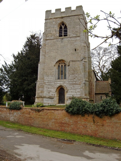
Kirklington is a village and civil parish in the Newark and Sherwood district of Nottinghamshire, England. The population as of the 2011 census was 400. Kirklington lies on the A617 road between Newark (9½ miles to the east) and Mansfield (10 miles to the west). Kirklington once had a railway station on the Mansfield- Southwell line; it was closed to passenger traffic in 1929 and goods trains in 1964. The former trackbed is now the Southwell Trail footpath. The place-name Kirklington seems to contain an Old English personal name, ''Cyrtla'', + ''tun'' (Old English), an enclosure; a farmstead; a village; an estate.., so 'Cyrtla's farm or settlement'.J. Gover, A. Mawer & F. M. Stenton (eds.), ''Place Names of Nottinghamshire'' (Cambridge, 1940), p.170; A.D.Mills, ''Dictionary of English Place-Names'' (Oxford, 2002), p.209 Notable people *John Boddam-Whetham John Whetham Boddam-Whetham (25 May 1843 – 23 March 1918) was an English naturalist, traveler and first-class cr ... [...More Info...] [...Related Items...] OR: [Wikipedia] [Google] [Baidu] |
Newark And Sherwood
Newark and Sherwood is a local government district and is the largest district in Nottinghamshire, England. The district was formed on 1 April 1974, by a merger of the municipal borough of Newark with Newark Rural District and Southwell Rural District. The district is predominantly rural, with some large forestry plantations, the ancient Sherwood Forest and the towns of Newark-on-Trent, Southwell and Ollerton. The council is based at Castle House, adjacent to Newark Castle Railway station, having previously used Kelham Hall in the nearby village of Kelham as its headquarters. Settlements Newark-on-Trent, together with Balderton, forms the largest urban area in the district. Newark-on-Trent has many important historic features including Newark Castle, St Mary's Magdalene Church, Georgian architecture and a defensive earthwork from the British Civil Wars. Other important towns in the district include Ollerton and Southwell which is home to Southwell Minster and Southwell ... [...More Info...] [...Related Items...] OR: [Wikipedia] [Google] [Baidu] |
Nottinghamshire
Nottinghamshire (; abbreviated Notts.) is a landlocked county in the East Midlands region of England, bordering South Yorkshire to the north-west, Lincolnshire to the east, Leicestershire to the south, and Derbyshire to the west. The traditional county town is Nottingham, though the county council is based at County Hall in West Bridgford in the borough of Rushcliffe, at a site facing Nottingham over the River Trent. The districts of Nottinghamshire are Ashfield, Bassetlaw, Broxtowe, Gedling, Mansfield, Newark and Sherwood, and Rushcliffe. The City of Nottingham was administratively part of Nottinghamshire between 1974 and 1998, but is now a unitary authority, remaining part of Nottinghamshire for ceremonial purposes. The county saw a minor change in its coverage as Finningley was moved from the county into South Yorkshire and is part of the City of Doncaster. This is also where the now-closed Doncaster Sheffield Airport is located (formerly Robin Hood Airport). In 20 ... [...More Info...] [...Related Items...] OR: [Wikipedia] [Google] [Baidu] |
Newark (UK Parliament Constituency)
Newark is a constituency in Nottinghamshire, England. It is currently represented by Robert Jenrick of the Conservative Party who won the seat in a by-election on 5 June 2014, following the resignation of Patrick Mercer in April 2014. Boundaries 1918–1950: The Municipal Borough of Newark, and the Rural Districts of Bingham, Newark, and Southwell. 1950–1983: The Municipal Borough of Newark, the Urban District of Mansfield Woodhouse, and the Rural Districts of Newark and Southwell. 1983–2010: The District of Newark wards of Beacon, Bridge, Bullpit Pinfold, Castle, Caunton, Collingham, Devon, Elston, Farndon, Magnus, Meering, Milton Lowfield, Muskham, Southwell East, Southwell West, Sutton on Trent, Trent, and Winthorpe, and the District of Bassetlaw wards of East Markham, East Retford East, East Retford North, East Retford West, Elkesley, Trent, and Tuxford. 2010–present: The District of Newark and Sherwood wards of Balderton North, Balderton West, Beacon, Bridge, Ca ... [...More Info...] [...Related Items...] OR: [Wikipedia] [Google] [Baidu] |
Civil Parish
In England, a civil parish is a type of administrative parish used for local government. It is a territorial designation which is the lowest tier of local government below districts and counties, or their combined form, the unitary authority. Civil parishes can trace their origin to the ancient system of ecclesiastical parishes, which historically played a role in both secular and religious administration. Civil and religious parishes were formally differentiated in the 19th century and are now entirely separate. Civil parishes in their modern form came into being through the Local Government Act 1894, which established elected parish councils to take on the secular functions of the parish vestry. A civil parish can range in size from a sparsely populated rural area with fewer than a hundred inhabitants, to a large town with a population in the tens of thousands. This scope is similar to that of municipalities in Continental Europe, such as the communes of France. However, ... [...More Info...] [...Related Items...] OR: [Wikipedia] [Google] [Baidu] |
A617 Road
The A617 road runs through the northern East Midlands, England, between Newark-on-Trent and Chesterfield. Route The route runs south-east to north-west through the northern East Midlands, largely through former coal-mining areas. It runs largely parallel to the A616 road, around six miles further south. Newark to Sutton-in-Ashfield The eastern terminus begins on the A46 Newark bypass, at the roundabout with the A616, on the former route of the Great North Road in the Newark and Sherwood district of Nottinghamshire, as a trunk road. It traverses the Trent Valley, crossing the River Trent at narrow bridge only really passable by light traffic; Kelham Bridge was built in 1857 when larger road vehicles never existed, and is mildly dangerous. The eastern terminus of the route was formerly in Kelham, where it met the former route of the A616 at a T-junction. It meets the Trent Valley Way, which it follows to Averham. A mile to the south is Staythorpe Power Station, with a traffi ... [...More Info...] [...Related Items...] OR: [Wikipedia] [Google] [Baidu] |
Newark-on-Trent
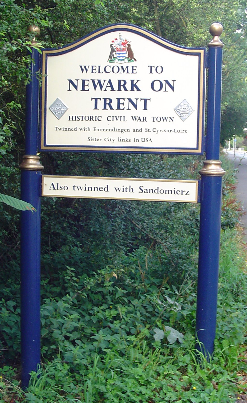
Newark-on-Trent or Newark () is a market town and civil parish in the Newark and Sherwood district in Nottinghamshire, England. It is on the River Trent, and was historically a major inland port. The A1 road (Great Britain), A1 road bypasses the town on the line of the ancient Great North Road (Great Britain), Great North Road. The town's origins are likely to be Roman Britain, Roman, as it lies on a major Roman road, the Fosse Way. It grew up round Newark Castle, Nottinghamshire, Newark Castle and as a centre for the wool and cloth trades. In the English Civil War, it was besieged by Roundheads, Parliamentary forces and Relief of Newark, relieved by Cavaliers, Royalist forces under Prince Rupert. Newark has a market place lined with many historical buildings and one of its most notable landmark is Church of St Mary Magdalene, Newark-on-Trent, St Mary Magdalene church with its towering spire at high and the highest structure in the town. The church is the tallest church in Nott ... [...More Info...] [...Related Items...] OR: [Wikipedia] [Google] [Baidu] |
Mansfield
Mansfield is a market town and the administrative centre of Mansfield District in Nottinghamshire, England. It is the largest town in the wider Mansfield Urban Area (followed by Sutton-in-Ashfield). It gained the Royal Charter of a market town in 1227. The town lies in the Maun Valley, north of Nottingham and near Sutton-in-Ashfield. Most of the 109,000 population live in the town itself (including Mansfield Woodhouse), with Warsop as a secondary centre. Mansfield is the one local authority in Nottinghamshire with a publicly elected mayor. History Roman to Mediaeval Period Settlement dates to the Roman period. Major Hayman Rooke in 1787 discovered a villa between Mansfield Woodhouse and Pleasley; a cache of denarii was found near King's Mill in 1849. Early English royalty stayed there; Mercian Kings used it as a base to hunt in Sherwood Forest. The Royal Manor of Mansfield was held by the King. In 1042 Edward the Confessor possessed a manor in Mansfield. William the Conqu ... [...More Info...] [...Related Items...] OR: [Wikipedia] [Google] [Baidu] |
Kirklington And Edingley Railway Station
Kirklington and Edingley railway station was a railway station serving the villages of Edingley and Kirklington in Nottinghamshire, England. History The station opened in 1871 when the Midland Railway opened a line from Southwell to Mansfield. Shortly after opening the timetable comprised 3 trains from Mansfield to Lincoln per day, and 4 trains from Lincoln to Mansfield. The station closed to passengers on 12 August 1929 when the Mansfield to Southwell section, which passed through a mining Mining is the extraction of valuable minerals or other geological materials from the Earth, usually from an ore body, lode, vein, seam, reef, or placer deposit. The exploitation of these deposits for raw material is based on the economic via ... area closed to passengers in 1929. The railway replaced it with a road motor omnibus service provided in conjunction with the Mansfield and District Tramways Limited connecting with the railway stations between Mansfield and Newark. Freig ... [...More Info...] [...Related Items...] OR: [Wikipedia] [Google] [Baidu] |
Southwell, Nottinghamshire
Southwell (, ) is a minster and market town in the district of Newark and Sherwood in Nottinghamshire, England. It is home to the grade-I listed Southwell Minster, the cathedral of the Anglican Diocese of Southwell and Nottingham. The population of the town was recorded at 7,558 in the 2021 Census. The town is on the River Greet and is located geographically west of Newark on Trent, north-east of Nottingham, south-east of Mansfield and south-east of Worksop. Toponymy The origin of the name is unclear. Several sites claim to be the original "well", notably at GR where a plaque has been placed; in the ''Admiral Rodney'' pub; on the south side of the Minster, known as Lady Well in the 19th century; and one by the cloisters called Holy Well. Norwell, north-west, may support the idea of a pair of "south" and "north" wells. Early history The remains of an opulent Roman villa were excavated beneath the Minster and its churchyard in 1959. Part of a mural from the excavation i ... [...More Info...] [...Related Items...] OR: [Wikipedia] [Google] [Baidu] |
Southwell Trail , a settlement in South Africa
{{disambiguation, geo ...
Southwell may refer to: *Southwell (surname) *Southwell, assumed name of Nathaniel Bacon (Jesuit) *Southwell, Dorset, a village *Southwell, Nottinghamshire, a town **Southwell Minster, historic cathedral ***Prebends of Southwell **Southwell Racecourse, horse racing venue located near Newark-on-Trent, Nottinghamshire **Southwell Rural District, a rural district in Nottinghamshire, England from 1894 to 1974 * Viscount Southwell, a title in the Peerage of Ireland *Southwell School, a co-educational independent preparatory school in Hamilton, New Zealand * Southwell, Eastern Cape Southwell is a settlement within the former farming district of the same name, about from Port Alfred and about from Grahamstown. Established in 1849 as a mission station, it was located at Lombard's Post, a fortified farmhouse originally gran ... [...More Info...] [...Related Items...] OR: [Wikipedia] [Google] [Baidu] |
Old English
Old English (, ), or Anglo-Saxon, is the earliest recorded form of the English language, spoken in England and southern and eastern Scotland in the early Middle Ages. It was brought to Great Britain by Anglo-Saxon settlement of Britain, Anglo-Saxon settlers in the mid-5th century, and the first Old English literature, Old English literary works date from the mid-7th century. After the Norman conquest of 1066, English was replaced, for a time, by Anglo-Norman language, Anglo-Norman (a langues d'oïl, relative of French) as the language of the upper classes. This is regarded as marking the end of the Old English era, since during this period the English language was heavily influenced by Anglo-Norman, developing into a phase known now as Middle English in England and Early Scots in Scotland. Old English developed from a set of Anglo-Frisian languages, Anglo-Frisian or Ingvaeonic dialects originally spoken by Germanic peoples, Germanic tribes traditionally known as the Angles, Sa ... [...More Info...] [...Related Items...] OR: [Wikipedia] [Google] [Baidu] |
John Boddam-Whetham
John Whetham Boddam-Whetham (25 May 1843 – 23 March 1918) was an English naturalist, traveler and first-class cricketer. Cricketer The son of Colonel Alexander Boddam-Whetham and his wife, Maria, Boddam-Whetham was born at Kirklington Hall in May 1843. He was educated at Eton College, though he did not represent the college XI in cricket. He did however make a single appearance in first-class cricket for the Gentlemen of the North against the Gentlemen of the South at Beeston in 1870. Batting twice in the match, he was dismissed for seven runs in the Gentlemen of the North first-innings by W. G. Grace, while in their second-innings he was dismissed by his brother, Fred Grace, for five runs. Travels During the 1870s he became a well known naturalist and traveller. He toured the western United States in the early 1870s, which included an ascent of Mount Shasta. From there he departed for Australia, and from Sydney he took a boat to Honolulu, arriving in July 1874. During his ... [...More Info...] [...Related Items...] OR: [Wikipedia] [Google] [Baidu] |


