|
Kirkandrews-on-Eden
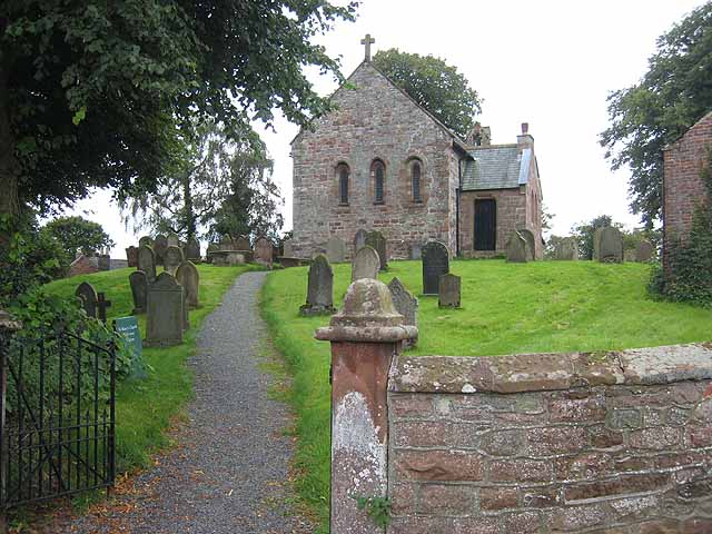
Kirkandrews-on-Eden or Kirkandrews-upon-Eden, in the past known as Kirkanders, is a village and former civil parish, now in the civil parish of Beaumont, in the Carlisle District of the county of Cumbria, England. The village is found 4 miles North-West of Carlisle. Kirkandrews forms part of the Barony of Burgh together with the nearby villages Monkhill, Grinsdale, Rattlingate and Burgh-by-Sands. The civil parish was merged into Beaumont in 1934. In 1931 the civil parish had a population of 145. History Hadrian's Wall Path and the Vallum run through the village. The village is 500m from the River Eden along which the Cumbrian Coastal Walk runs. It contains several examples of interesting listed buildings, Hollow Creek Farm; built in 1760, The Manor House, The Croft; built in the 1600s, The Beeches, Beech House are Grade II listed. National Cycle Network Route 72, Hadrian's Cycleway, stretches 160 miles along the Hadrian's Wall World Heritage Site from Ravenglass on the Cumb ... [...More Info...] [...Related Items...] OR: [Wikipedia] [Google] [Baidu] |
Kirkandrews Railway Station
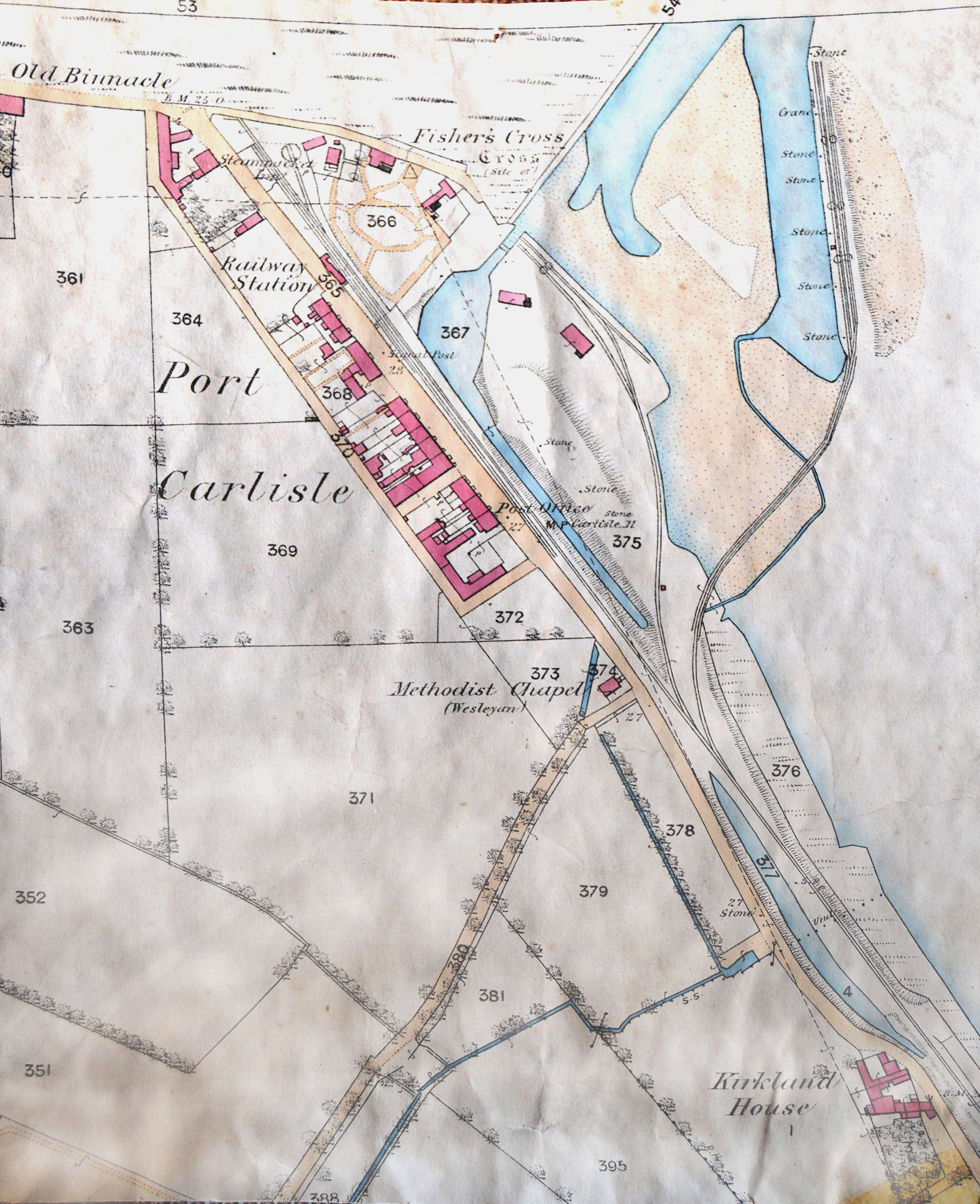
Kirkandrews railway station was a railway station near Kirkandrews-on-Eden, Cumberland (now in Cumbria), England, on the Port Carlisle Railway branch and later the Silloth branch. Retrieved : 2012-08-21 The station served the village and the rural district. Kirkandrews closed on 7 September 1964;Cumbria Railways Retrieved : 2012-08-21 the station building survives as a private dwelling. The line to Silloth closed on 7 September 1964 as part of the . History In 1819 a port was constructed at |
Beaumont, Cumbria
Beaumont (pronounced locally as bee-mont) is a village and civil parish in the City of Carlisle district of Cumbria, England. The village lies four miles north-west of Carlisle on the banks of the River Eden. Description The civil parish of Beaumont includes the surrounding villages of Kirkandrews-on-Eden, Grinsdale and Monkhill. The parish is bordered by the River Eden to the north and east, and by the parishes of Burgh by Sands to the west and Orton to the south. The village has very limited facilities; although it has a pub: The Drover's Rest. There is no school, post office or shop. History Beaumont's name, as suggested by the French translation 'beautiful mount', comes from its high setting. The manor was anciently held by the Brun family, Lords of Bowness, who were patrons also of the church. Before the year 1380 it became the property of the Dacres, and was annexed to the Barony of Burgh, belonging to the Earl of Lonsdale. The church is in the diocese and deanery o ... [...More Info...] [...Related Items...] OR: [Wikipedia] [Google] [Baidu] |
Listed Buildings In Beaumont, Cumbria
Beaumont is a civil parish in the Carlisle district of Cumbria, England. It contains 26 listed buildings that are recorded in the National Heritage List for England. Of these, one is listed at Grade II*, the middle of the three grades, and the others are at Grade II, the lowest grade. The parish contains the settlements of Beaumont, Kirkandrews-upon-Eden, Monkhill, and Grinsdale, and is otherwise mainly rural. Most of the listed buildings are houses and associated structures, farmhouses and farm buildings. The other listed buildings include churches and associated structures, a former windmill, and a public house. __NOTOC__ Key Buildings References Citations Sources * * * * * * * * * * * * * * * * * * * * * * * * * * * * {{DEFAULTSORT:Beaumont, Cumbria Lists of listed buildings in Cumbria Listed buildings In the United Kingdom, a listed building or listed structure is one that has been placed on one of the four statutory lists maintained by Hi ... [...More Info...] [...Related Items...] OR: [Wikipedia] [Google] [Baidu] |
Monkhill, Cumbria
Monkhill is a small village in the civil parish of Beaumont, in the City of Carlisle district, in the county of Cumbria, England. Nearby settlements include the small city of Carlisle and the villages of Burgh by Sands and Kirkandrews-on-Eden. Monkhill has a pub called the Drovers Rest Inn and a Methodist Chapel with adjoining School Room which holds local village events. The village is situated on the course of a ''vallum'' associated with Hadrian's Wall and is near the narrowest point of the River Eden, the site was a crossing point for Roman troops, Scottish border raiders, and cattle drovers. Monkhill, today, is a quiet little hamlet. See also *Listed buildings in Beaumont, Cumbria Beaumont is a civil parish in the Carlisle district of Cumbria, England. It contains 26 listed buildings that are recorded in the National Heritage List for England. Of these, one is listed at Grade II*, the middle of the three grades, an ... References Villages in Cumbria Beau ... [...More Info...] [...Related Items...] OR: [Wikipedia] [Google] [Baidu] |
Grinsdale
Grinsdale is a village and former civil parish, now in the civil parish of Beaumont, Cumbria, Beaumont, in the City of Carlisle, Carlisle district, in the English county of Cumbria. Grinsdale has a church called St Kentigern's Church, Grinsdale, St Kentigern's Church. It is the source of the Grinsdale (surname), surname. It is also beside the River Eden, Cumbria, River Eden. The civil parish was merged into Beaumont, Cumbria, Beaumont in 1934. In 1931 the civil parish had a population of 161. Grinsdale lies beside the river Eden near Carlisle. Four Roman military marching camps were set up in the area. The rich loamy soil encouraged farming around Grinsdale. Linen manufacture and weaving once provided employment in the hamlet. Grinsdale's church, St Kentigern, was built in 1740 outside the village and just above the river on the site where a 12th-century church once stood. It has a small west tower, a three-bay nave, and a two-bay chancel with arched windows. The church was rest ... [...More Info...] [...Related Items...] OR: [Wikipedia] [Google] [Baidu] |
Hadrian's Wall
Hadrian's Wall ( la, Vallum Aelium), also known as the Roman Wall, Picts' Wall, or ''Vallum Hadriani'' in Latin, is a former defensive fortification of the Roman province of Britannia, begun in AD 122 in the reign of the Emperor Hadrian. Running from Wallsend on the River Tyne in the east to Bowness-on-Solway in the west of what is now northern England, it was a stone wall with large ditches in front of it and behind it that crossed the whole width of the island. Soldiers were garrisoned along the line of the wall in large forts, smaller milecastles and intervening turrets. In addition to the wall's defensive military role, its gates may have been customs posts. A significant portion of the wall still stands and can be followed on foot along the adjoining Hadrian's Wall Path. The largest Roman archaeological feature in Britain, it runs a total of in northern England. Regarded as a British cultural icon, Hadrian's Wall is one of Britain's major ancient tourist attract ... [...More Info...] [...Related Items...] OR: [Wikipedia] [Google] [Baidu] |
World Heritage Site
A World Heritage Site is a landmark or area with legal protection by an international convention administered by the United Nations Educational, Scientific and Cultural Organization (UNESCO). World Heritage Sites are designated by UNESCO for having cultural, historical, scientific or other form of significance. The sites are judged to contain " cultural and natural heritage around the world considered to be of outstanding value to humanity". To be selected, a World Heritage Site must be a somehow unique landmark which is geographically and historically identifiable and has special cultural or physical significance. For example, World Heritage Sites might be ancient ruins or historical structures, buildings, cities, deserts, forests, islands, lakes, monuments, mountains, or wilderness areas. A World Heritage Site may signify a remarkable accomplishment of humanity, and serve as evidence of our intellectual history on the planet, or it might be a place of great natural beauty. A ... [...More Info...] [...Related Items...] OR: [Wikipedia] [Google] [Baidu] |
Beeching Cuts
The Beeching cuts (also Beeching Axe) was a plan to increase the efficiency of the nationalised British Rail, railway system in Great Britain. The plan was outlined in two reports: ''The Reshaping of British Railways'' (1963) and ''The Development of the Major Railway Trunk Routes'' (1965), written by Richard Beeching and published by the British Railways Board. The first report identified 2,363 stations and of railway line for closure, amounting to 55% of stations, 30% of route miles, and 67,700 British Rail positions, with an objective of stemming the large losses being incurred during a period of increasing competition from road transport and reducing the rail subsidies necessary to keep the network running. The second report identified a small number of major routes for significant investment. The 1963 report also recommended some less well-publicised changes, including a switch to the now-standard practice of containerisation for rail freight, and the replacement of some ... [...More Info...] [...Related Items...] OR: [Wikipedia] [Google] [Baidu] |
Silloth
Silloth (sometimes known as Silloth-on-Solway) is a port town and civil parish in the Allerdale borough of Cumbria, England. Historically in the county of Cumberland, the town is an example of a Victorian seaside resort in the North of England. Silloth had a population of 2,932 at the 2001 Census, falling slightly to 2,906 at the 2011 Census. Location It sits on the shoreline of the Solway Firth, north of Workington and west of Carlisle. The town of Maryport lies south, down the B5300 coast road which also passes through the villages of Blitterlees, Beckfoot, Mawbray, and Allonby. Wigton is east, along the B5302 road, which also passes through the village of Abbeytown, southeast. History Silloth developed in the 1860s onwards around the terminus of the railway from Carlisle and associated docks which had begun construction in 1855 to replace Port Carlisle as the deep-water port for Carlisle. Workers from the factories of Carlisle were presented with access to t ... [...More Info...] [...Related Items...] OR: [Wikipedia] [Google] [Baidu] |
Carlisle Canal
The Carlisle Canal opened in 1823, to link Carlisle to the Solway Firth, to facilitate the transport of goods to and from the city. It was a short-lived venture, being replaced by a railway which used the canal bed for most of its route in 1854. History The River Eden flows through the city of Carlisle, and into the Solway Firth. There were coal mines at Maryport, a little further down the coast, and prior to 1720, places along the river were supplied with coal by boats. However, this trade ended in 1720, when duties were levied on all goods carried around the coast by sea, and it became cheaper to transport the coal by land. Three traders from Carlisle, John Hicks, Henry Orme and Thomas Pattinson, sought an Act of Parliament which would waive the coastwise duties between Ellen Foot, as Maryport was then known, and Bank End, which was locate on the river close to Carlisle. The Act enabled them to build wharves, cranes and warehouses, and to dredge the river. They obtained the Act in ... [...More Info...] [...Related Items...] OR: [Wikipedia] [Google] [Baidu] |
Beaumont Parish Hall
Beaumont may refer to: Places Canada * Beaumont, Alberta * Beaumont, Quebec England * Beaumont, Cumbria * Beaumont, Essex **Beaumont Cut, a canal closed in the 1930s * Beaumont Street, Oxford France (communes) * Beaumont, Ardèche * Beaumont, Corrèze * Beaumont, Gers * Beaumont, Haute-Loire * Beaumont, Meurthe-et-Moselle * Beaumont, Puy-de-Dôme * Beaumont, Haute-Savoie * Beaumont, Vienne * Beaumont, Yonne * Beaumont-en-Diois United States * Beaumont, California * Beaumont, Kansas * Beaumont, Mississippi * Beaumont Scout Reservation, High Ridge, Missouri * Beaumont, Ohio * Beaumont, Texas ** Beaumont (Amtrak station) * Beaumont, Wisconsin Elsewhere * Beaumont, South Australia, a suburb of Adelaide * Beaumont, Belgium, in the province of Hainaut, Wallonia * Beaumont, Grand'Anse, commune in Haiti ** Beaumont City the principal city of the Beaumont, Grand'Anse commune * Beaumont, Dublin, a suburb of Dublin, Ireland * Beaumont, New Zealand, a township in Otago * Be ... [...More Info...] [...Related Items...] OR: [Wikipedia] [Google] [Baidu] |
Newcastle Upon Tyne
Newcastle upon Tyne ( RP: , ), or simply Newcastle, is a city and metropolitan borough in Tyne and Wear, England. The city is located on the River Tyne's northern bank and forms the largest part of the Tyneside built-up area. Newcastle is also the most populous city of North East England. Newcastle developed around a Roman settlement called Pons Aelius and the settlement later took the name of a castle built in 1080 by William the Conqueror's eldest son, Robert Curthose. Historically, the city’s economy was dependent on its port and in particular, its status as one of the world's largest ship building and repair centres. Today, the city's economy is diverse with major economic output in science, finance, retail, education, tourism, and nightlife. Newcastle is one of the UK Core Cities, as well as part of the Eurocities network. Famous landmarks in Newcastle include the Tyne Bridge; the Swing Bridge; Newcastle Castle; St Thomas’ Church; Grainger Town including G ... [...More Info...] [...Related Items...] OR: [Wikipedia] [Google] [Baidu] |


