|
Killynaff
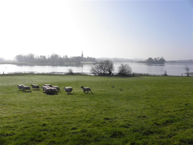
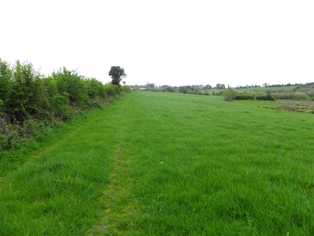
Killynaff () is a townland in the civil parish of Templeport, County Cavan, Ireland. It lies in the Roman Catholic parish of Templeport and barony of Tullyhaw. Geography Killynaff is bounded on the north by Urhannagh, Bofealan and Drumane townlands, on the west by Cavanaquill and Crossmakelagher townlands and on the southeast by Lecharrownahone townland. Its chief geographical features are cow pastures. Killynaff is traversed by a minor road and rural lanes. The townland covers 133 statute acres. History In medieval times the McGovern barony of Tullyhaw was divided into economic taxation areas called ballibetoes, from the Irish ''Baile Biataigh'' (Anglicized as 'Ballybetagh'), meaning 'A Provisioner's Town or Settlement'. The original purpose was to enable the farmer, who controlled the baile, to provide hospitality for those who needed it, such as poor people and travellers. The ballybetagh was further divided into townlands farmed by individual families who paid a tribute o ... [...More Info...] [...Related Items...] OR: [Wikipedia] [Google] [Baidu] |
Lecharrownahone
Lecharrownahone () is a townland in the civil parish of Templeport, County Cavan, Ireland. It lies in the Roman Catholic parish of Templeport and barony of Tullyhaw. Geography Lecharrownahone is bounded on the north by Carrowmore, County Cavan and Derryginny townlands in Tomregan parish and by Drumane townland, on the west by Killynaff and Crossmakelagher townlands, on the south by Cormeen townland in Kildallan parish and on the east by Agharaskilly townland in Tomregan parish. Its chief geographical features are the Shannon-Erne Waterway and the Crooked River (Ireland). Lecharrownahone is traversed by the regional R205 road, several rural lanes and the disused Cavan and Leitrim Railway. The townland covers 314 statute acres. History In medieval times the McGovern barony of Tullyhaw was divided into economic taxation areas called ballibetoes, from the Irish ''Baile Biataigh'' (Anglicized as 'Ballybetagh'), meaning 'A Provisioner's Town or Settlement'. The original purpose was ... [...More Info...] [...Related Items...] OR: [Wikipedia] [Google] [Baidu] |
Templeport
Templeport () is a civil parish in the barony of Tullyhaw, County Cavan, Ireland. The chief towns in the parish are Bawnboy and Ballymagauran. The large Roman Catholic parish of Templeport containing 42,172 statute acres was split up in the 18th & 19th centuries into three new parishes, Templeport, Corlough and Glangevlin. Etymology The name of Templeport parish derives from the old townland of Templeport (which is now shortened to Port) which is the anglicisation of the Gaelic 'Teampall An Phoirt' ("The Church of the Port or Bank or Landing-Place"). The church referred to is the old church on St. Mogue's Island in the middle of Port Lake. This church fell into disuse in medieval times and a new church was built on the opposite shore of the lake. It was forfeited to Queen Elizabeth in 1590 and started use as a Protestant church in about 1610. It is very unlikely that the island church ever served as the parish church because there was only one boat available and it would have ... [...More Info...] [...Related Items...] OR: [Wikipedia] [Google] [Baidu] |
Urhannagh
Urhannagh () is a townland in the civil parish of Templeport, County Cavan, Ireland. It lies in the Roman Catholic parish of Templeport and barony of Tullyhaw. Geography Urhannagh is bounded on the north by Clontycarnaghan townland, on the west by Munlough North townland, on the east by Bofealan townland and on the south by Cavanaquill and Killynaff townlands. Its chief geographical features are a small stream and cow pastures. Urhannagh is traversed by rural lanes. The townland covers 68 statute acres. History In medieval times the McGovern barony of Tullyhaw was divided into economic taxation areas called ballibetoes, from the Irish ''Baile Biataigh'' (Anglicized as ''Ballybetagh''), meaning 'A Provisioner's Town or Settlement'. The original purpose was to enable the farmer, who controlled the baile, to provide hospitality for those who needed it, such as poor people and travellers. The ballybetagh was further divided into townlands farmed by individual families who paid a ... [...More Info...] [...Related Items...] OR: [Wikipedia] [Google] [Baidu] |
Bofealan
Bofealan () is a townland in the civil parish of Templeport, County Cavan, Ireland. It lies in the Roman Catholic parish of Templeport and barony of Tullyhaw. Geography Bofealan is bounded on the north by Moher and Mullanacre Lower townlands in Tomregan parish and Clontycarnaghan townland, on the west by Urhannagh townland, on the east by Drumane townland and on the south by Killynaff townland. It includes a subdivision called Ballyness (Irish derived place name either Béal Átha an Easa, meaning ''Entrance to the Ford of the Waterfall'' or Baile an Easa, meaning 'Town of the Waterfall'). Bofealan's chief geographical features are the Crooked River (Ireland) and a disused mill race and pond. Bofealan is traversed by rural lanes. The townland covers 78 statute acres. History In medieval times the McGovern barony of Tullyhaw was divided into economic taxation areas called ballibetoes, from the Irish ''Baile Biataigh'' (Anglicized as 'Ballybetagh'), meaning 'A Provisioner's To ... [...More Info...] [...Related Items...] OR: [Wikipedia] [Google] [Baidu] |
Drumane
Drumane () is a townland in the civil parish of Templeport, County Cavan, Ireland. It lies in the Roman Catholic parish of Templeport and barony of Tullyhaw. Geography Drumane is bounded on the north by Mullanacre Lower townland in Tomregan parish, on the west by Bofealan townland, on the south by Killynaff and Lecharrownahone townlands and on the east by Carrowmore, County Cavan townland in Tomregan parish. Its main geographical features are the Crooked River (Ireland), a small wood and a gravel pit. Dromane is traversed by a minor road and rural lanes. The townland covers 147 statute acres. History The 1609 Baronial Map depicts the townland as ''Drommeane''. The 1652 Commonwealth Survey spells the name as ''Dromeane''. The 1665 Down Survey map depicts it as ''Dromane''. William Petty's 1685 map depicts it as ''Dromean''. In the Plantation of Ulster by grant dated 4 June 1611, King James VI and I granted, along with other lands, one poll of ''Dromeane to Donill Backagh McS ... [...More Info...] [...Related Items...] OR: [Wikipedia] [Google] [Baidu] |
Cavanaquill
Cavanaquill () is a townland in the civil parish of Templeport, County Cavan, Ireland. It lies in the Roman Catholic parish of Templeport and barony of Tullyhaw. Geography Cavanaquill is bounded on the north by Urhannagh townland, on the west by Munlough South and Lissanover townlands, on the east by Killynaff townland and on the south by Tonyhallagh and Crossmakelagher townlands. Cavanaquill's chief geographical features are a small stream and cow pastures. It is traversed by rural lanes. The townland covers 102 statute acres. History The Plantation of Ulster 1609 Baronial Map depicts the townland as ''Cavanekilly''. The 1652 Commonwealth Survey lists the townland as ''Cavancuill''. A deed dated 10 May 1744 spells the name as ''Cavanacull''. An 1808 map of ecclesiastical lands in Templeport depicts the townland as ''Cavanagh Hill''. In the Plantation of Ulster by grant dated 4 June 1611, along with other lands, King James VI and I granted one poll of ''Cavanaquill to Donill ... [...More Info...] [...Related Items...] OR: [Wikipedia] [Google] [Baidu] |
Crossmakelagher
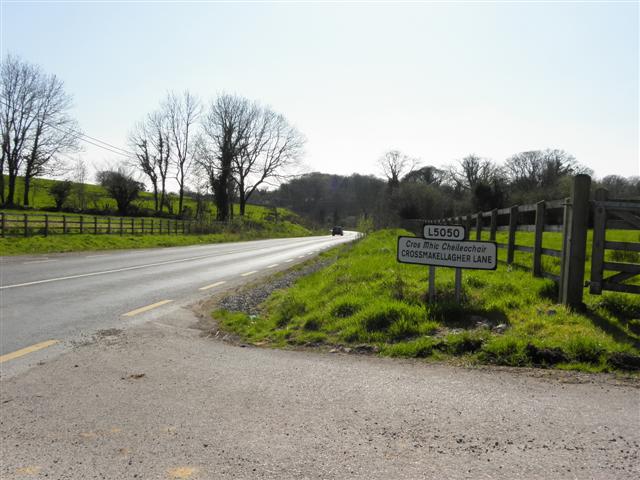
Crossmakelagher, also written Crossmakellagher or Crossmakellegher () is a townland in the civil parish of Templeport, County Cavan, Ireland. It lies in the Roman Catholic parish of Templeport and barony of Tullyhaw. The local people abbreviate it as 'Cross'. Geography Crossmakelagher is bounded on the north by Cavanaquill and Killynaff townlands, on the west by Tonyhallagh and Tonyrevan townlands, on the south by Bellaheady and Killarah townlands in Kildallan parish and on the east by Cormeen townland in Kildallan parish and Lecharrownahone townland. Its chief geographical features are the Shannon-Erne Waterway, a small plantation, a pond, a quarry, a spring well and several dug wells. Crossmakelagher is traversed by the regional R205 road, minor roads and rural lanes and the disused Cavan and Leitrim Railway. The townland covers 197 statute acres. History In medieval times the McGovern barony of Tullyhaw was divided into economic taxation areas called ballibetoes, from the ... [...More Info...] [...Related Items...] OR: [Wikipedia] [Google] [Baidu] |
George Calvert, 1st Baron Baltimore
George Calvert, 1st Baron Baltimore (; 1580 – 15 April 1632), was an English politician and colonial administrator. He achieved domestic political success as a member of parliament and later Secretary of State under King James I. He lost much of his political power after his support for a failed marriage alliance between Prince Charles and the Spanish House of Habsburg royal family. Rather than continue in politics, he resigned all of his political offices in 1625 except for his position on the Privy Council and declared his Catholicism publicly. He was created Baron Baltimore in the Peerage of Ireland upon his resignation. Baltimore Manor was located in County Longford, Ireland. Calvert took an interest in the British colonisation of the Americas, at first for commercial reasons and later to create a refuge for persecuted Irish and English Catholics. He became the proprietor of Avalon, the first sustained English settlement on the southeastern peninsula on the island ... [...More Info...] [...Related Items...] OR: [Wikipedia] [Google] [Baidu] |
Griffith's Valuation
Griffith's Valuation was a boundary and land valuation survey of Ireland completed in 1868. Griffith's background Richard John Griffith started to value land in Scotland, where he spent two years in 1806-1807 valuing terrain through the examination of its soils. He used 'the Scotch system of valuation' and it was a modified version of this that he introduced into Ireland when he assumed the position of Commissioner of Valuation. Tasks in Ireland In 1825 Griffith was appointed by the British Government to carry out a boundary survey of Ireland. He was to mark the boundaries of every county, barony, civil parish and townland in preparation for the first Ordnance Survey. He completed the boundary work in 1844. He was also called upon to assist in the preparation of a Parliamentary bill to provide for the general valuation of Ireland. This Act was passed in 1826, and he was appointed Commissioner of Valuation in 1827, but did not start work until 1830 when the new 6" maps, became av ... [...More Info...] [...Related Items...] OR: [Wikipedia] [Google] [Baidu] |
Dorchester, Dorset
Dorchester ( ) is the county town of Dorset, England. It is situated between Poole and Bridport on the A35 trunk route. A historic market town, Dorchester is on the banks of the River Frome to the south of the Dorset Downs and north of the South Dorset Ridgeway that separates the area from Weymouth, to the south. The civil parish includes the experimental community of Poundbury and the suburb of Fordington. The area around the town was first settled in prehistoric times. The Romans established a garrison there after defeating the Durotriges tribe, calling the settlement that grew up nearby Durnovaria; they built an aqueduct to supply water and an amphitheatre on an ancient British earthwork. After the departure of the Romans, the town diminished in significance, but during the medieval period became an important commercial and political centre. It was the site of the "Bloody Assizes" presided over by Judge Jeffreys after the Monmouth Rebellion, and later the trial of t ... [...More Info...] [...Related Items...] OR: [Wikipedia] [Google] [Baidu] |
Lissanover
Lissanover () is a townland in the civil parishes in Ireland, civil parish of Templeport, County Cavan, Republic of Ireland, Ireland. It lies in the Roman Catholic parish of Templeport and barony of Tullyhaw. Geography Lissanover is bounded on the north by Keenagh, Templeport and Munlough South townlands, on the west by Cor, Templeport, Cloneary and Gortnaleck townlands, on the south by Kilnavert townland and on the east by Killycluggin, Tonyhallagh and Cavanaquill townlands. Its chief geographical features are streams, quarries, gravel pits and a spring well. Lissanover is traversed by a public road, several rural lanes and the disused Cavan and Leitrim Railway. The townland covers 299 statute acres. Etymology The supposed derivation of the townland name ''The Fort of the Pride'' is given in a book published in 1875 ''The Origin and History of Irish Names of Places'' by Patrick Weston Joyce as follows- ''Lissanover is the name of a place near the village of Bawnboy, in Cava ... [...More Info...] [...Related Items...] OR: [Wikipedia] [Google] [Baidu] |
Act For The Settlement Of Ireland 1652
The Act for the Setling of Ireland imposed penalties including death and land confiscation against Irish civilians and combatants after the Irish Rebellion of 1641 and subsequent unrest. British historian John Morrill wrote that the Act and associated forced movements represented "perhaps the greatest exercise in ethnic cleansing in early modern Europe." Background The Act was passed on 12 August 1652 by the Rump Parliament of England, which had taken power after the Second English Civil War and had agreed to the Cromwellian conquest of Ireland. The conquest was deemed necessary as Royalist supporters of Charles II of England had allied themselves with the Confederation of Kilkenny (the confederation formed by Irish Catholics during the Irish Confederate Wars) and so were a threat to the newly formed English Commonwealth. The Rump Parliament had a large independent Dissenter membership who strongly empathised with the plight of the settlers of the Ulster Plantation, who ... [...More Info...] [...Related Items...] OR: [Wikipedia] [Google] [Baidu] |

.jpg)


