|
Khao Nom Nang, Tha Kradan
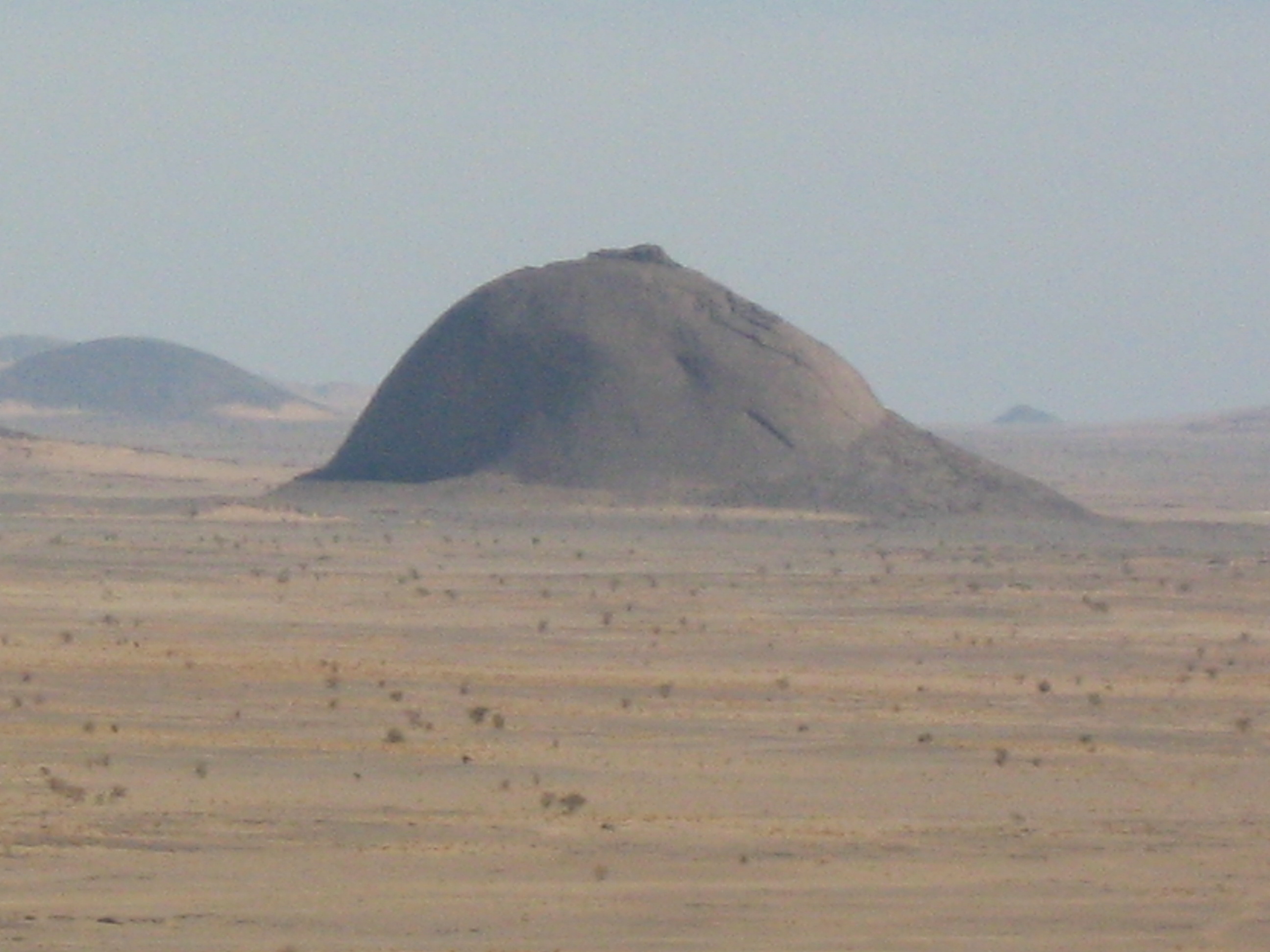
Khao Nom Nang (), " female breast mountain", is a high mountain in the Tenasserim Hills in Kanchanaburi Province, Thailand. Description Khao Nom Nang rises above the surrounding limestone hills between Nong Pet and Chong Sadao east of Route 3199. The mountain is in the Erawan National Park area. See also * *Breast-shaped hill
Some breast-shaped hills are named "wikt:pap#Etymology 2, pap", an archaic word for the breast or nipple of a wom ...
[...More Info...] [...Related Items...] OR: [Wikipedia] [Google] [Baidu] |
Kanchanaburi Province
Kanchanaburi (, ) is the largest of the western Provinces of Thailand, provinces (''changwat'') of Thailand. The neighboring provinces are (clockwise, from the north) Tak province, Tak, Uthai Thani province, Uthai Thani, Suphan Buri province, Suphan Buri, Nakhon Pathom province, Nakhon Pathom, and Ratchaburi province, Ratchaburi. In the west it borders Kayin State, Mon State, and the Tanintharyi Region of Myanmar. Tourists are attracted by the history of its ancient civilization and the World War II Bridge over the Khwae Yai River, River Kwai, originally spelt "Khwae" but officially changed to Kwai to accommodate the expectations of tourists. Geography The province is in the west of Thailand, 129 km from Bangkok, and covers a total area of approximately . It is the country's third largest province, after Nakhon Ratchasima and Chiang Mai. Topographically, it is covered with timber and evergreen forests. The total forest area is or 61.9 percent of provincial area. The distri ... [...More Info...] [...Related Items...] OR: [Wikipedia] [Google] [Baidu] |
Thailand
Thailand, officially the Kingdom of Thailand and historically known as Siam (the official name until 1939), is a country in Southeast Asia on the Mainland Southeast Asia, Indochinese Peninsula. With a population of almost 66 million, it spans . Thailand Template:Borders of Thailand, is bordered to the northwest by Myanmar, to the northeast and east by Laos, to the southeast by Cambodia, to the south by the Gulf of Thailand and Malaysia, and to the southwest by the Andaman Sea; it also shares maritime borders with Vietnam to the southeast and Indonesia and India to the southwest. Bangkok is the state capital and List of municipalities in Thailand#Largest cities by urban population, largest city. Tai peoples, Thai peoples migrated from southwestern China to mainland Southeast Asia from the 6th to 11th centuries. Greater India, Indianised kingdoms such as the Mon kingdoms, Mon, Khmer Empire, and Monarchies of Malaysia, Malay states ruled the region, competing with Thai states s ... [...More Info...] [...Related Items...] OR: [Wikipedia] [Google] [Baidu] |
Tenasserim Hills
The Tenasserim Hills or Tenasserim Range (, ; , , ; ) is the geographical name of a roughly 1,700 km long mountain chain, part of the Indo-Malayan mountain system in Southeast Asia. Despite their relatively scant altitude these mountains form an effective barrier between Thailand and Myanmar in their northern and central region. There are only two main transnational roads and cross-border points between Kanchanaburi and Tak, at the Three Pagodas Pass and at Mae Sot. The latter is located beyond the northern end of the range, where the Tenasserim Hills meet the Dawna Range. Minor cross-border points are Sing Khon, near Prachuap Khiri Khan, as well as Bong Ti and Phu Nam Ron west of Kanchanaburi. The latter is expected to gain in importance if the planned Dawei Port Project goes ahead, along with a highway and a railway line between Bangkok and that harbor. The southern section of this extensive chain of mountains runs along the Kra Isthmus into the Malay ... [...More Info...] [...Related Items...] OR: [Wikipedia] [Google] [Baidu] |
Limestone
Limestone is a type of carbonate rock, carbonate sedimentary rock which is the main source of the material Lime (material), lime. It is composed mostly of the minerals calcite and aragonite, which are different Polymorphism (materials science), crystal forms of calcium carbonate . Limestone forms when these minerals Precipitation (chemistry), precipitate out of water containing dissolved calcium. This can take place through both biological and nonbiological processes, though biological processes, such as the accumulation of corals and shells in the sea, have likely been more important for the last 540 million years. Limestone often contains fossils which provide scientists with information on ancient environments and on the evolution of life. About 20% to 25% of sedimentary rock is carbonate rock, and most of this is limestone. The remaining carbonate rock is mostly Dolomite (rock), dolomite, a closely related rock, which contains a high percentage of the mineral Dolomite (mine ... [...More Info...] [...Related Items...] OR: [Wikipedia] [Google] [Baidu] |
Breast
The breasts are two prominences located on the upper ventral region of the torso among humans and other primates. Both sexes develop breasts from the same embryology, embryological tissues. The relative size and development of the breasts is a major secondary sex distinction between females and males. There is also considerable Bra size, variation in size between individuals. Permanent Breast development, breast growth during puberty is caused by estrogens in conjunction with the growth hormone. Female humans are the only mammals that permanently develop breasts at puberty; all other mammals develop their mammary tissue during the latter period of pregnancy. In females, the breast serves as the mammary gland, which produces and secretes milk to feed infants. Subcutaneous fat covers and envelops a network of lactiferous duct, ducts that converge on the nipple, and these tissue (biology), tissues give the breast its distinct size and globular shape. At the ends of the ducts are ... [...More Info...] [...Related Items...] OR: [Wikipedia] [Google] [Baidu] |
Limestone
Limestone is a type of carbonate rock, carbonate sedimentary rock which is the main source of the material Lime (material), lime. It is composed mostly of the minerals calcite and aragonite, which are different Polymorphism (materials science), crystal forms of calcium carbonate . Limestone forms when these minerals Precipitation (chemistry), precipitate out of water containing dissolved calcium. This can take place through both biological and nonbiological processes, though biological processes, such as the accumulation of corals and shells in the sea, have likely been more important for the last 540 million years. Limestone often contains fossils which provide scientists with information on ancient environments and on the evolution of life. About 20% to 25% of sedimentary rock is carbonate rock, and most of this is limestone. The remaining carbonate rock is mostly Dolomite (rock), dolomite, a closely related rock, which contains a high percentage of the mineral Dolomite (mine ... [...More Info...] [...Related Items...] OR: [Wikipedia] [Google] [Baidu] |
Erawan National Park
Erawan National Park () is a protected area in Western Thailand, in the Tenasserim Hills of Kanchanaburi Province. Founded in 1975, it was the 12th national park of Thailand. History The establishment of the national park was declared in the Royal Thai Government Gazette on 19 June 1975 and came into effect the following day. This park area was further modified in 1995. The park covers an area of in Sai Yok, Tha Sao and Lum Sum subdistricts in Sai Yok District; Nong Pet and Tha Kradan subdistricts in Si Sawat District, and Chong Sadao Subdistrict in Mueang Kanchanaburi District. Features The major attraction of the park is Erawan Falls, a waterfall named after Erawan, the three-headed white elephant of Hindu mythology. The seven-tiered falls are said to resemble Erawan. There are four caves in the park: Mi, Rua, Wang Badan, and Phrathat. Rising northeast of the waterfall area there is a breast-shaped hill named Khao Nom Nang. Flora Mixed deciduous forest accounts for 8 ... [...More Info...] [...Related Items...] OR: [Wikipedia] [Google] [Baidu] |
List Of Mountains In Thailand
A list is a set of discrete items of information collected and set forth in some format for utility, entertainment, or other purposes. A list may be memorialized in any number of ways, including existing only in the mind of the list-maker, but lists are frequently written down on paper, or maintained electronically. Lists are "most frequently a tool", and "one does not ''read'' but only ''uses'' a list: one looks up the relevant information in it, but usually does not need to deal with it as a whole". Lucie Doležalová,The Potential and Limitations of Studying Lists, in Lucie Doležalová, ed., ''The Charm of a List: From the Sumerians to Computerised Data Processing'' (2009). Purpose It has been observed that, with a few exceptions, "the scholarship on lists remains fragmented". David Wallechinsky, a co-author of '' The Book of Lists'', described the attraction of lists as being "because we live in an era of overstimulation, especially in terms of information, and lists help ... [...More Info...] [...Related Items...] OR: [Wikipedia] [Google] [Baidu] |
Breast-shaped Hill
Some breast-shaped hills are named "wikt:pap#Etymology 2, pap", an archaic word for the breast or nipple of a woman, particularly those with a small hilltop protuberance. Such anthropomorphic geographic features are found in different parts of the world, and in some traditional cultures, they were once revered as the attributes of the Mother Goddess, such as the Paps of Anu, named after Anu (Irish goddess), Anu, an important female deity of pre-Christian Ireland. Overview The name ''Mamucium'' that gave origin to the name of the city of Manchester is thought to derive from a Celtic language name meaning "breast-shaped hill", referring to the sandstone bluff on which the fort stood; this later evolved into the name Manchester. ''Mamelon'' (from French "nipple") is a French name for a breast-shaped hillock. Mamelon (fort), Fort Mamelon was a famous hillock fortified by the Russians and captured by the French as part of the Siege of Sevastopol (1854–1855), Siege of Sevastopol du ... [...More Info...] [...Related Items...] OR: [Wikipedia] [Google] [Baidu] |
Geography Of Kanchanaburi Province
Geography (from Ancient Greek ; combining 'Earth' and 'write', literally 'Earth writing') is the study of the lands, features, inhabitants, and phenomena of Earth. Geography is an all-encompassing discipline that seeks an understanding of Earth and its human and natural complexities—not merely where objects are, but also how they have changed and come to be. While geography is specific to Earth, many concepts can be applied more broadly to other celestial bodies in the field of planetary science. Geography has been called "a bridge between natural science and social science disciplines." Origins of many of the concepts in geography can be traced to Greek Eratosthenes of Cyrene, who may have coined the term "geographia" (). The first recorded use of the word γεωγραφία was as the title of a book by Greek scholar Claudius Ptolemy (100 – 170 AD). This work created the so-called "Ptolemaic tradition" of geography, which included "Ptolemaic cartographic theory." ... [...More Info...] [...Related Items...] OR: [Wikipedia] [Google] [Baidu] |
Mountains Of Thailand
A mountain is an elevated portion of the Earth's crust, generally with steep sides that show significant exposed bedrock. Although definitions vary, a mountain may differ from a plateau in having a limited summit area, and is usually higher than a hill, typically rising at least above the surrounding land. A few mountains are isolated summits, but most occur in mountain ranges. Mountains are formed through tectonic forces, erosion, or volcanism, which act on time scales of up to tens of millions of years. Once mountain building ceases, mountains are slowly leveled through the action of weathering, through slumping and other forms of mass wasting, as well as through erosion by rivers and glaciers. High elevations on mountains produce colder climates than at sea level at similar latitude. These colder climates strongly affect the ecosystems of mountains: different elevations have different plants and animals. Because of the less hospitable terrain and climate, mountains te ... [...More Info...] [...Related Items...] OR: [Wikipedia] [Google] [Baidu] |


