|
Khaki Jabbar District
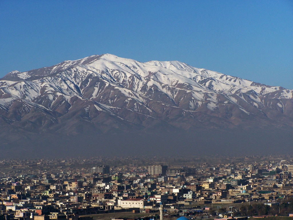
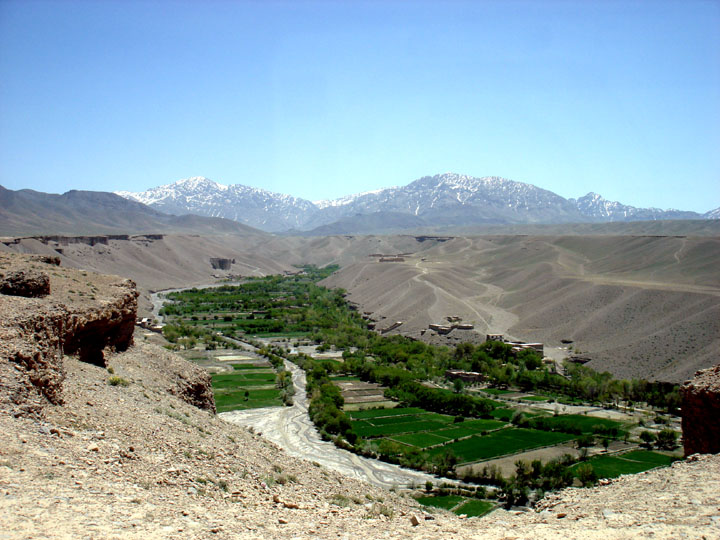
Khaki Jabbar District (Persian: ولسوالی خاک جبار) is a mountainous district situated in the southeastern part of Kabul Province, Afghanistan. The district headquarters is Khak-i Jabbar village, which is located in the central part of the district. Demographics Like in the rest of Afghanistan, no exact population numbers are available. The Afghan Ministry of Rural Rehabilitation & Development (MRRD) along with UNHCR estimates the population of the district to be around 7,461. According to AIMS and UNHCR, the overwhelmingly majority of the population are Pashtuns (at 80%), while the remaining 20% are ethnic Tajiks.UNHCR Profile for Khaki Jabbar District 31 July 2002 Geography Khaki ...[...More Info...] [...Related Items...] OR: [Wikipedia] [Google] [Baidu] |
Districts Of Afghanistan
The districts of Afghanistan, known as ''wuleswali'' ( ps, ولسوالۍ, ''wuləswāləi''; fa, شهرستان, ''shahrestān'') are secondary-level administrative units, one level below provinces. The Afghan government issued its first district map in 1973.''Afghanistan; Districts and Codes by Province'', Edition 2.0, AID / Rep. DC&A Mapping Unit, October 1991, Peshawar, Pakista/ref> It recognized 325 districts, counting ''wuleswalis'' (districts), ''alaqadaries'' (sub-districts), and ''markaz-e-wulaiyat'' (provincial center districts). In the ensuing years, additional districts have been added through splits, and some eliminated through merges. In June 2005, the Afghan government issued a map of 398 districts. It was widely adopted by many information management systems, though usually with the addition of ''Sharak-e-Hayratan'' for 399 districts in total. It remains the ''de facto'' standard as of late 2018, despite a string of government announcements of the creation of ... [...More Info...] [...Related Items...] OR: [Wikipedia] [Google] [Baidu] |
List Of Sovereign States
The following is a list providing an overview of sovereign states around the world with information on their status and recognition of their sovereignty. The 206 listed states can be divided into three categories based on membership within the United Nations System: 193 UN member states, 2 UN General Assembly non-member observer states, and 11 other states. The ''sovereignty dispute'' column indicates states having undisputed sovereignty (188 states, of which there are 187 UN member states and 1 UN General Assembly non-member observer state), states having disputed sovereignty (16 states, of which there are 6 UN member states, 1 UN General Assembly non-member observer state, and 9 de facto states), and states having a special political status (2 states, both in free association with New Zealand). Compiling a list such as this can be a complicated and controversial process, as there is no definition that is binding on all the members of the community of nations concerni ... [...More Info...] [...Related Items...] OR: [Wikipedia] [Google] [Baidu] |
Provinces Of Afghanistan
Afghanistan is divided into 34 provinces (, '' wilåyat''). The provinces of Afghanistan are the primary administrative divisions. Each province encompasses a number of districts or usually over 1,000 villages. Provincial governors played a critical role in the reconstruction of the Afghan state following the creation of the new government under Hamid Karzai. According to international security scholar Dipali Mukhopadhyay, many of the provincial governors of the western-backed government were former warlords who were incorporated into the political system. Provinces of Afghanistan Regions of Afghanistan UN Regions Former provinces of Afghanistan During Afghanistan's history it had a number of provinces in it. It started out as just Kabul, Herat, Qandahar, and Balkh but the number of provinces increased and by 1880 the provinces consisted of Balkh, Herat, Qandahar, Ghazni, Jalalabad, and Kabul. * Southern Province – dissolved in 1964 to create Paktia Provinc ... [...More Info...] [...Related Items...] OR: [Wikipedia] [Google] [Baidu] |
Kabul Province
Kabul (Persian: ), situated in the east of the country, is one of the thirty-four provinces of Afghanistan. The capital of the province is Kabul city, which is also Afghanistan's capital and largest city. The population of the Kabul Province is over 5 million people as of 2020, of which over 85 percent live in urban areas. The current governor of the province is Qari Baryal. It borders the provinces of Parwan to the north, Kapisa to the north-east, Laghman to the east, Nangarhar to the south-east, Logar to the south, and Wardak to the west. Geography Kabul is located between Latitude 34-31' North and Longitude 69-12' East at an altitude of 1800 m (6000 feet) above sea level, which makes it one of the world's highest capital cities. Kabul is strategically situated in a valley surrounded by high mountains at crossroads of north-south and east-west trade routes. One million years ago the Kabul region was surrounded from south-east between Lowgar and Paghman Mountains ... [...More Info...] [...Related Items...] OR: [Wikipedia] [Google] [Baidu] |
Capital (political)
A capital city or capital is the municipality holding primary status in a country, state, province, department, or other subnational entity, usually as its seat of the government. A capital is typically a city that physically encompasses the government's offices and meeting places; the status as capital is often designated by its law or constitution. In some jurisdictions, including several countries, different branches of government are in different settlements. In some cases, a distinction is made between the official (constitutional) capital and the seat of government, which is in another place. English-language news media often use the name of the capital city as an alternative name for the government of the country of which it is the capital, as a form of metonymy. For example, "relations between Washington and London" refer to " relations between the United States and the United Kingdom". Terminology and etymology The word ''capital'' derives from the Latin word ... [...More Info...] [...Related Items...] OR: [Wikipedia] [Google] [Baidu] |
Khak-i Jabbar
Khak-i Jabbar is a village and the center of Khaki Jabbar District, Kabul Province, Afghanistan. It is located at at 2,287 m altitude. See also *Kabul Province Kabul (Persian: ), situated in the east of the country, is one of the thirty-four provinces of Afghanistan. The capital of the province is Kabul city, which is also Afghanistan's capital and largest city. The population of the Kabul Province is ... References Populated places in Kabul Province {{Kabul-geo-stub ... [...More Info...] [...Related Items...] OR: [Wikipedia] [Google] [Baidu] |
Afghanistan Standard Time
Time in Afghanistan is officially UTC+04:30, called Afghanistan Time or AFT. Afghanistan does not observe daylight saving time. IANA time zone database Afghanistan has the IANA time zone database The tz database is a collaborative compilation of information about the world's time zones, primarily intended for use with computer programs and operating systems. Paul Eggert is its current editor and maintainer, with the organizational backi ... time zone "Asia/Kabul". References {{afghanistan-stub ru:Афганистан#Время в Афганистане ... [...More Info...] [...Related Items...] OR: [Wikipedia] [Google] [Baidu] |
Afghanistan
Afghanistan, officially the Islamic Emirate of Afghanistan,; prs, امارت اسلامی افغانستان is a landlocked country located at the crossroads of Central Asia and South Asia. Referred to as the Heart of Asia, it is bordered by Pakistan to the Durand Line, east and south, Iran to the Afghanistan–Iran border, west, Turkmenistan to the Afghanistan–Turkmenistan border, northwest, Uzbekistan to the Afghanistan–Uzbekistan border, north, Tajikistan to the Afghanistan–Tajikistan border, northeast, and China to the Afghanistan–China border, northeast and east. Occupying of land, the country is predominantly mountainous with plains Afghan Turkestan, in the north and Sistan Basin, the southwest, which are separated by the Hindu Kush mountain range. , Demographics of Afghanistan, its population is 40.2 million (officially estimated to be 32.9 million), composed mostly of ethnic Pashtuns, Tajiks, Hazaras, and Uzbeks. Kabul is the country's largest city and ser ... [...More Info...] [...Related Items...] OR: [Wikipedia] [Google] [Baidu] |
Pashtuns
Pashtuns (, , ; ps, پښتانه, ), also known as Pakhtuns or Pathans, are an Iranian ethnic group who are native to the geographic region of Pashtunistan in the present-day countries of Afghanistan and Pakistan. They were historically referred to as Afghans () or xbc, αβγανο () until the 1970s, when the term's meaning officially evolved into that of a demonym for all residents of Afghanistan, including those outside of the Pashtun ethnicity. The group's native language is Pashto, an Iranian language in the Indo-Iranian branch of the Indo-European language family. Additionally, Dari Persian serves as the second language of Pashtuns in Afghanistan while those in the Indian subcontinent speak Urdu and Hindi (see Hindustani language) as their second language. Pashtuns are the 26th-largest ethnic group in the world, and the largest segmentary lineage society; there are an estimated 350–400 Pashtun tribes and clans with a variety of origin theories. The total popul ... [...More Info...] [...Related Items...] OR: [Wikipedia] [Google] [Baidu] |
Tājik People
Tajiks ( fa, تاجيک، تاجک, ''Tājīk, Tājek''; tg, Тоҷик) are a Persian-speaking Iranian ethnic group native to Central Asia, living primarily in Afghanistan, Tajikistan, and Uzbekistan. Tajiks are the largest ethnicity in Tajikistan, and the second-largest in Afghanistan and Uzbekistan. They speak varieties of Persian, a Western Iranian language. In Tajikistan, since the 1939 Soviet census, its small Pamiri and Yaghnobi ethnic groups are included as Tajiks. In China, the term is used to refer to its Pamiri ethnic groups, the Tajiks of Xinjiang, who speak the Eastern Iranian Pamiri languages. In Afghanistan, the Pamiris are counted as a separate ethnic group. As a self-designation, the literary New Persian term ''Tajik'', which originally had some previous pejorative usage as a label for eastern Persians or Iranians, has become acceptable during the last several decades, particularly as a result of Soviet administration in Central Asia. Alternative names for t ... [...More Info...] [...Related Items...] OR: [Wikipedia] [Google] [Baidu] |
Logar Province
Logar (Pashto/Dari: ; meaning Greater Mountain ( لوې غر)) is one of the 34 provinces of Afghanistan located in the eastern section of the country. It is divided into 7 districts and contains hundreds of villages. Puli Alam is the capital of the province. As of 2021, Logar has a population of approximately 442,037. It is a multi-ethnic tribal society, while about 65% of its residents are made up by Pashtuns whereas the remainder are Tajiks and Hazaras. The Logar River enters the province through the west and leaves to the north. History Pre Islamic era A 2,600-year-old a Zoroastrian fire temple was found at Mes Aynak (about 25 miles or 40 kilometers southeast of Kabul). Several Buddhist stupas and more than 1,000 statues were also found. Smelting workshops, miners’ quarters (even then the site's copper was well known), a mint, two small forts, a citadel, and a stockpile of Kushan, Sassanian and Indo-Parthian coins were also found at the site. Recent history ... [...More Info...] [...Related Items...] OR: [Wikipedia] [Google] [Baidu] |
Mussahi District
Mussahi District (Pashto: د موسهي ولسوالی) (Persian: ولسوالی موسهي) is a southern district of Kabul Province, Afghanistan. Mussai district borders Char Asiab District to the west, Bagrami District to the north, Khaki Jabbar District to the east and Logar Province to the south. Its headquarter is in Mussahi village, which is in the central part of the district. Demography It had a population of 30,000 people by the 2002 UNHCR official estimation. The Pashtuns Pashtuns (, , ; ps, پښتانه, ), also known as Pakhtuns or Pathans, are an Iranian ethnic group who are native to the geographic region of Pashtunistan in the present-day countries of Afghanistan and Pakistan. They were historically re ... form the majority of the population and there is distinctive Tajik population. Mussahi district is located at the south of Kabul (25 km away from Kabul City) with fair road access (an hour car drive in rough road). Formerly being a part of Char ... [...More Info...] [...Related Items...] OR: [Wikipedia] [Google] [Baidu] |


