|
Kerikeri River (Waikato)
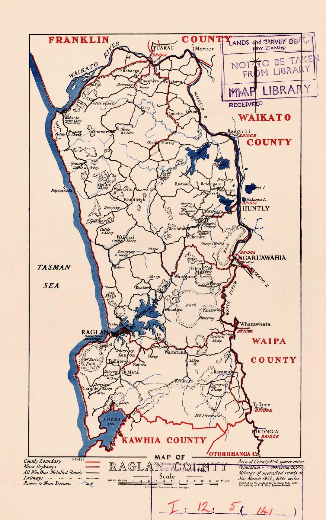
The Kerikeri River is a short river of the Waikato region of New Zealand's North Island. It flows into the northern shore of Raglan Harbour. The valley is largely along the line of the fault on the eastern edge of Whaingaroa Harbour. It flows over Coleman Conglomerate and, at its lower end, blue-grey Puti Siltstone, both of Puaroan age (about 150 million years ago). From about 1870 Sam and Tom Wilson ran a flax mill powered by a wheel in the river. Much of the native bush was cleared for farming between 1910 and 1920. See also *List of rivers of New Zealand This is a list of all waterways named as rivers in New Zealand. A * Aan River * Acheron River (Canterbury) * Acheron River (Marlborough) * Ada River * Adams River * Ahaura River * Ahuriri River * Ahuroa River * Akatarawa River * Ākiti ... References External links 1:50,000 mapat NZ Topomaps 1955 Waingaro Landing aerial photo– the foreground shows part of the Kerikeri River arm of the harbour, which is ... [...More Info...] [...Related Items...] OR: [Wikipedia] [Google] [Baidu] |
Raglan Harbour
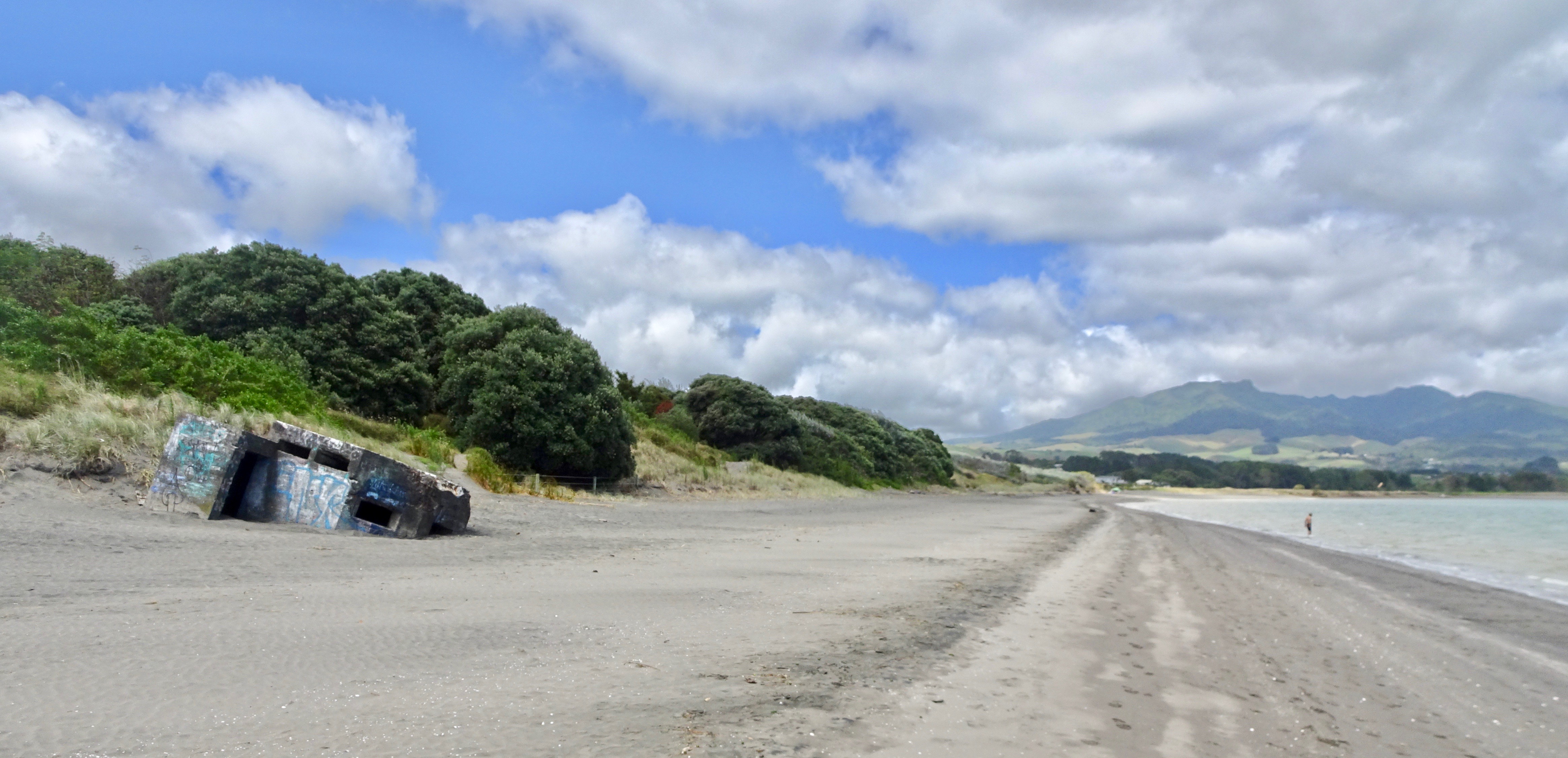
Raglan is a small beachside town located 48 km west of Hamilton, New Zealand on State Highway 23. It is known for its surfing, and volcanic black sand beaches. History The Ngāti Māhanga iwi occupied the area around Raglan in the late 18th century. There are at least 81 archaeological sites in the area, mainly near the coast. Limited radiocarbon dating puts the earliest sites at about 1400AD. The Māori people named the site ("the long pursuit"). One tradition says that Tainui priest, Rakataura, crossed Whāingaroa on his way to Kāwhia. Another says it was among the places the early Te Arawa explorer, Kahumatamomoe, with his nephew Īhenga, visited on their expedition from Maketū. The first Europeans to settle in the area, the Rev James and Mary Wallis, Wesleyan missionaries, were embraced and welcomed by local Māori in 1835. European settlement, including large scale conversion of land to pasture, began in the mid-1850s after a large sale of land by Chief Wirem ... [...More Info...] [...Related Items...] OR: [Wikipedia] [Google] [Baidu] |
New Zealand
New Zealand ( mi, Aotearoa ) is an island country in the southwestern Pacific Ocean. It consists of two main landmasses—the North Island () and the South Island ()—and over 700 smaller islands. It is the sixth-largest island country by area, covering . New Zealand is about east of Australia across the Tasman Sea and south of the islands of New Caledonia, Fiji, and Tonga. The country's varied topography and sharp mountain peaks, including the Southern Alps, owe much to tectonic uplift and volcanic eruptions. New Zealand's capital city is Wellington, and its most populous city is Auckland. The islands of New Zealand were the last large habitable land to be settled by humans. Between about 1280 and 1350, Polynesians began to settle in the islands and then developed a distinctive Māori culture. In 1642, the Dutch explorer Abel Tasman became the first European to sight and record New Zealand. In 1840, representatives of the United Kingdom and Māori chiefs ... [...More Info...] [...Related Items...] OR: [Wikipedia] [Google] [Baidu] |
Waikato
Waikato () is a Regions of New Zealand, local government region of the upper North Island of New Zealand. It covers the Waikato District, Waipa District, Matamata-Piako District, South Waikato District and Hamilton, New Zealand, Hamilton City, as well as Hauraki Plains, Hauraki, Coromandel Peninsula, the northern King Country, much of the Taupō District, and parts of Rotorua, Rotorua District. It is governed by the Waikato Regional Council. The region stretches from Coromandel Peninsula in the north, to the north-eastern slopes of Mount Ruapehu in the south, and spans the North Island from the west coast, through the Waikato and Hauraki to Coromandel Peninsula on the east coast. Broadly, the extent of the region is the Waikato River catchment. Other major catchments are those of the Waihou River, Waihou, Piako River, Piako, Awakino River (Waikato), Awakino and Mokau River, Mokau rivers. The region is bounded by Auckland Region, Auckland on the north, Bay of Plenty on the east ... [...More Info...] [...Related Items...] OR: [Wikipedia] [Google] [Baidu] |
North Island
The North Island, also officially named Te Ika-a-Māui, is one of the two main islands of New Zealand, separated from the larger but much less populous South Island by the Cook Strait. The island's area is , making it the world's 14th-largest island. The world's 28th-most-populous island, Te Ika-a-Māui has a population of accounting for approximately % of the total residents of New Zealand. Twelve main urban areas (half of them officially cities) are in the North Island. From north to south, they are Whangārei, Auckland, Hamilton, Tauranga, Rotorua, Gisborne, New Plymouth, Napier, Hastings, Whanganui, Palmerston North, and New Zealand's capital city Wellington, which is located at the south-west tip of the island. Naming and usage Although the island has been known as the North Island for many years, in 2009 the New Zealand Geographic Board found that, along with the South Island, the North Island had no official name. After a public consultation, the board officially ... [...More Info...] [...Related Items...] OR: [Wikipedia] [Google] [Baidu] |
Fault (geology)
In geology, a fault is a planar fracture or discontinuity in a volume of rock across which there has been significant displacement as a result of rock-mass movements. Large faults within Earth's crust result from the action of plate tectonic forces, with the largest forming the boundaries between the plates, such as the megathrust faults of subduction zones or transform faults. Energy release associated with rapid movement on active faults is the cause of most earthquakes. Faults may also displace slowly, by aseismic creep. A ''fault plane'' is the plane that represents the fracture surface of a fault. A ''fault trace'' or ''fault line'' is a place where the fault can be seen or mapped on the surface. A fault trace is also the line commonly plotted on geologic maps to represent a fault. A ''fault zone'' is a cluster of parallel faults. However, the term is also used for the zone of crushed rock along a single fault. Prolonged motion along closely spaced faults can blur the ... [...More Info...] [...Related Items...] OR: [Wikipedia] [Google] [Baidu] |
List Of Rivers Of New Zealand
This is a list of all waterways named as rivers in New Zealand. A * Aan River * Acheron River (Canterbury) * Acheron River (Marlborough) * Ada River * Adams River * Ahaura River * Ahuriri River * Ahuroa River * Akatarawa River * Ākitio River * Alexander River * Alfred River * Allen River * Alma River * Alph River (Ross Dependency) * Anatoki River * Anatori River * Anaweka River * Anne River * Anti Crow River * Aongatete River * Aorangiwai River * Aorere River * Aparima River * Arahura River * Arapaoa River * Araparera River * Arawhata River * Arnold River * Arnst River * Aropaoanui River * Arrow River * Arthur River * Ashburton River / Hakatere * Ashley River / Rakahuri * Avoca River (Canterbury) * Avoca River (Hawke's Bay) * Avon River / Ōtākaro * Avon River (Marlborough) * Awakari River * Awakino River (Canterbury) and its East and West branches * Awakino River (Northland) * Awakino River (Waikato) * Awanui River * Awapoko River * Awarau River * A ... [...More Info...] [...Related Items...] OR: [Wikipedia] [Google] [Baidu] |
Waingaro River (Waikato)
The Waingaro River is a river of the Waikato region of New Zealand's North Island. It flows generally southwest from its origins near Glen Afton and Glen Massey, west of Ngāruawāhia, to reach a northern arm of Raglan Harbour (se1:50,000 map. Its main tributary is Kahuhuru Stream, which Highway 22 follows for several kilometres. Tributaries total about . At Waingaro it is fed by a hot spring. Geology The lower river flows over Puaroan age (about 150 million years ago), blue-grey Puti siltstone.Geology of the Raglan-Kawhia Area: Institute of Geological & Nuclear Sciences (N.Z.), Barry Clayton Waterhouse, P. J. White 1994 Pollution The Waingaro River is one of the largest sources of sediment in Whaingaroa Harbour, partly because it is 99 percent unfenced. Pollution has been worsening for phosphorus, though nitrogen has improved, as shown in this table of important (i.e. slope direction probability over 95% and RSKSE over ±1% pa) improvements, or deteriorations (-) i ... [...More Info...] [...Related Items...] OR: [Wikipedia] [Google] [Baidu] |
Rivers Of Waikato
A river is a natural flowing watercourse, usually freshwater, flowing towards an ocean, sea, lake or another river. In some cases, a river flows into the ground and becomes dry at the end of its course without reaching another body of water. Small rivers can be referred to using names such as creek, brook, rivulet, and rill. There are no official definitions for the generic term river as applied to geographic features, although in some countries or communities a stream is defined by its size. Many names for small rivers are specific to geographic location; examples are "run" in some parts of the United States, "burn" in Scotland and northeast England, and "beck" in northern England. Sometimes a river is defined as being larger than a creek, but not always: the language is vague. Rivers are part of the water cycle. Water generally collects in a river from precipitation through a drainage basin from surface runoff and other sources such as groundwater recharge, springs, a ... [...More Info...] [...Related Items...] OR: [Wikipedia] [Google] [Baidu] |
Waikato District
Waikato District is a territorial authority of New Zealand, in the northern part of Waikato region, North Island. Waikato District is administered by the Waikato District Council, with headquarters in Ngāruawāhia. The district is centred to the north and west of the city of Hamilton, and takes in much of the northern Waikato Plains and also the Hakarimata Range. The north of the district contains swampy floodplain of the Waikato River and several small lakes, of which the largest is Lake Waikare. Other than Ngāruawāhia, the main population centres are Huntly, Raglan, and Te Kauwhata. The main industries in the district are dairy farming, forestry, and coal mining. There is a major coal-fired power station at Huntly. Te Kauwhata is at the centre of a major wine region. Demographics At the 2006 census the district had a population of 43,959. Of these, 6834 lived in Huntly, 5106 in Ngāruawāhia, 2637 in Raglan, and 1294 in Te Kauwhata. In 2010, the district acquired part o ... [...More Info...] [...Related Items...] OR: [Wikipedia] [Google] [Baidu] |


