|
Katuwa Chaupari
Katuwa Chaupari ( ne, कटुवा चौपारी) is a market center in Kushma Municipality in Gyandi of Parbat District in the Dhawalagiri Zone of central Nepal. The formerly Village Development committee was annexed to form the municipality since 18 May 2014. At the time of the 1991 Nepal census it had a population of 1838 people living in 361 individual households. Meaning and origination Katuwa Chaupari is composed of two words 'Katuwa' and 'Chaupari'. Literally, 'Katuwa' means 'Cut-off' and 'Chaupari' means 'Forum'. There used to be a Chaupari (चौपरी)/Chautari(चौतारी) having two trees: Bar (वर) Peepal(पिपल) and between those two trees local people made a pathway for travelers dividing (cut-off) the Chaupri into two. From then and there the name of the place was originated. The exact place exists now also known as "Katuwa" only. The Chaupari was made for people especially porters to let them rest their heavy loads. There were seats ... [...More Info...] [...Related Items...] OR: [Wikipedia] [Google] [Baidu] |
Municipality
A municipality is usually a single administrative division having corporate status and powers of self-government or jurisdiction as granted by national and regional laws to which it is subordinate. The term ''municipality'' may also mean the governing body of a given municipality. A municipality is a general-purpose administrative subdivision, as opposed to a special-purpose district. The term is derived from French and Latin . The English word ''municipality'' derives from the Latin social contract (derived from a word meaning "duty holders"), referring to the Latin communities that supplied Rome with troops in exchange for their own incorporation into the Roman state (granting Roman citizenship to the inhabitants) while permitting the communities to retain their own local governments (a limited autonomy). A municipality can be any political jurisdiction, from a sovereign state such as the Principality of Monaco, to a small village such as West Hampton Dunes, New York. Th ... [...More Info...] [...Related Items...] OR: [Wikipedia] [Google] [Baidu] |
Kushma Municipality
Kushma is a small village and the headquarter of Parbat District in Nepal. Kushma municipality was formed by merging thirteen village development committees Pang, Dhawalagiri, Pang, Khurkot, Parbat, Khurkot, Durlung, Dhawalagiri, Durlung, Shivalaya, Parbat, Shivalaya, Chuwa, Katuwa Chaupari, Pipaltari and Pakuwa on 18 May 2014. This city lies in the western part of Nepal just about 57 km from Pokhara and 12 km from Baglung. Kushma falls under Western Development Region, Nepal, Western Development Region and Dhaulagiri Zone of Nepal. It is located at 28°13'06N 83°40'45E at an altitude of 1294 meters. Kusma Bazaar straddling a narrow and high strip of land between the banks of Gandaki River, Kaligandaki and Modi Khola, Modi is the main market centre of the municipality. A bridge joins Kushma with Gyadichour located on the other side of the deep Modi river canyon. History From early times Kusma has been an important stop for travellers from Baglung on their way t ... [...More Info...] [...Related Items...] OR: [Wikipedia] [Google] [Baidu] |
Gorge
A canyon (from ; archaic British English spelling: ''cañon''), or gorge, is a deep cleft between escarpments or cliffs resulting from weathering and the erosion, erosive activity of a river over geologic time scales. Rivers have a natural tendency to cut through underlying surfaces, eventually wearing away rock layers as sediments are removed downstream. A river bed will gradually reach a baseline elevation, which is the same elevation as the body of water into which the river drains. The processes of weathering and erosion will form canyons when the river's River source, headwaters and estuary are at significantly different elevations, particularly through regions where softer rock layers are intermingled with harder layers more resistant to weathering. A canyon may also refer to a rift between two mountain peaks, such as those in ranges including the Rocky Mountains, the Alps, the Himalayas or the Andes. Usually, a river or stream carves out such splits between mountains. Examp ... [...More Info...] [...Related Items...] OR: [Wikipedia] [Google] [Baidu] |
Saligram Stone
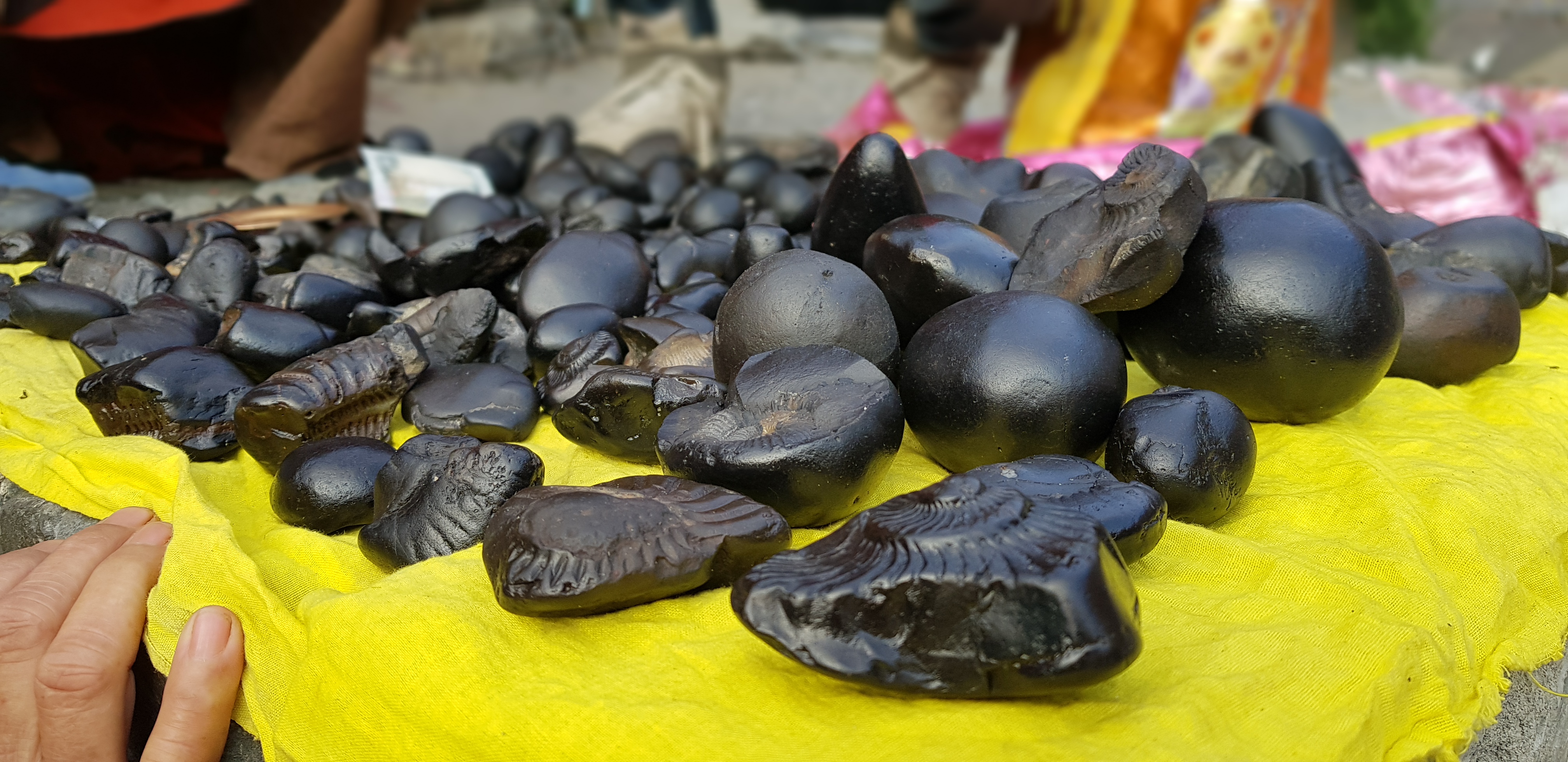
A shaligrama shila ( deva, शालिग्राम शिला, Śāligrāma-śilā), also rendered as shaligram, is a particular variety of stone collected from riverbed or banks of the Kali Gandaki, a tributary of the Gandaki River in Nepal, used as a non-anthropomorphic representation of God Vishnu by Hindus. They are typically fossils of ammonite shells from the Devonian-Cretaceous period of 400 to 66 million years ago. The fossils are considered holy by Hindus because Madhvacharya received it from Vyasadeva, also called Astamurti, and also they resemble symbols associated with God Vishnu, mainly the Shankha (conch shell). Legends According to the Devi Bhagavata Purana, Brahmavaivarta Purana, and Shiva Purana, shilagrama shilas originated due to the following chain of events. A king named Vrishadhvaja had been cursed by Surya to endure poverty, due to his reluctance to worship any deity other than Shiva. To regain their lost prosperity, his grandsons Dharmadhvaja ... [...More Info...] [...Related Items...] OR: [Wikipedia] [Google] [Baidu] |
Kali Gandaki River
The Gandaki River, also known as the Narayani and the Gandak, is one of the major rivers in Nepal and a left bank tributary of the Ganges in India. Its total catchment area amounts to , most of it in Nepal. In the Nepal Himalayas, it is notable for its deep canyon. The basin also contains three mountains over , namely Dhaulagiri, Manaslu and Annapurna I. Dhaulagiri is the highest point of the Gandaki basin. River course Nepal The Kali Gandaki river source is at the border with Tibet at an elevation of at the Nhubine Himal Glacier in the Mustang region of Nepal. The headwaters stream on some maps is named the Chhuama Khola and then, nearing Lo Manthang, the Nhichung Khola or Choro Khola. The Kali Gandaki then flows southwest (with the name of Mustang Khola on old, outdated maps) through a sheer-sided, deep canyon before widening at the steel footbridge at Chele, where part of its flow funnels through a rock tunnel, and from this point the now wide river is called the Kali ... [...More Info...] [...Related Items...] OR: [Wikipedia] [Google] [Baidu] |
Modi Beni
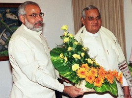
Narendra Damodardas Modi (; born 17 September 1950) is an Indian politician serving as the 14th and current Prime Minister of India since 2014. Modi was the Chief Minister of Gujarat from 2001 to 2014 and is the Member of Parliament from Varanasi. He is a member of the Bharatiya Janata Party (BJP) and of the Rashtriya Swayamsevak Sangh (RSS), a right-wing Hindu nationalist paramilitary volunteer organisation. He is the longest serving prime minister from outside the Indian National Congress. Modi was born and raised in Vadnagar in northeastern Gujarat, where he completed his secondary education. He was introduced to the RSS at age eight. He has reminisced about helping out after school at his father's tea stall at the Vadnagar railway station. At age 18, Modi was married to Jashodaben Chimanlal Modi, whom he abandoned soon after. He first publicly acknowledged her as his wife more than four decades later when required to do so by Indian law, but has made no contact with ... [...More Info...] [...Related Items...] OR: [Wikipedia] [Google] [Baidu] |


