|
Karatau
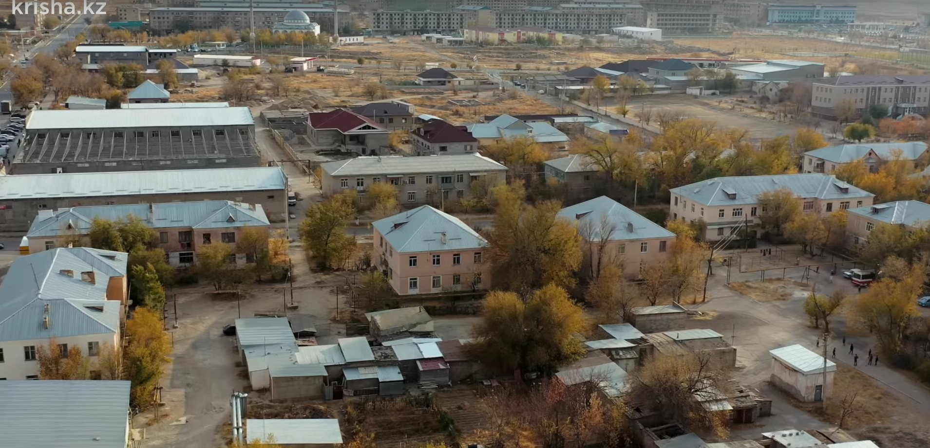
Karatau ( kz, Қаратау, ''Qaratau'') is an administrative center in the Talas region located in the Jambyl Region in the south of Kazakhstan. It has an estimated population of roughly 30,000 in 1999. , the population is now 27,667. The largest city from Karatau, Taraz, is approximately 100 km to the southwest. Name The name ''Karatau'' means ''Black Mountain'' in the Kazakh language. Karatau was named after the Karatau Mountain range which it is located next to and was famous during the Soviet era for phosphate. As part of the de-russification of the Kazakh language, Karatau will be re-written with Latin scripts in 2025 and spelled Qaratau. Ghost Town Krisha KZ reported on Karatau describing this town as a ghost town in December, 2019. The value of apartments in Karatau, according to Krisha, was between $3300–$11,500 USD. Economy Industry During the Soviet Union times, the main functioning industrial enterprise in the town was the phosphorite factory. Transpo ... [...More Info...] [...Related Items...] OR: [Wikipedia] [Google] [Baidu] |
Karatau2019
Karatau ( kz, Қаратау, ''Qaratau'') is an administrative center in the Talas River, Talas region located in the Jambyl Region in the south of Kazakhstan. It has an estimated population of roughly 30,000 in 1999. , the population is now 27,667. The largest city from Karatau, Taraz, is approximately 100 km to the southwest. Name The name ''Karatau'' means ''Black Mountain'' in the Kazakh language. Karatau was named after the Karatau Mountains, Karatau Mountain range which it is located next to and was famous during the Soviet era for phosphate. As part of the de-russification of the Kazakh language, Karatau will be re-written with Latin scripts in 2025 and spelled Qaratau. Ghost Town Krisha KZ reported on Karatau describing this town as a ghost town in December, 2019. The value of apartments in Karatau, according to Krisha, was between $3300–$11,500 USD. Economy Industry During the Soviet Union times, the main functioning industrial enterprise in the town was the ... [...More Info...] [...Related Items...] OR: [Wikipedia] [Google] [Baidu] |
Karatau Mountains
The Karatau or Qaratau ( kk, Қаратау жотасы, Qarataw jotasy) is a mountain range located in southern Kazakhstan. The name Karatau means ''Black Mountain'' in the Kazakh language. The mountains have deposits of phosphorite, lead and zinc. Geography The range extends for about in a roughly NW/SE direction just north of the Syrdaria River. The Muyunkum Desert lies to the north of the range. The Karatau is the westernmost prolongation of the Tian Shan. The summits of the mountains are smooth and the slopes are cut by snow-fed rivers. The Shabakty, Ushbas, Bugun and Asa, are among the rivers having their sources in the range. World Heritage Status There are numerous ancient archaeological sites in the range that display the stages of cultural evolution from the early Paleolithic Age (1 million BP) to the Neolithic Age (6500 BP). This site was added to the UNESCO World Heritage Tentative List on September 24, 1998 in the Cultural category. Nature Reserve The Karatau ... [...More Info...] [...Related Items...] OR: [Wikipedia] [Google] [Baidu] |
Jambyl Region
Jambyl or Zhambyl Region ( kk, Жамбыл облысы, translit=Jambyl oblysy; russian: Жамбылская область, Zhambylskaya oblast), formerly known as Dzhambul Region (russian: Джамбульская область, Dzhambulskaya Oblast) until 1991, is a region of Kazakhstan. Its capital is Taraz. The population of the region is 1,000,000; the city is 335,100. The region borders Kyrgyzstan, and is very near to Uzbekistan (all to the south). Jambyl also borders three other provinces: Karaganda Region (to the north), Turkistan Region (to the west) and Almaty Region (to the east). The total area is . The province borders Lake Balkhash to its northeast. The province (and its capital during the Soviet era) was named after the Kazakh ''akyn'' (folk singer) Jambyl Jabayev. History The Dzhambul Region was formed by decree of the Presidium of the Supreme Soviet on October 14, 1939 and included nine districts, of which six were separated from the South Kazakhstan and ... [...More Info...] [...Related Items...] OR: [Wikipedia] [Google] [Baidu] |
Karatau Mine
The Karatau mine is a large in-situ leaching mine located in the southern part of Kazakhstan in South Kazakhstan Province. Karatau represents one of the largest uranium reserves in Kazakhstan having estimated reserves of 70.4 million tonnes of ore grading 0.05% uranium. References {{DEFAULTSORT:Karatau Mine Uranium mines in Kazakhstan ... [...More Info...] [...Related Items...] OR: [Wikipedia] [Google] [Baidu] |
Taraz
Taraz ( kz, Тараз, تاراز, translit=Taraz ; known to Europeans as Talas) is a city and the administrative center of Jambyl Region in Kazakhstan, located on the Talas (river), Talas (Taraz) River in the south of the country near the border with Kyrgyzstan. It had a population of 330,100 as of the 1999 census, up 9% from 1989, making it one of the fastest-growing cities in the country, after Astana and Turkistan (city), Turkistan. One of the oldest cities in Kazakhstan and in Transoxania, built and populated by the ancient Sogdians, Taraz celebrated its official 2,000th anniversary (recognized by UNESCO) in 2001, dating from a fortress built in the area by a Xiongnu Chanyu named Zhizhi, and was a site of the Battle of Zhizhi in 36 BCE. The city was first recorded under the name "Talas" in 568 CE by Menander Protector. The medieval city of Talas was a major trade centre along the Silk Road. Talas was later described by Buddhist monk and traveller Xuanzang, who passed Talas i ... [...More Info...] [...Related Items...] OR: [Wikipedia] [Google] [Baidu] |
Petroglyphs Of Arpa-Uzen
The Petroglyphs of Arpa-Uzen can be found in the Karatau mountain range of southern Kazakhstan. Site description The petroglyphs of Arpa-Uzen, located on ancient migration routes, include over 3500 examples of rock art, the most abundant collection in all of southern Kazakhstan. These pictorials depict scenes from life during the Late Bronze Age to Early Iron Age, portraying the domestication and sacrifice of animals amongst other things. A palimpsest was formed where in older petroglyphs were covered by Saka pictorials from the Middle Ages. World Heritage Status This site was added to the UNESCO World Heritage Tentative List on September 24, 1998 in the Cultural category. (''see'' |
Janatas
Janatas ( kz, Жаңатас, ''Zhaŋatas'', russian: Жанатас) is a town in Sarysu District of Jambyl Region of southern Kazakhstan. The name means "New stone" in Kazakh, referring to the newly found phosphorite deposits. Janatas serves as the administrative center of the district. Population: Geography The town lies north of the Karatau slopes, by the banks of the Burkittі (Бүркітті) river, a left tributary of the Shabakty. Saudakent village is located to the northeast. History Janatas was founded in 1964 as a settlement to serve the phosphorite deposits. In 1969, it was granted town status. The town was steadily growing until the 1990s, when most industrial enterprises closed down owing to economic hardships, and population started to decline. As of 2013, some of residential areas stand deserted. Economy Industry As of 2013, the only functioning industrial enterprise in the town is the phosphorite factory. Transportation Janatas is connected by railway w ... [...More Info...] [...Related Items...] OR: [Wikipedia] [Google] [Baidu] |
Kazakhstan
Kazakhstan, officially the Republic of Kazakhstan, is a transcontinental country located mainly in Central Asia and partly in Eastern Europe. It borders Russia to the north and west, China to the east, Kyrgyzstan to the southeast, Uzbekistan to the south, and Turkmenistan to the southwest, with a coastline along the Caspian Sea. Its capital is Astana, known as Nur-Sultan from 2019 to 2022. Almaty, Kazakhstan's largest city, was the country's capital until 1997. Kazakhstan is the world's largest landlocked country, the largest and northernmost Muslim-majority country by land area, and the ninth-largest country in the world. It has a population of 19 million people, and one of the lowest population densities in the world, at fewer than 6 people per square kilometre (15 people per square mile). The country dominates Central Asia economically and politically, generating 60 percent of the region's GDP, primarily through its oil and gas industry; it also has vast mineral ... [...More Info...] [...Related Items...] OR: [Wikipedia] [Google] [Baidu] |
Otrar
Otrar or Utrar ( kk, Отырар, ''Otyrar'', Help:IPA/Kazakh, [wotəˈɾɑɾ]; otk, 𐰚𐰭𐱃𐰺𐰢𐰣, Keŋü Tarman), also called Farab, is a Central Asian ghost town that was a city located along the Silk Road in Kazakhstan. Otrar was an important town in the history of Central Asia, situated on the borders of settled and agricultural civilizations. It was the center of a great oasis and political district, commanding a key point connecting Kazakhstan with China, Europe, Near East, Near and Middle East, Siberia and Ural (region), Ural. Names The first known state in the region was known to Chinese scholars as ''Kangju'', which was centered on the Syr Darya (also known as the Kang River). Kangju existed from the 1st century BC until the 5th century AD. Its capital was reportedly at or near Bityan. After being subject to several different waves of invaders, Kangju collapsed into several independent states situated mainly in the Syr Darya valley and its tributaries of Ke ... [...More Info...] [...Related Items...] OR: [Wikipedia] [Google] [Baidu] |
Köppen Climate Classification
The Köppen climate classification is one of the most widely used climate classification systems. It was first published by German-Russian climatologist Wladimir Köppen (1846–1940) in 1884, with several later modifications by Köppen, notably in 1918 and 1936. Later, the climatologist Rudolf Geiger (1894–1981) introduced some changes to the classification system, which is thus sometimes called the Köppen–Geiger climate classification system. The Köppen climate classification divides climates into five main climate groups, with each group being divided based on seasonal precipitation and temperature patterns. The five main groups are ''A'' (tropical), ''B'' (arid), ''C'' (temperate), ''D'' (continental), and ''E'' (polar). Each group and subgroup is represented by a letter. All climates are assigned a main group (the first letter). All climates except for those in the ''E'' group are assigned a seasonal precipitation subgroup (the second letter). For example, ''Af'' indi ... [...More Info...] [...Related Items...] OR: [Wikipedia] [Google] [Baidu] |
Phosphorite
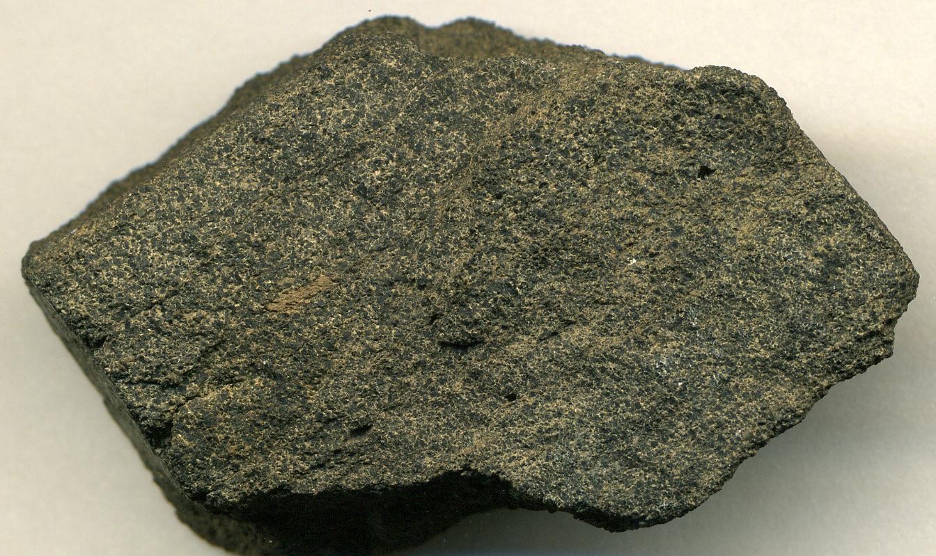
Phosphorite, phosphate rock or rock phosphate is a non-detrital sedimentary rock that contains high amounts of phosphate minerals. The phosphate content of phosphorite (or grade of phosphate rock) varies greatly, from 4% to 20% phosphorus pentoxide (P2O5). Marketed phosphate rock is enriched ("beneficiated") to at least 28%, often more than 30% P2O5. This occurs through washing, screening, de-liming, magnetic separation or flotation. By comparison, the average phosphorus content of sedimentary rocks is less than 0.2%.Blatt, Harvey and Robert J. Tracy, ''Petrology'', Freeman, 1996, 2nd ed. pp. 345–349 The phosphate is present as fluorapatite Ca5(PO4)3F typically in cryptocrystalline masses (grain sizes < 1 μm) referred to as -sedimentary apatite deposits of uncertain origin. It is also present as |
Cold Semi-arid Climate
A semi-arid climate, semi-desert climate, or steppe climate is a dry climate sub-type. It is located on regions that receive precipitation below potential evapotranspiration, but not as low as a desert climate. There are different kinds of semi-arid climates, depending on variables such as temperature, and they give rise to different biomes. Defining attributes of semi-arid climates A more precise definition is given by the Köppen climate classification, which treats steppe climates (''BSk'' and ''BSh'') as intermediates between desert climates (BW) and humid climates (A, C, D) in ecological characteristics and agricultural potential. Semi-arid climates tend to support short, thorny or scrubby vegetation and are usually dominated by either grasses or shrubs as it usually can't support forests. To determine if a location has a semi-arid climate, the precipitation threshold must first be determined. The method used to find the precipitation threshold (in millimeters): *multiply ... [...More Info...] [...Related Items...] OR: [Wikipedia] [Google] [Baidu] |


