|
Kalsubai
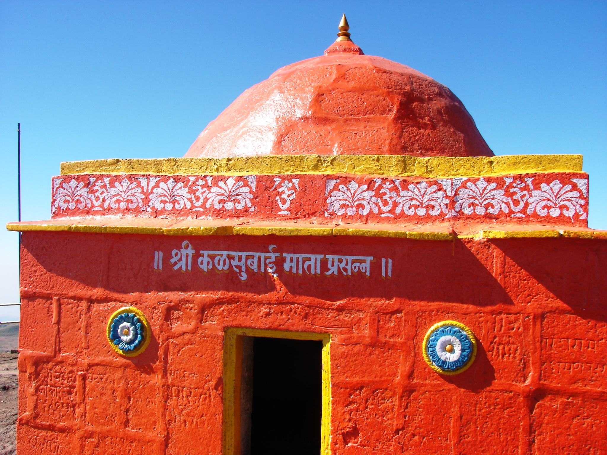
Kalsubai ( mr, कळसूबाई शिखर) is a mountain in the Western Ghats, located in the Indian state of Maharashtra. Its summit, situated at an elevation of , is the highest point in Maharashtra. The mountain range lies within the Kalsubai-Harishchandragad Wildlife Sanctuary. It is visited throughout the year by avid trekkers, Kalsubai temple devotees and wildlife enthusiasts alike. It is named after one of the three sisters Kalsubai, Ratnabai and Katrabai. The other peak Ratangad is named after Ratnabai. Geology The mountain range was formed by the same geological events that gave birth to the Western Ghats. Resting on the Deccan Plateau, a large igneous province, it consists of solidified flood basalt dating back to the Cenozoic era. Geography and topography The peak along with the adjoining hills spans along a downward-slanting east to the west axis eventually merging with the formidable escarpment of the Western Ghats at almost right angles. Along it ... [...More Info...] [...Related Items...] OR: [Wikipedia] [Google] [Baidu] |
Akole
Akole is a city and Taluka in Akole tehsil, Ahmednagar district in the state of Maharashtra, India. Akole is surrounded by the Sahyadri Mountains of Western Ghats, India. Several historical sites in the city honor Akole's connection to the history and culture of Maharashtra. General Knowledge * Akole being a tehsil has Vidhan Sabha seat. And is included in Shirdi Lok Sabha constituency. *It is the westernmost part of Ahmednagar district. *Akole tehsil is full of tourist places so, is a major tourist attraction. History * It is believed that lord Rama visited Akole after departing to 14 yrs vanvaas. *King Harishchandra built a fort for his wife Taramati known as Harishchandragad it is located in Akole tehsil. *Great Maratha emperor Shivaji Maharaj visited Vishramgad in Akole after looting Surat and halted here for 30 days for recovery from the exhaustion due to Surat tour. Geography * Kalsubai is the highest peak in Maharashtra, standing at . * Ghatghar – situated from Bh ... [...More Info...] [...Related Items...] OR: [Wikipedia] [Google] [Baidu] |
Bhandardara
Bhandardara is a holiday resort village near Igatpuri, in the western ghats of India. The village is located in the Akole tehsil, Ahmednagar district of the state of Maharashtra, about from Mumbai and from Ahmednagar. Bhandardara sits by the Pravara River, and the natural environment, waterfalls, mountains, Wilson dam, Arthur lake and Randha falls are tourist attractions. Bhandardara attractions include Wilson Dam and Arthur Lake. The recent attraction in this place is Fireflies camp in the Purushwadi area. There are number of historic and natural places of interest near the dam. From Bhandardara, visitors can climb up to see the Ratangad and Harishchandragad forts. Or visitors can follow the trails that lead to Ajoba and Ghanchakkar peaks. The highest peak in Maharashtra, Mount Kalsubai is 1646 m, and the starting point for this trek is Bari Village, located 12 km away from Bhandardara. Atop, there is a small temple located at the summit, with views of Sahyadris a ... [...More Info...] [...Related Items...] OR: [Wikipedia] [Google] [Baidu] |
List Of Indian States And Territories By Highest Point
This is the alphabetical list of the highest points of the Indian states and union territories. States Union territories Gallery Image:Kangchenjunga.jpg, Kangchenjunga (8,586 m) Image:Nanda devi.jpg, Nanda Devi (7,816 m) Image:Saltoro_Kangri.jpg, Saltoro Kangri (7,742m) Image:View_of_Nun_Kun_massif_from_airplane.jpg, Nun Kun (7,135 m) Image:The_Kangto_Peak_(The_highest_peak_in_the_North-east_after_Kanchenjunga).jpg, Kangto (7,090 m) Image:LeoPargial.jpg, Reo_Purgyil(6,816 m) Image:Sandakphu.jpg, Sandakphu (3,636 m) Image:Anamudi peak, Munnar.jpg, Anamudi (2,695 m) Image:Guru Shikhar Mount Abu.jpg, Gurushikhar Mount Abu (1,722 m) Image:Kalsubai.jpg, Kalsubai (1,646 m) See also * List of hill stations in India * List of mountains in India * List of the tallest statues in India * List of tallest buildings in India * List of tallest structures in India * Rameswaram TV Tower, tallest Towers in India * Tourism in India Tourism in India is important for the country' ... [...More Info...] [...Related Items...] OR: [Wikipedia] [Google] [Baidu] |
Igatpuri
Igatpuri (Pronunciation: ɡət̪puɾiː formerly known as Egutpoora) is a town and a Hill Station. It is also a municipal council in Nashik District in the Indian state of Maharashtra. It is located in the Western Ghats. Igatpuri railway station lies in Nashik District between Mumbai and Nashik Road on the Central Railway. Igatpuri is known for Vipassana International Academy, where ancient technique of meditation is taught called Vipassana. The place is one of the best places to visit in Maharashtra in monsoon. It is a hill station on busy Mumbai-Agra NH-3 only 45 km from Nashik and 130 km from Mumbai. Igatpuri railway station is a major railway station connecting Igatpuri to Mumbai. The station is known for its surrounding scenery, wada pao and idlis sold by vendors to commuters traveling in the train. The exit of Igatpuri railway station signals the proximity of Mumbai on down route. Igatpuri is surrounded by the highest peaks in Sahyadri i.e. Western Ghats, most ... [...More Info...] [...Related Items...] OR: [Wikipedia] [Google] [Baidu] |
Ahmednagar District
Ahmednagar district (Marathi pronunciation: Help:IPA/Marathi, [əɦ(ə)məd̪nəɡəɾ]) is the largest districts of Maharashtra, district of Maharashtra state in western India. The historical Ahmednagar city is the headquarters of the district. Ahmednagar and Sangamner are largest cities in the district. Ahmednagar was the seat of the Ahmadnagar Sultanate, Ahmednagar Sultanate of late medieval period (1496–1636 CE). This district is known for the towns of Shirdi associated with Sai Baba of Shirdi, Sai Baba, Meherabad associated with Meher Baba, Shani Shingnapur, Shani Shinganapur with Shanidev, and Devgad with Lord Dattatreya. Ahmednagar district is part of Nashik Division. The district is bordered by Aurangabad district, Maharashtra, Aurangabad district to the northeast, Nashik district to the northwest, Thane district, Thane and Pune district, Pune districts to the southwest, Solapur district to the south and Beed district to the southeast. Officer Members of Parliament *Su ... [...More Info...] [...Related Items...] OR: [Wikipedia] [Google] [Baidu] |
Ratangad
Ratangad ( mr, रतनगड) is a fort in Ratan Wadi, Maharashtra, India, overlooking the locale of Bhandardara, one of the oldest artificial catchment area. This fort is located in the Ahmadnagar district of Maharashtra. It is on the boundary of Ahmadnagar and Thane districts. The fort is about 400 years old. This fort is often covered with flowering plants in November. Ratangad is also called Jewel of the Sahyadris. Places to see Ratangad has a natural rock peak with a cavity in it at the top which is called 'Nedhe' or 'Eye of the Needle'. The fort has four gates Ganesh, Hanuman, Konkan and Trimbak. The sculptures of Lord Ganesh and Hanuman are seen on the main gate. It also has many wells on the top. The main attraction at Ratanwadi is the Amruteshwar Temple, famous for its carvings, dating back to the Hemadpant Era - roughly from the eighth century. The fort is origin for the river Pravara/Amrutvahini. The Bhandardara dam (Arthar dam) is built on this river. From the top ... [...More Info...] [...Related Items...] OR: [Wikipedia] [Google] [Baidu] |
Hanuman
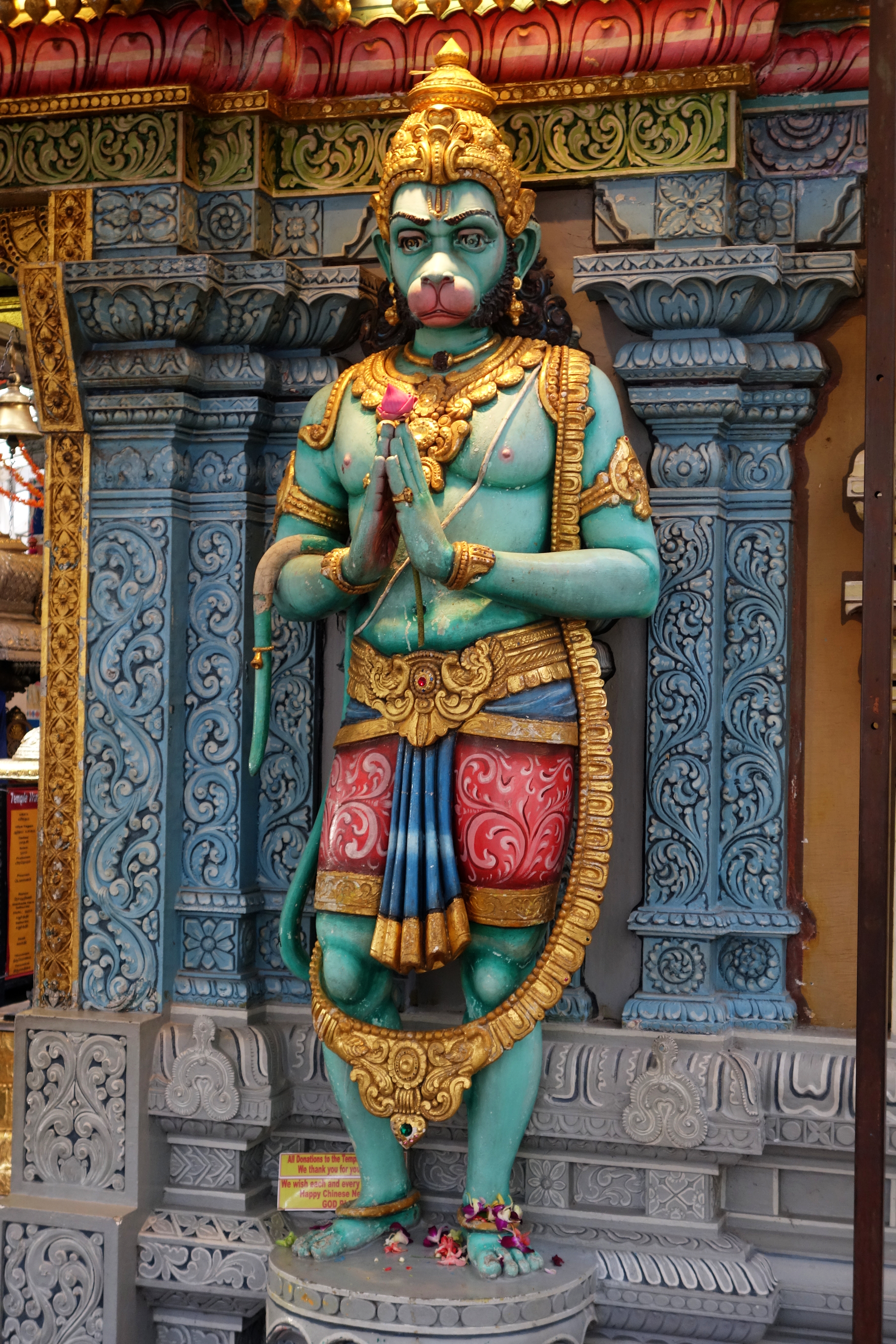
Hanuman (; sa, हनुमान, ), also called Anjaneya (), is a Hindu god and a divine '' vanara'' companion of the god Rama. Hanuman is one of the central characters of the Hindu epic ''Ramayana''. He is an ardent devotee of Rama and one of the Chiranjivis. Hanuman is regarded to be the son of the wind-god Vayu, who in several stories played a direct role in Hanuman's birth, and considered to be an incarnation or son of Shiva in Shaivism. Hanuman is mentioned in several other texts, such as the epic ''Mahabharata'' and the various Puranas. Evidence of devotional worship to Hanuman is largely absent in these texts, as well as in most archeological sites. According to Philip Lutgendorf, an American Indologist, the theological significance of Hanuman and devotional dedication to him emerged about 1,000 years after the composition of the ''Ramayana'', in the 2nd millennium CE, after the arrival of Islamic rule in the Indian subcontinent.Paula Richman (2010), ''Review: Lut ... [...More Info...] [...Related Items...] OR: [Wikipedia] [Google] [Baidu] |
View Enroute Trek
A view is a sight or prospect or the ability to see or be seen from a particular place. View, views or Views may also refer to: Common meanings * View (Buddhism), a charged interpretation of experience which intensely shapes and affects thought, sensation, and action * Graphical projection in a technical drawing or schematic ** Multiview orthographic projection, standardizing 2D images to represent a 3D object * Opinion, a belief about subjective matters * Page view, a visit to a World Wide Web page * Panorama, a wide-angle view * Scenic viewpoint, an elevated location where people can view scenery * World view, the fundamental cognitive orientation of an individual or society encompassing the entirety of the individual or society's knowledge and point-of-view Places * View, Kentucky, an unincorporated community in Crittenden County * View, Texas, an unincorporated community in Taylor County Arts, entertainment, and media Music * ''View'' (album), the 2003 debut album by ... [...More Info...] [...Related Items...] OR: [Wikipedia] [Google] [Baidu] |
Maharashtra State Road Transport Corporation
The Maharashtra State Road Transport Corporation abbreviated as (MSRTC, or simply ST), is the state run bus service of Maharashtra, India which serves routes to towns and cities within Maharashtra as well as to its adjoining states. It has a fleet strength of 18,449 buses. It also offers a facility for online booking of tickets for all buses. Recently From 21 May 2020, the Corporation Started Goods Transportation, Private Bus Body Building, Private Vehicle Tyre Remoulding. In future, Corporation plans to start petrol pump for private vehicles all over the Maharashtra. History The Maharashtra State Road Transport Corporation was established by the State Government of Maharashtra as per the provision in Section 3 of RTC Act 1950. The MSRTC operates its services by the approved scheme of road transport published vide Notification MVA 3173/30303-XIIA dated 29 November 1973 in the official gazette. The area covered by the scheme is the entire area of the state of Maharashtra. The und ... [...More Info...] [...Related Items...] OR: [Wikipedia] [Google] [Baidu] |
Kasara
Kasara is a census town in Thane district in the Indian state of Maharashtra. The town is on the busy Mumbai–Nashik route, which is one of the four major routes that lead into Mumbai. Kasara is served by a railway station on the Mumbai Suburban Railway, and is the final stop in the north-east sector of the Central Line and important railway station. That is for abbreviation for Kasara Local is set as "N" means North side Local's Last Station. Town is also known for the winding Kasara ghat pass. Demographics India census A census is the procedure of systematically acquiring, recording and calculating information about the members of a given population. This term is used mostly in connection with national population and housing censuses; other common censuses incl ..., Kasara had a population of 15,611. Males constitute 51% of the population and females 49%. Kasara has an average literacy rate of 63%, lower than the national average of 76.5%: male literacy is 73%, and femal ... [...More Info...] [...Related Items...] OR: [Wikipedia] [Google] [Baidu] |


