|
Kadina, South Australia
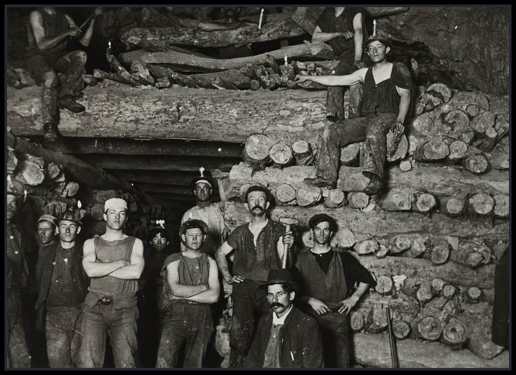
Kadina ( ) is a town on the Yorke Peninsula of the Australian state of South Australia, approximately 144 kilometres north-northwest of the state capital of Adelaide. The largest town of the Peninsula, Kadina is one of the three Copper Triangle towns famous for their shared copper mining history. The three towns are known as "Little Cornwall" for the significant number of immigrants from Cornwall who worked at the mines in the late 19th century. Kadina's surrounds form an important agricultural base for the region, and are used for growing cereal crops. Kadina used to be a mining town but now the majority of Kadina's land is used for farming. Description Kadina is about north-east of Moonta and east of the port town of Wallaroo. There are 6 suburbs making up Kadina's township, each being a distinct historic locality or hamlet. These are: Jericho, Jerusalem, Matta Flat, New Town and Wallaroo Mines as well as central Kadina itself. Kadina East was previously a gazetted suburb ... [...More Info...] [...Related Items...] OR: [Wikipedia] [Google] [Baidu] |
Copper Coast Council
The Copper Coast Council is a local government area in the Australian state of South Australia located at the northern end of the Yorke Peninsula. It was established in 1997 and its seat is in Kadina. Description The Copper Coast Council is located at the northern end of Yorke Peninsula adjoining the coastline with Spencer Gulf between the settlement in Tickera in the north and the northern boundary of Nalyappa in the south. The council seat is located at Kadina where its head office is located, while it maintains sub-offices at Moonta and Wallaroo. It covers an area of about of which 97.5% is used for agricultural purposes and with the remaining 2.5% (i.e. ) being associated with three urban areas centred on the former government towns of Kadina, Moonta and Wallaroo. A fourth settlement, Paskeville, is located on the Copper Coast Highway in the east of the local government area. The area's population counted at the 2016 census was 12,949. History The District Council ... [...More Info...] [...Related Items...] OR: [Wikipedia] [Google] [Baidu] |
Jerusalem, South Australia
Jerusalem (originally New Jerusalem) is a suburb of the town of Kadina on the Yorke Peninsula. It is located in the Copper Coast Council. The boundaries were formally gazetted in January, 1999, although the name had long been in use for the area. History It was surveyed in 1871 as a result of demand for housing from those involved in the nearby Wallaroo Mines Wallaroo Mines is a suburb of the inland town of Kadina on the Yorke Peninsula in the Copper Coast Council area. It was named for the land division in which it was established in 1860, the Hundred of Wallaroo, as was the nearby coastal town of ..., forming one of four "occupation blocks" in the area. An old resident claimed that the suburb was intended for "gentleman's residences" as opposed to the other occupation blocks, and that a "Councillor Rosenberg" had suggested Jerusalem as a name for an "aristocratic suburb". In 1874, the local newspaper stated that "the name is not considered suitable to the place, and gene ... [...More Info...] [...Related Items...] OR: [Wikipedia] [Google] [Baidu] |
Port Wakefield, South Australia
Port Wakefield (formerly Port Henry) is a town at the mouth of the River Wakefield, at the head of the Gulf St Vincent in South Australia. It was the first government town to be established north of the state capital, Adelaide. Port Wakefield is situated from the Adelaide city centre on the Port Wakefield Highway section of the A1 National Highway. Port Wakefield is a major stop on the Adelaide – Yorke Peninsula and Adelaide – Port Augusta road routes. Travellers between Adelaide and any of the Flinders Ranges, Yorke Peninsula, Eyre Peninsula or the Nullarbor Plain will likely travel through Port Wakefield. Due to its strategic location, Port Wakefield is known for its roadhouses and trucking stops. Just north of the township there is a major forked intersection where the Yorke Peninsula traffic diverges west onto the Copper Coast Highway from the main Augusta Highway. The intersection is notorious for road accidents and traffic delays, especially at the end of holidays ... [...More Info...] [...Related Items...] OR: [Wikipedia] [Google] [Baidu] |
Hundred Of Kadina
The Hundred of Kadina is a cadastral unit of hundred located on the north-western Yorke Peninsula in South Australia. It is one of the 16 hundreds of the County of Daly and was proclaimed by Governor Dominick Daly on 12 June 1862. The hundred was named for a Narungga term ''Gardina'' which is thought to mean 'lizard plain'. The township of Cunliffe is located in the south western corner of the hundred and the eastern outskirts of the eponymous major township of Kadina cross the mid-western border of the hundred. Local government The District Council of Green's Plains was established in 1871, bringing parts of the hundreds of Kadina and Kulpara under local administration for the first time. In 1888 the council was abolished by promulgation of the District Councils Act 1887 and replaced with the new District Council of Kadina, which administered both the Hundred of Kadina and much of the adjacent Hundred of Wallaroo as the part of the Hundred of Kulpara formerly in Green's Pla ... [...More Info...] [...Related Items...] OR: [Wikipedia] [Google] [Baidu] |
Hundred Of Wallaroo
The Hundred of Wallaroo is a cadastral unit of hundred located on the Copper Coast of South Australia. It is one of the 16 hundreds of the County of Daly. It was named in 1862 by Governor Dominick Daly after the indigenous term ''wadla warru'' presumed to mean ''wallaby urine''. Locations The most densely populated town and localities of the Copper Coast council are situated inside (or largely inside) the bounds of the Hundred of Wallaroo: * Wallaroo and North Beach * Kadina (western half) and its suburbs: New Town, Jericho, Wallaroo Mines, Matta Flat and Jerusalem * Moonta and its suburbs: Moonta Bay, North Moonta, Paramatta, Cross Roads, North Yelta, Yelta, Moonta Mines, East Moonta, Hamley, Port Hughes and Kooroona * Rural localities of Wallaroo Plain (west portion), Warburto and Boors Plain (larger west portion) Local government * Corporate Town of Kadina (1872-1977) * Corporate Town of Moonta (1872-1984) * Corporate Town of Wallaroo (1874-1997) * District ... [...More Info...] [...Related Items...] OR: [Wikipedia] [Google] [Baidu] |
Cornish People
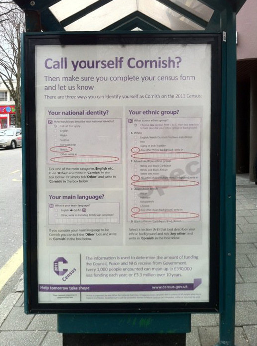
The Cornish people or Cornish ( kw, Kernowyon, ang, Cornƿīelisċ) are an ethnic group native to, or associated with Cornwall: and a recognised national minority in the United Kingdom, which can trace its roots to the ancient Britons who inhabited southern and central Great Britain before the Roman conquest. Many in Cornwall today continue to assert a distinct identity separate from or in addition to English or British identities. Cornish identity has been adopted by migrants into Cornwall, as well as by emigrant and descendant communities from Cornwall, the latter sometimes referred to as the Cornish diaspora. Although not included as an tick-box option in the UK census, the numbers of those writing in a Cornish ethnic and national identity are officially recognised and recorded. Throughout classical antiquity, the ancient Britons formed a series of tribes, cultures and identities in Great Britain; the Dumnonii and Cornovii were the Celtic tribes who inhabited what w ... [...More Info...] [...Related Items...] OR: [Wikipedia] [Google] [Baidu] |
Wallaroo Mines
Wallaroo Mines is a suburb of the inland town of Kadina on the Yorke Peninsula in the Copper Coast Council area. It was named for the land division in which it was established in 1860, the Hundred of Wallaroo, as was the nearby coastal town of Wallaroo. The boundaries were formally gazetted in January 1999 for "the long established name". History With the arrival of British pioneers in the late 1830s and 1840s, pastoralists began grazing livestock in the vicinity but no permanent settlements were formed. Development On 17 December 1859, James Boor, a shepherd on the Wallaroo sheep run, owned by Walter Watson Hughes, discovered copper at what was to become Wallaroo Mines. Thirty or forty men were reportedly working at the site by the end of the year. By August 1860, the new copper mines employed 150 men and were "turning out ores of a rich quality", and by the end of 1860 there was a total population of 500. The mines had an enginehouse, office, a residence for the captain and ... [...More Info...] [...Related Items...] OR: [Wikipedia] [Google] [Baidu] |
Indigenous Australians
Indigenous Australians or Australian First Nations are people with familial heritage from, and membership in, the ethnic groups that lived in Australia before British colonisation. They consist of two distinct groups: the Aboriginal peoples of the Australian mainland and Tasmania, and the Torres Strait Islander peoples from the seas between Queensland and Papua New Guinea. The term Aboriginal and Torres Strait Islander peoples or the person's specific cultural group, is often preferred, though the terms First Nations of Australia, First Peoples of Australia and First Australians are also increasingly common; 812,728 people self-identified as being of Aboriginal and/or Torres Strait Islander origin in the 2021 Australian Census, representing 3.2% of the total population of Australia. Of these indigenous Australians, 91.4% identified as Aboriginal; 4.2% identified as Torres Strait Islander; while 4.4% identified with both groups. [...More Info...] [...Related Items...] OR: [Wikipedia] [Google] [Baidu] |
Narungga
The Narungga people, also spelt Narangga, are a group of Aboriginal Australians whose traditional lands are located throughout Yorke Peninsula, South Australia. Their traditional language, one of the Yura-Thura grouping, is Narungga. Country In Norman Tindale's estimation the Narungga held some of tribal land on the Yorke Peninsula, running north as far as Port Broughton. Their eastern limits were around the Hummock Range. The following places all lay within Narungga tribal territory - Bute, Wallaroo, Ardrossan, Marion Bay, and Cape Spencer. Their borders with the Kaurna lay at the head of Gulf St Vincent. Language The Narungga people's language is Narungga, which in the 21st century is being revived under various language revival projects. Social organisation The Narungga are known to have been composed of at least four groups, according to Norman Tindale, one being Wallaroo. Later sources say that the Narungga comprised four clans who shared the Yorke Peninsula (w ... [...More Info...] [...Related Items...] OR: [Wikipedia] [Google] [Baidu] |
Government Of South Australia
The Government of South Australia, also referred to as the South Australian Government, SA Government or more formally, His Majesty’s Government, is the Australian state democratic administrative authority of South Australia. It is modelled on the Westminster system of government, which is governed by an elected parliament. History Until 1857, the Province of South Australia was ruled by a Governor responsible to the British Crown. The Government of South Australia was formed in 1857, as prescribed in its Constitution created by the Constitution Act 1856 (an act of parliament of the then United Kingdom of Great Britain and Ireland under Queen Victoria), which created South Australia as a self-governing colony rather than being a province governed from Britain. Since the federation of Australia in 1901, South Australia has been a state of the Commonwealth of Australia, which is a constitutional monarchy, and the Constitution of Australia regulates the state of South A ... [...More Info...] [...Related Items...] OR: [Wikipedia] [Google] [Baidu] |


.png)