|
Kadaň
Kadaň (; ) is a town in Chomutov District in the Ústí nad Labem Region of the Czech Republic. It has about 18,000 inhabitants. It lies on the banks of the Ohře river. Kadaň is a tourist centre with highlights being the Franciscan Monastery in Kadaň, Franciscan Monastery and the historical square with late Gothic Town Hall Tower. The historic town centre is well preserved and is protected as an Cultural monument (Czech Republic)#Monument reservations, urban monument reservation. Administrative division Kadaň consists of ten municipal parts (in brackets population according to the 2021 census): *Kadaň (16,478) *Brodce (20) *Kadaňská Jeseň (114) *Meziříčí (7) *Nová Víska (6) *Pokutice (39) *Prunéřov (252) *Tušimice (351) *Úhošťany (113) *Zásada u Kadaně (6) Etymology The name is most likely derived from the personal name Kadan, meaning "Kadan's (court)". Geography Kadaň is located about southwest of Chomutov and northeast of Karlovy Vary. It lies on the ... [...More Info...] [...Related Items...] OR: [Wikipedia] [Google] [Baidu] |
Franciscan Monastery In Kadaň
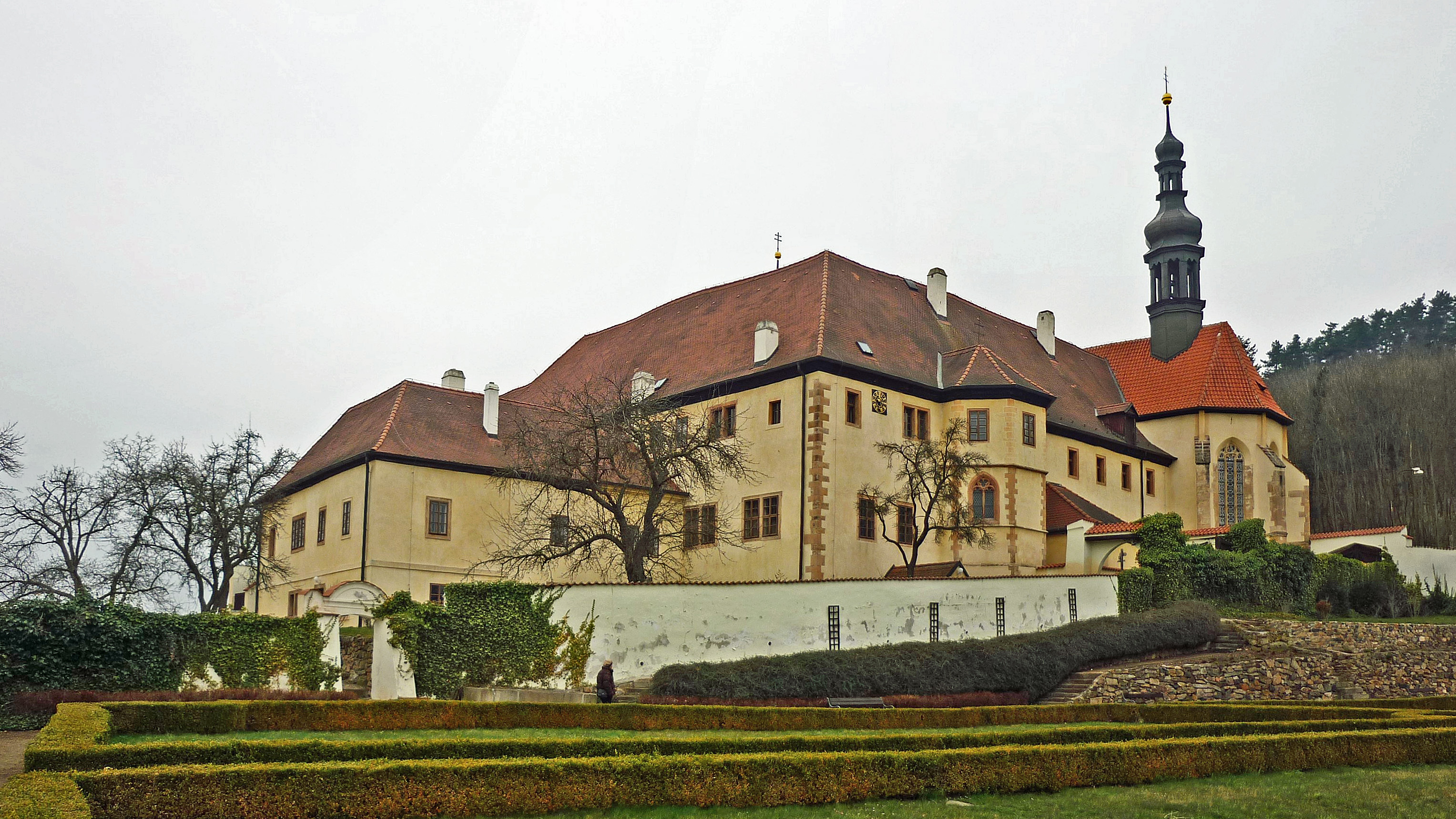
The Franciscan Monastery () lies on the edge of the town of Kadaň, Czech Republic and near the river Ohře. Its history dates back to the 15th century. It is now the seat of the Municipal Museum of Kadaň with an exposition of life in a monastery. The church's dedication to the Fourteen Holy Helpers shows the connection to then popular German shrines of the same cult. Around the building is a beautiful vineyard, a French park and many plum trees. The monastery was ranked among the national cultural monuments by the Ministry of Culture of the Czech Republic in 1995. The monastery faces the Úhošť hill on the opposite slope of the Ohře valley. History The first building on the site of the present-day Franciscan Monastery in Kadaň was a moderate holy shrine first mentioned in 1469. At Easter 1473 Franciscan Order assumed the shrine and with the support of Kadaň inhabitants and the House of Vitzhum built a temporary Convent house around it with the view of building a stone mon ... [...More Info...] [...Related Items...] OR: [Wikipedia] [Google] [Baidu] |
Chomutov District
Chomutov District () is a district in the Ústí nad Labem Region of the Czech Republic. Its capital is the city of Chomutov. Administrative division Chomutov District is divided into two administrative districts of municipalities with extended competence: Chomutov and Kadaň. List of municipalities Cities and towns are marked in bold and market towns in ''italics'': Bílence - Blatno - Boleboř - Březno - Černovice - Chbany - Chomutov - Domašín - Droužkovice - Hora Svatého Šebestiána - Hrušovany - Jirkov - Kadaň - Kalek - Klášterec nad Ohří - '' Kovářská'' - Křimov - Kryštofovy Hamry - Libědice - Loučná pod Klínovcem - Málkov - Mašťov - Měděnec - Místo - Nezabylice - Okounov - Otvice - Perštejn - Pesvice - Pětipsy - Račetice - Radonice - Rokle - Spořice - Strupčice - Údlice - Vejprty - Veliká Ves - Vilémov - Vrskmaň - Všehrdy - Všestudy - Výsluní - Vysoká Pec Geography Chomutov District bord ... [...More Info...] [...Related Items...] OR: [Wikipedia] [Google] [Baidu] |
Ústí Nad Labem Region
Ústí nad Labem Region or Ústecký Region () is an Regions of the Czech Republic, administrative unit () of the Czech Republic, located in the north-western part of the historical land of Bohemia, and named after the capital, Ústí nad Labem. It covers the majority of the former Administrative divisions of Czechoslovakia, North Bohemia province () and is part of the broader area of North Bohemia. The region borders the regions of Liberec Region, Liberec (east), Central Bohemian Region, Central Bohemia (south), Plzeň Region, Plzeň (southwest), Karlovy Vary Region, Karlovy Vary (west) and the German region of Saxony to the north. The Ústí nad Labem Region comprises a range of very different types of landscape. Between the high escarpment of the Ore Mountains range and the České středohoří, Bohemian Central Uplands with many volcanic hills, there are vast areas devastated by surface coal mining (the Most Basin), partly being recultivated into an artificial landscape with ... [...More Info...] [...Related Items...] OR: [Wikipedia] [Google] [Baidu] |
Lobkowicz Family
The House of Lobkowicz (''Lobkovicové'' in modern Czech, sg. ''z Lobkovic''; ''Lobkowitz'' in German) is an important Bohemian noble family that dates back to the 14th century and is one of the oldest noble families of the region. Over the centuries, the family expanded their possessions through marriage with the most powerful families of the region, which resulted in gaining vast territories all across central Europe. Due to that, the family was also incorporated into the German, Austrian and Belgian nobility. History The first Lobkowiczs were members of the gentry of north-eastern Bohemia in the late 14th century. On 3 August 1459 they were granted the title of Freiherr. In the 17th century, members of the family were awarded with the title of Prince, which was granted to them on 17 October 1623 by Ferdinand II, Holy Roman Emperor. In 1786, Emperor Joseph II further ennobled the 7th Prince when he created him Duke of Roudnice (''Herzog von Raudnitz'' in German, ''vévoda ... [...More Info...] [...Related Items...] OR: [Wikipedia] [Google] [Baidu] |
Úhošť
Úhošť () is a hill and a national nature reserve in the Ústí nad Labem Region of the Czech Republic. It lies in the Doupov Mountains. The hill reaches the elevation of . It is also a place where might have occurred the Battle of Wogastisburg in 631 AD. Geography Úhošť is located in the Doupov Mountains in the municipal territory of Kadaň, between the villages Brodce and Pokutice (parts of Kadaň). The hill is a mesa with an area of ; the plateau at the top has an area of . It has been protected as a national nature reserve since 1974. The national nature reserve has an area of and a negligible area of the reserve lies also in the territory of Klášterec nad Ohří. Nature The hill arose in connection with the volcanic activity thad created all the Doupov Mountains. It is thus mainly formed by basalt. In terms of plants, the area is very diverse. There are 1,000 plant species out of 3,000 recorded in the Czech Republic in the nature reserve. The slopes are covered ... [...More Info...] [...Related Items...] OR: [Wikipedia] [Google] [Baidu] |
Jan Hasištejnský Of Lobkowicz
Jan Hasištejnský of Lobkowicz (, ; 1450–1517) was a Bohemian diplomat of the House of Lobkowicz. In 1482 he became a Doctor of Canon Law. He undertook diplomatic missions to Luxembourg (in 1477) and Rome (in 1487) in the time of King Vladislaus II. The king sent him to negotiate a marriage with Mary of Burgundy, which was ultimately unsuccessful. He made a journey to Palestine in 1493 and wrote a travel book about it, titled ''Pilgrimage to the Holy Grave in Jerusalem'' (first published in 1505). He also edited ''Advice and Precept to the Son Jaroslav, What to Do and What to Beware''. He founded the Franciscan monastery in Kadaň The Franciscan Monastery () lies on the edge of the town of Kadaň, Czech Republic and near the river Ohře. Its history dates back to the 15th century. It is now the seat of the Municipal Museum of Kadaň with an exposition of life in a monastery .... He died on or around 28 January 1517 and was buried in the monastery. He was the elder brother ... [...More Info...] [...Related Items...] OR: [Wikipedia] [Google] [Baidu] |
Fourteen Holy Helpers
The Fourteen Holy Helpers (, ) are a group of saints venerated together by Catholics because their intercession is believed to be particularly effective, especially against various diseases. This group of ''Nothelfer'' ("helpers in need") originated in the 14th century at first in the Rhineland, largely as a result of the epidemic (probably of bubonic plague) that became known as the Black Death. History of veneration Devotion to the fourteen Holy Helpers began in Rhineland, now part of Germany, in the time of the Black Death. Among the fourteen were three virgin martyrs. A German mnemonic for them says: ''Margaretha mit dem Wurm,'' ''Barbara mit dem Turm,'' ''Katharina mit dem Radl'' ''das sind die drei heiligen Madl.'' ("Margaret with the lindworm, Barbara with the tower, Catherine with the wheel, those are the three holy maids.") As the other saints began to be invoked along with these three virgin martyrs, they were represented together in works of art. Popular ... [...More Info...] [...Related Items...] OR: [Wikipedia] [Google] [Baidu] |
Battle Of Wogastisburg
According to the contemporary ''Chronicle of Fredegar'', the Battle of Wogastisburg (also called the siege of Wogastisburg) took place between Slavs (''Sclav, cognomento Winidi'') under King Samo and Franks under King Dagobert I in 631 or 632. The Frankish armies advanced into the area of the Slavic tribal union in three groups - Alamanni, Lombards, and Austrasian Franks. The first two were quite successful, but the main fighting force was defeated in a three-day siege near a place referred to as ''Wogastisburg''. The location of the siege has not been determined because the primary source, Fredegar's chronicle, gives no geographical specifications. Several places claim to be connected with the battle (usually based on linguistic parallels and some excavations), for example Rubín hill near Podbořany (Bohemia), Úhošť hill near Kadaň (Bohemia), Bratislava (Slovakia), Trenčín (Slovakia), Beckov (Slovakia), Váh river near Voga (Slovakia), Staffelberg near Bad Staffelstein ... [...More Info...] [...Related Items...] OR: [Wikipedia] [Google] [Baidu] |
Most Basin
The Most Basin (also known as North Bohemian Basin; , ) is a structural basin and geomorphological mesoregion of the Czech Republic. It is named after the city of Most. It forms the southwestern and central parts of the Ústí nad Labem Region. It is among the richest European deposits of lignite, which has been extracted here since the second half of 19th century, mostly by extensive surface mining. Geomorphology The Most Basin is a mesoregion of the Podkrušnohorská Macroregion within the Bohemian Massif. It is further subdivided into the microregions of Žatec Basin and Chomutov-Teplice Basin. A flat landscape without peaks is typical for the Most Basin. The highest point of the territory is a contour line near Libouchec, at above sea level. There are several low hills with an elevation of 350–380 in the southwestern part of the basin. Adjacent landscapes The basin lies between the Central and Eastern Ore Mountains to the north and the Rakovník Uplands to the south. ... [...More Info...] [...Related Items...] OR: [Wikipedia] [Google] [Baidu] |
Chomutov
Chomutov (; ) is a city in the Ústí nad Labem Region of the Czech Republic. It has about 47,000 inhabitants. There are almost 80,000 inhabitants in the city's wider metropolitan area. The historic city centre is well preserved and is protected as an urban monument zone. Administrative division Chomutov consists of only one municipal part and is the only such Czech statutory city. Etymology The name is derived from the personal name Chomút/Chomout, meaning "Chomout's (court)". The word ''chomút'', from which the personal name arise, denoted a clumsy person in Old Czech. Geography Chomutov is located about northwest of Prague. It lies on the Chomutovka River in the Ore Mountains Foothills. The surface is mostly flat with some hills in the north and southeast of the city. The highest point of the municipal territory is Hůrka , a hill on the northwestern municipal border. There are several bodies of water on the outskirts of the city. Lake Kamencové jezero and the fishpond ... [...More Info...] [...Related Items...] OR: [Wikipedia] [Google] [Baidu] |
Doupov Mountains
Doupov Mountains (, ) is a Cenozoic volcanic mountain range with the typical structure of stratovolcano. The centre of the stratovolcano was in the place of a former town of Doupov. The highest mountain is Hradiště (934 metres), the lowest point is by the river Ohře near Kadaň (cca 275 metres). In 1945, most of the German population was expelled so that Doupov Mountains became almost completely unpopulated. It became an Army Training Area in 1953, and currently serves this purpose for NATO The North Atlantic Treaty Organization (NATO ; , OTAN), also called the North Atlantic Alliance, is an intergovernmental organization, intergovernmental Transnationalism, transnational military alliance of 32 Member states of NATO, member s ... forces. Mountain ranges of the Czech Republic Volcanoes of the Czech Republic Stratovolcanoes Chomutov District Karlovy Vary District Louny District Geography of the Karlovy Vary Region Geography of the Ústí nad Labem Re ... [...More Info...] [...Related Items...] OR: [Wikipedia] [Google] [Baidu] |
Ohře
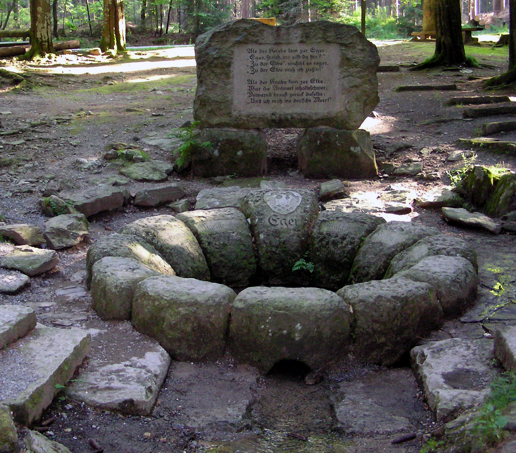
The Ohře (), also known in English and German as Eger (), is a river in Germany and the Czech Republic, a left tributary of the Elbe River. It flows through the Bavarian district of Upper Franconia in Germany, and through the Karlovy Vary Region, Karlovy Vary and Ústí nad Labem Region, Ústí nad Labem regions in the Czech Republic. It is long, of which is in the Czech Republic, making it the List of rivers of the Czech Republic, fourth longest river in the country. Etymology The name is of Celtic language, Celtic or pre-Celtic origin. In the 9th century, it appeared as ''Agara''. According to one theory, its meaning was 'salmon river' (composed of the words ''ag'', ''eg'' – 'salmon', and ''are'', ''ara'' – 'flowing water'). Another theory suggests that the name was derived from ''agriā'' and meant a fast-moving, fast-flowing river. In the 12th century, Ohře was written as ''Egre'', ''Oegre'' and ''Ogre''. Course The Ohře originates in the territory of Weißenstadt i ... [...More Info...] [...Related Items...] OR: [Wikipedia] [Google] [Baidu] |


