|
Japanese Minelayer Yaeyama
was a small minelayer of the Imperial Japanese Navy, which was in service during the Second Sino-Japanese War and World War II primarily as an escort vessel. She was named after the Yaeyama Islands in the Ryukyu Islands chain. She was the first Japanese warship built with an all-welded hull. Background and construction The Imperial Japanese Navy budget for Fiscal 1927 include a small minelayer for coastal and river service to complement its larger minelayers, the former cruisers , and . ''Yaeyama'' was launched by the Kure Naval Arsenal in Hiroshima Prefecture, Japan on 15 October 1931, and was commissioned into service on 31 August 1932. Operational history On completion, ''Yaeyama'' was assigned to the Sasebo Naval District. In August 1937, following the Marco Polo Bridge Incident and the start of the Second Sino-Japanese War, ''Yaeyama'' was assigned as flagship for Admiral Tanimoto’s 11th Gunboat Division, at Shanghai and was responsible for patrols on the Yangzi River. ... [...More Info...] [...Related Items...] OR: [Wikipedia] [Google] [Baidu] |
Naval Ensign Of Japan
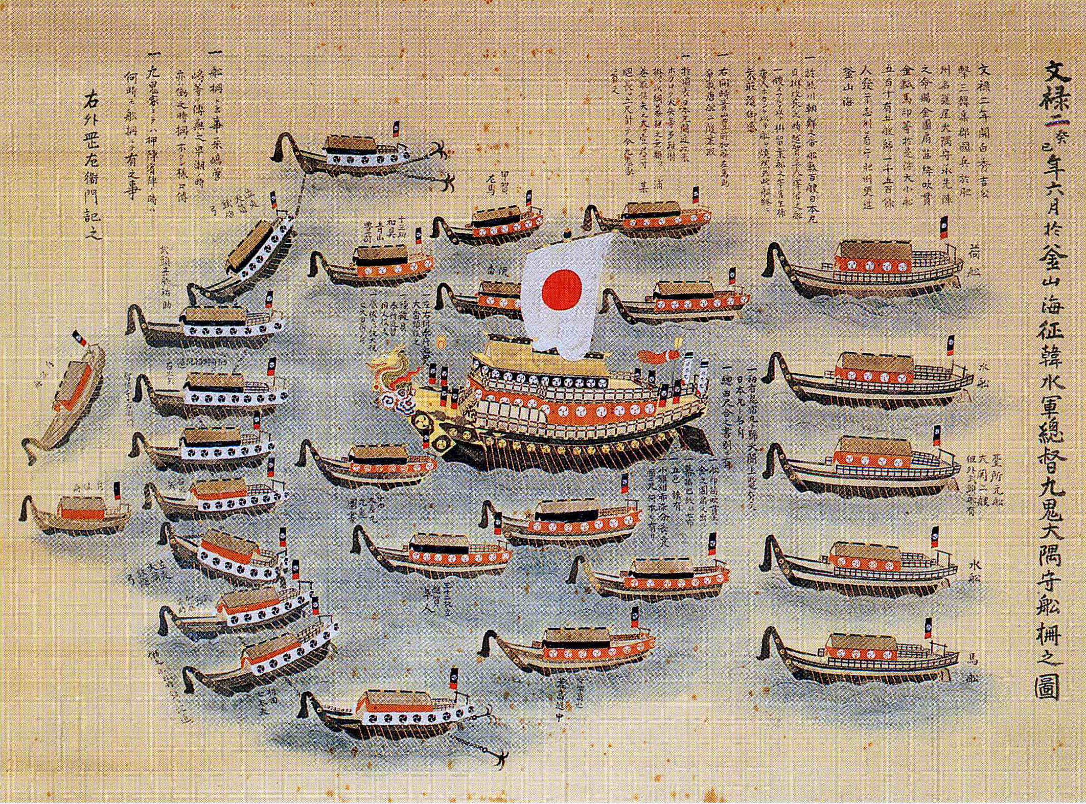
The national flag of Japan is a rectangular white banner bearing a crimson-red circle at its center. This flag is officially called the , but is more commonly known in Japan as the . It embodies the country's sobriquet: the Land of the Rising Sun. The ''Nisshoki'' flag is designated as the national flag in the Act on National Flag and Anthem, which was promulgated and became effective on 13 August 1999. Although no earlier legislation had specified a national flag, the sun-disc flag had already become the ''de facto'' national flag of Japan. Two proclamations issued in 1870 by the Daijō-kan, the governmental body of the early Meiji period, each had a provision for a design of the national flag. A sun-disc flag was adopted as the national flag for merchant ships under Proclamation No. 57 of Meiji 3 (issued on 27 February 1870), and as the national flag used by the Navy under Proclamation No. 651 of Meiji 3 (issued on 27 October 1870). Use of the ''Hinomaru'' was severely restric ... [...More Info...] [...Related Items...] OR: [Wikipedia] [Google] [Baidu] |
Yangzi River
The Yangtze or Yangzi ( or ; ) is the longest river in Asia, the third-longest in the world, and the longest in the world to flow entirely within one country. It rises at Jari Hill in the Tanggula Mountains (Tibetan Plateau) and flows in a generally easterly direction to the East China Sea. It is the seventh-largest river by discharge volume in the world. Its drainage basin comprises one-fifth of the land area of China, and is home to nearly one-third of the country's population. The Yangtze has played a major role in the history, culture, and economy of China. For thousands of years, the river has been used for water, irrigation, sanitation, transportation, industry, boundary-marking, and war. The prosperous Yangtze Delta generates as much as 20% of China's GDP. The Three Gorges Dam on the Yangtze is the largest hydro-electric power station in the world that is in use. In mid-2014, the Chinese government announced it was building a multi-tier transport network, c ... [...More Info...] [...Related Items...] OR: [Wikipedia] [Google] [Baidu] |
Naval Station Sangley Point
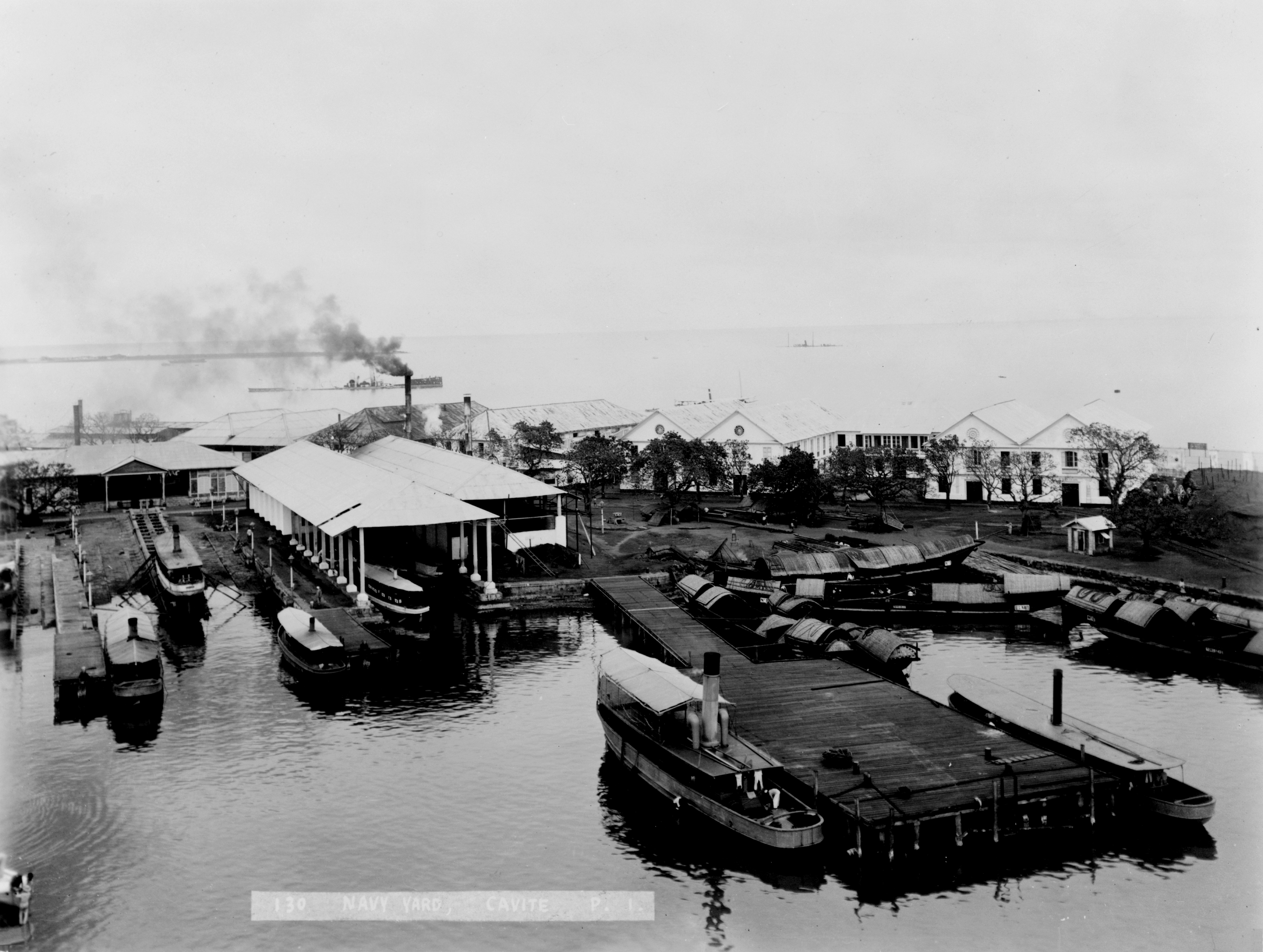
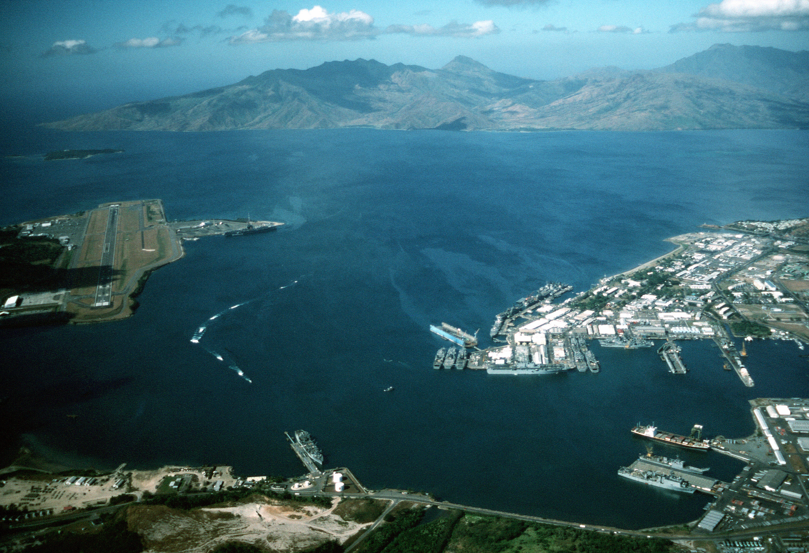
Naval Station Sangley Point was a communication and hospital facility of the United States Navy which occupied the northern portion of the Cavite City peninsula and is surrounded by Manila Bay, approximately eight miles southwest of Manila, the Philippines. The station was a part of the Cavite Navy Yard across the peninsula. The naval station had a runway that was built after World War II, which was used by U.S. Navy Lockheed P-2 Neptune, Lockheed P-3 Orion, and Martin P4M Mercator maritime patrol and anti-submarine warfare aircraft. An adjacent seaplane runway, ramp area and seaplane tender berths also supported Martin P5M Marlin maritime patrol aircraft until that type's retirement from active naval service in the late 1960s. NAS Sangley Point/NAVSTA Sangley Point was also used extensively during the Vietnam War, primarily for U.S. Navy patrol squadrons forward deployed from the United States on six-month rotations. The naval station was turned over to the Philippine govern ... [...More Info...] [...Related Items...] OR: [Wikipedia] [Google] [Baidu] |
Southwest Area Fleet
The was a fleet of the Imperial Japanese Navy established during World War II. History The Southwest Area Fleet was an operational command of the Imperial Japanese Navy established on April 10, 1942 to coordinate naval, air, and ground forces for the invasion, occupation and defense of the Philippines, French Indochina, Malaya, and the Netherlands East Indies. The 1st, 2nd, 3rd and 4th Southern Expeditionary Fleets and the IJN 13th Air Fleet were under operational control of the Southwest Area Fleet. After February 1945, the headquarters of the Southwest Area Fleet was isolated in the Philippines, and the IJN 10th Area Fleet was created in Singapore to take over operational command of its surviving forces, with the exception of the 3rd Southern Expeditionary Fleet, which was also trapped in the Philippines. Through fierce fighting during the American re-occupation of the Philippines, especially in Manila, Cebu and Mindanao Mindanao ( ) ( Jawi: مينداناو) is ... [...More Info...] [...Related Items...] OR: [Wikipedia] [Google] [Baidu] |
Manila
Manila ( , ; fil, Maynila, ), officially the City of Manila ( fil, Lungsod ng Maynila, ), is the capital of the Philippines, and its second-most populous city. It is highly urbanized and, as of 2019, was the world's most densely populated city proper. Manila is considered to be a global city and rated as an Alpha – City by Globalization and World Cities Research Network (GaWC). It was the first chartered city in the country, designated as such by the Philippine Commission Act 183 of July 31, 1901. It became autonomous with the passage of Republic Act No. 409, "The Revised Charter of the City of Manila", on June 18, 1949. Manila is considered to be part of the world's original set of global cities because its commercial networks were the first to extend across the Pacific Ocean and connect Asia with the Spanish Americas through the galleon trade; when this was accomplished, it marked the first time in world history that an uninterrupted chain of trade routes circling ... [...More Info...] [...Related Items...] OR: [Wikipedia] [Google] [Baidu] |
Subic Bay
Subic Bay is a bay on the west coast of the island of Luzon in the Philippines, about northwest of Manila Bay. An extension of the South China Sea, its shores were formerly the site of a major United States Navy facility, U.S. Naval Base Subic Bay, now an industrial and commercial area known as the Subic Bay Freeport Zone under the Subic Bay Metropolitan Authority. Today, water as well as the towns and establishments surrounding the bay are collectively known as Subic Bay. This includes the former naval base, Hanjin shipyard, Olongapo city, the municipal town of Subic, and the erstwhile US defense housing areas of Binictican and Kalayan housing, up to Morong, Bataan. The bay was long recognized for its deep and protected waters, but development was slow due to lack of level terrain around the bay. History In 1542, Spanish conquistador Juan de Salcedo sailed into Subic Bay but no port developed there because the main Spanish naval base would be established in the nearby Ma ... [...More Info...] [...Related Items...] OR: [Wikipedia] [Google] [Baidu] |
Surigao Strait
Surigao Strait (Filipino: ''Kipot ng Surigaw'') is a strait in the southern Philippines, between the Bohol Sea and the Leyte Gulf of the Philippine Sea. Geography It is located between the regions of Visayas and Mindanao. It lies between northern Mindanao Island and Panaon Island, and between the Dinagat Islands and Leyte island. The strait is deep but has a strong current, up to . The northern entrance of the Surigao Strait is marked by a navigation light on Suluan Island. The Hibuson island lies at the north end of the Surigao Strait. Transport It is regularly crossed by numerous ferries that transport goods and people between Visayas and Mindanao. The ferries stop at Liloan, Southern Leyte and Surigao City in Surigao del Norte. Etymology According to legend, the strait was named after Solibao, a Negrito chieftain, who lived at the outlet of the Surigao River. Migrating Visayan fishermen gradually formed a settlement there, and when Spanish explorers visited the place, they ... [...More Info...] [...Related Items...] OR: [Wikipedia] [Google] [Baidu] |
Philippines
The Philippines (; fil, Pilipinas, links=no), officially the Republic of the Philippines ( fil, Republika ng Pilipinas, links=no), * bik, Republika kan Filipinas * ceb, Republika sa Pilipinas * cbk, República de Filipinas * hil, Republika sang Filipinas * ibg, Republika nat Filipinas * ilo, Republika ti Filipinas * ivv, Republika nu Filipinas * pam, Republika ning Filipinas * krj, Republika kang Pilipinas * mdh, Republika nu Pilipinas * mrw, Republika a Pilipinas * pag, Republika na Filipinas * xsb, Republika nin Pilipinas * sgd, Republika nan Pilipinas * tgl, Republika ng Pilipinas * tsg, Republika sin Pilipinas * war, Republika han Pilipinas * yka, Republika si Pilipinas In the recognized optional languages of the Philippines: * es, República de las Filipinas * ar, جمهورية الفلبين, Jumhūriyyat al-Filibbīn is an archipelagic country in Southeast Asia. It is situated in the western Pacific Ocean and consists of around 7,641 islands t ... [...More Info...] [...Related Items...] OR: [Wikipedia] [Google] [Baidu] |
Philippines Campaign (1941–1942)
The Philippines campaign ( fil, Kampanya sa Pilipinas, es, Campaña en las Filipinas del Ejercito Japonés, ja, フィリピンの戦い, Firipin no Tatakai), also known as the Battle of the Philippines ( fil, Labanan sa Pilipinas) or the Fall of the Philippines, was from December 8, 1941, to May 8, 1942, the invasion of the Philippines by the Empire of Japan and the defense of the islands by United States and the Philippine Armies during World War II. The Japanese launched the invasion by sea from Formosa, over north of the Philippines. The defending forces outnumbered the Japanese by a ratio of 3:2 but were a mixed force of non-combat-experienced regular, national guard, constabulary and newly created Commonwealth units. The Japanese used first-line troops at the outset of the campaign, and by concentrating their forces, they swiftly overran most of Luzon during the first month. The Japanese high command, believing that they had won the campaign, made a strategic decision ... [...More Info...] [...Related Items...] OR: [Wikipedia] [Google] [Baidu] |
Attack On Pearl Harbor
The attack on Pearl HarborAlso known as the Battle of Pearl Harbor was a surprise military strike by the Imperial Japanese Navy Air Service upon the United States against the naval base at Pearl Harbor in Honolulu, Territory of Hawaii, just before 8:00a.m. (local time) on Sunday, December 7, 1941. The United States was a neutral country at the time; the attack led to its formal entry into World War II the next day. The Japanese military leadership referred to the attack as the Hawaii Operation and Operation AI, and as Operation Z during its planning. Japan intended the attack as a preventive action. Its aim was to prevent the United States Pacific Fleet from interfering with its planned military actions in Southeast Asia against overseas territories of the United Kingdom, the Netherlands, and those of the United States. Over the course of seven hours there were coordinated Japanese attacks on the US-held Philippines, Guam, and Wake Island and on the British Empire ... [...More Info...] [...Related Items...] OR: [Wikipedia] [Google] [Baidu] |
Palau
Palau,, officially the Republic of Palau and historically ''Belau'', ''Palaos'' or ''Pelew'', is an island country and microstate in the western Pacific. The nation has approximately 340 islands and connects the western chain of the Caroline Islands with parts of the Federated States of Micronesia. It has a total area of . The most populous island is Koror, home to the country's most populous city of the same name. The capital Ngerulmud is located on the nearby island of Babeldaob, in Melekeok State. Palau shares maritime boundaries with international waters to the north, the Federated States of Micronesia to the east, Indonesia to the south, and the Philippines to the northwest. The country was originally settled approximately 3,000 years ago by migrants from Maritime Southeast Asia. Palau was first drawn on a European map by the Czech missionary Paul Klein based on a description given by a group of Palauans shipwrecked on the Philippine coast on Samar. Palau islands ... [...More Info...] [...Related Items...] OR: [Wikipedia] [Google] [Baidu] |
Amoy
Xiamen ( , ; ), also known as Amoy (, from Hokkien pronunciation ), is a sub-provincial city in southeastern Fujian, People's Republic of China, beside the Taiwan Strait. It is divided into six districts: Huli, Siming, Jimei, Tong'an, Haicang, and Xiang'an. All together, these cover an area of with a population of 5,163,970 as of 2020 and estimated at 5.28 million as of 31 December 2021. The urbanized area of the city has spread from its original island to include most parts of all six of its districts, and with 4 Zhangzhou districts ( Xiangcheng, Longwen, Longhai and Changtai), form a built-up area of 7,284,148 inhabitants. This area also connects with Quanzhou in the north, making up a metropolis of nearly ten million people. The Kinmen Islands (Quemoy) administered by the Republic of China (Taiwan) which lie less than away separated by Xiamen Bay. As part of the Opening Up Policy under Deng Xiaoping, Xiamen became one of China's original four special economic zo ... [...More Info...] [...Related Items...] OR: [Wikipedia] [Google] [Baidu] |


