|
Jalsen Talab
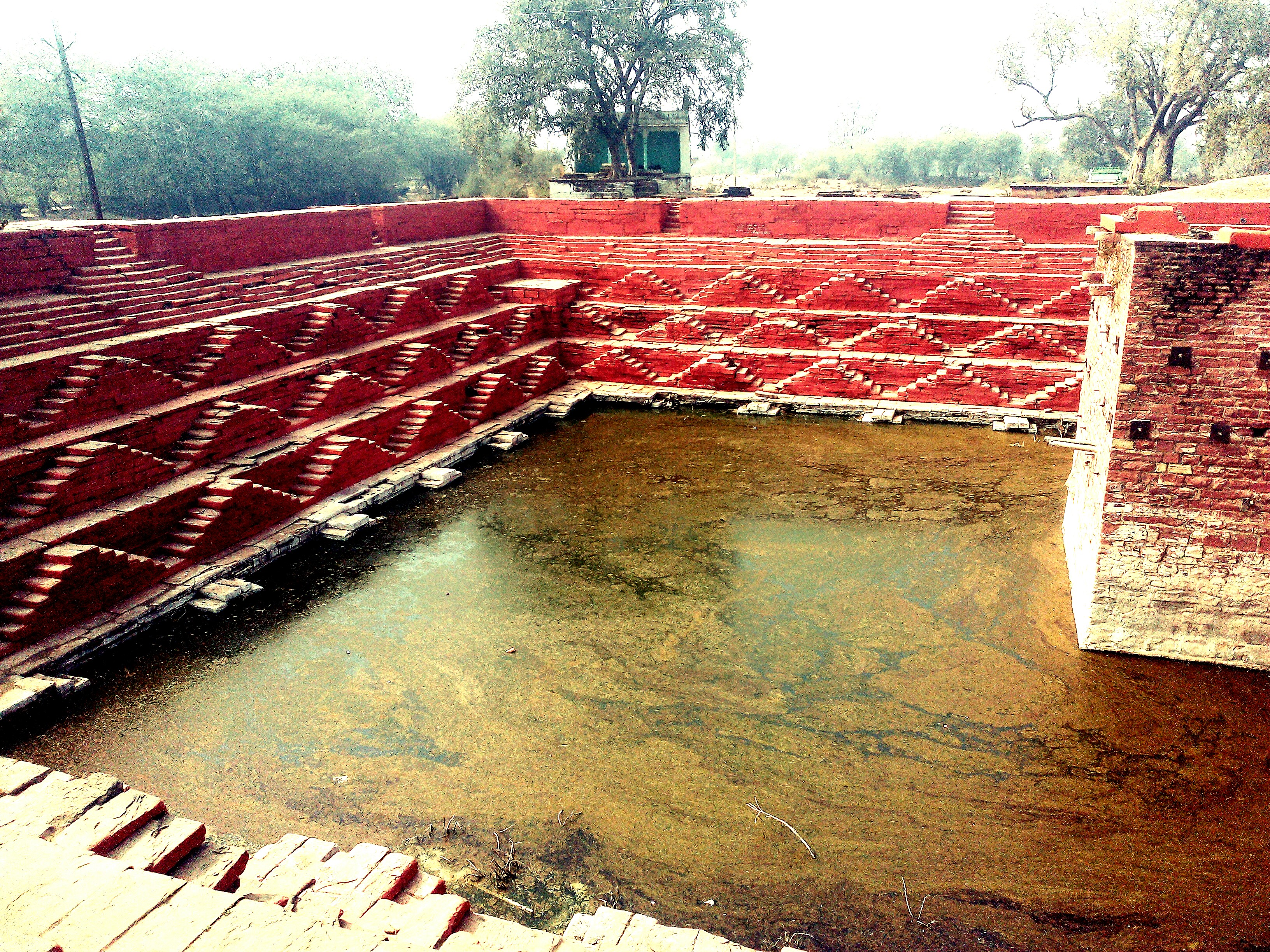
Jalsen Reservoir is a famous pond in Hindaun City, Hindaun Block in Rajasthan, India. It is cover reservoir (pond) area. It is located Central in the Hindaun, in the Hindaun Block. It is the most famous pond of Hindaun. Rastriya park in North, SH-1,SH-22 in West, Ramlila maidan in Naurth-East and Nakkash Ki Devi - Gomti Dham Nakkash Ki Devi - Gomti Dham Temple is a Hindu temple, situated in the Hindaun City, in the Indian state of Rajasthan. This temple is at the heart of Hindaun City, with adjacent sacred pond known as Jalsen Reservoir. The temple is located o ... in East of Jalsen. References Ponds of India Hindaun Block {{Rajasthan-geo-stub ... [...More Info...] [...Related Items...] OR: [Wikipedia] [Google] [Baidu] |
Hindaun City
Hindaun is a city and municipality, near city of Karauli in Karauli district, Rajasthan, India. It has a population of 105690 and is governed by a municipal council. In the vicinity are the Aravalli range, Aravalli and Vindhya Range, Vindhya mountainous ranges. History In the ancient time Hindaun came under the Matsya (tribe), Matsya kingdom. There are many ancient structures still present in the town built during the regime of Matsya Kingdom. Traditionally in some mythological stories the town is believed to be associated with the mythology of Hiranyakashipu and Prahlada mentioned in Bhagavata Purana. Hindaun is named after the name of ancient ruler king Hiranyakashipu, father of Prahlada. The temple to Narasimha, an Avatar of Hindu God Vishnu who killed Hiranyakashipu, along with the historic Prahalad Kund (now in dilapidated condition) demonstrates the town's connection to the mythology surrounding Hiranyakashipu and Prahlada. During the start of April 2018, Hinduan w ... [...More Info...] [...Related Items...] OR: [Wikipedia] [Google] [Baidu] |
Rajasthan
Rajasthan (; lit. 'Land of Kings') is a state in northern India. It covers or 10.4 per cent of India's total geographical area. It is the largest Indian state by area and the seventh largest by population. It is on India's northwestern side, where it comprises most of the wide and inhospitable Thar Desert (also known as the Great Indian Desert) and shares a border with the Pakistani provinces of Punjab to the northwest and Sindh to the west, along the Sutlej- Indus River valley. It is bordered by five other Indian states: Punjab to the north; Haryana and Uttar Pradesh to the northeast; Madhya Pradesh to the southeast; and Gujarat to the southwest. Its geographical location is 23.3 to 30.12 North latitude and 69.30 to 78.17 East longitude, with the Tropic of Cancer passing through its southernmost tip. Its major features include the ruins of the Indus Valley civilisation at Kalibangan and Balathal, the Dilwara Temples, a Jain pilgrimage site at Rajasthan's only hill stat ... [...More Info...] [...Related Items...] OR: [Wikipedia] [Google] [Baidu] |
Pond
A pond is an area filled with water, either natural or artificial, that is smaller than a lake. Defining them to be less than in area, less than deep, and with less than 30% emergent vegetation helps in distinguishing their ecology from that of lakes and wetlands.Clegg, J. (1986). Observer's Book of Pond Life. Frederick Warne, London Ponds can be created by a wide variety of natural processes (e.g. on floodplains as cutoff river channels, by glacial processes, by peatland formation, in coastal dune systems, by beavers), or they can simply be isolated depressions (such as a kettle hole, vernal pool, prairie pothole, or simply natural undulations in undrained land) filled by runoff, groundwater, or precipitation, or all three of these. They can be further divided into four zones: vegetation zone, open water, bottom mud and surface film. The size and depth of ponds often varies greatly with the time of year; many ponds are produced by spring flooding from rivers. Ponds may be ... [...More Info...] [...Related Items...] OR: [Wikipedia] [Google] [Baidu] |
Barah Khamba Gumbat, Hindaun
Bara may refer to: Names * Bara (name), a given name and surname * Barah (surname) or Borah, an Assamese surname Places Bhutan * Bara Gewog, a former village block of Samtse District Bosnia and Herzegovina * Bara Lake * Bara, Bosanski Petrovac, a village in Bosanski Petrovac municipality Germany * Bära, a river in Baden-Württemberg India * Bara, Punjab, a village and archaeological site * Bara, Allahabad, a town in Uttar Pradesh * Bara, Dildarnagar, a village in Uttar Pradesh * Bara, North 24 Parganas, a census town in West Bengal * Bara, Raebareli, a village in Uttar Pradesh Iran * Bara, Iran, a village in Kurdistan Province Mali * Bara, Gao Region, a village and rural commune Nepal * Bara District, Nepal Nigeria * Bara, Nigeria, a town in Oyo State Pakistan * Bara, FATA, a town in the Khyber Agency, Federally Administered Tribal Areas * Bara Tehsil, a district in the Federally Administered Tribal Areas * Bara River, Khyber Agency Poland * Bara, West Pomeranian Vo ... [...More Info...] [...Related Items...] OR: [Wikipedia] [Google] [Baidu] |
Hindaun Block
Hindaun is a Community development block in India, Block in Karauli List of districts of Rajasthan, district of the Indian States and territories of India, state of Rajasthan in Northern India. It is a subdivisional headquarter. Its population is approximately 442,000. The block covers an area of 700 Square kilometres, which makes it the biggest block in Karauli. The subdistrict code of Hindaun Block is 00522. There are about 165 villages in Hindaun Block. Geography and location Hindaun Block is located on the eastern part of Rajasthan between the Aravalli Range & Vindhya Range. The subdistrict of Hindaun encompasses an area of 690 km2. It is bordered by Manshalpur to the east; by Bayana, Bharatpur District to the north-east; by Mahwa, Rajasthan, Mahwa Subdistrict, to the north;by Todabhim, Todabhim Tahsil to west; by Karauli, Karauli Subdistrict to south; and by Gangapur City, Gangapur Subdistrict, Sawai Madhopur District to the South-west. Good grade stone, slate ... [...More Info...] [...Related Items...] OR: [Wikipedia] [Google] [Baidu] |
India
India, officially the Republic of India (Hindi: ), is a country in South Asia. It is the seventh-largest country by area, the second-most populous country, and the most populous democracy in the world. Bounded by the Indian Ocean on the south, the Arabian Sea on the southwest, and the Bay of Bengal on the southeast, it shares land borders with Pakistan to the west; China, Nepal, and Bhutan to the north; and Bangladesh and Myanmar to the east. In the Indian Ocean, India is in the vicinity of Sri Lanka and the Maldives; its Andaman and Nicobar Islands share a maritime border with Thailand, Myanmar, and Indonesia. Modern humans arrived on the Indian subcontinent from Africa no later than 55,000 years ago., "Y-Chromosome and Mt-DNA data support the colonization of South Asia by modern humans originating in Africa. ... Coalescence dates for most non-European populations average to between 73–55 ka.", "Modern human beings—''Homo sapiens''—originated in Africa. Then, int ... [...More Info...] [...Related Items...] OR: [Wikipedia] [Google] [Baidu] |
Reservoir
A reservoir (; from French ''réservoir'' ) is an enlarged lake behind a dam. Such a dam may be either artificial, built to store fresh water or it may be a natural formation. Reservoirs can be created in a number of ways, including controlling a watercourse that drains an existing body of water, interrupting a watercourse to form an embayment within it, through excavation, or building any number of retaining walls or levees. In other contexts, "reservoirs" may refer to storage spaces for various fluids; they may hold liquids or gasses, including hydrocarbons. ''Tank reservoirs'' store these in ground-level, elevated, or buried tanks. Tank reservoirs for water are also called cisterns. Most underground reservoirs are used to store liquids, principally either water or petroleum. Types Dammed valleys Dammed reservoirs are artificial lakes created and controlled by a dam A dam is a barrier that stops or restricts the flow of surface water or underground streams ... [...More Info...] [...Related Items...] OR: [Wikipedia] [Google] [Baidu] |
Hindaun
Hindaun is a city and municipality, near city of Karauli in Karauli district, Rajasthan, India. It has a population of 105690 and is governed by a municipal council. In the vicinity are the Aravalli range, Aravalli and Vindhya Range, Vindhya mountainous ranges. History In the ancient time Hindaun came under the Matsya (tribe), Matsya kingdom. There are many ancient structures still present in the town built during the regime of Matsya Kingdom. Traditionally in some mythological stories the town is believed to be associated with the mythology of Hiranyakashipu and Prahlada mentioned in Bhagavata Purana. Hindaun is named after the name of ancient ruler king Hiranyakashipu, father of Prahlada. The temple to Narasimha, an Avatar of Hindu God Vishnu who killed Hiranyakashipu, along with the historic Prahalad Kund (now in dilapidated condition) demonstrates the town's connection to the mythology surrounding Hiranyakashipu and Prahlada. During the start of April 2018, Hinduan w ... [...More Info...] [...Related Items...] OR: [Wikipedia] [Google] [Baidu] |
Nakkash Ki Devi - Gomti Dham
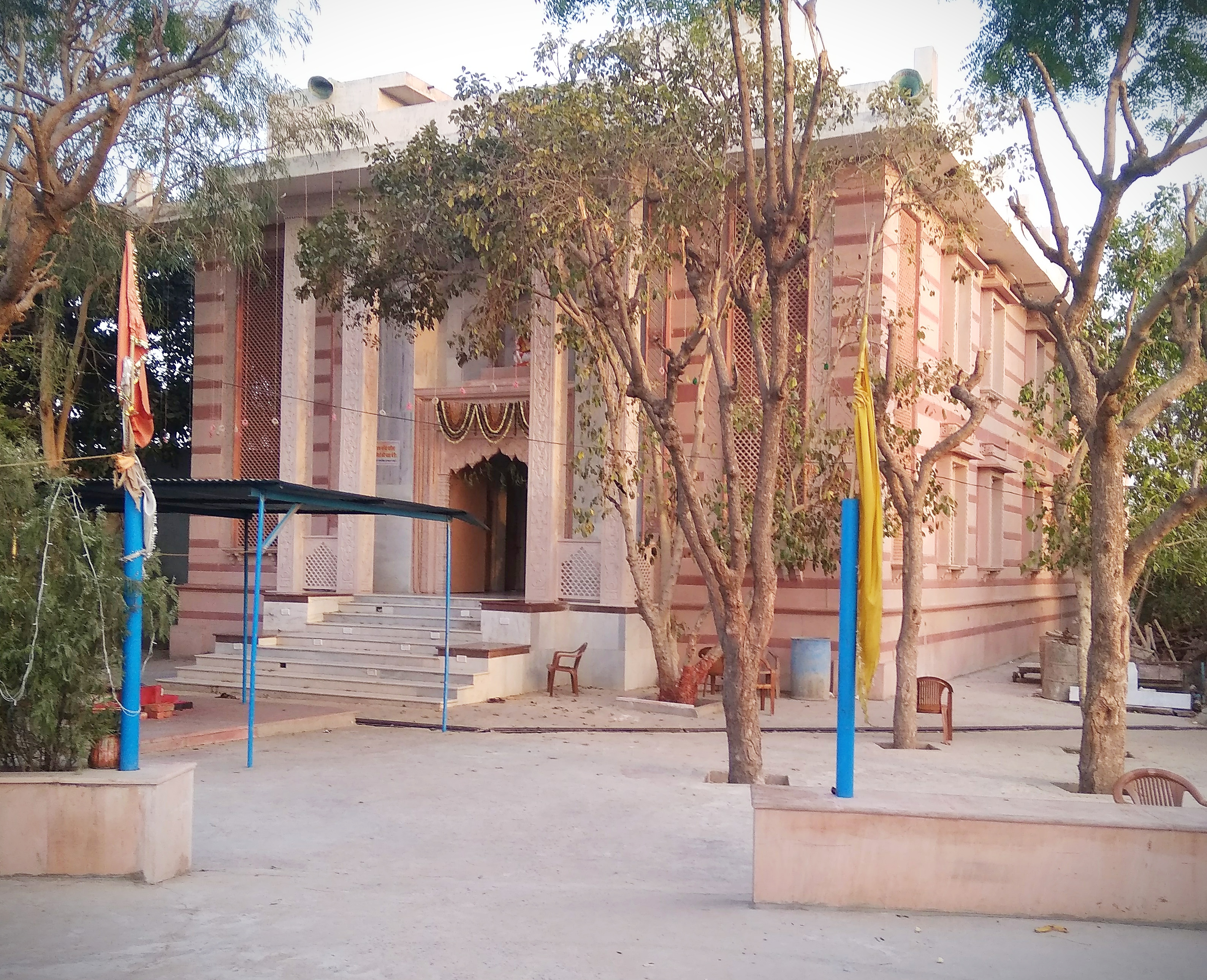
Nakkash Ki Devi - Gomti Dham Temple is a Hindu temple, situated in the Hindaun City, in the Indian state of Rajasthan. This temple is at the heart of Hindaun City, with adjacent sacred pond known as Jalsen Reservoir. The temple is located on the banks of the Jalsen Talab. Nakkash Ki Devi is a Hindu Devi Temple of Durga Durga ( sa, दुर्गा, ) is a major Hindu goddess, worshipped as a principal aspect of the mother goddess Mahadevi. She is associated with protection, strength, motherhood, destruction, and wars. Durga's legend centres around c ... and Gomti Dham is the biggest Temple in Hindaun City of Gomti Dass Ji Maharaj. References Hindu temples in Rajasthan Tourist attractions in Karauli district Tourist attractions in Hindaun Hindaun {{India-hindu-temple-stub ... [...More Info...] [...Related Items...] OR: [Wikipedia] [Google] [Baidu] |
Nakkash Ki Devi
''Nakkash'' () is a 2019 Hindi language film written and directed by Zaigham Imam, and produced by Pawan Tiwari’s Jalsa Pictures and Imam's AB Infosoft Creations in association with Padmaja Productions. ''Nakkash'' stars Inaamulhaq Sharib Hashmi and Kumud Mishra along with Rajesh Sharma. Nakkash was premiered at DCSAFF (Washington DC South Asian Film Festival) where the lead actor Inaamulhaq won the Best Actor Award for outstanding performance in "Nakkash". It was also screened at SgSAIFF (Singapore South Asian International Film Festival) where Imam won the Emerging Filmmaker of the Year award. The first look poster of Nakkash was unveiled in Indian Pavilion at the Cannes Film Festival in 2018. Cast *Inaamulhaq as Alla Rakkha Siddiqui *Sharib Hashmi as Samad *Kumud Mishra as Bhagwandas Vedanti *Rajesh Sharma (actor) as Inspector *Gulki Joshi as Sabia Bano * Pawan Tiwari as Munna Bhaiya *Harminder Singh Alag as Mohammad *Anil Rastogi as Politician *Siddharth Bhardwaj ... [...More Info...] [...Related Items...] OR: [Wikipedia] [Google] [Baidu] |
Ponds Of India
A pond is an area filled with water, either natural or artificial, that is smaller than a lake. Defining them to be less than in area, less than deep, and with less than 30% emergent vegetation helps in distinguishing their ecology from that of lakes and wetlands.Clegg, J. (1986). Observer's Book of Pond Life. Frederick Warne, London Ponds can be created by a wide variety of natural processes (e.g. on floodplains as cutoff river channels, by glacial processes, by peatland formation, in coastal dune systems, by beavers), or they can simply be isolated depressions (such as a kettle hole, vernal pool, prairie pothole, or simply natural undulations in undrained land) filled by runoff, groundwater, or precipitation, or all three of these. They can be further divided into four zones: vegetation zone, open water, bottom mud and surface film. The size and depth of ponds often varies greatly with the time of year; many ponds are produced by spring flooding from rivers. Ponds may be f ... [...More Info...] [...Related Items...] OR: [Wikipedia] [Google] [Baidu] |


