|
Juventae Chasma
Juventae Chasma is an enormous box canyon (250 km × 100 km) on Mars which opens to the north and forms the outflow channel Maja Valles. Juventae Chasma is located north of Valles Marineris in the Coprates quadrangle and cuts more than 5 km into the plains of Lunae Planum. Name Juventae was named by Giovanni Schiaparelli after the mythical ''Juventae Fons'', the fountain of youth. Observations The floor of Juventae Chasma is partly covered by sand dunes. There is also a 2.5 km high mountain inside Juventae, 59 km long and 23 km wide, that was confirmed by Mars Express to be composed of sulfate deposits. MRO discovered sulfates, hydrated sulfates, and iron oxides in Juventae Chasma. Juventae Chasma has four bright mounds or light-toned interior layered deposits (IlD's), as they are often called. Researchers have found that monohydrated sulfates were first deposited on the floor. And then polyhydrated sulfates were laid down. Kieserite, a magne ... [...More Info...] [...Related Items...] OR: [Wikipedia] [Google] [Baidu] |
Sulfate
The sulfate or sulphate ion is a polyatomic anion with the empirical formula . Salts, acid derivatives, and peroxides of sulfate are widely used in industry. Sulfates occur widely in everyday life. Sulfates are salts of sulfuric acid and many are prepared from that acid. Spelling "Sulfate" is the spelling recommended by IUPAC, but "sulphate" was traditionally used in British English. Structure The sulfate anion consists of a central sulfur atom surrounded by four equivalent oxygen atoms in a tetrahedral arrangement. The symmetry is the same as that of methane. The sulfur atom is in the +6 oxidation state while the four oxygen atoms are each in the −2 state. The sulfate ion carries an overall charge of −2 and it is the conjugate base of the bisulfate (or hydrogensulfate) ion, , which is in turn the conjugate base of , sulfuric acid. Organic sulfate esters, such as dimethyl sulfate, are covalent compounds and esters of sulfuric acid. The tetrahedral molecular geometry of th ... [...More Info...] [...Related Items...] OR: [Wikipedia] [Google] [Baidu] |
Valley Networks (Mars)
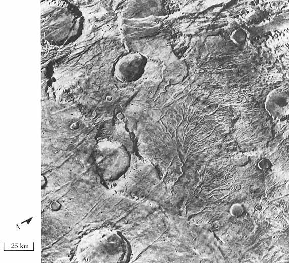
Valley networks are branching networks of valleys on Mars that superficially resemble terrestrial river drainage basins.Carr, M.H. (2006), The Surface of Mars. Cambridge Planetary Science Series, Cambridge University Press. They are found mainly incised into the terrain of the martian southern highlands, and are typically - though not always - of Noachian age (approximately four billion years old). The individual valleys are typically less than 5 kilometers wide, though they may extend for up to hundreds or even thousands of kilometers across the martian surface. The form, distribution, and implied evolution of the valley networks are of great importance for what they may tell us about the history of liquid water on the martian surface, and hence Mars' climate history. Some authors have argued that the properties of the networks demand that a hydrological cycle must have been active on ancient Mars,Craddock, R.A., and Howard, A.D. (2002), The case for rainfall on a warm, wet earl ... [...More Info...] [...Related Items...] OR: [Wikipedia] [Google] [Baidu] |
Lakes On Mars
In summer 1965, the first close-up images from Mars showed a cratered desert with no signs of water. However, over the decades, as more parts of the planet were imaged with better cameras on more sophisticated satellites, Mars showed evidence of past river valleys, lakes and present ice in glaciers and in the ground. It was discovered that the climate of Mars displays huge changes over geologic time because its axis is not stabilized by a large moon, as Earth's is. Also, some researchers maintain that surface liquid water could have existed for periods of time due to geothermal effects, chemical composition or asteroid impacts. This article describes some of the places that could have held large lakes. Overview Besides seeing features that were signs of past surface water, researchers found other types of evidence for past water. Minerals detected in many locations needed water to form. An instrument in ''2001 Mars Odyssey'' orbiter mapped the distribution of water in the shal ... [...More Info...] [...Related Items...] OR: [Wikipedia] [Google] [Baidu] |
Geology Of Mars
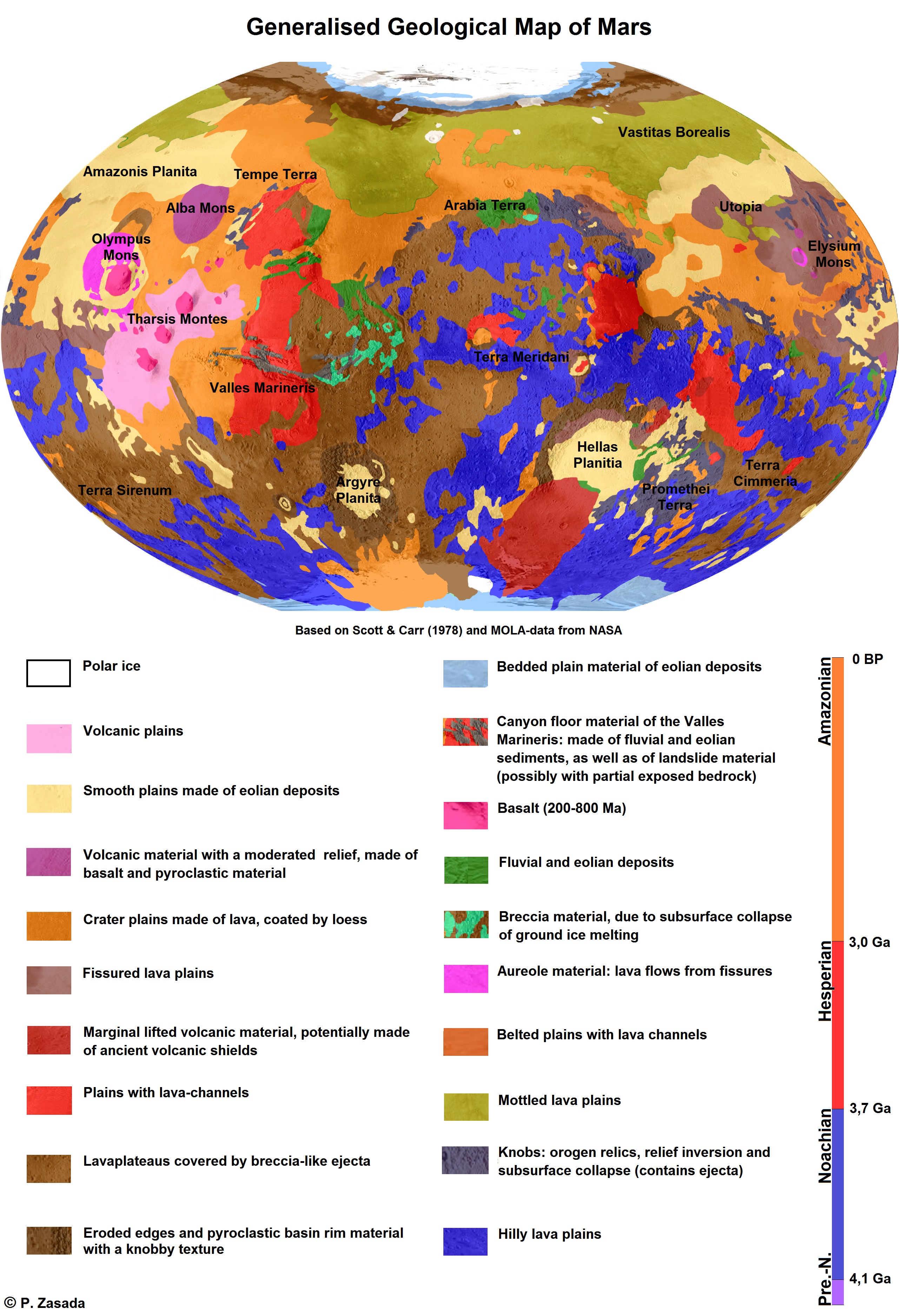
The geology of Mars is the scientific study of the surface, crust, and interior of the planet Mars. It emphasizes the composition, structure, history, and physical processes that shape the planet. It is analogous to the field of terrestrial geology. In planetary science, the term ''geology'' is used in its broadest sense to mean the study of the solid parts of planets and moons. The term incorporates aspects of geophysics, geochemistry, mineralogy, geodesy, and cartography. A neologism, areology, from the Greek word ''Arēs'' (Mars), sometimes appears as a synonym for Mars's geology in the popular media and works of science fiction (e.g. Kim Stanley Robinson, Kim Stanley Robinson's Mars trilogy). The term areology is also used by the Areological Society. Geological map of Mars (2014) File:Geologic Map of Mars figure2.pdf, Figure 2 for the geologic map of Mars Global Martian topography and large-scale features Composition of Mars Mars is a terrestrial planet, whic ... [...More Info...] [...Related Items...] OR: [Wikipedia] [Google] [Baidu] |
Climate On Mars
The climate of Mars has been a topic of scientific curiosity for centuries, in part because it is the only terrestrial planet whose surface can be directly observed in detail from the Earth with help from a telescope. Although Mars is smaller than the Earth, 11% of Earth's mass, and 50% farther from the Sun than the Earth, its climate has important similarities, such as the presence of polar ice caps, seasonal changes and observable weather patterns. It has attracted sustained study from planetologists and climatologists. While Mars' climate has similarities to Earth's, including periodic ice ages, there are also important differences, such as much lower thermal inertia. Mars' atmosphere has a scale height of approximately , 60% greater than that on Earth. The climate is of considerable relevance to the question of whether life is or ever has been present on the planet. The climate briefly received more interest in the news due to NASA measurements indicating increased sublima ... [...More Info...] [...Related Items...] OR: [Wikipedia] [Google] [Baidu] |
Chasma
In planetary nomenclature, a chasma (''plural'': chasmata ) is a deep, elongated, steep-sided depression. As of 2020, the IAU has named 122 such features in the Solar System, on Venus (63), Mars (25), Saturn's satellites Mimas (6), Tethys (2), Dione (8) and Rhea (5), Uranus's satellites Ariel (7), Titania (2) and Oberon (1) and Pluto's satellite Charon (3). An example is Eos Chasma on Mars. Mars Below are images of some of the major chasmata of Mars. The map shows their relative locations. Interior layered deposits and sulfate Parts of the floor of Candor Chasma contains layered deposits that have been termed interior layered deposits (ILD's). These layers may have formed when the whole area was a giant lake. Some places on Mars contain hydrated sulfate deposits. Sulfate formation involves the presence of water. The European Space Agency's Mars Express found evidence of perhaps epsomite and kieserite. Scientists want to visit these areas with robotic rovers. Layers ... [...More Info...] [...Related Items...] OR: [Wikipedia] [Google] [Baidu] |
Mars Global Surveyor
''Mars Global Surveyor'' (MGS) was an American robotic space probe developed by NASA's Jet Propulsion Laboratory and launched November 1996. MGS was a global mapping mission that examined the entire planet, from the ionosphere down through the atmosphere to the surface. As part of the larger Mars Exploration Program, Mars Global Surveyor performed atmospheric monitoring for sister orbiters during aerobraking, and helped Mars rovers and lander missions by identifying potential landing sites and relaying surface telemetry. It completed its primary mission in January 2001 and was in its third extended mission phase when, on 2 November 2006, the spacecraft failed to respond to messages and commands. A faint signal was detected three days later which indicated that it had gone into safe mode. Attempts to recontact the spacecraft and resolve the problem failed, and NASA officially ended the mission in January 2007. MGS remains in a stable near-polar circular orbit at about 450 km ... [...More Info...] [...Related Items...] OR: [Wikipedia] [Google] [Baidu] |
HiRISE
High Resolution Imaging Science Experiment is a camera on board the ''Mars Reconnaissance Orbiter'' which has been orbiting and studying Mars since 2006. The 65 kg (143 lb), US$40 million instrument was built under the direction of the University of Arizona's Lunar and Planetary Laboratory by Ball Aerospace & Technologies Corp. It consists of a 0.5m (19.7 in) aperture reflecting telescope, the largest so far of any deep space mission, which allows it to take pictures of Mars with resolutions of 0.3m/pixel (1ft/pixel), resolving objects below a meter across. HiRISE has imaged Mars exploration rovers on the surface, including the ''Opportunity'' rover and the ongoing ''Curiosity'' mission. History In the late 1980s, of Ball Aerospace & Technologies began planning the kind of high-resolution imaging needed to support sample return and surface exploration of Mars. In early 2001 he teamed up with Alfred McEwen of the University of Arizona to propose such a c ... [...More Info...] [...Related Items...] OR: [Wikipedia] [Google] [Baidu] |
Inverted Relief
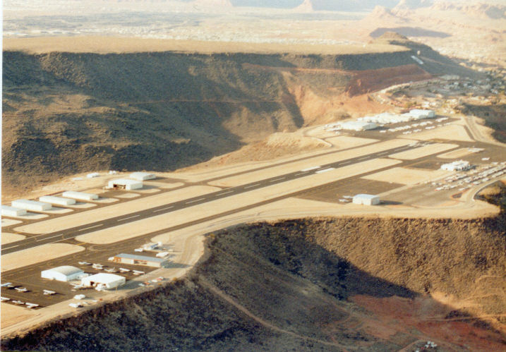
Inverted relief, inverted topography, or topographic inversion refers to landscape features that have reversed their elevation relative to other features. It most often occurs when low areas of a landscape become filled with lava or sediment that hardens into material that is more resistant to erosion than the material that surrounds it. ''Differential erosion'' then removes the less resistant surrounding material, leaving behind the younger resistant material, which may then appear as a ridge where previously there was a valley. Terms such as "inverted valley" or "inverted channel" are used to describe such features.Pain, C.F., and C.D. Ollier, 1995, ''Inversion of relief - a component of landscape evolution.'' Geomorphology. 12(2):151-165. Inverted relief has been observed on the surfaces of other planets as well as on Earth. For example, well-documented inverted topographies have been discovered on Mars.Pain, C.F., J.D.A. Clarke, and M. Thomas, 2007, ''Inversion of relief on ... [...More Info...] [...Related Items...] OR: [Wikipedia] [Google] [Baidu] |


