|
Jumilla
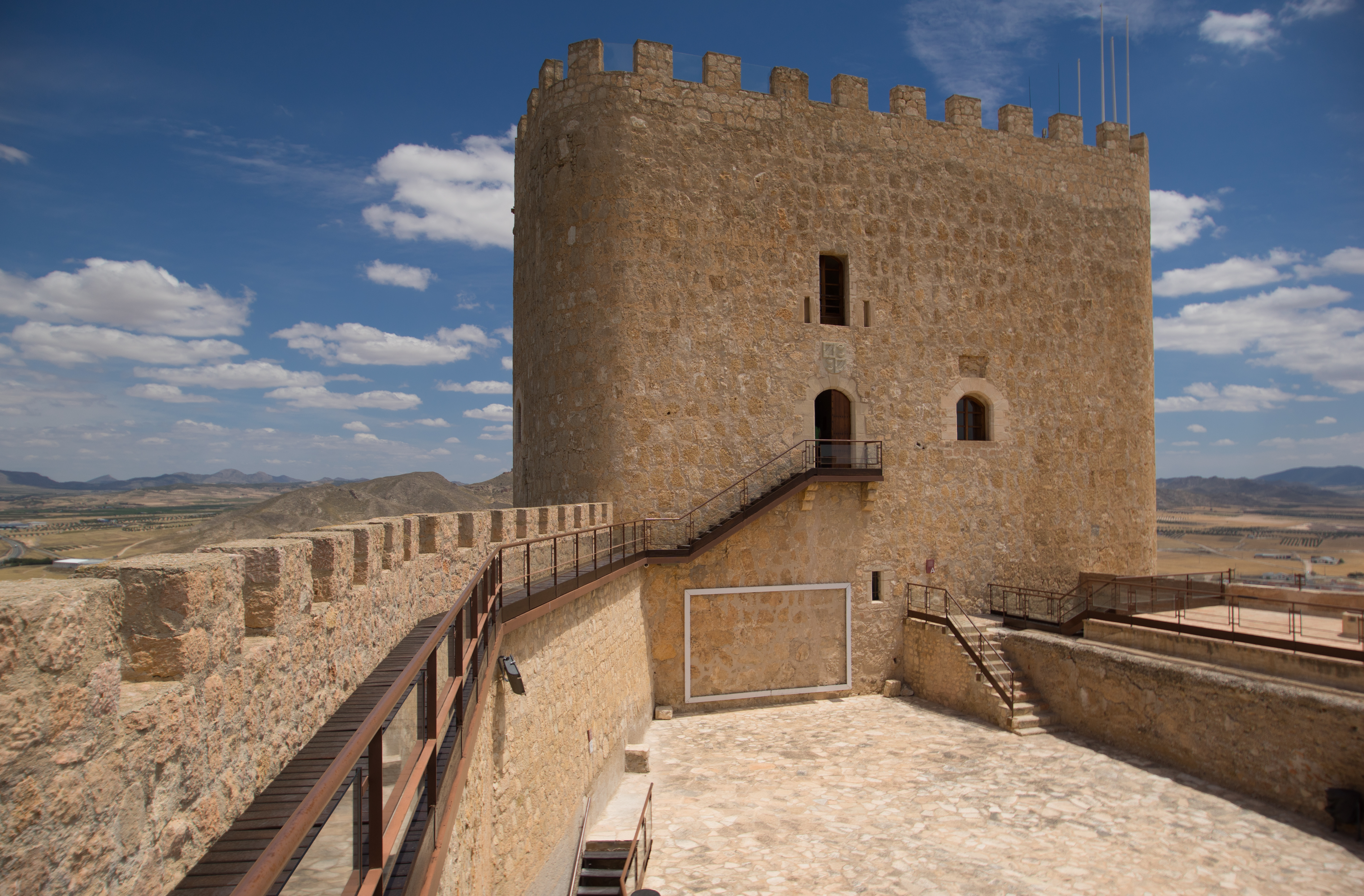
Jumilla () is a town and a municipality in southeastern Spain. It is located in the north east of the Region of Murcia, close to the towns of Cieza and Yecla. According to the 2018 census, the town population was 25,547. Geography The municipality, located in the north of the Region of Murcia, covers . It shares borders with the municipality of Yecla at its northeast and its east; with Abarán, Fortuna and Cieza at its south and with Abanilla at its east. It also adjoins the province of Albacete in the autonomous community Castilla–La Mancha at its west and the province of Alicante in the autonomous community Valencian Community. In this municipality there are several mountain landforms. There are three which are specially noteworthy in the territory and these are Sierra del Carche, Sierra del Buey and Sierra de la Pila. Other geographical elements that occupy the territory are three salt evaporation ponds. Regarding water landforms, there are not any basin with permanent w ... [...More Info...] [...Related Items...] OR: [Wikipedia] [Google] [Baidu] |
Region Of Murcia
The Region of Murcia (, ; es, Región de Murcia ), is an Autonomous communities of Spain, autonomous community of Spain located in the southeastern part of the Iberian Peninsula, on the Mediterranean Sea, Mediterranean coast. The region is in area and had a population of 1,511,251 as at the start of 2020. About one-third of its population lives in the capital, Murcia. At , the region's highest point is Los Obispos Peak in the .[ftp://ftp.geodesia.ign.es/Red_Geodesica/Hoja0909/090974.pdf Review Geodesic Vertex, Government of Spain (pdf)] A jurisdiction of the Crown of Castile since the middle ages, the Kingdom of Murcia was replaced in the 19th century by territory primarily belonging to the Provinces of Spain, provinces of province of Albacete, Albacete and Murcia (and subsidiarily to those of Jaén and Alicante). The former two were henceforth attached to a 'historical region' also named after Murcia. The province of Murcia constituted as the full-fledged single-province auto ... [...More Info...] [...Related Items...] OR: [Wikipedia] [Google] [Baidu] |
Yecla
Yecla () is a town and municipality in eastern Spain, in the extreme north of the autonomous community of Murcia, located 96 km from the capital of the region, Murcia. Toponymy The origin of the term Yecla comes from the Arabic Yakka, which was the name of a fortress located in the place that is now called Cerro del Castillo. This toponym, however, is not from Arabic origin and it is very likely that it derives from the pre-Roman terms Iko or Ika. The most important mountains of the locality are Sierra de Salinas (1,238 m), Monte Arabí (1,065 m), Sierra de la Magdalena (1,038 m), and others. The chief buildings are a half-ruined citadel, a modern parish church with a pillared Corinthian facade, and a town hall standing in a fine arcaded plaza mayor (square). Yecla has traditionally had a thriving trade in grain, wine, oil, fruit and other agricultural products produced in the surrounding country. Since the second half of the 20th century, furniture making has become a local t ... [...More Info...] [...Related Items...] OR: [Wikipedia] [Google] [Baidu] |
Abanilla
Abanilla is a Spanish municipality located in the Comarca Oriental (composed by Fortuna and Abanilla) in the Autonomous Community of Murcia. It lies close to the border of the province of Alicante in the Autonomous Community of Valencia. Geography Abanilla occupies a surface area of 236.6 km² and is situated 222 metres above sea level. It lies on a natural foundation which has been degraded by a number of aggregate and marble quarries. Paleontological Significance A karstic paleontological site is located on the southeast slope of the Sierra de Quibas in an abandoned limestone quarry. Researchers have discovered vertebrate and invertebrate fossils at this site. They collected rodent fossils and used dental patterns to identify these to be of the Muroidea subfamily Arvicolinae. Using stratigraphic and sedimentological features in the limestone, the scientists were able to date these fossils to the Early Pleistocene subepoch. Points of interest Points of interest in Ab ... [...More Info...] [...Related Items...] OR: [Wikipedia] [Google] [Baidu] |
Municipalities Of Spain
The municipality ( es, municipio, , ca, municipi, gl, concello, eu, udalerria, ast, conceyu)In other languages of Spain: * Catalan/Valencian (), sing. ''municipi''. * Galician () or (), sing. ''municipio''/''bisbarra''. *Basque (), sing. ''udalerria''. * Asturian (), sing. ''conceyu''. is the basic local administrative division in Spain together with the province. Organisation Each municipality forms part of a province which in turn forms part or the whole of an autonomous community (17 in total plus Ceuta and Melilla): some autonomous communities also group municipalities into entities known as ''comarcas'' (districts) or ''mancomunidades'' (commonwealths). There are a total of 8,131 municipalities in Spain, including the autonomous cities of Ceuta and Melilla. In the Principality of Asturias, municipalities are officially named ''concejos'' (councils). The average population of a municipality is about 5,300, but this figure masks a huge range: the most populo ... [...More Info...] [...Related Items...] OR: [Wikipedia] [Google] [Baidu] |
Salt Evaporation Pond
A salt evaporation pond is a shallow artificial salt pan designed to extract salts from sea water or other brines. The Salt pans are shallow and large of size because it will be easier for sunlight to travel and reach the sea water. Natural salt pans are geological formations that are also created by water evaporating and leaving behind salts. Some salt evaporation ponds are only slightly modified from their natural version, such as the ponds on Great Inagua in the Bahamas, or the ponds in Jasiira, a few kilometres south of Mogadishu, where seawater is trapped and left to evaporate in the sun. The seawater or brine is fed into large ponds and water is drawn out through natural evaporation which allows the salt to be subsequently harvested. The ponds also provide a productive resting and feeding ground for many species of waterbirds, which may include endangered species. The ponds are commonly separated by levees. Salt evaporation ponds may also be called salterns, salt works or ... [...More Info...] [...Related Items...] OR: [Wikipedia] [Google] [Baidu] |
Arroyo (creek)
An arroyo (; from Spanish arroyo , "brook"), also called a wash, is a dry stream, creek, stream bed or gulch that temporarily or seasonally fills and flows after sufficient rain. Flash floods are common in arroyos following thunderstorms. ''Wadi'' (Arabic) is used in North Africa and Western Asia for similar landforms. The desert dry wash biome is restricted to the arroyos of the southwestern United States. Arroyos provide a water source to desert animals. Types and processes Arroyos can be natural fluvial landforms or constructed flood control channels. The term usually applies to a Grade (slope), sloped or mountainous terrain in xeric and desert climates. In addition: in many rural communities arroyos are also the principal transportation routes; and in many urban communities arroyos are also parks and recreational locations, often with linear multi-use bicycle, pedestrian, and equestrian trails. Flash flooding can cause the deep arroyos or deposition of sediment on flo ... [...More Info...] [...Related Items...] OR: [Wikipedia] [Google] [Baidu] |
Lower Paleolithic
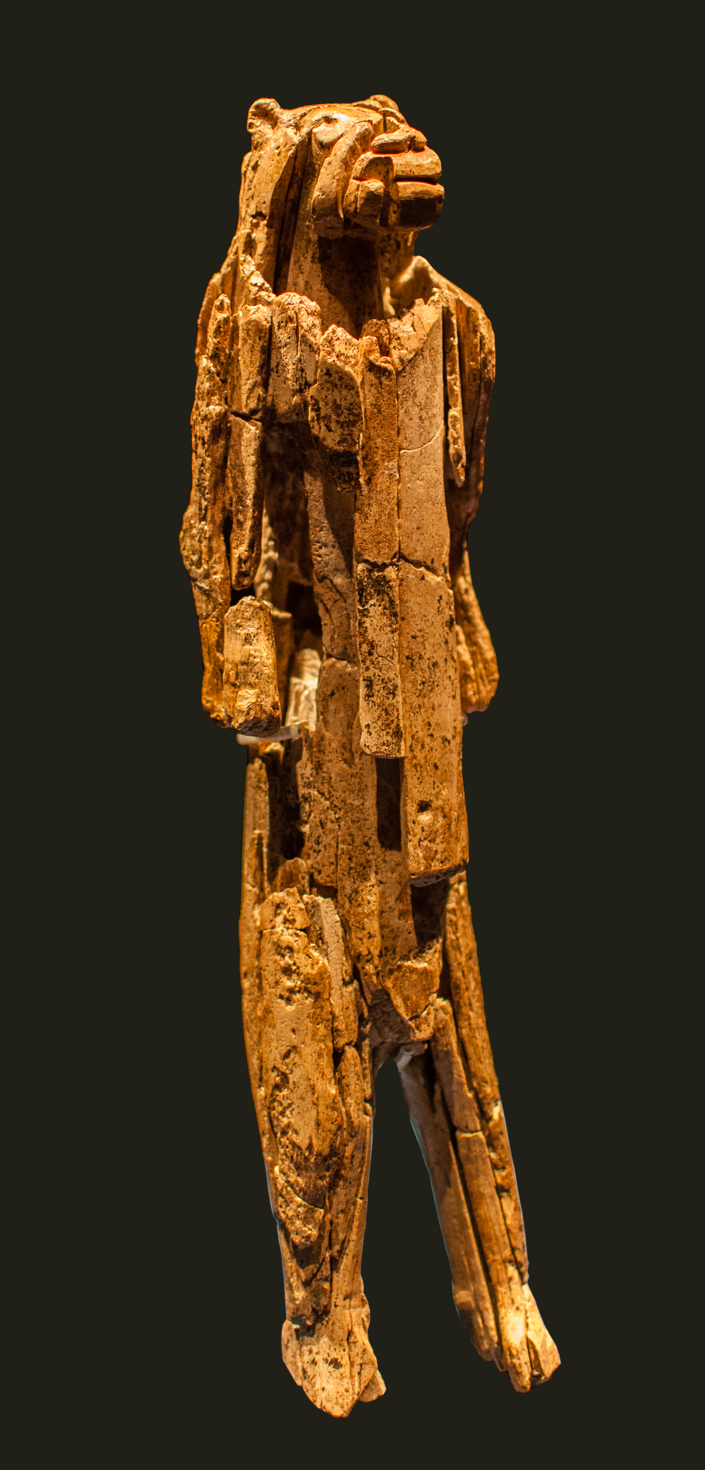
The Lower Paleolithic (or Lower Palaeolithic) is the earliest subdivision of the Paleolithic or Old Stone Age. It spans the time from around 3 million years ago when the first evidence for stone tool production and use by hominins appears in the current archaeological record, until around 300,000 years ago, spanning the Oldowan ("mode 1") and Acheulean ("mode 2") lithics industries. In African archaeology, the time period roughly corresponds to the Early Stone Age, the earliest finds dating back to 3.3 million years ago, with Lomekwian stone tool technology, spanning Mode 1 stone tool technology, which begins roughly 2.6 million years ago and ends between 400,000 and 250,000 years ago, with Mode 2 technology. The Middle Paleolithic followed the Lower Paleolithic and recorded the appearance of the more advanced prepared-core tool-making technologies such as the Mousterian. Whether the earliest control of fire by hominins dates to the Lower or to the Middle Paleolithic remai ... [...More Info...] [...Related Items...] OR: [Wikipedia] [Google] [Baidu] |
Upper Paleolithic
The Upper Paleolithic (or Upper Palaeolithic) is the third and last subdivision of the Paleolithic or Old Stone Age. Very broadly, it dates to between 50,000 and 12,000 years ago (the beginning of the Holocene), according to some theories coinciding with the appearance of behavioral modernity in early modern humans, until the advent of the Neolithic Revolution and agriculture. Anatomically modern humans (i.e. ''Homo sapiens'') are believed to have emerged in Africa around 300,000 years ago, it has been argued by some that their ways of life changed relatively little from that of archaic humans of the Middle Paleolithic, until about 50,000 years ago, when there was a marked increase in the diversity of Artefact (archaeology), artefacts found associated with modern human remains. This period coincides with the most common date assigned to early human migrations, expansion of modern humans from Africa throughout Asia and Eurasia, which contributed to the Neanderthal extinction, ex ... [...More Info...] [...Related Items...] OR: [Wikipedia] [Google] [Baidu] |
Middle Paleolithic
The Middle Paleolithic (or Middle Palaeolithic) is the second subdivision of the Paleolithic or Old Stone Age as it is understood in Europe, Africa and Asia. The term Middle Stone Age is used as an equivalent or a synonym for the Middle Paleolithic in African archeology. The Middle Paleolithic broadly spanned from 300,000 to 30,000 years ago. There are considerable dating differences between regions. The Middle Paleolithic was succeeded by the Upper Paleolithic subdivision which first began between 50,000 and 40,000 years ago. Pettit and White date the Early Middle Paleolithic in Great Britain to about 325,000 to 180,000 years ago (late Marine Isotope Stage 9 to late Marine Isotope Stage 7), and the Late Middle Paleolithic as about 60,000 to 35,000 years ago. According to the theory of the recent African origin of modern humans, anatomically modern humans began migrating out of Africa during the Middle Stone Age/Middle Paleolithic around 125,000 years ago and began to replace e ... [...More Info...] [...Related Items...] OR: [Wikipedia] [Google] [Baidu] |
Alicante
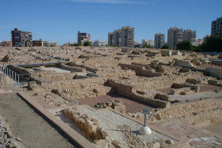
Alicante ( ca-valencia, Alacant) is a city and municipality in the Valencian Community, Spain. It is the capital of the province of Alicante and a historic Mediterranean port. The population of the city was 337,482 , the second-largest in the Valencian Community. Toponymy The name of the city echoes the Arabic name ''Laqant'' () or ''al-Laqant'' (), which in turn reflects the Latin ''Lucentum'' and Greek root ''Leuké'' (or ''Leuka''), meaning "white". History The area around Alicante has been inhabited for over 7000 years. The first tribes of hunter-gatherers moved down gradually from Central Europe between 5000 and 3000 BC. Some of the earliest settlements were made on the slopes of Mount Benacantil. By 1000 BC Greek and Phoenician traders had begun to visit the eastern coast of Spain, establishing small trading ports and introducing the native Iberian tribes to the alphabet, iron, and the pottery wheel. The Carthaginian general Hamilcar Barca established the fortifie ... [...More Info...] [...Related Items...] OR: [Wikipedia] [Google] [Baidu] |
Epipalaeolithic
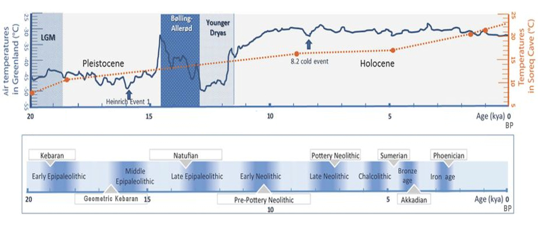
In archaeology, the Epipalaeolithic or Epipaleolithic (sometimes Epi-paleolithic etc.) is a period occurring between the Upper Paleolithic and Neolithic during the Stone Age. Mesolithic also falls between these two periods, and the two are sometimes confused or used as synonyms. More often, they are distinct, referring to approximately the same period of time in different geographic areas. Epipaleolithic always includes Epipalaeolithic Near East, this period in the Levant and, often, the rest of the Near East. It sometimes includes parts of Southeast Europe, where Mesolithic is much more commonly used. Mesolithic very rarely includes the Levant or the Near East; in Europe, Epipalaeolithic is used, though not very often, to refer to the early Mesolithic. The Epipalaeolithic has been defined as the "final Upper Palaeolithic industries occurring at the end of the final Last glacial period, glaciation which appear to merge technologically into the Mesolithic". The period is general ... [...More Info...] [...Related Items...] OR: [Wikipedia] [Google] [Baidu] |
Chalcolithic
The Copper Age, also called the Chalcolithic (; from grc-gre, χαλκός ''khalkós'', "copper" and ''líthos'', "stone") or (A)eneolithic (from Latin '' aeneus'' "of copper"), is an archaeological period characterized by regular human manipulation of copper, but prior to the discovery of bronze alloys. Modern researchers consider the period as a subset of the broader Neolithic, but earlier scholars defined it as a transitional period between the Neolithic and the Bronze Age. The archaeological site of Belovode, on Rudnik mountain in Serbia, has the world's oldest securely dated evidence of copper smelting at high temperature, from (7000 BP). The transition from Copper Age to Bronze Age in Europe occurred between the late 5th and the late In the Ancient Near East the Copper Age covered about the same period, beginning in the late and lasting for about a millennium before it gave rise to the Early Bronze Age. Terminology The multiple names result from m ... [...More Info...] [...Related Items...] OR: [Wikipedia] [Google] [Baidu] |


