|
Jubata Ez-Zeit
Jubata ez-Zeit ( ar, جباتا الزيت, ''Jubātā az-Zayt'') was a Syrian village situated in the far north of the Golan Heights. According to an Arab resident of a nearby town, it had a population of around 1,500 to 2,000 people prior to the forced expulsion of the town's residents in 1968. Etymology Jubata ez-Zeit is an Arabic name that translates into English as "olive oil pit," and refers to the olive trees that grew in the village which remain present today. History 19th century In 1810, Johann Ludwig Burckhardt visited the village and wrote: "... One hour more brought us to the village of Djoubeta, where we remained during the night at the house of some friends of the Sheikh of Banias. This village belongs to Hasbeya; it is inhabited by about fifty Turkish and ten Greek families; they subsist chiefly by the cultivation of olives, and by the rearing of cattle. I was well treated at the house where we alighted, and also at that of the Sheikh of the village, where I went ... [...More Info...] [...Related Items...] OR: [Wikipedia] [Google] [Baidu] |
Governorates Of Syria
Syria is a unitary state, but for administrative purposes, it is divided into fourteen governorates, also called provinces or counties in English (Arabic ''muḥāfaẓāt'', singular '' muḥāfaẓah''). The governorates are divided into sixty-five districts (''manāṭiq'', singular '' minṭaqah''), which are further divided into subdistricts (''nawāḥī'', singular '' nāḥiyah''). The ''nawāḥī'' contain villages, which are the smallest administrative units. Each governorate is headed by a governor, appointed by the president, subject to cabinet approval. The governor is responsible for administration, health, social services, education, tourism, public works, transportation, domestic trade, agriculture, industry, civil defense, and maintenance of law and order in the governorate. The minister of local administration works closely with each governor to coordinate and supervise local development projects. The governor is assisted by a provincial council, all of who ... [...More Info...] [...Related Items...] OR: [Wikipedia] [Google] [Baidu] |
Hasbeya
Hasbeya or Hasbeiya ( ar, حاصبيا) is a town in Lebanon, situated at the foot of Mount Hermon, overlooking a deep amphitheatre from which a brook flows to the Hasbani. In 1911, the population was about 5000. Hasbaya is the capital of the Wadi El Taym, a long fertile valley running parallel to the western foot of Mount Hermon. Watered by the Hasbani river, the low hills of Wadi El Taym are covered with rows of silver-green olive trees, its most important source of income. Villagers also produce honey, grapes, figs, prickly pears, pine nuts and other fruit. Mount Hermon, 2745 metres high, is a unifying presence throughout the Wadi El Taym. This imposing mountain held great religious significance for the Canaanites and Phoenicians, who called it the seat of the All High. The Romans, recognising it as a holy site, built many temples on its slopes. Some identify Hasbaya with the Old Testament's "Baal – Hermon," while in the New Testament the mountain is the site of the transfigur ... [...More Info...] [...Related Items...] OR: [Wikipedia] [Google] [Baidu] |
Syrian Towns And Villages Depopulated In The Arab-Israeli Conflict
Syrians ( ar, سُورِيُّون, ''Sūriyyīn'') are an Eastern Mediterranean ethnic group indigenous to the Levant. They share common Levantine Semitic roots. The cultural and linguistic heritage of the Syrian people is a blend of both indigenous elements and the foreign cultures that have come to inhabit the region of Syria over the course of thousands of years. The mother tongue of most Syrians is Levantine Arabic, which came to replace the former mother tongue, Aramaic, following the Muslim conquest of the Levant in the 7th century. The conquest led to the establishment of the Caliphate under successive Arab dynasties, who, during the period of the later Abbasid Caliphate, promoted the use of the Arabic language. A minority of Syrians have retained Aramaic which is still spoken in its Eastern and Western dialects. In 2018, the Syrian Arab Republic had an estimated population of 19.5 million, which includes, aside from the aforementioned majority, ethnic minorities such as ... [...More Info...] [...Related Items...] OR: [Wikipedia] [Google] [Baidu] |
Marwan Habash
Marwan Habash ( ar, مروان حبش; born in 1938) is a Syrian former politician and writer. He was a member of the Regional Command of the Baath Party in Syria and Minister of Industry in the government of Salah Jadid. Following a successful coup d'etat against Jadid's leadership in 1970, Habash was imprisoned along with others perceived to be Jadid loyalists. One of the world's longest-held political prisoners, he was released in 1993. He has since become a writer and public analyst. Early career Born in Jubata ez-Zeit in the Golan Heights, Habash was a member of the Regional Command for the Ba'ath Party between August 1965 and November 1970. Habash also served as the Minister of Front Line Villages Affairs and the Minister of Industry in the government of Salah Jadid. When the Ba'ath Party split, Habash belonged to the faction that remained loyal to the National Command based in Iraq. Imprisonment When followers of then-Defense Minister Hafez al-Assad launched a coup d'éta ... [...More Info...] [...Related Items...] OR: [Wikipedia] [Google] [Baidu] |
Banias
Banias or Banyas ( ar, بانياس الحولة; he, בניאס, label=Modern Hebrew; Judeo-Aramaic, Medieval Hebrew: פמייס, etc.; grc, Πανεάς) is a site in the Golan Heights near a natural spring, once associated with the Greek god Pan. It had been inhabited for 2,000 years, until it was abandoned and destroyed following the Six Day War.How modern disputes have reshaped the ancient city of Banias : "In June 1967, the penultimate day of the Six Day War saw Israeli tanks storm into Banias in breach of a UN ceasefire accepted by Syria hours earlier. The Israeli general Moshe Dayan had decided to act u ... [...More Info...] [...Related Items...] OR: [Wikipedia] [Google] [Baidu] |
Nimrod Castle
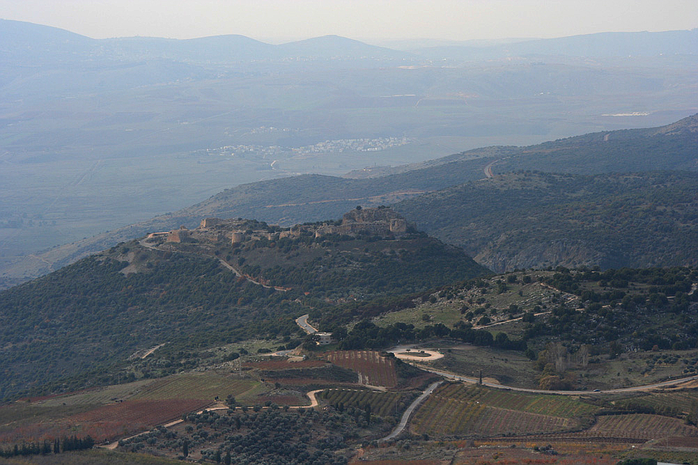
The Nimrod Fortress or Nimrod Castle ( ar, قلعة الصبيبة ''Qal'at al-Subeiba'', "Castle of the Large Cliff", later ''Qal'at Namrud'', "Nimrod's Castle"; he, מבצר נמרוד, ''Mivtzar Nimrod'', "Nimrod's Fortress") is a castle built by the Ayyubids and hugely enlarged by the Mamluks, situated on the southern slopes of Mount Hermon, on a ridge rising about 800 m (2600 feet) above sea level. It overlooks the Golan Heights and was built with the purpose of guarding a major access route to Damascus against armies coming from the west. Alternative forms and spellings include: ''Kal'at'' instead of '' Qal'at'', the prefix ''as-'' instead of ''al-'', and ''Subayba'', ''Subaybah'' and ''Subeibeh'' in place of ''Subeiba''. The area is under Israeli occupation and administration since 1967 together with the adjacent Golan Heights. The international community sees the area as Syrian territory. History According to geological observations and archaeological findings, the N ... [...More Info...] [...Related Items...] OR: [Wikipedia] [Google] [Baidu] |
Jabal Esh-Sheikh
Mount Hermon ( ar, جبل الشيخ or جبل حرمون / ALA-LC: ''Jabal al-Shaykh'' ("Mountain of the Sheikh") or ''Jabal Haramun''; he, הַר חֶרְמוֹן, ''Har Hermon'') is a mountain cluster constituting the southern end of the Anti-Lebanon mountain range. Its summit straddles the border between Syria and Lebanon and, at above sea level, is the highest point in Syria. On the top, in the United Nations buffer zone between Syrian and Israeli-occupied territories, is the highest permanently manned UN position in the world, known as "Hermon Hotel", located at 2814 metres altitude. The southern slopes of Mount Hermon extend to the Israeli-occupied portion of the Golan Heights, where the Mount Hermon ski resort is located with a top elevation of 2,040 metres (6,690 ft). A peak in this area rising to 2,236 m (7,336 ft) is the highest elevation in Israeli-controlled territory. Geography Wider mountain range The Anti-Lebanon range, of which the H ... [...More Info...] [...Related Items...] OR: [Wikipedia] [Google] [Baidu] |
Neve Ativ
Neve Ativ (), is an Israeli settlement in the Golan Heights, organized as a small Alpine-styled moshav. Located on the slopes of Mount Hermon, west of Majdal Shams. it falls under the jurisdiction of Golan Regional Council. In it had a population of . The international community considers Israeli settlements in the Golan Heights illegal under international law, but the Israeli government disputes this. Ski resort The moshav's main industry is tourism. Neve Ativ operates the nearby Mount Hermon ski resort, which has of ski runs on the slopes of the -above-sea-level Mount Hermon. The resort was destroyed in the 1973 Yom Kippur War, but re-opened the following year. [...More Info...] [...Related Items...] OR: [Wikipedia] [Google] [Baidu] |
Israeli Settlement
Israeli settlements, or Israeli colonies, are civilian communities inhabited by Israeli citizens, overwhelmingly of Jewish ethnicity, built on lands occupied by Israel in the 1967 Six-Day War. The international community considers Israeli settlements to be illegal under international law, though Israel disputes this. Israeli settlements currently exist in the West Bank (including East Jerusalem), claimed by the State of Palestine as its sovereign territory, and in the Golan Heights, widely viewed as Syrian territory. East Jerusalem and the Golan Heights have been effectively annexed by Israel, though the international community has rejected any change of status in both territories and continues to consider each occupied territory. Although the West Bank settlements are on land administered under Israeli military rule rather than civil law, Israeli civil law is "pipelined" into the settlements, such that Israeli citizens living there are treated similarly to those livi ... [...More Info...] [...Related Items...] OR: [Wikipedia] [Google] [Baidu] |
Israel Defense Forces
The Israel Defense Forces (IDF; he, צְבָא הַהֲגָנָה לְיִשְׂרָאֵל , ), alternatively referred to by the Hebrew-language acronym (), is the national military of the Israel, State of Israel. It consists of three service branches: the Israeli Ground Forces, the Israeli Air Force, and the Israeli Navy. It is the sole military wing of the Israeli security forces, Israeli security apparatus, and has no civilian jurisdiction within Israel. The IDF is headed by the Chief of the General Staff (Israel), Chief of the General Staff, who is subordinate to the Ministry of Defense (Israel), Israeli Defense Minister. On the orders of David Ben-Gurion, the IDF was formed on 26 May 1948 and began to operate as a Conscription in Israel, conscript military, drawing its initial recruits from the already-existing paramilitaries of the Yishuv—namely Haganah, the Irgun, and Lehi (militant group), Lehi. Since its formation shortly after the Israeli Declaration of Independen ... [...More Info...] [...Related Items...] OR: [Wikipedia] [Google] [Baidu] |
Six-Day War
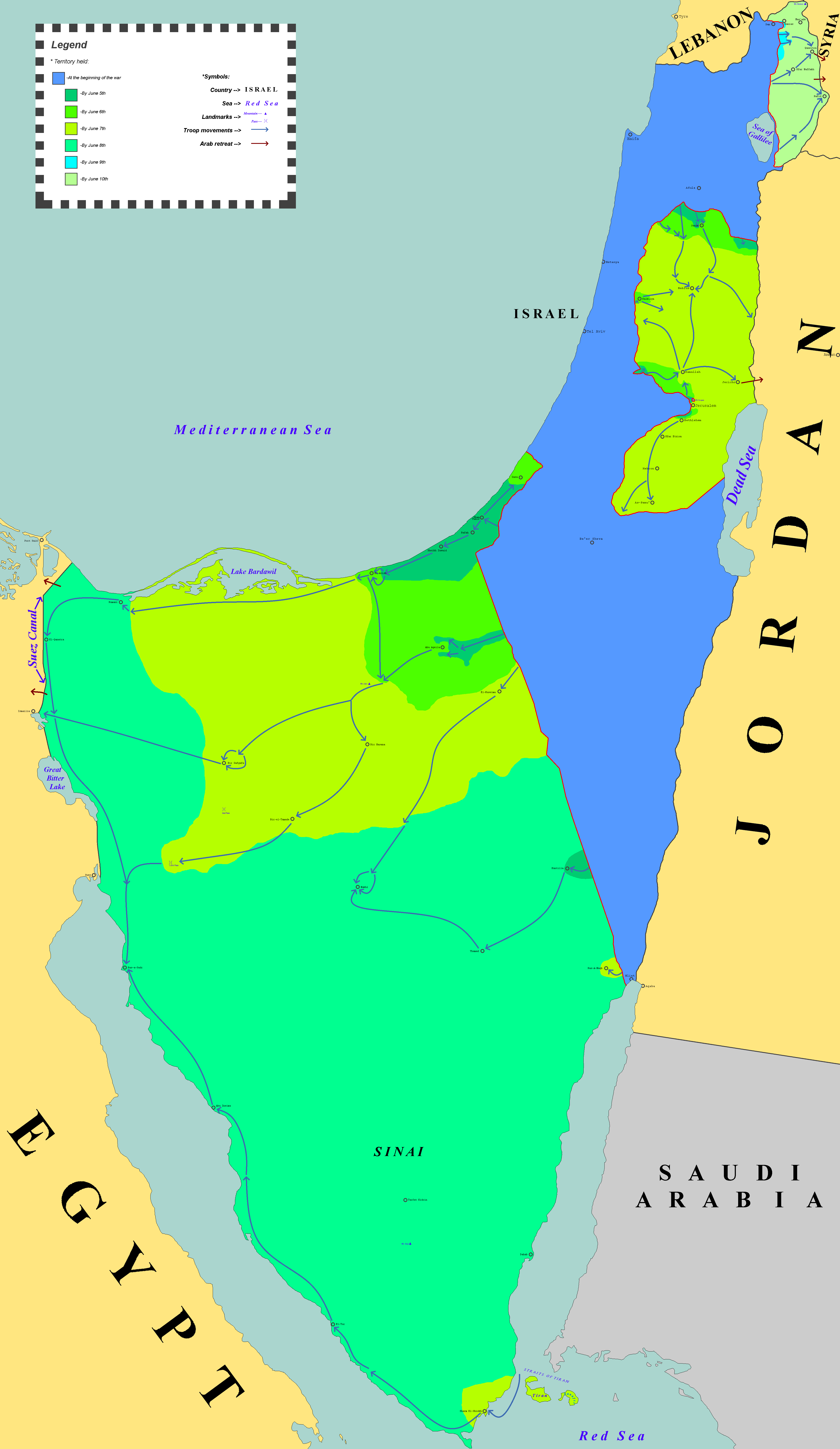
The Six-Day War (, ; ar, النكسة, , or ) or June War, also known as the 1967 Arab–Israeli War or Third Arab–Israeli War, was fought between Israel and a coalition of Arab world, Arab states (primarily United Arab Republic, Egypt, Syria, and Jordan) from 5 to 10 June 1967. Escalated hostilities broke out amid poor relations between Israel and its Arab neighbours following the 1949 Armistice Agreements, which were signed at the end of the 1948 Arab–Israeli War, First Arab–Israeli War. Earlier, in 1956, regional tensions over the Straits of Tiran escalated in what became known as the Suez Crisis, when Israel invaded Egypt over the Israeli passage through the Suez Canal and Straits of Tiran, Egyptian closure of maritime passageways to Israeli shipping, ultimately resulting in the re-opening of the Straits of Tiran to Israel as well as the deployment of the United Nations Emergency Force (UNEF) along the Borders of Israel#Border with Egypt, Egypt–Israel border. In ... [...More Info...] [...Related Items...] OR: [Wikipedia] [Google] [Baidu] |
Johann Ludwig Burckhardt
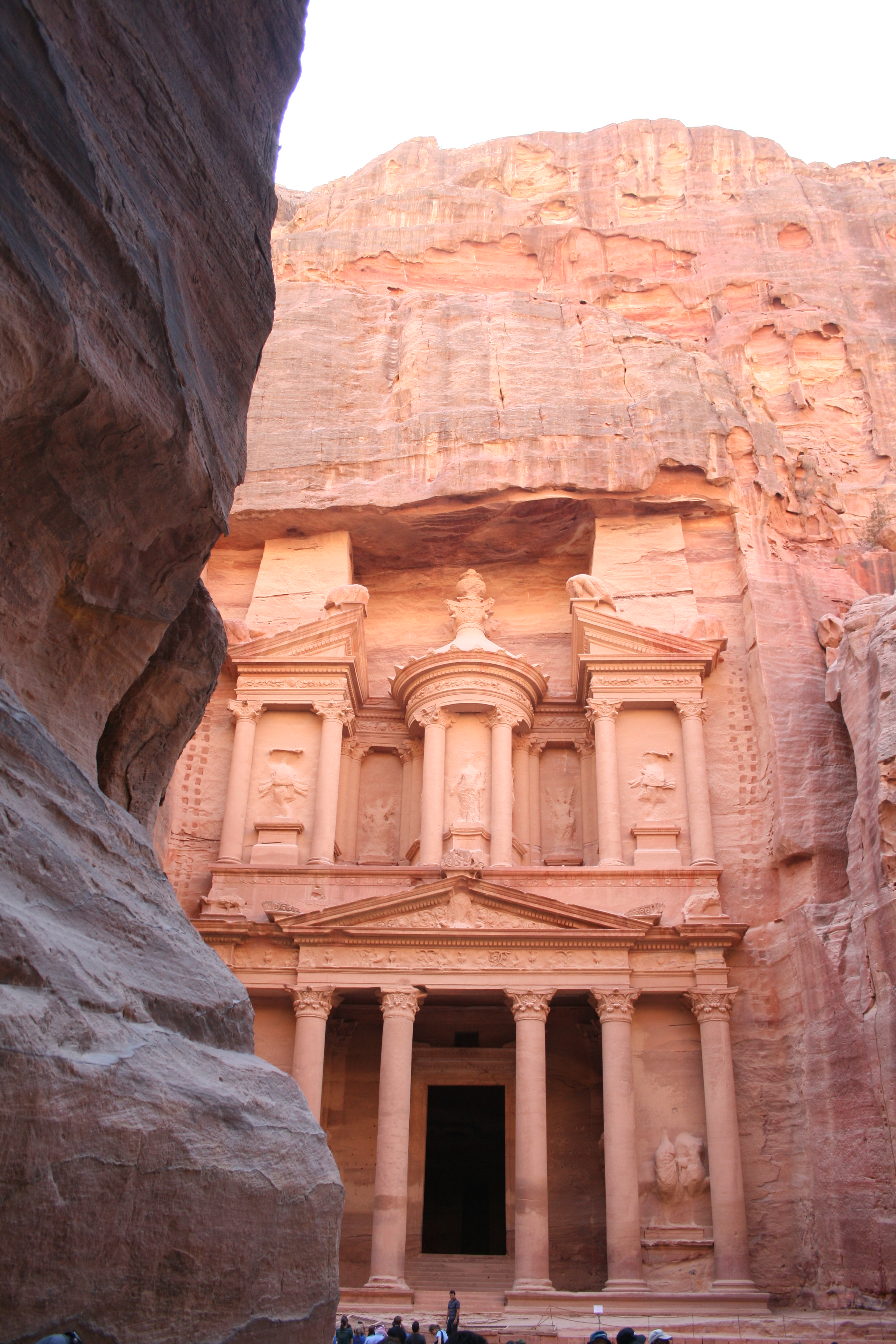
Johann Ludwig (also known as John Lewis, Jean Louis) Burckhardt (24 November 1784 – 15 October 1817) was a Swiss traveller, geographer and Orientalist. Burckhardt assumed the alias ''Sheikh Ibrahim Ibn Abdallah'' during his travels in Arabia. He wrote his letters in French and signed '' Louis''. He is best known for rediscovering the ruins of the ancient Nabataean city of Petra in Jordan. Youth and early travels Burckhardt was born on 24 November 1784 in Lausanne, Switzerland to a wealthy Basel family of silk merchants, the Burckhardt family. His father was named Rudolf, son of Gedeon Burckhardt, an affluent silk ribbon manufacturer; his mother, Sara Rohner, was Rudolf's second wife following a brief marriage to the daughter of the mayor of Basel which ended in divorce. After studying at the universities of Leipzig and Göttingen, he travelled to England in the summer of 1806 with goal of obtaining employment in the civil service. Unsuccessful, he took employment with the Afr ... [...More Info...] [...Related Items...] OR: [Wikipedia] [Google] [Baidu] |


