|
John Morris Jones Walkway
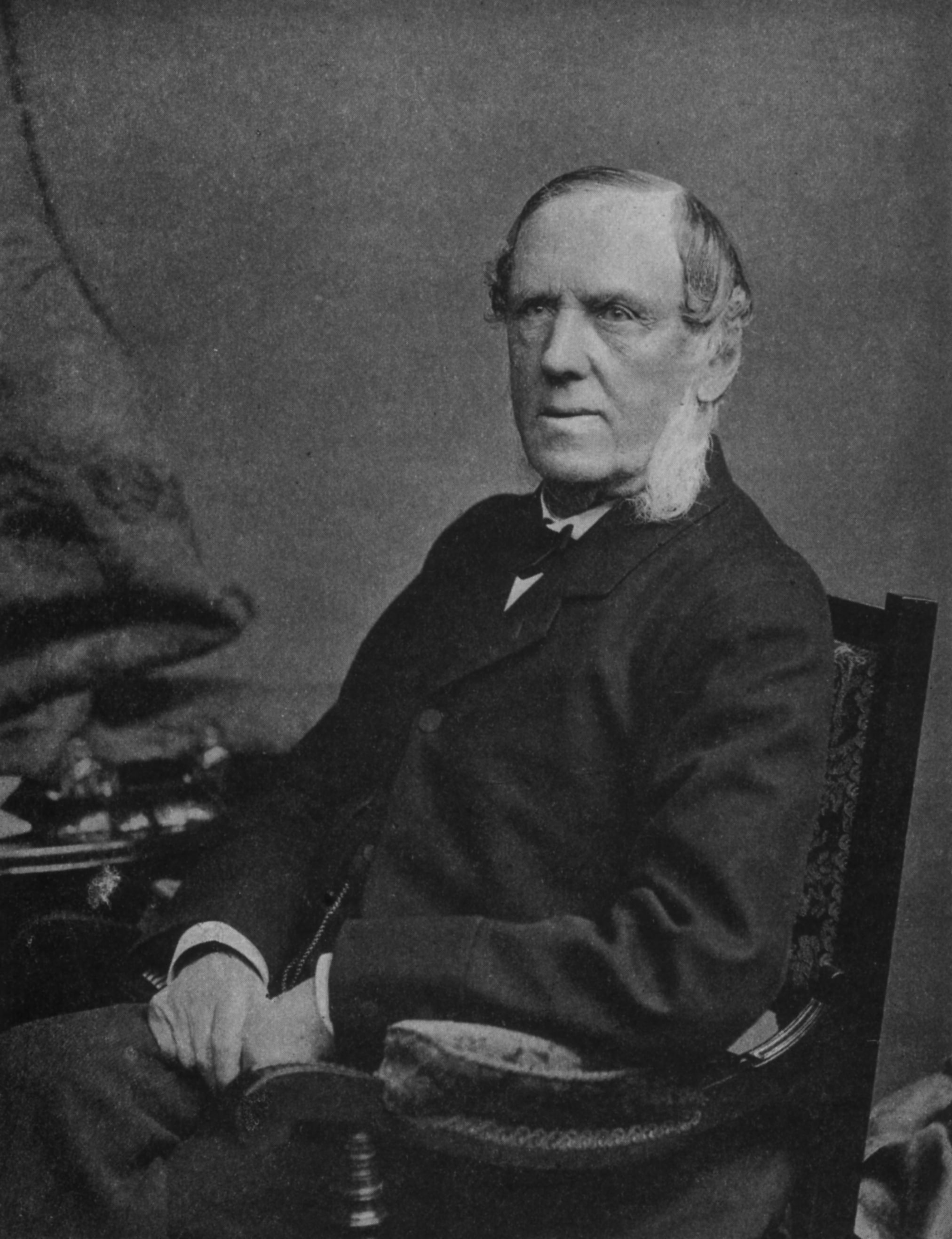
John Morris Jones Walkway () is a path on the River Cole in Hall Green, Birmingham, England (in an area once called Sarehole). It is part of the Shire Country Park The Shire Country Park () is a country park in the south of Birmingham, England, taking its name from Tolkien's The Shire. It consists of the Millstream Way following the course of the River Cole from Yardley Wood to Small Heath and includes .... John Morris Jones was a headmaster of George Dixon Junior School in west Birmingham from 1960 to 1980. He wrote extensively about the local history of the South Birmingham area, particularly Yardley, Hall Green and Sarehole. See also * ''Hall Green and Hereabout'', John Morris JONES, ed. Michael Byrne 1989,Birmingham Libraries Catalogue * '' Here and Then - The past of Our District'', John Morris JONES,Birmingham Libraries Catalogue External links Birmingham Grid for Learning - John Morris Jones Collection* ttp://www.birmingham.gov.uk/shirecountrypark Shire Count ... [...More Info...] [...Related Items...] OR: [Wikipedia] [Google] [Baidu] |
River Cole, West Midlands
The River Cole is a river in the English Midlands. It source (river), rises on the lower slopes of Forhill, one of the south-western ramparts of the Birmingham Plateau, at Red Hill and flows south before flowing largely north-east across the plateau to enter the River Blythe below Coleshill, near Ladywalk Reserve, Ladywalk, shortly before the Blythe meets the River Tame, West Midlands, Tame. This then joins the River Trent, Trent, whose waters reach the North Sea via the Humber, Humber Estuary. Its source is very near the main watershed of Midland England : tributaries are few and very short except in the lower reaches, so the Cole is only a small stream. Geology Average gradient of the central reaches is 10 1/2 feet in a mile. There is a fast run-off from the drift covered Keuper marl clay which makes up its catchment area, and heavy rain produces sudden floods; in the absence of replenishing side-streams these subside as quickly as they rise. The Cole is normally shallow, ... [...More Info...] [...Related Items...] OR: [Wikipedia] [Google] [Baidu] |
Hall Green
Hall Green is an area in southeast Birmingham, England, synonymous with the B28 postcode. It is also a council constituency, managed by its own district committee. Historically it lay within the county of Worcestershire. Politics Hall Green is part of the parliamentary constituency of Birmingham, Hall Green, which also includes the wards of Moseley and Kings Heath, Sparkbrook and Springfield; the Member of Parliament for the constituency is Tahir Ali, of the Labour Party. Hall Green ward is represented by three Labour councillors; Sam Burden (Hall Green's first elected Labour Councillor, elected in the 2011 May elections) with Barry Bowles (elected in May 2012) and is the Executive Member for Local Services Hall Green and Kerry Jenkins who was elected in May 2014 and is the Chair of the Hall Green Ward Committee. Demographics The 2001 Population Census found that there were 25,921 people living in Hall Green with a population density of 4,867 people per km2, this compares ... [...More Info...] [...Related Items...] OR: [Wikipedia] [Google] [Baidu] |
Birmingham
Birmingham ( ) is a city and metropolitan borough in the metropolitan county of West Midlands in England. It is the second-largest city in the United Kingdom with a population of 1.145 million in the city proper, 2.92 million in the West Midlands metropolitan county, and approximately 4.3 million in the wider metropolitan area. It is the largest UK metropolitan area outside of London. Birmingham is known as the second city of the United Kingdom. Located in the West Midlands region of England, approximately from London, Birmingham is considered to be the social, cultural, financial and commercial centre of the Midlands. Distinctively, Birmingham only has small rivers flowing through it, mainly the River Tame and its tributaries River Rea and River Cole – one of the closest main rivers is the Severn, approximately west of the city centre. Historically a market town in Warwickshire in the medieval period, Birmingham grew during the 18th century during the Midla ... [...More Info...] [...Related Items...] OR: [Wikipedia] [Google] [Baidu] |
England
England is a country that is part of the United Kingdom. It shares land borders with Wales to its west and Scotland to its north. The Irish Sea lies northwest and the Celtic Sea to the southwest. It is separated from continental Europe by the North Sea to the east and the English Channel to the south. The country covers five-eighths of the island of Great Britain, which lies in the North Atlantic, and includes over 100 smaller islands, such as the Isles of Scilly and the Isle of Wight. The area now called England was first inhabited by modern humans during the Upper Paleolithic period, but takes its name from the Angles, a Germanic tribe deriving its name from the Anglia peninsula, who settled during the 5th and 6th centuries. England became a unified state in the 10th century and has had a significant cultural and legal impact on the wider world since the Age of Discovery, which began during the 15th century. The English language, the Anglican Church, and Engli ... [...More Info...] [...Related Items...] OR: [Wikipedia] [Google] [Baidu] |
Sarehole
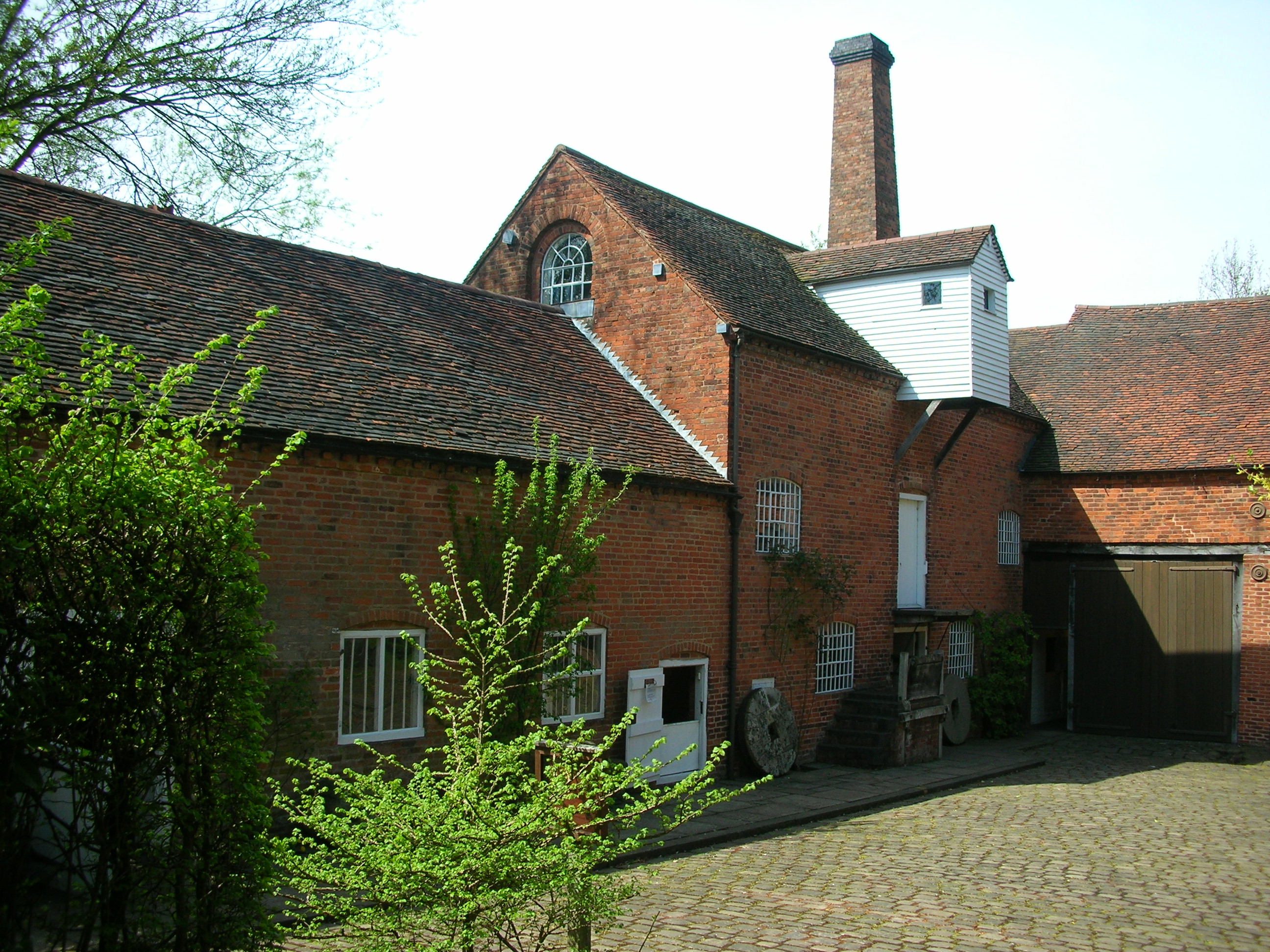
Sarehole () is an area in Hall Green, Birmingham, England. Historically in Worcestershire, it was a small hamlet in the larger parish, and manor, of Yardley, which was transferred to Birmingham in 1911. Birmingham was classed as part of Warwickshire until 1974, and since then has been part of the West Midlands. W. H. Duignan's ''Worcestershire Place Names'' conjectures that the name derives from Old English ''Syrfe'', "Service tree", and ''hyll'', "Hill". Sarehole gave its name to a farm (now built over) and a mill. It extended from the ford at Green Lane (now Green Road), southwards for about a mile, along the River Cole to the Dingles. Birmingham City Council has named the segment of the path along the Cole southwards from Sarehole Mill the '' John Morris Jones Walkway'' after a local historian. J. R. R. Tolkien lived here as a child in the 1890s. The area influenced his description of the green and peaceful country of the Shire in his books. The nearby Moseley Bog (now a ... [...More Info...] [...Related Items...] OR: [Wikipedia] [Google] [Baidu] |
Shire Country Park
The Shire Country Park () is a country park in the south of Birmingham, England, taking its name from Tolkien's The Shire. It consists of the Millstream Way following the course of the River Cole from Yardley Wood to Small Heath and includes the following sites: Scribers Lane SINC, Trittiford Mill Pool, The Dingles, Chinn Brook Recreation Ground, Sarehole Mill Recreation Ground, Moseley Bog LNR, Burbury Brickworks, The John Morris Jones Walkway and Cocksmoor BMX. History River Cole's race to Sarehole Mill formerly went under Brook Lane in a culvert, but this has been blocked and the line of the race is lost to northward. The spillway from race to river is seen to be still there, and the slots for the removable plank weir can be seen. The riverside walk continues as the John Morris Jones Walkway past the site of Robin Hood Lane ford, across Cotterills Meadow which has been Colebank Playing Field for the last ninety years until it reaches the Grade II Listed water mill, Sarehole ... [...More Info...] [...Related Items...] OR: [Wikipedia] [Google] [Baidu] |
George Dixon Academy
George Dixon Academy is a school in north Edgbaston, Birmingham, England. Former names include George Dixon Higher Grade School, George Dixon Grammar School, George Dixon Community School, George Dixon Grant Maintained School and George Dixon International School. The current headmaster is Tutvinder Mann. Former heads include Robert Dowling and Anthony Hamilton, a double gold medal paralympian. History George Dixon (1820–1898) was a councillor, mayor, and MP in Birmingham. One of his first actions after being elected mayor in 1866 was to hold a conference to discuss the lack of education for children. This led to the formation of the Birmingham Education Society in 1867, and the National Education League, which he chaired, in 1869. The League in turn was instrumental in the creation of the Elementary Education Act 1870 (Forster's Act), leading to the formation of the first school boards in England and Wales. In 1884, Dixon created Bridge Street Technical School. He bought ... [...More Info...] [...Related Items...] OR: [Wikipedia] [Google] [Baidu] |
Yardley, Birmingham
Yardley is an area in east Birmingham, England. It is also a council constituency, managed by its own district committee. Historically it lay within Worcestershire. Birmingham Yardley is a constituency and its Member of Parliament is Jess Phillips, elected in May 2015. The area of Gilbertstone straddles the border of Yardley and South Yardley. Features Yardley's main shopping area is known as Yew Tree, named after the yew that stood, originally to the south of the roundabout, outside what was then Boots, then on the roundabout at the junction in the centre of Yardley. It was damaged during work to the roundabout, and as a result was removed. It was later replaced by another tree located in the centre of the island. In 2012, the Swan Shopping Centre was opened in the area serving the Yardley area in the place of the old Swan Centre which used to hold markets. History Parish of Yardley Yardley is not a town. The ancient parish of Yardley included the areas known as Ste ... [...More Info...] [...Related Items...] OR: [Wikipedia] [Google] [Baidu] |


