|
Joggins Formation
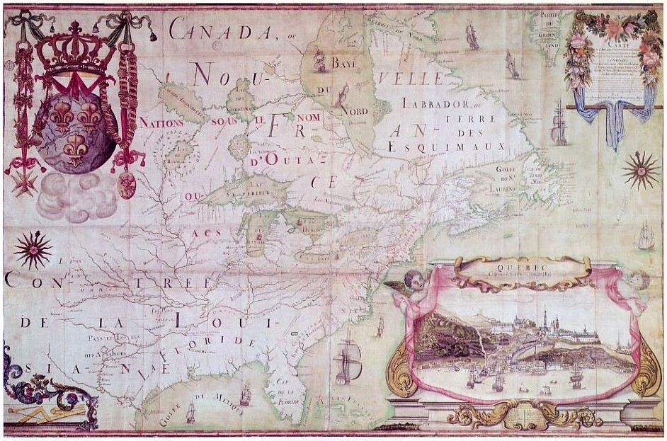
The Joggins Formation is a geologic formation in Nova Scotia. It preserves fossils dating back to the Carboniferous period, including ''Hylonomus'', the earliest known reptile. In addition to fossils, the Joggins Formation was a valuable source of coal from the 17th century until the mid-20th century. The Joggins Formation's spectacular coastal exposure, the Joggins Fossil Cliffs at Coal Mine Point, was named a UNESCO World Heritage Site in 2008. History Early mining Prior to European colonization, the Joggins Formation and surrounding territory was part of the Miꞌkmaꞌki, the traditional homeland of the Mi'kmaq nation. French colonization of the Bay of Fundy began in 1604. Acadian miners from Beaubassin were the first Europeans to mine the cliffs at Joggins, taking advantage of the deposits less than a decade after Jean-Baptiste-Louis Franquelin visited the site in 1686. Though Franquelin failed to make any mention of coal on his 1686 map, the document precisely det ... [...More Info...] [...Related Items...] OR: [Wikipedia] [Google] [Baidu] |
Formation (stratigraphy)
A geological formation, or simply formation, is a body of rock having a consistent set of physical characteristics (lithology) that distinguishes it from adjacent bodies of rock, and which occupies a particular position in the layers of rock exposed in a geographical region (the stratigraphic column). It is the fundamental unit of lithostratigraphy, the study of strata or rock layers. A formation must be large enough that it can be mapped at the surface or traced in the subsurface. Formations are otherwise not defined by the thickness (geology), thickness of their rock strata, which can vary widely. They are usually, but not universally, tabular in form. They may consist of a single lithology (rock type), or of alternating beds of two or more lithologies, or even a heterogeneous mixture of lithologies, so long as this distinguishes them from adjacent bodies of rock. The concept of a geologic formation goes back to the beginnings of modern scientific geology. The term was used by ... [...More Info...] [...Related Items...] OR: [Wikipedia] [Google] [Baidu] |
Period (geology)
The geologic time scale, or geological time scale, (GTS) is a representation of time based on the rock record of Earth. It is a system of chronological dating that uses chronostratigraphy (the process of relating strata to time) and geochronology (scientific branch of geology that aims to determine the age of rocks). It is used primarily by Earth scientists (including geologists, paleontologists, geophysicists, geochemists, and paleoclimatologists) to describe the timing and relationships of events in geologic history. The time scale has been developed through the study of rock layers and the observation of their relationships and identifying features such as lithologies, paleomagnetic properties, and fossils. The definition of standardized international units of geologic time is the responsibility of the International Commission on Stratigraphy (ICS), a constituent body of the International Union of Geological Sciences (IUGS), whose primary objective is to precisely define ... [...More Info...] [...Related Items...] OR: [Wikipedia] [Google] [Baidu] |
Chignecto Bay
Chignecto Bay (french: Baie de Chignectou) is an inlet of the Bay of Fundy located between the Canadian provinces of New Brunswick and Nova Scotia and separated from the waters of the Northumberland Strait by the Isthmus of Chignecto. It is a unit within the greater Gulf of Maine Watershed. Chignecto Bay forms the northeastern part of the Bay of Fundy which splits at Cape Chignecto and is delineated on the New Brunswick side by Martin Head. Chignecto bay was also the site of an unsuccessful railway and canal project of the 1880s and 1890s that would have intersected the landmass, thereby providing a transit passage between New England and Prince Edward Island. After several investigations into the feasibility of a new canal project, including most importantly by the Chignecto Canal Commission, the proposed Chignecto Canal was deemed commercially and economically unjustifiable and the project was abandoned. Some of the physical remnants of the 1880s project still continue to dot ... [...More Info...] [...Related Items...] OR: [Wikipedia] [Google] [Baidu] |
Jean-Baptiste-Louis Franquelin
Jean-Baptiste-Louis Franquelin (1650-c.1712) was a French trader who was appointed in the early 1670s as the first cartographer in '' Nouvelle France'' (Canada) by the colony's governor. He was appointed in 1688 as royal hydrographer by Louis XIV. Franquelin was born in the commune of Pallauau-sur-Indre in central France. He migrated to New France in 1671 where he was soon appointed as the colony's cartographer. He documented a decade of Louis Jolliet and René-Robert Cavelier de La Salle's explorations in North America. He also completed other projects for the Crown and served the king's military engineer. After returning to France in 1692, he never lived in Canada again. Biography Born at Saint-Michel de Villebernin, he grew up in the village in the small commune of Palluau-sur-Indre in central France. Having developed drawing and mapmaking skills, Franquelin migrated in 1671 from Indre department to ''Nouvelle France'' (Quebec) to work as a trader. New France Governor L ... [...More Info...] [...Related Items...] OR: [Wikipedia] [Google] [Baidu] |
Beaubassin
Beaubassin was an important Acadian village and trading centre on the Isthmus of Chignecto in what is now Nova Scotia, Canada. The area was a significant place in the geopolitical struggle between the British and French empires. It was established in the 1670s on an upland close to an extensive area of saltwater marsh. Settlers reclaimed the land to engage in cattle ranching and trade. French colony The settlement had strong ties with Port Royal, and Jacques Bourgeois, a farmer, shipbuilder, and merchant at sold a part of his holdings there to settle in the Chignecto Basin, where he built a flour-mill and a saw-mill. Around the same time Michel Leneuf de la Vallière de Beaubassin set up a fur-trading post on the isthmus, while devoting part of his time to the fishing, farming, settlement, and soldiering. Following success in the latter activity, in 1676 governor Frontenac granted him 100 square leagues land which became the Beaubassin seigneury. He established himself on a ... [...More Info...] [...Related Items...] OR: [Wikipedia] [Google] [Baidu] |
Acadia
Acadia (french: link=no, Acadie) was a colony of New France in northeastern North America which included parts of what are now the Maritime provinces, the Gaspé Peninsula and Maine to the Kennebec River. During much of the 17th and early 18th centuries, Norridgewock on the Kennebec River and Castine at the end of the Penobscot River were the southernmost settlements of Acadia. The French government specified land bordering the Atlantic coast, roughly between the 40th and 46th parallels. It was eventually divided into British colonies. The population of Acadia included the various indigenous First Nations that comprised the Wabanaki Confederacy, the Acadian people and other French settlers. The first capital of Acadia was established in 1605 as Port-Royal. An English force from Virginia attacked and burned down the town in 1613, but it was later rebuilt nearby, where it remained the longest-serving capital of French Acadia until the British siege of Port Royal in 17 ... [...More Info...] [...Related Items...] OR: [Wikipedia] [Google] [Baidu] |
Bay Of Fundy
The Bay of Fundy (french: Baie de Fundy) is a bay between the Canadian provinces of New Brunswick and Nova Scotia, with a small portion touching the U.S. state of Maine. It is an arm of the Gulf of Maine. Its extremely high tidal range is the highest in the world. The name is likely a corruption of the French word , meaning 'split'. Hydrology Tides The tidal range in the Bay of Fundy is about ; the average tidal range worldwide is only . Some tides are higher than others, depending on the position of the moon, the sun, and atmospheric conditions. Tides are semidiurnal, meaning they have two highs and two lows each day, with about six hours and 13 minutes between each high and low tide. Because of tidal resonance in the funnel-shaped bay, the tides that flow through the channel are very powerful. In one 12-hour tidal cycle, about 100 billion tons (110 billion short tons) of water flows in and out of the bay, which is twice as much as the combined total flow of all the rive ... [...More Info...] [...Related Items...] OR: [Wikipedia] [Google] [Baidu] |
Mi'kmaq
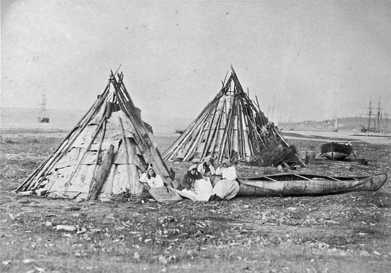
The Mi'kmaq (also ''Mi'gmaq'', ''Lnu'', ''Miꞌkmaw'' or ''Miꞌgmaw''; ; ) are a First Nations people of the Northeastern Woodlands, indigenous to the areas of Canada's Atlantic Provinces and the Gaspé Peninsula of Quebec as well as the northeastern region of Maine. The traditional national territory of the Mi'kmaq is named Miꞌkmaꞌki (or Miꞌgmaꞌgi). There are 170,000 Mi'kmaq people in the region, (including 18,044 members in the recently formed Qalipu First Nation in Newfoundland.) Nearly 11,000 members speak Miꞌkmaq, an Eastern Algonquian language. Once written in Miꞌkmaw hieroglyphic writing, it is now written using most letters of the Latin alphabet. The Mi'kmaq, Maliseet, and Pasamaquoddy nations signed a series of treaties known as the Covenant Chain of Peace and Friendship Treaties with the British Crown throughout the eighteenth century; the first was signed in 1725, and the last in 1779. The Miꞌkmaq maintain that they did not cede or give up their land t ... [...More Info...] [...Related Items...] OR: [Wikipedia] [Google] [Baidu] |
Miꞌkmaꞌki
Miꞌkmaꞌki or Miꞌgmaꞌgi is composed of the traditional and current territories, or country, of the Miꞌkmaq people, in what is now Nova Scotia, Canada. It is shared by an inter-Nation forum among Miꞌkmaq First Nations and is divided into seven geographical and traditional districts. Today ''Taqamkuk'' is separately represented as an eighth district. Miꞌkmaꞌki is one of the confederate nations within the Wabanaki. History Each district was autonomous, headed by a '' Sagamaw''. He would meet with Wampum readers and knowledge keepers called ''turkey keeper's'', a women's council, and the ''Kji Sagamaw'', or Grand Chief, to form the ''Santeꞌ' or ''Miꞌkmawey Mawioꞌmi (Grand Council). The seat of the Santeꞌ Mawioꞌmi is at Mniku in Unamaꞌkik. It still functions as the capital today in the Potlotek reserve. Following European contact, Miꞌkmaꞌki was colonized by the French and British in modern Nova Scotia, who made competing claims for the land. S ... [...More Info...] [...Related Items...] OR: [Wikipedia] [Google] [Baidu] |
Colonization
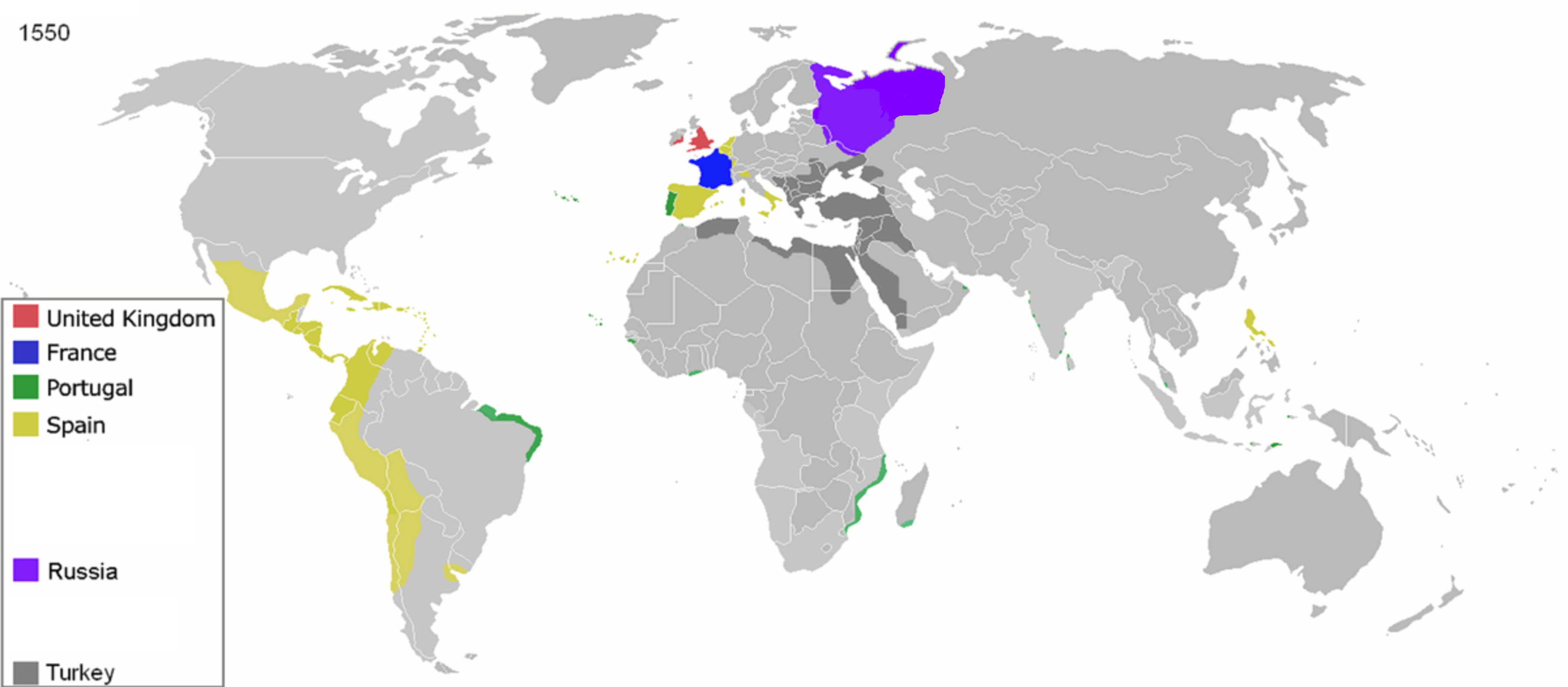
Colonization, or colonisation, constitutes large-scale population movements wherein migrants maintain strong links with their, or their ancestors', former country – by such links, gain advantage over other inhabitants of the territory. When colonization takes place under the protection of Colonialism, colonial structures, it may be termed settler colonialism. This often involves the settlers dispossessing Indigenous peoples, indigenous inhabitants, or instituting legal and other structures which disadvantage them. Colonization can be defined as a process of establishing foreign control over target territory, territories or people, peoples for the purpose of colonialism, cultivation, often by establishing Colony, colonies and possibly by settling them. In colonies established by Western European countries in the Americas, Australia, and New Zealand, settlers (supplemented by Central European, Eastern European, Asian, and African people) eventually formed a large majority of ... [...More Info...] [...Related Items...] OR: [Wikipedia] [Google] [Baidu] |
UNESCO
The United Nations Educational, Scientific and Cultural Organization is a specialized agency of the United Nations (UN) aimed at promoting world peace and security through international cooperation in education, arts, sciences and culture. It has 193 member states and 12 associate members, as well as partners in the non-governmental, intergovernmental and private sector. Headquartered at the World Heritage Centre in Paris, France, UNESCO has 53 regional field offices and 199 national commissions that facilitate its global mandate. UNESCO was founded in 1945 as the successor to the League of Nations's International Committee on Intellectual Cooperation.English summary). Its constitution establishes the agency's goals, governing structure, and operating framework. UNESCO's founding mission, which was shaped by the Second World War, is to advance peace, sustainable development and human rights by facilitating collaboration and dialogue among nations. It pursues this objective t ... [...More Info...] [...Related Items...] OR: [Wikipedia] [Google] [Baidu] |


