|
Jarvis Island
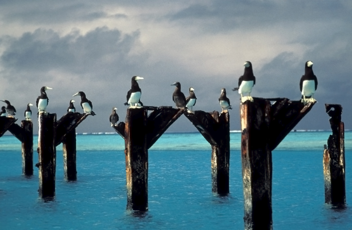
Jarvis Island (; formerly known as Bunker Island or Bunker's Shoal) is an uninhabited coral island located in the South Pacific Ocean, about halfway between Hawaii and the Cook Islands. It is an unincorporated, unorganized territory of the United States, administered by the United States Fish and Wildlife Service of the United States Department of the Interior as part of the National Wildlife Refuge system. Unlike most coral atolls, the lagoon on Jarvis is wholly dry. Jarvis is one of the Line Islands and for statistical purposes is also grouped as one of the United States Minor Outlying Islands. Jarvis Island is the largest of three U.S. equatorial possessions, which include Baker Island and Howland Island. Geography and ecology While a few offshore anchorage spots are marked on maps, Jarvis island has no ports or harbors, and swift currents are a hazard. There is a boat landing area in the middle of the western shoreline near a crumbling day beacon, and another near the sou ... [...More Info...] [...Related Items...] OR: [Wikipedia] [Google] [Baidu] |
United States Minor Outlying Islands
The United States Minor Outlying Islands is a statistical designation defined by the International Organization for Standardization's ISO 3166-1 code. The entry code is ISO 3166-2:UM. The minor outlying islands and groups of islands consist of eight United States insular areas in the Pacific Ocean (Baker Island, Howland Island, Jarvis Island, Johnston Atoll, Kingman Reef, Midway Atoll, Palmyra Atoll, and Wake Island) and one in the Caribbean Sea (Navassa Island). History In 1936, a colonization program began to settle Americans on Baker, Howland, and Jarvis, but all three islands were evacuated in 1942 as a result of World War II. ISO introduced the term "United States Minor Outlying Islands" in 1986. From 1974 until 1986, five of the islands (Baker Island, Howland Island, Jarvis Island, Palmyra Atoll, and Kingman Reef) were grouped under the term United States Miscellaneous Pacific Islands, with ISO 3166 code . The code of Midway Atoll was , the code of Johnston Atoll ... [...More Info...] [...Related Items...] OR: [Wikipedia] [Google] [Baidu] |
NASA
The National Aeronautics and Space Administration (NASA ) is an independent agency of the US federal government responsible for the civil space program, aeronautics research, and space research. NASA was established in 1958, succeeding the National Advisory Committee for Aeronautics (NACA), to give the U.S. space development effort a distinctly civilian orientation, emphasizing peaceful applications in space science. NASA has since led most American space exploration, including Project Mercury, Project Gemini, the 1968-1972 Apollo Moon landing missions, the Skylab space station, and the Space Shuttle. NASA supports the International Space Station and oversees the development of the Orion spacecraft and the Space Launch System for the crewed lunar Artemis program, Commercial Crew spacecraft, and the planned Lunar Gateway space station. The agency is also responsible for the Launch Services Program, which provides oversight of launch operations and countdown management f ... [...More Info...] [...Related Items...] OR: [Wikipedia] [Google] [Baidu] |
The World Factbook
''The World Factbook'', also known as the ''CIA World Factbook'', is a reference resource produced by the Central Intelligence Agency (CIA) with almanac-style information about the countries of the world. The official print version is available from the Government Publishing Office. The ''Factbook'' is available in the form of a website that is partially updated every week. It is also available for download for use off-line. It provides a two- to three-page summary of the demographics, geography, communications, government, economy, and military of each of 267 international entities including U.S.-recognized countries, dependencies, and other areas in the world. ''The World Factbook'' is prepared by the CIA for the use of U.S. government officials, and its style, format, coverage, and content are primarily designed to meet their requirements. However, it is frequently used as a resource for academic research papers and news articles. As a work of the U.S. government, it is i ... [...More Info...] [...Related Items...] OR: [Wikipedia] [Google] [Baidu] |
Kiritimati
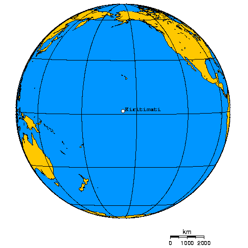
Kiritimati (also known as Christmas Island) is a Pacific Ocean atoll in the northern Line Islands. It is part of the Republic of Kiribati. The name is derived from the English word "Christmas" written in Gilbertese according to its phonology, in which the combination ''ti'' is pronounced ''s'', giving kiˈrɪsmæs. Kiritimati has the greatest land area of any atoll in the world, about ; its lagoon is roughly the same size. The atoll is about in perimeter, while the lagoon shoreline extends for over . Kiritimati comprises over 70% of the total land area of Kiribati, a country encompassing 33 Pacific atolls and islands. It lies north of the equator, south of Honolulu, and from San Francisco. Kiritimati is in the world's farthest forward time zone, UTC+14, and is therefore one of the first inhabited places on Earth to experience New Year's Day. (see also Caroline Atoll, Kiribati). Although it lies east of the 180th meridian, the Republic of Kiribati realigned the Internati ... [...More Info...] [...Related Items...] OR: [Wikipedia] [Google] [Baidu] |
Topographic Isolation
The topographic isolation of a summit is the minimum distance to a point of equal elevation, representing a radius of dominance in which the peak is the highest point. It can be calculated for small hills and islands as well as for major mountain peaks and can even be calculated for submarine summits. Isolation table The following sortable table lists Earth's 40 most topographically isolated summits. Examples *The nearest peak to Germany's highest mountain, the 2,962-metre-high Zugspitze, that has a 2962-metre-contour is the Zwölferkogel (2,988 m) in Austria's Stubai Alps. The distance between the Zugspitze and this contour is 25.8 km; the Zugspitze is thus the highest peak for a radius of 25.8 km around. Its isolation is thus 25.8 km. *Because there are no higher mountains than Mount Everest, it has no definitive isolation. Many sources list its isolation as the circumference of the earth over the poles or – questionably, because there is no agreed def ... [...More Info...] [...Related Items...] OR: [Wikipedia] [Google] [Baidu] |
Habitat
In ecology, the term habitat summarises the array of resources, physical and biotic factors that are present in an area, such as to support the survival and reproduction of a particular species. A species habitat can be seen as the physical manifestation of its ecological niche. Thus "habitat" is a species-specific term, fundamentally different from concepts such as environment or vegetation assemblages, for which the term "habitat-type" is more appropriate. The physical factors may include (for example): soil, moisture, range of temperature, and light intensity. Biotic factors will include the availability of food and the presence or absence of predators. Every species has particular habitat requirements, with habitat generalist species able to thrive in a wide array of environmental conditions while habitat specialist species requiring a very limited set of factors to survive. The habitat of a species is not necessarily found in a geographical area, it can be the interior ... [...More Info...] [...Related Items...] OR: [Wikipedia] [Google] [Baidu] |
Vine
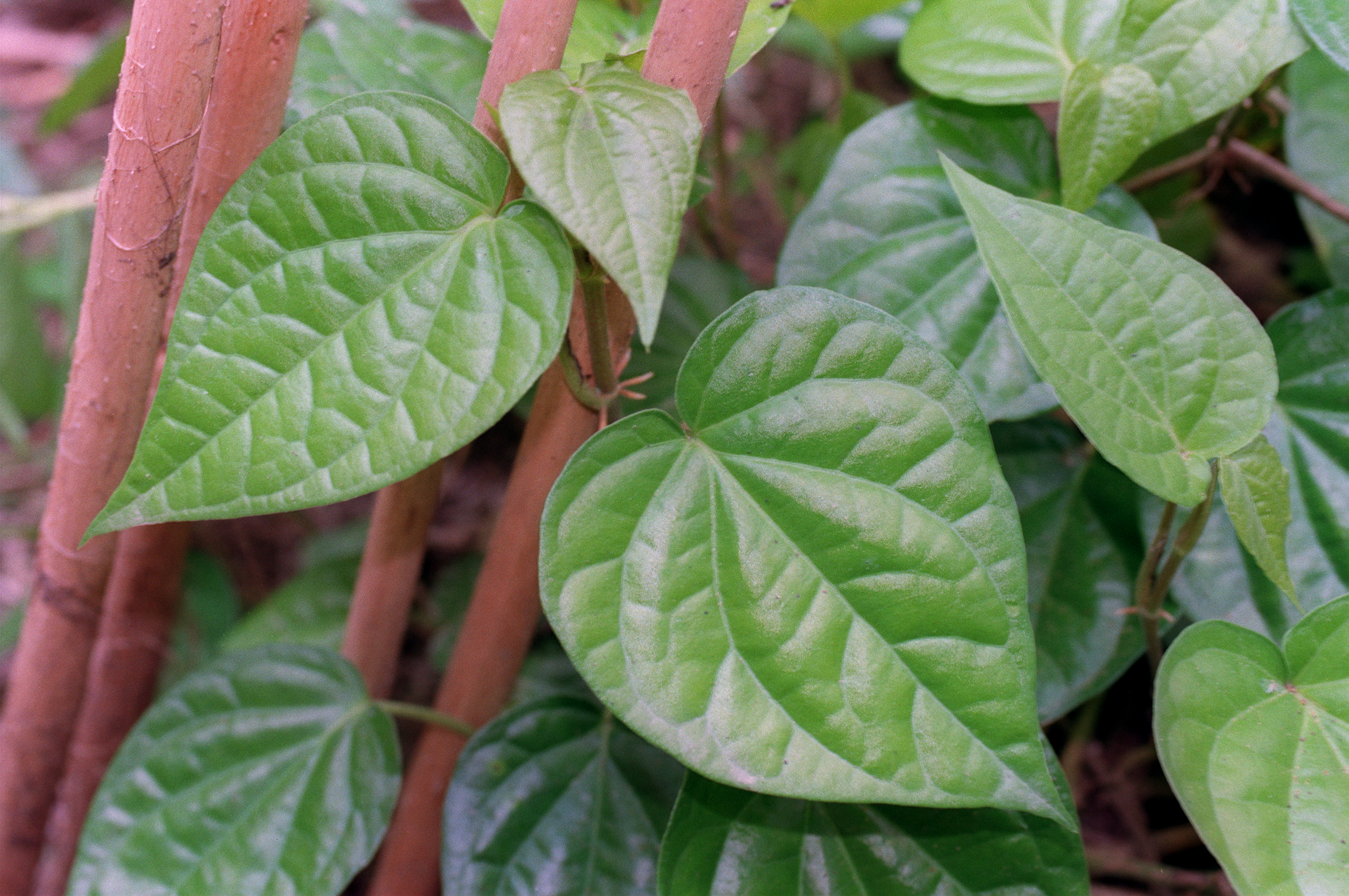
A vine (Latin ''vīnea'' "grapevine", "vineyard", from ''vīnum'' "wine") is any plant with a growth habit of trailing or scandent (that is, climbing) stems, lianas or runners. The word ''vine'' can also refer to such stems or runners themselves, for instance, when used in wicker work.Jackson; Benjamin; Daydon (1928). ''A Glossary of Botanic Terms with their Derivation and Accent'', 4th ed. London: Gerald Duckworth & Co. In parts of the world, including the British Isles, the term "vine" usually applies exclusively to grapevines (''Vitis''), while the term "climber" is used for all climbing plants. Growth forms Certain plants always grow as vines, while a few grow as vines only part of the time. For instance, poison ivy and bittersweet can grow as low shrubs when support is not available, but will become vines when support is available. A vine displays a growth form based on very long stems. This has two purposes. A vine may use rock exposures, other plants, or other ... [...More Info...] [...Related Items...] OR: [Wikipedia] [Google] [Baidu] |
Bunch Grass
Tussock grasses or bunch grasses are a group of grass species in the family Poaceae. They usually grow as singular plants in clumps, tufts, hummocks, or bunches, rather than forming a sod or lawn, in meadows, grasslands, and prairies. As perennial plants, most species live more than one season. Tussock grasses are often found as forage in pastures and ornamental grasses in gardens. Many species have long roots that may reach or more into the soil, which can aid slope stabilization, erosion control, and soil porosity for precipitation absorption. Also, their roots can reach moisture more deeply than other grasses and annual plants during seasonal or climatic droughts. The plants provide habitat and food for insects (including Lepidoptera), birds, small animals and larger herbivores, and support beneficial soil mycorrhiza. The leaves supply material, such as for basket weaving, for indigenous peoples and contemporary artists. Tussock and bunch grasses occur in almost any habitat w ... [...More Info...] [...Related Items...] OR: [Wikipedia] [Google] [Baidu] |
Rainfall
Rain is water droplets that have condensed from atmospheric water vapor and then fall under gravity. Rain is a major component of the water cycle and is responsible for depositing most of the fresh water on the Earth. It provides water for hydroelectric power plants, crop irrigation, and suitable conditions for many types of ecosystems. The major cause of rain production is moisture moving along three-dimensional zones of temperature and moisture contrasts known as weather fronts. If enough moisture and upward motion is present, precipitation falls from convective clouds (those with strong upward vertical motion) such as cumulonimbus (thunder clouds) which can organize into narrow rainbands. In mountainous areas, heavy precipitation is possible where upslope flow is maximized within windward sides of the terrain at elevation which forces moist air to condense and fall out as rainfall along the sides of mountains. On the leeward side of mountains, desert climates can exi ... [...More Info...] [...Related Items...] OR: [Wikipedia] [Google] [Baidu] |
Lens (hydrology)
In hydrology, a lens, also called freshwater lens or Ghyben-Herzberg lens, is a convex-shaped layer of fresh groundwater that floats above the denser saltwater and is usually found on small coral or limestone islands and atolls. This aquifer of fresh water is recharged through precipitation that infiltrates the top layer of soil and percolates downward until it reaches the saturated zone. The recharge rate of the lens can be summarized by the following equation: R = p-ET Where R is the recharge rate in meters, p is precipitation (m), and ET is evapotranspiration (m) of water. With higher amounts of recharge, the hydraulic head is increased, and a thick freshwater lens is maintained through the dry season. Lower rates of precipitation or higher rates of interception and evapotranspiration will decrease the hydraulic head, resulting in a thin lens.Bailey, Ryan T., John W. Jenson, and Arne E. Olsen. ''An atoll freshwater lens algebraic model for groundwater management in the ... [...More Info...] [...Related Items...] OR: [Wikipedia] [Google] [Baidu] |
Equator
The equator is a circle of latitude, about in circumference, that divides Earth into the Northern and Southern hemispheres. It is an imaginary line located at 0 degrees latitude, halfway between the North and South poles. The term can also be used for any other celestial body that is roughly spherical. In spatial (3D) geometry, as applied in astronomy, the equator of a rotating spheroid (such as a planet) is the parallel (circle of latitude) at which latitude is defined to be 0°. It is an imaginary line on the spheroid, equidistant from its poles, dividing it into northern and southern hemispheres. In other words, it is the intersection of the spheroid with the plane perpendicular to its axis of rotation and midway between its geographical poles. On and near the equator (on Earth), noontime sunlight appears almost directly overhead (no more than about 23° from the zenith) every day, year-round. Consequently, the equator has a rather stable daytime temperature throug ... [...More Info...] [...Related Items...] OR: [Wikipedia] [Google] [Baidu] |
American Samoa
American Samoa ( sm, Amerika Sāmoa, ; also ' or ') is an unincorporated territory of the United States located in the South Pacific Ocean, southeast of the island country of Samoa. Its location is centered on . It is east of the International Date Line, while Samoa is west of the Line. The total land area is , slightly more than Washington, D.C. American Samoa is the southernmost territory of the United States and one of two U.S. territories south of the Equator, along with the uninhabited Jarvis Island. Tuna products are the main exports, and the main trading partner is the rest of the United States. American Samoa consists of five main islands and two coral atolls. The largest and most populous island is Tutuila, with the Manuʻa Islands, Rose Atoll and Swains Island also included in the territory. All islands except for Swains Island are part of the Samoan Islands, west of the Cook Islands, north of Tonga, and some south of Tokelau. To the west are the islands of the Wall ... [...More Info...] [...Related Items...] OR: [Wikipedia] [Google] [Baidu] |


