|
Japan National Route 382
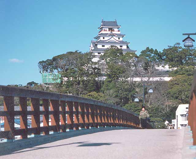
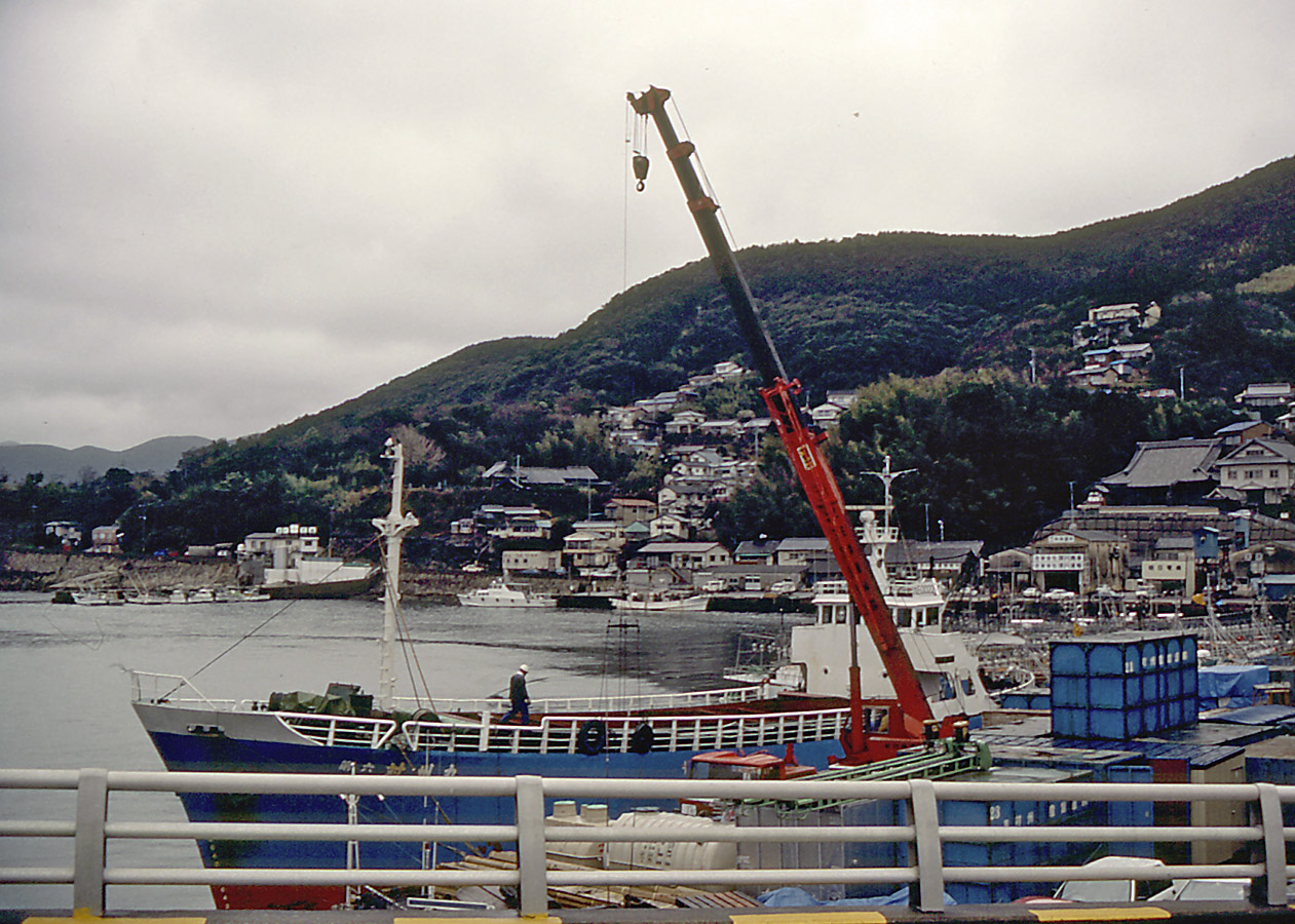
National Route 382 is a National highways of Japan, national highway of Japan connecting Tsushima, Nagasaki and Karatsu, Saga in Japan, with a total length of 125.2 km (77.8 mi). The highway includes segments on the islands of Tsushima Island, Tsushima and Iki Island, Iki, as well on Kyushu. File:R382 yobuko.JPG, Route 382 in Yobuko, Saga, Yobuko, Saga Prefecture. References National highways in Japan with maritime sections, 382 Roads in Nagasaki Prefecture Roads in Saga Prefecture {{Japan-road-stub ... [...More Info...] [...Related Items...] OR: [Wikipedia] [Google] [Baidu] |
National Highways Of Japan
Japan has a nationwide system of distinct from the expressways. The Ministry of Land, Infrastructure, Transport and Tourism and other government agencies administer the national highways. Beginning in 1952, Japan classified these as Class 1 or Class 2. Class 1 highways had one- or two-digit numbers, while Class 2 highways had three-digit numbers. For example, routes 1 and 57 were Class 1 highways while 507 (the one with the highest number) was a Class 2 highway. A 1964 amendment to the governing law resulted in a unification of the classes, which took effect in April of the following year. Highways numbered since that time have had three-digit numbers, so the numbers 58–100, which had so far been unused, remained unused. However, when Okinawa Prefecture reverted to Japanese control in 1972, Route 58, with its southern endpoint in Okinawa's capital city of Naha, was established. The numbers from 59 to 100 remain unused. Some other numbers have been vacated by the joining or ... [...More Info...] [...Related Items...] OR: [Wikipedia] [Google] [Baidu] |
Japan
Japan ( ja, 日本, or , and formally , ''Nihonkoku'') is an island country in East Asia. It is situated in the northwest Pacific Ocean, and is bordered on the west by the Sea of Japan, while extending from the Sea of Okhotsk in the north toward the East China Sea, Philippine Sea, and Taiwan in the south. Japan is a part of the Ring of Fire, and spans Japanese archipelago, an archipelago of List of islands of Japan, 6852 islands covering ; the five main islands are Hokkaido, Honshu (the "mainland"), Shikoku, Kyushu, and Okinawa Island, Okinawa. Tokyo is the Capital of Japan, nation's capital and largest city, followed by Yokohama, Osaka, Nagoya, Sapporo, Fukuoka, Kobe, and Kyoto. Japan is the List of countries and dependencies by population, eleventh most populous country in the world, as well as one of the List of countries and dependencies by population density, most densely populated and Urbanization by country, urbanized. About three-fourths of Geography of Japan, the c ... [...More Info...] [...Related Items...] OR: [Wikipedia] [Google] [Baidu] |
Tsushima, Nagasaki
is an island city grouped in Nagasaki Prefecture, Japan. It is the only city of Tsushima Subprefecture and it encompasses all of Tsushima Island Archipelago, which lies in the Tsushima Strait north of Nagasaki on the western side of Kyushu, the southernmost mainland island of Japan. As of March 2017, the city has an estimated population of 31,550 and a population density of 45 persons per km2. Its total area is 708.61 km2, 17.3% of the area of Nagasaki Prefecture. History An Imperial decree in July 1899 established Izuhara, Sasuna, and Shishimi as open ports for trading with the United States and the United Kingdom. On April 1, 1975, Toyotama Village was promoted to the status of a town. Mine Village was also elevated to the status of a town in the following year. The modern city of Tsushima was established on March 1, 2004, from the merger of six towns on Tsushima Island: Izuhara, Mitsushima, and Toyotama (all from Shimoagata District), and Mine, Kamiagata, and Kamitsus ... [...More Info...] [...Related Items...] OR: [Wikipedia] [Google] [Baidu] |
Karatsu, Saga
is a city located in Saga Prefecture on the island of Kyushu, Japan. Its name, formed from the Japanese word roots 唐 ''kara'' (China, or continental East Asia in general), and 津 ''tsu'' (port), signifies its historical importance as an ancient trading port between Japan with China and Korea. The central area of Karatsu, which does not include the former cities and villages of Higashimatsuura District, has a population of 78,386. As of January 1, 2020, the city had an estimated population of 117,663 and a population density of 241 persons per km2. The total area is 487.59 km2. On January 1, 2005, the towns of Chinzei, Hamatama, Hizen, Kyūragi, Ōchi, Yobuko and the village of Kitahata (all from Higashimatsuura District) were merged into Karatsu. On January 1, 2006, the village of Nanayama (from Higashimatsuura District) was merged into Karatsu. Geography Due to its proximity to mainland Asia, Karatsu has long been known as a stopover to Korea and China. ... [...More Info...] [...Related Items...] OR: [Wikipedia] [Google] [Baidu] |
Tsushima Island
is an island of the Japanese archipelago situated in-between the Tsushima Strait and Korea Strait, approximately halfway between Kyushu and the Korean Peninsula. The main island of Tsushima, once a single island, was divided into two in 1671 by the Ōfunakoshiseto canal and into three in 1900 by the Manzekiseto canal. These canals were driven through isthmuses in the center of the island, forming "North Tsushima Island" (Kamino-shima) and "South Tsushima Island" ( Shimono-shima). Tsushima also incorporates over 100 smaller islands, many tiny. The name ''Tsushima'' generally refers to all the islands of the Tsushima archipelago collectively. Administratively, Tsushima Island is in Nagasaki Prefecture. The island group measures about by and had a population of about 34,000 . The main islands (that is, the "North" and "South" islands, and the thin island that connects them) are the largest coherent satellite island group of Nagasaki Prefecture and the eighth-largest in Japan. T ... [...More Info...] [...Related Items...] OR: [Wikipedia] [Google] [Baidu] |
Iki Island
, or the , is an archipelago in the Tsushima Strait, which is administered as the city of Iki in Nagasaki Prefecture, Japan. The islands have a total area of with a total population of 28,008. Only four (4) of the twenty-three (23) named islands are permanently inhabited. Together with the neighboring islands of Tsushima, they are collectively within the borders of the Iki–Tsushima Quasi-National Park. Geology The Iki Islands are volcanic in origin: they are the exposed and eroded basaltic summit of a massive Quaternary stratovolcano last active over 400,000 years ago. Iki Island is slightly oval in shape, and measures approximately from north-south and from east-west. The highest elevation is , a weakly curved peak with a highest elevation at above sea level. The average height of the land surface is 100 meters above sea level. The archipelago is approximately north-northeast of the Kyushu coast at its closest point and southeast of the Tsushima Islands. History The Ik ... [...More Info...] [...Related Items...] OR: [Wikipedia] [Google] [Baidu] |
Kyushu
is the third-largest island of Japan's five main islands and the most southerly of the four largest islands ( i.e. excluding Okinawa). In the past, it has been known as , and . The historical regional name referred to Kyushu and its surrounding islands. Kyushu has a land area of and a population of 14,311,224 in 2018. In the 8th-century Taihō Code reforms, Dazaifu was established as a special administrative term for the region. Geography The island is mountainous, and Japan's most active volcano, Mount Aso at , is on Kyushu. There are many other signs of tectonic activity, including numerous areas of hot springs. The most famous of these are in Beppu, on the east shore, and around Mt. Aso in central Kyushu. The island is separated from Honshu by the Kanmon Straits. Being the nearest island to the Asian continent, historically it is the gateway to Japan. The total area is which makes it the 37th largest island in the world. It's slightly larger than Taiwan island . ... [...More Info...] [...Related Items...] OR: [Wikipedia] [Google] [Baidu] |
Yobuko, Saga
was a town located in the Higashimatsuura District of Saga Prefecture, Japan. As of 2003, the town had an estimated population of 5,895 and a density of 809.75 persons per km². The total area was 7.28 km². On January 1, 2005, Yobuko, along with the towns of Chinzei, Hamatama, Hizen, Kyūragi and Ōchi, and the village of Kitahata (all from Higashimatsuura District), was merged into the expanded city of Karatsu. Yobuko is famed for its fresh squid, ika (烏賊) in Japanese, which is offered sashimi is a Japanese delicacy consisting of fresh raw fish or meat sliced into thin pieces and often eaten with soy sauce. Origin The word ''sashimi'' means "pierced body", i.e. "刺身" = ''sashimi'', where 刺 し = ''sashi'' (pierced, stuck) ... style, or it can be eaten while the squid is still alive. Yobuko also attracts local tourists, who come to see the Yobuko Big Bridge (呼子大橋). Yobuko has a festival known as Yobuko Ouzunabi (呼子大綱引), or the Yobuko ... [...More Info...] [...Related Items...] OR: [Wikipedia] [Google] [Baidu] |
Saga Prefecture
is a prefecture of Japan located on the island of Kyushu. Saga Prefecture has a population of 809,248 (1 August 2020) and has a geographic area of 2,440 km2 (942 sq mi). Saga Prefecture borders Fukuoka Prefecture to the northeast and Nagasaki Prefecture to the southwest. Saga is the capital and largest city of Saga Prefecture, with other major cities including Karatsu, Tosu, and Imari. Saga Prefecture is located in the northwest of Kyūshū covering an isthmus-like area extending between the Sea of Japan and the Ariake Sea. Saga Prefecture's western region is known for the production of ceramics and porcelain, particularly in the towns of Karatsu, Imari, and Arita. History In ancient times, the area composed by Nagasaki Prefecture and Saga Prefecture was called Hizen Province. The current name dates from the Meiji Restoration. Rice farming culture has prospered here since ancient times, and vestiges can be seen at the ruins of Nabatake in Karatsu and the Yoshinogari sit ... [...More Info...] [...Related Items...] OR: [Wikipedia] [Google] [Baidu] |
National Highways In Japan With Maritime Sections
National may refer to: Common uses * Nation or country ** Nationality – a ''national'' is a person who is subject to a nation, regardless of whether the person has full rights as a citizen Places in the United States * National, Maryland, census-designated place * National, Nevada, ghost town * National, Utah, ghost town * National, West Virginia, unincorporated community Commerce * National (brand), a brand name of electronic goods from Panasonic * National Benzole (or simply known as National), former petrol station chain in the UK, merged with BP * National Car Rental, an American rental car company * National Energy Systems, a former name of Eco Marine Power * National Entertainment Commission, a former name of the Media Rating Council * National Motor Vehicle Company, Indianapolis, Indiana, USA 1900-1924 * National Supermarkets, a defunct American grocery store chain * National String Instrument Corporation, a guitar company formed to manufacture the first resonator g ... [...More Info...] [...Related Items...] OR: [Wikipedia] [Google] [Baidu] |
Roads In Nagasaki Prefecture
A road is a linear way for the conveyance of traffic that mostly has an improved surface for use by vehicles (motorized and non-motorized) and pedestrians. Unlike streets, the main function of roads is transportation. There are many types of roads, including parkways, avenues, controlled-access highways (freeways, motorways, and expressways), tollways, interstates, highways, thoroughfares, and local roads. The primary features of roads include lanes, sidewalks (pavement), roadways (carriageways), medians, shoulders, verges, bike paths (cycle paths), and shared-use paths. Definitions Historically many roads were simply recognizable routes without any formal construction or some maintenance. The Organization for Economic Co-operation and Development (OECD) defines a road as "a line of communication (travelled way) using a stabilized base other than rails or air strips open to public traffic, primarily for the use of road motor vehicles running on their own wheels", ... [...More Info...] [...Related Items...] OR: [Wikipedia] [Google] [Baidu] |


