|
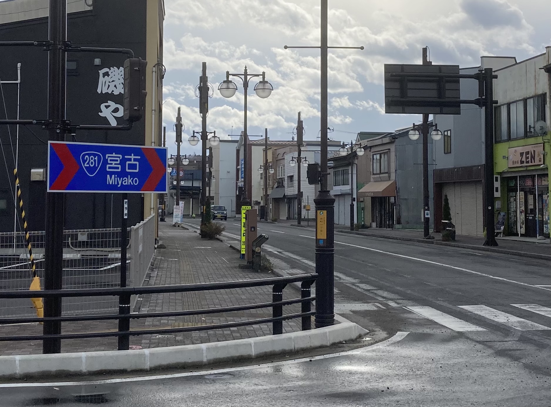
Japan National Route 281
is a national highway of Japan that traverses the prefecture of Iwate in a southwest–northeast routing. It connects the prefecture's capital city, Morioka to the coastal city of Kuji. It has a total length of . Route description National Route 281 crosses Iwate Prefecture in a southwest–northeast routing. Beginning at a junction with national routes 4 and 282 in the prefecture's capital city, Morioka, it travels north alongside the two routes out of Morioka. In the city of Takizawa, National Route 282 leaves the concurrency near Takizawa Interchange on the Tōhoku Expressway. The concurrency of national routes 4 and 281 continues northeast, briefly crossing back in to Morioka, before entering the town of Iwate. In Iwate, National Route 281 leaves National Route 4, traveling east across the Kitakami Mountains towards the coastal city of Kuji. In the mountains, it passes through the town of Kuzumaki where it briefly has a concurrency with National Route 340. Upon c ... [...More Info...] [...Related Items...] OR: [Wikipedia] [Google] [Baidu] |
Morioka
is the capital city of Iwate Prefecture located in the Tōhoku region of northern Japan. On 1 February 2021, the city had an estimated population of 290,700 in 132,719 households, and a population density of . The total area of the city is . Geography Morioka is located in the in central Iwate Prefecture, at the confluence of three rivers, the Kitakami, the Shizukuishi and the Nakatsu. The Kitakami River is the second largest river on the Pacific side of Japan (after the Tone River) and the longest in the Tōhoku region. It runs through the city from north to south and has a number of dams within the city boundaries, including the Shijūshida Dam and Gandō Dam. An active volcano, Mount Iwate, dominates the view to the northwest of the city. Mount Himekami is to the north and Mount Hayachine can sometimes be seen to the southeast. Surrounding municipalities Iwate Prefecture *Hanamaki * Hachimantai * Takizawa * Miyako *Shizukuishi * Kuzumaki * Shiwa *Yahaba * Iwaizumi Demo ... [...More Info...] [...Related Items...] OR: [Wikipedia] [Google] [Baidu] |
Ministry Of Land, Infrastructure, Transport And Tourism
The , abbreviated MLIT, is a ministry of the Japanese government.国土交通省設置法 , Ministry of Internal Affairs and Communications. It is responsible for one-third of all the laws and orders in Japan, and is the largest Japanese ministry in terms of employees, as well as the second-largest executive agency of the Japanese government after the Ministry of Defense (Japan), Ministry of Defense. The ministry oversees four external agencies including the Japan Coast Guard and the Japan Tourism Agency. Overview In order to accomplish the tasks set forth in Article 3 of the Ministry of Land, Infrastructure, Transport and Tourism Act, the following should be considered: national land planning, cities, roads, buildings, houses, rivers, ports, government maintenance, national land surveying, transp ...[...More Info...] [...Related Items...] OR: [Wikipedia] [Google] [Baidu] |
Iwate-Numakunai Station
is a junction railway station in the town of Iwate, Iwate, Japan, operated by JR East for the Tohoku Shinkansen and the third-sector railway operator Iwate Ginga Railway Company for local services. Lines Iwate-Numakunai Station is served by both the Tohoku Shinkansen and the Iwate Ginga Railway Line. It is located 32.0 rail kilometers from the terminus of the Iwate Ginga Railway Line at Morioka Station and 566.2 rail kilometers from Tokyo Station by the Tōhoku Shinkansen. Station layout The JR East Iwate-Numakunai Station has a four-story station building, with two elevated opposed side platforms on the fourth floor. The platforms have chest-high platform edge doors. The station has a ''Midori no Madoguchi'' staffed ticket office. The adjacent Iwate Ginga Railway Station has a ground level island platform and a single side platform connected to the three-story station building by an overhead crossing. The station is staffed. Platforms Connecting bus routes * ... [...More Info...] [...Related Items...] OR: [Wikipedia] [Google] [Baidu] |
Iwate-Kawaguchi Station
is a railway station on the Iwate Ginga Railway Line in the town of Iwate, Iwate Prefecture, Japan, operated by the Iwate Ginga Railway. Lines Iwate-Kawaguchi Station is served by the Iwate Ginga Railway Line, and is located 26.9 kilometers from the terminus of the line at Morioka Station and 562.2 kilometers from Tokyo Station. Station layout Iwate-Kawaguchi Station has an island platform and a single side platform connected to the station building by a footbridge. The station is staffed. Platforms Adjacent stations History Iwate-Kawaguchi Station was opened as on 11 January 1898. It was renamed to its present name on 1 February 1934. The station was absorbed into the JR East The is a major passenger railway company in Japan and is the largest of the seven Japan Railways Group companies. The company name is officially abbreviated as JR-EAST or JR East in English, and as in Japanese. The company's headquarters are ... network upon the privati ... [...More Info...] [...Related Items...] OR: [Wikipedia] [Google] [Baidu] |
Iwaizumi, Iwate
is a town located in Iwate Prefecture, Japan. , the town had an estimated population of 8,987, and a population density of 9.1 persons per km² in 4366 households. The total area of the town is . Geography Iwaizumi is in the Kitakami Mountains of northeast Iwate prefecture, east of the prefectural capital of Morioka. It has a small coastline on the Pacific Ocean to the east. The area has numerous limestone caves, including the Ryūsendō. Neighboring municipalities Iwate Prefecture *Morioka *Kuji * Miyako * Fudai * Tanohata * Kuzumaki *Noda Climate Iwaizumi has a humid climate (Köppen climate classification ''Cfa'') characterized by mild summers and cold winters with heavy snowfall. The average annual temperature in Iwaizumi is 9.5 °C. The average annual rainfall is 1283 mm with September as the wettest month and February as the driest month. The temperatures are highest on average in August, at around 22.3 °C, and lowest in January, at around −2.0 ... [...More Info...] [...Related Items...] OR: [Wikipedia] [Google] [Baidu] |
Aomori
is the capital city of Aomori Prefecture, in the Tōhoku region of Japan. , the city had an estimated population of 278,964 in 136,457 households, and a population density of 340 people per square kilometer spread over the city's total area of . Aomori is one of Japan's 60 core cities and the core of the Aomori metropolitan area. History ''Aomori'' literally means blue forest, although it could possibly be translated as "green forest". The name is generally considered to refer to a small forest on a hill which existed near the town. This forest was often used by fishermen as a landmark. A different theory suggests the name might have been derived from the Ainu language. The area has been settled extensively since prehistoric times, and numerous Jōmon period sites have been found by archaeologists, the most famous being the Sannai-Maruyama Site located just southwest of the city center dating to 5500–4000 BC, and the Komakino Site slightly farther south dating to arou ... [...More Info...] [...Related Items...] OR: [Wikipedia] [Google] [Baidu] |
Tokyo
Tokyo (; ja, 東京, , ), officially the Tokyo Metropolis ( ja, 東京都, label=none, ), is the capital and largest city of Japan. Formerly known as Edo, its metropolitan area () is the most populous in the world, with an estimated 37.468 million residents ; the city proper has a population of 13.99 million people. Located at the head of Tokyo Bay, the prefecture forms part of the Kantō region on the central coast of Honshu, Japan's largest island. Tokyo serves as Japan's economic center and is the seat of both the Japanese government and the Emperor of Japan. Originally a fishing village named Edo, the city became politically prominent in 1603, when it became the seat of the Tokugawa shogunate. By the mid-18th century, Edo was one of the most populous cities in the world with a population of over one million people. Following the Meiji Restoration of 1868, the imperial capital in Kyoto was moved to Edo, which was renamed "Tokyo" (). Tokyo was devastate ... [...More Info...] [...Related Items...] OR: [Wikipedia] [Google] [Baidu] |
Hachinohe Expressway
The is a 4-laned national expressway in the prefectures of Iwate and Aomori in the Tōhoku region of Japan. It is a spur of the Tōhoku Expressway, primarily serving the city of Hachinohe. Signed as E4A, it is owned and operated by East Nippon Expressway Company. Route description The expressway is officially referred to as the Tōhoku Jūkan Expressway Hachinohe Route. The route connects the city of Hachinohe with the Tōhoku Expressway in Iwate Prefecture. From the terminus at Hachinohe-kita Interchange, there are plans to extend the route northward to the terminus of the Aomori Expressway through a series of toll roads. History The Hachinohe Expressway was opened on November 27, 1986, with the Momoishi Extension to the Second Michinoku Toll Road opening later in 1995. After the Great East Japan Earthquake the expressway was made free to use temporarily for those who were impacted by the disaster. Tolls resumed in March 2012. Future Starting at the Momoishi Road Extension, ... [...More Info...] [...Related Items...] OR: [Wikipedia] [Google] [Baidu] |
E4A Expressway (Japan)
The E4A was an intelligence-gathering unit within 'E' Department of the Royal Ulster Constabulary, probably established in 1978. It was primarily made up of police officers who conducted surveillance to be acted on by RUC Special Branch (E4C). E4A was supported by the Headquarters Mobile Support Unit (now part of Special Operations Branch) and targeted paramilitary groups, primarily the Provisional IRA.Coogan, Tim Pat (2002). ''The troubles: Ireland's ordeal, 1966-1996, and the search for peace''. Tim Pat Coogan. Palgrave Macmillan, p. 347. References {{DEFAULTSORT:E4a Royal Ulster Constabulary 1978 establishments in Northern Ireland 2001 disestablishments in Northern Ireland Terrorism in Northern Ireland Counterterrorism in the United Kingdom ... [...More Info...] [...Related Items...] OR: [Wikipedia] [Google] [Baidu] |
Hachimantai, Iwate
is a city located in Iwate Prefecture, Japan. , the city had an estimated population of 25,076, and a population density of 29 persons per km2 in 10,531 households. The total area of the city is . Geography Hachimantai is located in the Ōu Mountains of far northwest Iwate Prefecture, bordered by Aomori Prefecture to the north and Akita Prefecture to the west. The headwaters of the Yoneshiro River are in Hachimanai. Part of Mount Hachimantai and Mount Iwate are within its borders. Parts of the city are within the borders of the Towada-Hachimantai National Park. Mount Iwate, the highest mountain in Iwate Prefecture, is on the border of Hachimantai with Shizukuishi and Takizawa. Neighboring municipalities Aomori Prefecture *Takko Akita Prefecture *Kazuno * Semboku Iwate Prefecture *Morioka * Ninohe * Takizawa * Ichinohe * Iwate *Shizukuishi Climate Hachimantai has a humid continental climate (Köppen climate classification ''Dfa''), the same as much of Hokkaido to the north, cha ... [...More Info...] [...Related Items...] OR: [Wikipedia] [Google] [Baidu] |
Morioka Station
Morioka Station ( ja, 盛岡駅, ) is a railway station in Morioka, Iwate Prefecture, Japan. It is operated by JR East. Lines Morioka Station is a major junction station, and is served by both the Tōhoku Shinkansen and the Akita Shinkansen. It is located 535.3 km from Tokyo Station. Local JR East services are provided by the Tohoku Main Line, Tazawako Line and Yamada Line, all of which terminate at Morioka Station. The station is also the southern terminus of the third-sector Iwate Ginga Railway Line. Station layout The station has three elevated island platforms for Shinkansen services, and four island platforms for local services. The station has a ''Midori no Madoguchi'' staffed ticket office. Platforms History The station was opened on November 1, 1890, by Japan's first private railway company, Nippon Railway. The line was nationalized in 1906. Services on the Tazawako Line started in 1921, on the Yamada line in 1923, the Tohoku Shinkansen in 198 ... [...More Info...] [...Related Items...] OR: [Wikipedia] [Google] [Baidu] |
Shinkansen Jre
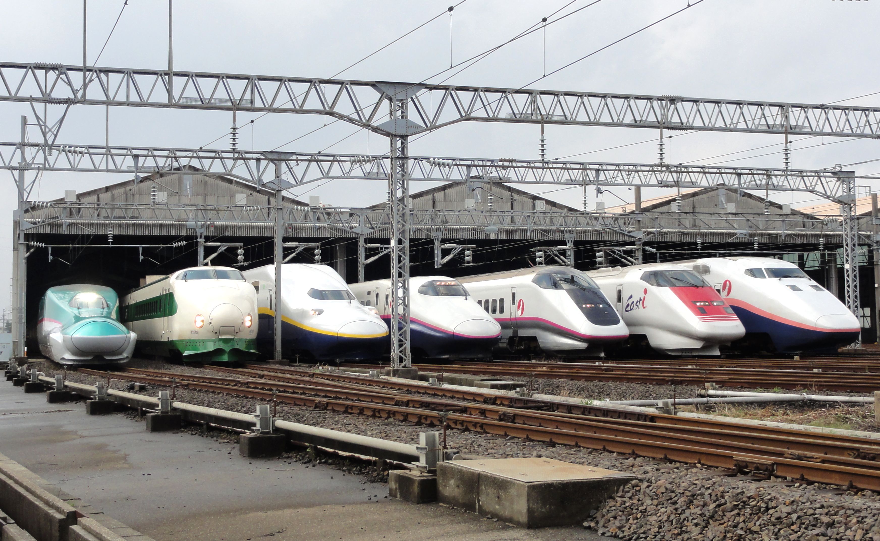
The , colloquially known in English as the bullet train, is a network of high-speed railway lines in Japan. Initially, it was built to connect distant Japanese regions with Tokyo, the capital, to aid economic growth and development. Beyond long-distance travel, some sections around the largest metropolitan areas are used as a commuter rail network. It is operated by five Japan Railways Group companies. Over the Shinkansen's 50-plus-year history, carrying over 10 billion passengers, there has been not a single passenger fatality or injury on board due to derailments or collisions. Starting with the Tokaido Shinkansen () in 1964, the network has expanded to currently consist of of lines with maximum speeds of , of Mini-Shinkansen lines with a maximum speed of , and of spur lines with Shinkansen services. The network presently links most major cities on the islands of Honshu and Kyushu, and Hakodate on northern island of Hokkaido, with an extension to Sapporo under constru ... [...More Info...] [...Related Items...] OR: [Wikipedia] [Google] [Baidu] |


.png)

.png)

