|
James Mitchell (New South Wales Politician)
James Mitchell (1789 or 1792 – 1 February 1869) was a Scottish-born Australian surgeon, businessman and politician. Personal life He was born in Fife to farmer David Mitchell and Margaret Low. He arrived in Sydney on 15 July 1820. He married Augusta Maria Scott on 22 August 1833 and fathered three children. One of them was David Scott Mitchell. On 1 February 1869 he died at his house in Cumberland and received a private funeral at Rockwood Cemetery. Military career In 1810 he joined the Army Medical Corps. With the army he spent nine years travelling around Spain, America, the Netherlands, the West Indies, and Australia. He served in several battles in the Peninsular War, Napoleonic Wars and American War including the Battle of New Orleans. He served in a Military hospital in Brussels during the Battle of Waterloo. Medical practice In 1813 he became a member of the Royal College of Surgeons. He served as Assistant Surgeon of the 48th Regiment, including two v ... [...More Info...] [...Related Items...] OR: [Wikipedia] [Google] [Baidu] |
Fife
Fife (, ; gd, Fìobha, ; sco, Fife) is a council area, historic county, registration county and lieutenancy area of Scotland. It is situated between the Firth of Tay and the Firth of Forth, with inland boundaries with Perth and Kinross (i.e. the historic counties of Perthshire and Kinross-shire) and Clackmannanshire. By custom it is widely held to have been one of the major Pictish kingdoms, known as ''Fib'', and is still commonly known as the Kingdom of Fife within Scotland. A person from Fife is known as a ''Fifer''. In older documents the county was very occasionally known by the anglicisation Fifeshire. Fife is Scotland's third largest local authority area by population. It has a resident population of just under 367,000, over a third of whom live in the three principal towns, Dunfermline, Kirkcaldy and Glenrothes. The historic town of St Andrews is located on the northeast coast of Fife. It is well known for the University of St Andrews, the most ancient univers ... [...More Info...] [...Related Items...] OR: [Wikipedia] [Google] [Baidu] |
Battle Of Waterloo
The Battle of Waterloo was fought on Sunday 18 June 1815, near Waterloo, Belgium, Waterloo (at that time in the United Kingdom of the Netherlands, now in Belgium). A French army under the command of Napoleon was defeated by two of the armies of the Seventh Coalition. One of these was a British-led coalition consisting of units from the United Kingdom of Great Britain and Ireland, United Kingdom, the Netherlands, Kingdom of Hanover, Hanover, Duchy of Brunswick, Brunswick, and Duchy of Nassau, Nassau, under the command of the Duke of Wellington (referred to by many authors as ''the Anglo-allied army'' or ''Wellington's army''). The other was composed of three corps of the Kingdom of Prussia, Prussian army under the command of Field Marshal Gebhard Leberecht von Blücher, von Blücher (the fourth corps of this army fought at the Battle of Wavre on the same day). The battle marked the end of the Napoleonic Wars. The battle was contemporaneously known as the Battle of Mont Saint-J ... [...More Info...] [...Related Items...] OR: [Wikipedia] [Google] [Baidu] |
AMP Limited
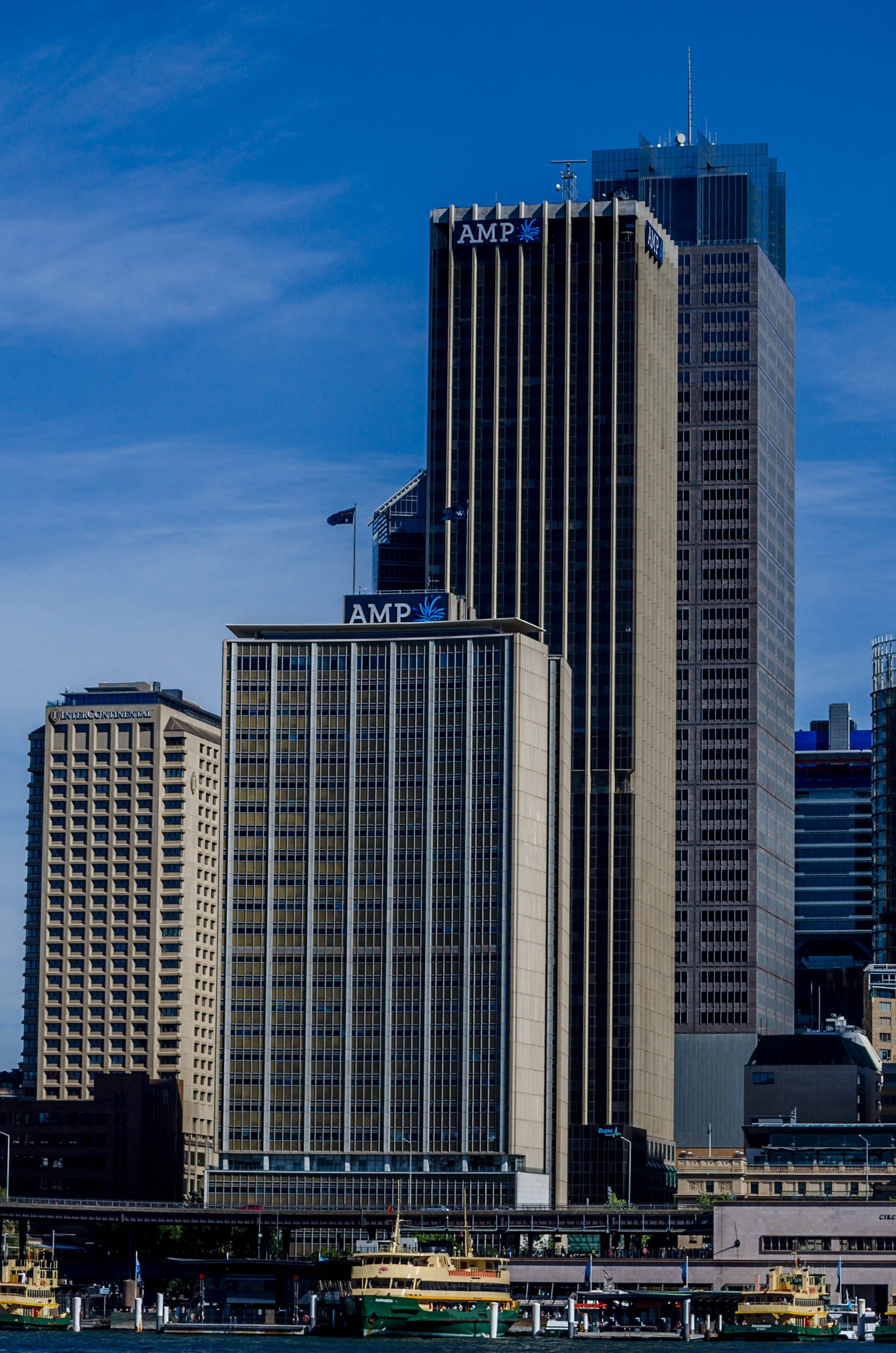
AMP is a financial services company in Australia and New Zealand providing superannuation and investment products, financial advice, and banking products (through AMP Banking) including home loans and savings accounts. Its headquarters is in Sydney, Australia. The Australian Mutual Provident Society was formed in 1849 as a non-profit life insurance company and mutual society. In 1998, it was demutualised into an Australian public company, AMP Limited, and listed on the Australian and New Zealand stock exchanges. AMP has one of Australia's largest shareholder registers, with most shareholders living in Australia and New Zealand. This is because when the society demutualised, all policy holders received shares in the new company. In 2003, the company demerged its UK operations, creating the Henderson Group. On 20 April 2018, Craig Meller resigned as CEO after it was revealed in the Royal Commission into Misconduct in the Banking, Superannuation and Financial Services Industr ... [...More Info...] [...Related Items...] OR: [Wikipedia] [Google] [Baidu] |
Bank Of Australia
The Bank of Australia was a failed financial institution of early colonial New South Wales formed in 1826 by a producers' and merchants' group as a rival to the Bank of New South Wales. Brian Fitzpatrick, ''British Imperialism and Australia 17831833 : An economic history of Australasia'' (1939, London, George Allen & Unwin Ltd). It was dubbed the "pure merino" bank because its share register included the plutocracy of the colony but excluded the ex-convicts who had been associated with the Bank of New South Wales.Vic Carroll, "The old, old story: the rich get richer while the rest go under", The Sydney Morning Herald, 22 May 1992, p 13 via factiva accessed 16 September 2011. When investors responded to the depression of the late 1830s by the abrupt withdrawal of capital leading to a chain of insolvencies, a number of colonial banks found that their unrestricted lending had sent prices land soaring as speculators borrowed to invest especially in urban areas. When the banks called ... [...More Info...] [...Related Items...] OR: [Wikipedia] [Google] [Baidu] |
Cooks River
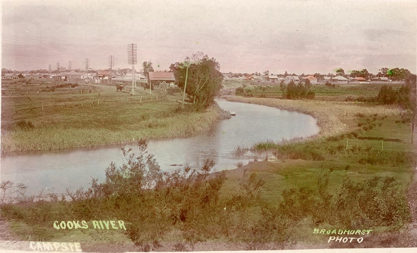
The Cooks River, a semi-mature tide-dominated drowned valley estuary, is a tributary of Botany Bay, located in south-eastern Sydney, New South Wales, Australia. The course of the long urban waterway has been altered to accommodate various developments along its shore. It serves as part of a stormwater system for the of its watershed, and many of the original streams running into it have been turned into concrete lined channels. The tidal sections support significant areas of mangroves, bird, and fish life, and are used for recreational activities. Course The river begins at Graf Park, Yagoona, then flows in a roughly north-easterly direction to Chullora. It reaches its northernmost point at Strathfield, where it leads into a concrete open canal, no more than one metre wide and thirty centimetres deep. It then heads towards the south-east. Where Cooks River runs through Strathfield Golf Course, the concrete lining has been partly removed. Here the plants have returned and hav ... [...More Info...] [...Related Items...] OR: [Wikipedia] [Google] [Baidu] |
Hunters Hill, New South Wales
Hunters Hill is a suburb of the lower north shore of Sydney, in the state of New South Wales, Australia. Hunters Hill is located north-west of the Sydney central business district and is the administrative centre for the local government area of the Municipality of Hunter's Hill. Hunters Hill is situated on a small peninsula that separates the Lane Cove and Parramatta Rivers. It can be reached by bus or by ferry. History The area's Aboriginal name is 'Mookaboola' or 'Moocooboola', which means ''meeting of waters. Hunters Hill was named after John Hunter, the second Governor of New South Wales, who was in office between 1795 and 1800. The area that is now Hunters Hill was settled in 1835. One of the earliest settlers was Mary Reibey, the first female retailer in Sydney. She built a cottage—later known as Fig Tree House—on land that fronted the Lane Cove River; Reiby Street is named after her. During the 1840s, bushrangers and convicts who had escaped from the pena ... [...More Info...] [...Related Items...] OR: [Wikipedia] [Google] [Baidu] |
Surry Hills, New South Wales
Surry Hills is an inner-city suburb of Sydney, in the state of New South Wales, Australia. Surry Hills is immediately south-east of the Sydney central business district in the local government area of the City of Sydney. Surry Hills is surrounded by the suburbs of Darlinghurst to the north, Chippendale and Haymarket to the west, Moore Park and Paddington to the east and Redfern to the south. It is often colloquially referred to as "Surry". It is bordered by Elizabeth Street and Chalmers Street to the west, Cleveland Street to the south, South Dowling Street to the east, and Oxford Street to the north. Crown Street is a main thoroughfare through the suburb with numerous restaurants, pubs and bars. Central is a locality in the north-west of the suburb around Central station. Prince Alfred Park is located nearby. Strawberry Hills is a locality around Cleveland and Elizabeth Streets and Brickfield Hill to the east of that. A multicultural suburb, Surry Hills has had a long ... [...More Info...] [...Related Items...] OR: [Wikipedia] [Google] [Baidu] |
Cumberland Place And Steps
The Cumberland Place and Steps are heritage-listed steps and a laneway located at Cumberland Place, in the inner city Sydney suburb of The Rocks in the City of Sydney local government area of New South Wales, Australia. It was built from 1807. It is also known as Suffolk Lane; Stubbs Lane; Gloucester Lane; and Cribb's Lane. The property is owned by Property NSW, an agency of the Government of New South Wales. It was added to the New South Wales State Heritage Register on 10 May 2002. The top steps lead to Cumberland Street. A set of steps at the lower end of the place leads to Harrington Street. Cumberland Place gives access to the rear of Susannah Place, a heritage-listed building, formerly cottages and a store and now a museum. History The 1994 archaeological investigation on the Cumberland and Gloucester Streets site confirmed that Cribbs Lane was in existence, between Cumberland and Gloucester Streets, by at least 1811. However the laneway may have existed earlier as ... [...More Info...] [...Related Items...] OR: [Wikipedia] [Google] [Baidu] |
Gosford
Gosford is the city and administrative centre of the Central Coast Council local government area in the heart of the Central Coast region, about north of Sydney and about south of Newcastle. The city centre is situated at the northern extremity of Brisbane Water, an extensive northern branch of the Hawkesbury River estuary and Broken Bay. The suburb is the administrative centre and Central Business District of the Central Coast region, which is the third largest urban area in New South Wales after Sydney and Newcastle. Following its formation from the combination of the previous Gosford City Council and Wyong Shire Councils, Gosford has been earmarked as a vital CBD spine under the NSW Metropolitan Strategy. The population of the Gosford area was 169,053 in 2016. History Until white settlement, the area around Gosford was inhabited by the Guringai peoples, who were principally coastal-dwellers, and the Darkinjung people that inhabited the hinterland. Along with the other ... [...More Info...] [...Related Items...] OR: [Wikipedia] [Google] [Baidu] |
Glendon Brook, New South Wales
Glendon Brook is a locality in the Singleton Council region of New South Wales, Australia Australia, officially the Commonwealth of Australia, is a Sovereign state, sovereign country comprising the mainland of the Australia (continent), Australian continent, the island of Tasmania, and numerous List of islands of Australia, sma .... It has also been known as Glendonbrook. It had a population of 266 as of the . Glendon Brook Public School opened in November 1878 and closed in December 1950. Glendonbrook Post Office opened in 1874 and closed on 31 August 1976. The Glendon Brook Hall opened in 1936. It continues to be used for community events. St Paul's Catholic Church at Glendon Brook celebrated its 125th anniversary in 2014. Heritage listings Glendon Brook has a number of heritage-listed sites, including: * 128 Main Road: Beckers Bridge over Webbers Creek References {{authority control Localities in New South Wales Suburbs of Singleton Council ... [...More Info...] [...Related Items...] OR: [Wikipedia] [Google] [Baidu] |
Burragorang, New South Wales
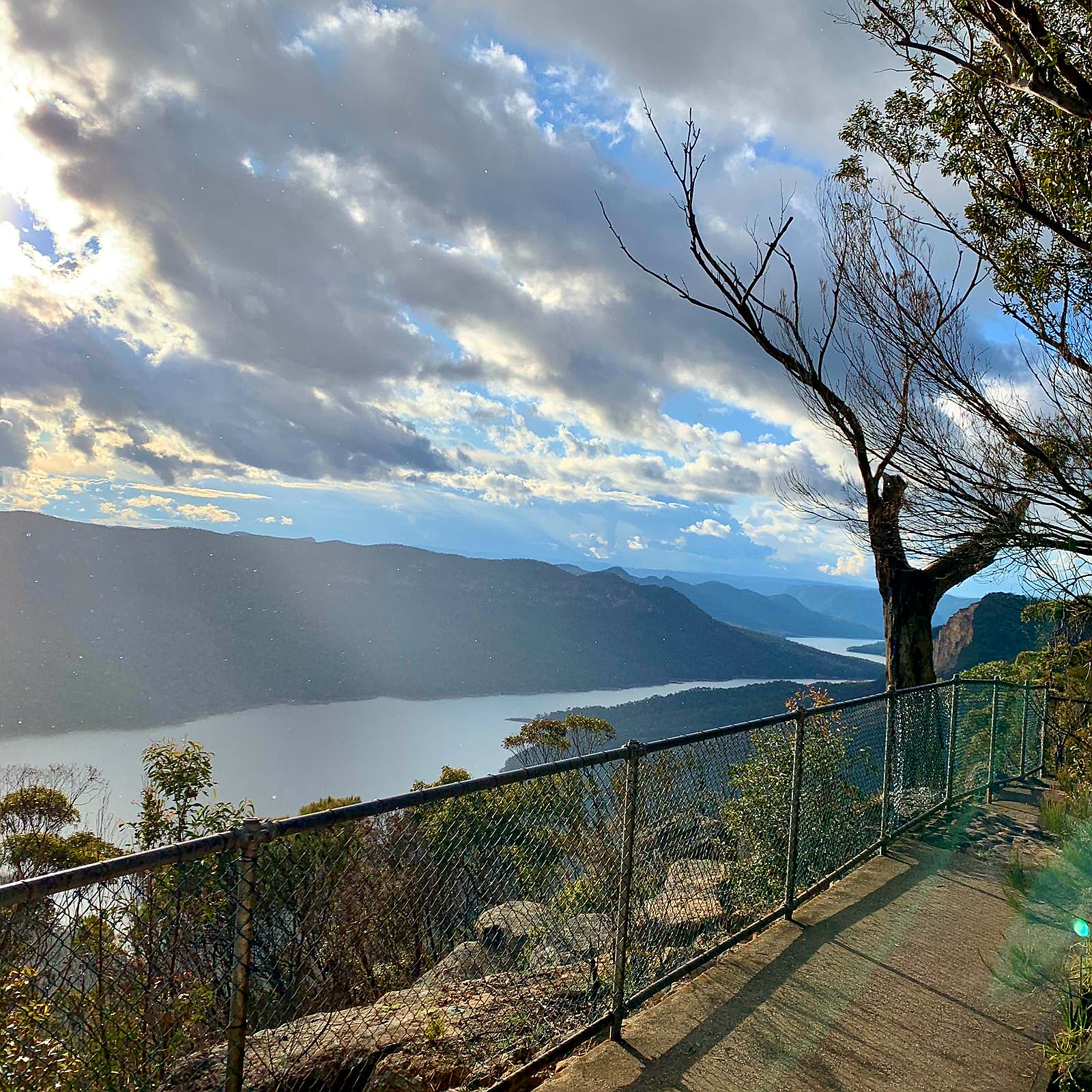
Burragorang or Burragorang Valley is a locality in the Macarthur Region of New South Wales, Australia, in Wollondilly Shire. It is home to Lake Burragorang, which is impounded by Warragamba Dam. It is located within the Blue Mountains National Park – specifically the Nattai National Park. History In 1827, the town of ''Burragorang'' was established as a mining town and up to the 1960s was a major supplier of coal. Moreover, lead and silver had also been mined in the valley until about 1927. With the boom of Sydney's population after World War II, Warragamba Dam was constructed between 1948 and 1960 on the Warragamba River, inundating the Burragorang Valley, creating Lake Burragorang. Consequently, the town of Burragorang and others like it in the valley were lost under water. The area around Burragorang and Nattai had been home to numerous collieries from the 1920s to the 1990s, such as the Nattai-Bulli, Oakleigh, Wollondlly, Nattai North and Valley collieries. It is estima ... [...More Info...] [...Related Items...] OR: [Wikipedia] [Google] [Baidu] |
Hyde Park Barracks, Sydney
The Hyde Park Barracks, Sydney is a heritage-listed former barracks, hospital, convict accommodation, mint and courthouse and now museum and cafe located at Macquarie Street in the Sydney central business district, in the City of Sydney local government area of New South Wales, Australia. Originally built from 1811 to 1819 as a brick building and compound to house convict men and boys, it was designed by convict architect Francis Greenway. It is also known as the Mint Building and Hyde Park Barracks Group and Rum Hospital; Royal Mint - Sydney Branch; Sydney Infirmary and Dispensary; Queen's Square Courts; Queen's Square. The site is managed by the Sydney Living Museums, an agency of the Government of New South Wales, as a living history museum open to the public. The site is inscribed on the UNESCO World Heritage List as one of 11 pre-eminent Australian Convict Sites as amongst "the best surviving examples of large-scale convict transportation and the colonial expansion o ... [...More Info...] [...Related Items...] OR: [Wikipedia] [Google] [Baidu] |


