|
Jaizkibel
Jaizkibel is a mountain range of the Basque Country located east of Pasaia, north of Lezo and west of Hondarribia, in Spain, with at the highest point (peak Alleru). The range stretches south-west to north-east, where it plunges into the sea at the Cape Higuer (spelled Higer too). To the north-west, the mountain dips its slopes in the sea with beautiful cliffs all along, overlooking on the east the marshes of Txingudi, the river Bidasoa and its mouth (tracing the France–Spain border) as well as the towns of Irun, Hendaia and Hondarribia on the river banks. The nearest relevant mountains are La Rhune, Aiako Harria and Ulia, closing the view east to west from the south. Some people consider Jaizkibel to be the first westernmost mountain of the Pyrenees. The area is a relevant landmark on the grounds of its strategic position close to the border with France, with the range standing as the easternmost Spanish rise by the seaside and affording an unmatched view miles aw ... [...More Info...] [...Related Items...] OR: [Wikipedia] [Google] [Baidu] |
Línea P
The Línea P (P line), officially the Pyrenees Defense Organisation (), was a fortified line of defense built in the Pyrenees between 1944 and 1948 to prevent an invasion into Spanish territory. After the end of the Spanish Civil War, the government of General Franco decided to build a defensive line in the Pyrenees, that would go from the Mediterranean to the Cantabrian Sea, approximately of fortified defensive points, stretching up to a depth of from the border. Some 8,000 – 10,000 bunkers were planned, of which approximately half were completed. Their garrison would have theoretically consisted of about 75,000 men. There is no evidence that the line was ever fully armed and operational. The defensive points of the Línea P and its access roads were built by war prisoners and jailed political opponents of the Francoist Spain, Francoist regime grouped in (Workers’ Battalions) immediately after the Spanish Civil War and from 1940 to December 1942, in (White Terror (Spain ... [...More Info...] [...Related Items...] OR: [Wikipedia] [Google] [Baidu] |
Gipuzkoa
Gipuzkoa (, , ; es, Guipúzcoa ; french: Guipuscoa) is a province of Spain and a historical territory of the autonomous community of the Basque Country. Its capital city is Donostia-San Sebastián. Gipuzkoa shares borders with the French department of Pyrénées-Atlantiques at the northeast, with the province and autonomous community of Navarre at east, Biscay at west, Álava at southwest and the Bay of Biscay to its north. It is located at the easternmost extreme of the Cantabric Sea, in the Bay of Biscay. It has of coast land. With a total area of , Gipuzkoa is the smallest province of Spain. The province has 89 municipalities and a population of 720,592 inhabitants (2018), from which more than half live in the Donostia-San Sebastián metropolitan area. Apart from the capital, other important cities are Irun, Errenteria, Zarautz, Mondragón, Eibar, Hondarribia, Oñati, Tolosa, Beasain and Pasaia. The oceanic climate gives the province an intense green co ... [...More Info...] [...Related Items...] OR: [Wikipedia] [Google] [Baidu] |
Pasaia
Pasaia ( es, Pasajes) is a town and municipality located in the province of Gipuzkoa in the Basque Autonomous Community of northern Spain. It is a fishing community, commercial port and the birthplace of the famous admiral Blas de Lezo. Pasaia lies approximately east of Donostia's centre, lying at the foot of Mount Ulia and the Jaizkibel massif. The municipality numbers 16,056 inhabitants ( estimates), clustering around the Bay of Pasaia in four nuclei, namely Pasai San Pedro, Pasai San Juan (or Donibane in Basque), Antxo and Trintxerpe, with each part showing distinctive features. History Pasaia is mentioned in documentary records for the first time in 1203 as Oiarso. The name of the village was later changed to "Pasage", which means 'port' in Gascon. The Gascons had come to inhabit the area side by side with the Basque people at the beginning of the 13th century. The current name is first attested in the 15th century, when it was called the above "Pasage". It was a major ... [...More Info...] [...Related Items...] OR: [Wikipedia] [Google] [Baidu] |
Hondarribia
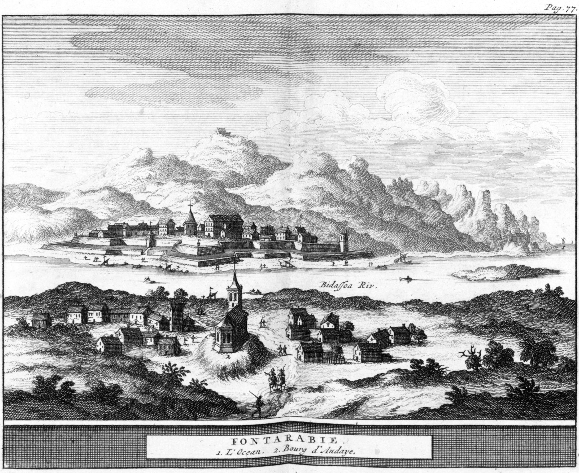
es, fuenterribense , population_note = , population_density_km2 = auto , blank_name_sec1 = Official language(s) , blank_info_sec1 = Basque, Spanish , timezone = CET , utc_offset = +1 , timezone_DST = CEST , utc_offset_DST = +2 , postal_code_type = Postal code , postal_code = 20280 , area_code_type = Dialing code , area_code = , leader_title = Mayor , leader_name = Txomin Sagarzazu , leader_party = EAJ-PNV , website = , footnotes = Hondarribia ( eu, Hondarribia; es, Fuenterrabía; french: Fontarrabie) is a town situated on the west shore of Bidasoa river's mouth, in Gipuzkoa, in Basque Country, Spain. The border town is situated on a little promontory facing Hendaye (France) over the Txingudi bay. A service boat makes the trip between the two cities. The town holds an ancient old q ... [...More Info...] [...Related Items...] OR: [Wikipedia] [Google] [Baidu] |
Cape Higuer
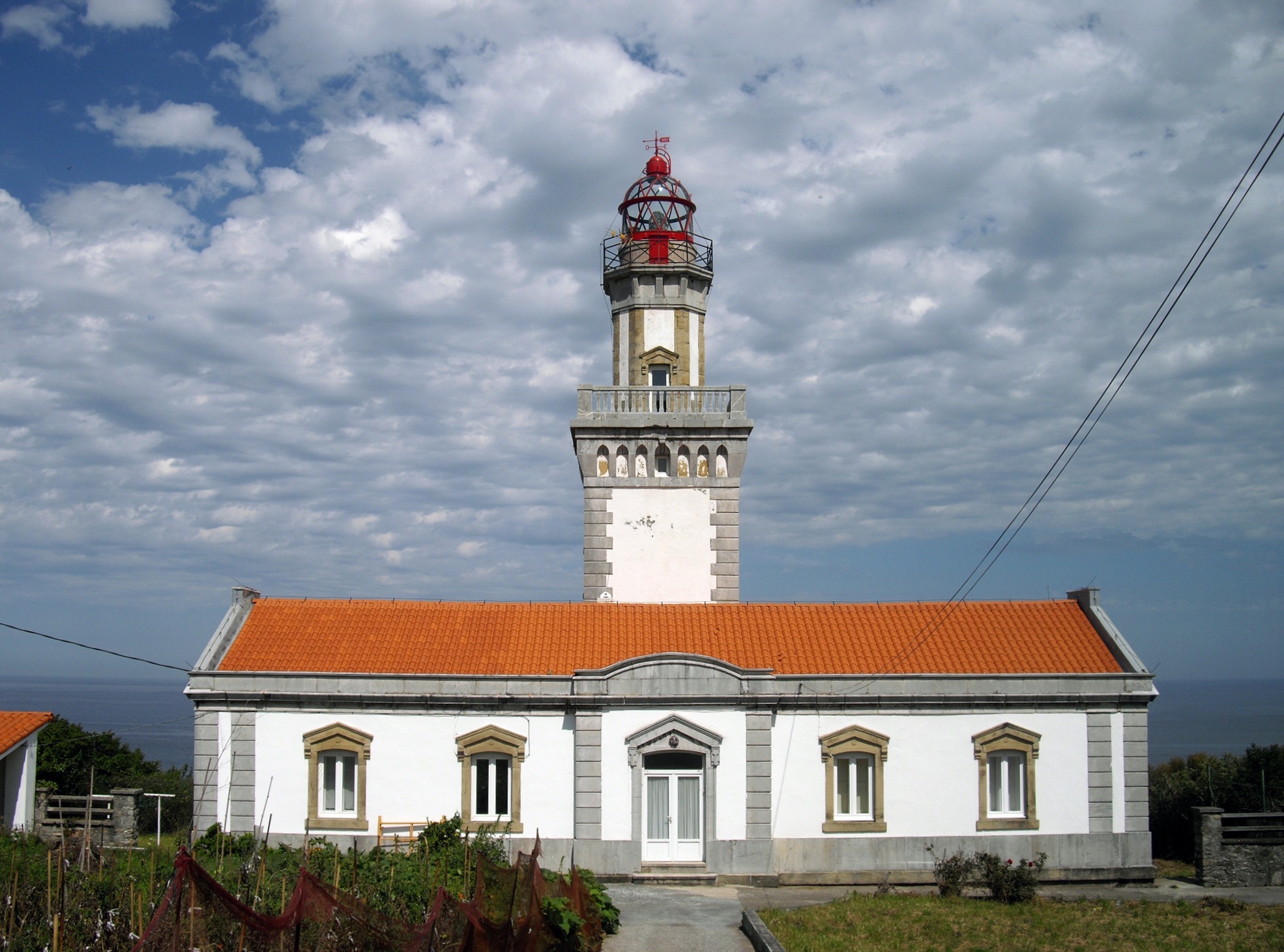
The Cape Higuer ( eu, Higer lurmuturra) is a cape on the Bay of Biscay standing out at the end of the mountain range Jaizkibel by the France–Spain border in the municipality of Hondarribia ( away from the town centre). The site is home to a lighthouse, besides holding a camp-site and a couple of inns. It is sometimes considered the westernmost land strip of the Pyrenees, with the trek trail GR 11 setting out at this point. Ancient Roman vestiges have been found deep in the water at a natural berth, next to the castle San Telmo. A wreck lies on the bed of the water, arguably a Roman one, with mineral load and remnants of timber alongside ceramics items in it. This is the third Roman archaeological site uncovered in the area of the Lower Bidasoa, which bears witness to the ancient Basque Roman town Oiasso Oiasso,Ptolemy, 2, 6, 10 Oiasona Strabo, Geographia III, 4, 10. The Casaubonus editions of 1587 and 1620 write ''Oídasoûna'', corrected by Adolf Schulten to ''Oíasoûna' ... [...More Info...] [...Related Items...] OR: [Wikipedia] [Google] [Baidu] |
Anglet
Anglet (; , eu, Angelu )ANGELU Auñamendi Eusko Entziklopedia is a commune in the department in the region of southwestern France. Anglet lies in the traditional province of Labourd of the Northern Basqu ... [...More Info...] [...Related Items...] OR: [Wikipedia] [Google] [Baidu] |
Mediterranean
The Mediterranean Sea is a sea connected to the Atlantic Ocean, surrounded by the Mediterranean Basin and almost completely enclosed by land: on the north by Western and Southern Europe and Anatolia, on the south by North Africa, and on the east by the Levant. The Sea has played a central role in the history of Western civilization. Geological evidence indicates that around 5.9 million years ago, the Mediterranean was cut off from the Atlantic and was partly or completely desiccated over a period of some 600,000 years during the Messinian salinity crisis before being refilled by the Zanclean flood about 5.3 million years ago. The Mediterranean Sea covers an area of about , representing 0.7% of the global ocean surface, but its connection to the Atlantic via the Strait of Gibraltar—the narrow strait that connects the Atlantic Ocean to the Mediterranean Sea and separates the Iberian Peninsula in Europe from Morocco in Africa—is only wide. The Mediterr ... [...More Info...] [...Related Items...] OR: [Wikipedia] [Google] [Baidu] |
GR 11 (Spain)
The GR 11, also known as the ruta Transpirenaica in Spain, is part of the extensive GR footpath network of paths, tracks and trails. It runs through the Spanish Pyrenees, passing only briefly into France near Candanchu. From West to East, the trail starts at Cape Higuer ( Basque Country), crosses Navarre and Aragon and finishes at Cap de Creus (Catalonia.) Its exact distance is difficult to measure, roughly 840 km (522 miles) and a total elevation change of 39,000 m (128,000 ft). The route is separated into 45 sections. At the end of each section there is normally a useful stopping point (camping spot, town, hostel or refuge) but in general, supplies have to be carried for 3–4 days. Because most rivers flow perpendicular to the trail, the GR 11 passes over many valleys affording beautiful vistas but also many ascents and descents - some days as much as 1600 m (5250 ft) ascent (with equivalent descent). The trail can be walked in either direction - the deciding ... [...More Info...] [...Related Items...] OR: [Wikipedia] [Google] [Baidu] |


