|
Jaggayyapeta Mandal
Jaggayyapeta mandal is one of the 20 mandals in NTR district of the state of Andhra Pradesh in India. It is under the administration of Nandigama revenue division and the headquarters are located at Jaggayyapeta town. Krishna River flows through the mandal and is bounded by Penuganchiprolu, Nandigama, Chandarlapadu mandals of Krishna district, some part of Guntur district, Nalgonda and Khammam districts of Telangana. Towns and villages census, the mandal has 18 settlements. It includes 1 town and 24 villages. The settlements in the mandal are listed below: ''Note: (CT)-Census town'' See also *Vijayawada revenue division Vijayawada revenue division (or Vijayawada division) is an administrative division in the NTR district of the Indian state of Andhra Pradesh. It is one of the 3 revenue divisions in the district with 8 mandals under its administration. Vijayawa ... References Mandals in NTR district {{AndhraPradesh-geo-stub ... [...More Info...] [...Related Items...] OR: [Wikipedia] [Google] [Baidu] |
Mandal
A tehsil (, also known as tahsil, taluka, or taluk) is a local unit of administrative division in some countries of South Asia. It is a subdistrict of the area within a district including the designated populated place that serves as its administrative centre, with possible additional towns, and usually a number of villages. The terms in India have replaced earlier terms, such as '' pargana'' (''pergunnah'') and ''thana''. In Andhra Pradesh and Telangana, a newer unit called mandal (circle) has come to replace the system of tehsils. It is generally smaller than a tehsil, and is meant for facilitating local self-government in the panchayat system. In West Bengal, Bihar, Jharkhand, community development blocks are the empowered grassroots administrative unit, replacing tehsils. As an entity of local government, the tehsil office (panchayat samiti) exercises certain fiscal and administrative power over the villages and municipalities within its jurisdiction. It is the ultimate execu ... [...More Info...] [...Related Items...] OR: [Wikipedia] [Google] [Baidu] |
Penuganchiprolu
Penuganchiprolu is a village in NTR district of the Indian state of Andhra Pradesh. It is the mandal headquarters of Penuganchiprolu mandal in Nandigama revenue division. Geography Penuganchiprolu is located at . It has an average elevation of 42 metres (141 feet).It is located 144 km west from District headquarters Machilipatnam.This place lies in the border of Krishna District(Town: Jaggayyapet), Khammam District(Town: Madhira) and Khammam District(City: Khammam). History Andhra Ratna Gopalakrishnayya Duggirala (1889-1928) born in our penuganchiprolu Gopalakrishnayya Duggirala was one of the famous leaders in the non-violent Indian Freedom Movement. Kommaraju Laxmana Rao, a great literature was also born in Penuganchiprolu.He Started "Sri Krishna Telugu maha Sabha" in Hyderabad. Penuganchprolu is also famous for agriculture, political movement and high skilled technical professionals are available. Temples Penuganchiprolu Previously Called "Pedakanch ... [...More Info...] [...Related Items...] OR: [Wikipedia] [Google] [Baidu] |
Census Town
In India and some other countries, a census town is designated as a town that satisfies certain characteristics. India In India, a census town is one which is not statutorily notified and administered as a town, but nevertheless whose population has attained urban characteristics. They are characterized by the following: * Population exceeds 5,000 * At least 75% of main male working population is employed outside the agricultural sector * Minimum population density of 400 persons per km2 Examples of Indian census towns include Avinissery in Thrissur District of Kerala, Greater Noida and Chakeri in Uttar Pradesh, Indranagar in Tripura, Begampur, Chandpara, Nandigram, Chittaranjan and Beliatore in West Bengal, Chevella in Telangana, Amini in Lakshadweep, Deolali in Maharashtra, Ghatshila in Purbi Singhbhum District of Jharkhand, BGR Township ( Bongaigaon Refinery Township) in Bongaigaon Urban Agglomeration of Assam, Pileru in Andhra Pradesh, Chikhli in Gujarat and Ichgam in ... [...More Info...] [...Related Items...] OR: [Wikipedia] [Google] [Baidu] |
Vedadri
Vedadri is a village in NTR district of the Indian state of Andhra Pradesh. It is located in Jaggayyapeta mandal of Vijayawada revenue division. It is one of the villages in the mandal to be a part of Andhra Pradesh Capital Region. The village is one of the religious destination for Hindus, with the Vedadri Narasimha Temple Vedadri Narasimha Temple is a prominent Hindu temple located in the town of Vedadri, Andhra Pradesh, India. It is dedicated to the worship of Narasimha. This temple is a major pilgrimage site in Andhra, attracting thousands of devotees eve ... on the banks of River Krishna. References Villages in NTR district {{AndhraPradesh-geo-stub ... [...More Info...] [...Related Items...] OR: [Wikipedia] [Google] [Baidu] |
Gowravaram
Gowravaram is a village in NTR district of the Indian state of Andhra Pradesh. It is located in Jaggayyapeta mandal of Vijayawada revenue division.In the Route of NH65 It is one of the villages in the mandal to be a part of Andhra Pradesh Capital Region Andhra Pradesh Capital Region is the metropolitan region area of Andhra Pradesh state capital, the defacto capital city of Andhra Pradesh. Vijayawada is the headquarters and the largest city of the region. It includes the major ancient cities o .... References Villages in NTR district {{AndhraPradesh-geo-stub ... [...More Info...] [...Related Items...] OR: [Wikipedia] [Google] [Baidu] |
Chillakallu
Chillakallu is a village in NTR district of the Indian state of Andhra Pradesh. It is located in Jaggayyapeta mandal of Vijayawada revenue division. It is one of the villages in the mandal, to be a part of Andhra Pradesh Capital Region Andhra Pradesh Capital Region is the metropolitan region area of Andhra Pradesh state capital, the defacto capital city of Andhra Pradesh. Vijayawada is the headquarters and the largest city of the region. It includes the major ancient cities o .... References Villages in NTR district {{AndhraPradesh-geo-stub ... [...More Info...] [...Related Items...] OR: [Wikipedia] [Google] [Baidu] |
Census Of India
The decennial Census of India has been conducted 16 times, as of 2021. While it has been undertaken every 10 years, beginning in 1872 under British Viceroy Lord Mayo, the first complete census was taken in 1881. Post 1949, it has been conducted by the Registrar General and Census Commissioner of India under the Ministry of Home Affairs, Government of India. All the censuses since 1951 were conducted under the 1948 Census of India Act. The last census was held in 2011, whilst the next was to be held in 2021. But it has been postponed due to the COVID-19 pandemic. Historically, there has been a long time between collection of data and dissemination of data. Census of India during British Rule List of censuses conducted in India before independence: * 1872 Census of india *1881 Census of India *1891 Census of India * 1901 Census of India *1911 Census of India * 1921 Census of India * 1931 Census of India *1941 Census of India Census of Republic of India List of censuses conduct ... [...More Info...] [...Related Items...] OR: [Wikipedia] [Google] [Baidu] |
Telangana
Telangana (; , ) is a States and union territories of India, state in India situated on the south-central stretch of the Indian subcontinent, Indian peninsula on the high Deccan Plateau. It is the List of states and union territories of India by area, eleventh-largest state and the List of states and union territories of India by population, twelfth-most populated state in India with a geographical area of and 35,193,978 residents as per 2011 Census of India, 2011 census. On 2 June 2014, the area was separated from the northwestern part of Andhra Pradesh as the newly formed States and union territories of India, state with Hyderabad as its capital. Its other major cities include Warangal, Nizamabad, Telangana, Nizamabad, Khammam, Karimnagar and Ramagundam. Telangana is bordered by the states of Maharashtra to the north, Chhattisgarh to the northeast, Karnataka to the west, and Andhra Pradesh to the east and south. The terrain of Telangana consists mostly of the Deccan Plateau wi ... [...More Info...] [...Related Items...] OR: [Wikipedia] [Google] [Baidu] |
Khammam District
Khammam district is a district in the eastern region of the Indian state of Telangana. The city of Khammam is the district headquarters. The district shares boundaries with Suryapet, Mahabubabad, Bhadradri districts and with Eluru and NTR districts in Andhra pradesh state. History Paleolithic man probably roamed around the areas of lower Godavari valley and the surroundings of Bhadrachalam, Kothagudem, Wyra, Sathupally and Paloncha Taluks in the district. Prehistoric rock paintings were found near Neeladri konda near Lankapalli of Sathupally Taluk. Megalithic Dolmens were found at Janampet of Pinapaka Taluk. Megalithic site on the campus of Government Degree college in Khammam has yielded pottery and skeletal remains. Kistapuram and Padugonigudem villages in Gundala Taluk of the district were rich in Megalithic cultural remnants explored and discovered recently. The southern parts of Khammam district flourished as famous Buddhist centers along with Amaravathi and Vija ... [...More Info...] [...Related Items...] OR: [Wikipedia] [Google] [Baidu] |
Nalgonda District
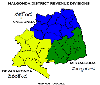
Nalgonda district is a district in the Telangana state of India. Nalgonda district has the highest number of mandals in the state with 31 mandals. The district shares boundaries with Suryapet, Rangareddy, Yadadri and Nagarkurnool districts and with the state boundary of Andhra Pradesh. Etymology Nalgonda is derived from two Telugu words Nalla (Black) & Konda (Hills) i.e. ''Black Hills''. History Nalgonda was earlier referred to as Neelagiri, the name given by some local rulers and the name was changed to ''Nallagonda'' only after its conquest by Allauddin Bahaman Shah, the founder of Bahmani Sultanate . The district had a major role in the Telangana Rebellion. Geography The district is spread over an area of . Demographics Census of India, the district has a population of 1,618,416. According to the 2011 census, 81.75% of the population spoke Telugu, 11.91% Lambadi and 5.51% Urdu as their first language. The Krishna River, Musi River, Aleru, Peddav ... [...More Info...] [...Related Items...] OR: [Wikipedia] [Google] [Baidu] |
Guntur District
Guntur district is one of the twenty six districts in the Coastal Andhra region of the Indian state of Andhra Pradesh. The administrative seat of the district is located at Guntur, the largest city of the district in terms of area and with a population of 670,073. It has a coastline of approximately on the right bank of Krishna River, that separates it from Krishna district and NTR district. It is bounded on the south by Bapatla district and on the west by Palnadu district. It has an area of and with a population of 20,91,075 as per 2011 census of India. The district is often referred to as the ''Land of Chillies''. It is also a major centre for agriculture, education and learning. It exports large quantities of chillies and tobacco. Etymology The district derives its name from its district headquarters, Guntur. There are several opinions on the meaning and origin of the word Guntur. The word owes its origin to words like gundu (a rock), gunta (a pond) and kunta (1/3 o ... [...More Info...] [...Related Items...] OR: [Wikipedia] [Google] [Baidu] |
Krishna District
Krishna district is district in the coastal Andhra Region in Indian state of Andhra Pradesh, with Machilipatnam as its administrative headquarters. It is the coastal district of Andhra Pradesh. Machilipatnam is the most populated city in the district. It is surrounded on the east by Bay of Bengal, west by Guntur and north by Eluru and NTR districts and south again by Bay of Bengal. In 2022 Krishna district was divided into Krishna and NTR districts. Etymology Krishna district, with its district headquarters at Machilipatnam was formerly called Machilipatnam district. Later it was renamed as Krishna district, by adding certain Taluks of the abolished Guntur District in 1859 with Machilipatnam with its head. It was named after the Krishna River, the third longest river in India. The river flows through the state of Andhra Pradesh before it empties itself into Bay of Bengal, near Hamsaladevi village of Krishna district. History This history of this region dates back ... [...More Info...] [...Related Items...] OR: [Wikipedia] [Google] [Baidu] |


