|
Iç Ada, Antalya
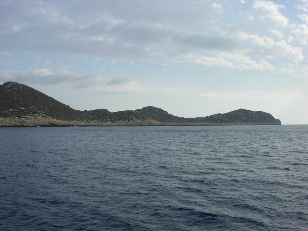
İç Ada ( tr, İç Ada, literally "internal island"; el, Αλιμενταριά; it, Alimentaria Bertarelli (1929), p.134) is a Turkish islet near Kaş (ancient Antiphellos), in the homonymous district of Antalya province. It lies in the eastern Mediterranean Sea, about five nautical miles west-southwest of the island of Kekova, and about halfway between Kekova and the Greek islet of Stroggyli. The island has the shape of a right triangle elongated along a northeast-southwest axis, whose legs are and long. It is separated by the mainland by a wide strait. Iç Ada is uninhabited and is covered with macchia. Contended between Italy and Turkey after the Italian occupation of Kastelorizo, the 1932 Convention between Italy and Turkey which defined the sea border between the two powers assigned it to Turkey. Notes Sources * See also * List of islands of Turkey This is a list of islands of Turkey. There are around 500 islands and islets in the Turkey. These islands ... [...More Info...] [...Related Items...] OR: [Wikipedia] [Google] [Baidu] |
Italy
Italy ( it, Italia ), officially the Italian Republic, ) or the Republic of Italy, is a country in Southern Europe. It is located in the middle of the Mediterranean Sea, and its territory largely coincides with the homonymous geographical region. Italy is also considered part of Western Europe, and shares land borders with France, Switzerland, Austria, Slovenia and the enclaved microstates of Vatican City and San Marino. It has a territorial exclave in Switzerland, Campione. Italy covers an area of , with a population of over 60 million. It is the third-most populous member state of the European Union, the sixth-most populous country in Europe, and the tenth-largest country in the continent by land area. Italy's capital and largest city is Rome. Italy was the native place of many civilizations such as the Italic peoples and the Etruscans, while due to its central geographic location in Southern Europe and the Mediterranean, the country has also historically been home ... [...More Info...] [...Related Items...] OR: [Wikipedia] [Google] [Baidu] |
Turkish Riviera
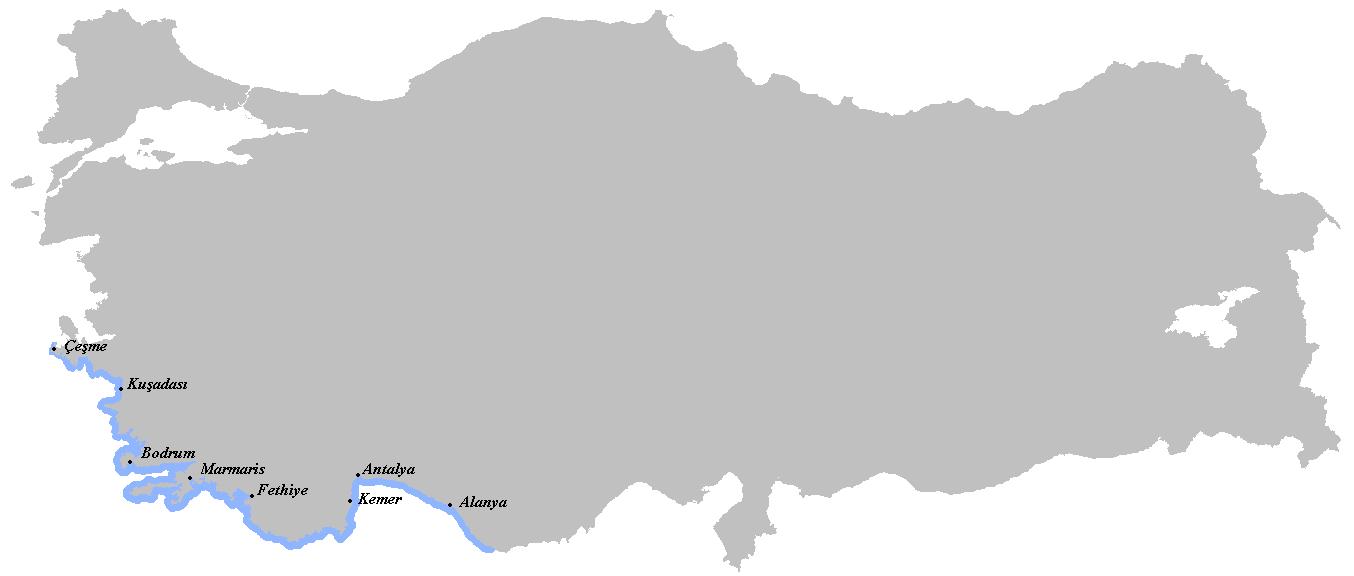
The Turkish Riviera ( tr, Türk Rivierası), also known popularly as the Turquoise Coast, is an area of southwest Turkey encompassing the provinces of Antalya and Muğla, and to a lesser extent Aydın, southern İzmir and western Mersin. The combination of a favorable climate, warm sea, mountainous scenery, fine beaches along more than a of shoreline along the Aegean and Mediterranean waters, and abundant natural and archaeological points of interest makes this stretch of Turkey's coastline a popular national and international tourist destination. Among the archaeological points of interest are two of the Seven Wonders of the Ancient World: The ruins of the Mausoleum of Maussollos in Halicarnassus; and the Temple of Artemis in Ephesus. The Turkish Riviera is also the home of the internationally known Blue Voyage (a.k.a. Carian Cruise), which allows participants to take a week-long trip aboard the local gulet schooners to ancient cities, harbors, tombs, mausolea, and beac ... [...More Info...] [...Related Items...] OR: [Wikipedia] [Google] [Baidu] |
Antalya
Antalya () is the List of largest cities and towns in Turkey, fifth-most populous city in Turkey as well as the capital of Antalya Province. Located on Anatolia's southwest coast bordered by the Taurus Mountains, Antalya is the largest Turkish city on the Mediterranean coast outside the Aegean region with over one million people in its metropolitan area.2011 Census Turkish Statistical Institute (Büyükşehir belediyeleri ve bağlı belediyelerin nüfusları) – 2011 The city that is now Antalya was first settled around 200 BC by the Attalid dynasty of Pergamon, which was soon subdued by the Romans. Roman rule saw Antalya thrive, including the construction of several new monuments, such as Hadrian's Gate, and the proliferation of ne ... [...More Info...] [...Related Items...] OR: [Wikipedia] [Google] [Baidu] |
Uninhabited Islands Of Turkey
The list of uninhabited regions includes a number of places around the globe. The list changes year over year as human beings migrate into formerly uninhabited regions, or migrate out of formerly inhabited regions. List As a group, the list of uninhabited places are called the "nonecumene". This is a special geography term which means the uninhabited area of the world. * Virtually all of the Ocean *Virtually all of Antarctica *Most of The Arctic *Most of Greenland *Most of The Sahara * Antipodes Islands * Ashmore and Cartier Islands * Bajo Nuevo Bank * Baker Island * Ball's Pyramid * Balleny Islands * Big Major Cay * Bouvet Island * Much of the interior of Brazil * Caroline Island * Clipperton Island * The semi-arid regions and deserts of Australia * Devon Island * Much of Eastern Oregon * Elephant Island * Elobey Chico * Ernst Thälmann Island * Much of Fiordland, New Zealand * Goa Island * Gough Island * Hans Island * Harmil * Hashima Island * Hatutu * Heard Island ... [...More Info...] [...Related Items...] OR: [Wikipedia] [Google] [Baidu] |
List Of Islands Of Turkey
This is a list of islands of Turkey. There are around 500 islands and islets in the Turkey. These islands are located in the Aegean Sea, Black Sea, Mediterranean Sea, Sea of Marmara, and Turkish lakes. The Turkish words for island/islands/rocks are Adasi/Adalar/Kayaları. The largest Turkish island is Gökçeada in the Aegean Sea with an area of . The lists in the following sections include name, formal name when different, Turkish Province, sea where the island is located and coordinates. Islands by body of water Aegean Sea islands The following Turkish islands are in the Aegean Sea: Aydın Province The Turkish Aegean Sea islands in Aydin Province include the following: Balıkesir Province There are at least 54 islands in Balıkesir Province, including islands in the Aegean Sea and the Sea of Marmara. Many of the islands in the Aegean Sea are part of the Ayvalık Islands Nature Park which contains 22 islands and numerous rocks. The only two populated Aegean isl ... [...More Info...] [...Related Items...] OR: [Wikipedia] [Google] [Baidu] |
1932 Convention Between Italy And Turkey
The Convention between Italy and Turkey, signed in Ankara on January 4, 1932, by the Italy, Italian Plenipotentiary, Ambassador Pompeo Aloisi, and the Turkey, Turkish foreign minister Tevfik Rüştü Aras, settled a dispute that had arisen in the aftermath of the Treaty of Lausanne of 1923, about the sovereignty over a number of small islets and the delimitation of the territorial waters between the coast of Anatolia and the island of Kastellórizo, which had been an Italian possession since 1921. Through the convention, the islets situated inside the bay of the harbour of Kastellorizo, along with the islands of Rho Island, Rho and Strongili further off, were assigned to Italy, while all other islets in the surrounding area were assigned to Turkey. Moreover, the Italian Government recognised the sovereignty of Turkey over the Aegean islet of Kara Ada (Bodrum), Kara Ada (Greek language, Greek: ''Arcos''), situated in front of the town of Bodrum. In an Appendix signed in December ... [...More Info...] [...Related Items...] OR: [Wikipedia] [Google] [Baidu] |
Kastelorizo
Kastellorizo or Castellorizo (; el, Καστελλόριζο, Kastellórizo), officially Megisti ( ''Megísti''), is a Greek island and municipality of the Dodecanese in the Eastern Mediterranean.Bertarelli, 131 It lies roughly off the south coast of Turkey, about southeast of Athens and east of Rhodes, almost halfway between Rhodes and Antalya, and northwest of Cyprus. Kastellorizo is part of the Rhodes regional unit. The island has become very popular in recent years among tourists looking for an isolated place in the Dodecanese, thanks also to the 1991 Oscar-winning movie ''Mediterraneo'', by Gabriele Salvatores, which is set on the island during the Second World War. Name and etymology The island's official name, ''Megisti'' (Μεγίστη) means "biggest" or "greatest", but at only in area, it is the smallest of the Dodecanese. The name refers to the fact that it is the largest of the small archipelago.Bertarelli, 131 This name was used in antiquity, but is now rare ... [...More Info...] [...Related Items...] OR: [Wikipedia] [Google] [Baidu] |
Turkey
Turkey ( tr, Türkiye ), officially the Republic of Türkiye ( tr, Türkiye Cumhuriyeti, links=no ), is a list of transcontinental countries, transcontinental country located mainly on the Anatolia, Anatolian Peninsula in Western Asia, with a East Thrace, small portion on the Balkans, Balkan Peninsula in Southeast Europe. It shares borders with the Black Sea to the north; Georgia (country), Georgia to the northeast; Armenia, Azerbaijan, and Iran to the east; Iraq to the southeast; Syria and the Mediterranean Sea to the south; the Aegean Sea to the west; and Greece and Bulgaria to the northwest. Cyprus is located off the south coast. Turkish people, Turks form the vast majority of the nation's population and Kurds are the largest minority. Ankara is Turkey's capital, while Istanbul is its list of largest cities and towns in Turkey, largest city and financial centre. One of the world's earliest permanently Settler, settled regions, present-day Turkey was home to important Neol ... [...More Info...] [...Related Items...] OR: [Wikipedia] [Google] [Baidu] |
Kaş
Kaş (; el, Αντίφελλος, translit=Antífellos, translit-std=ISO) is a small fishing, diving, yachting and tourist town, and a district of Antalya Province of Turkey, 168 km west of the city of Antalya. As a tourist resort, it is relatively unspoiled. Geography As the tenth largest district of Antalya as of 2021, Kaş is on a hill running down to the Turquoise Coast of southwestern Turkey. The district has a typical Mediterranean climate of hot, dry summers and mild, wet winters, which allows the growth of oranges, lemons and bananas. The lowland areas are also planted with cut flowers and a variety of fruits and vegetables. Many are grown all year round under glass. The hillsides produce honey and almonds, while at high altitudes there are extensive pine forests. The weather is drier at high altitudes. Although agriculture is still important, tourism is the main source of income in the district, which has many hotels and guest houses. About offshore from Kaş i ... [...More Info...] [...Related Items...] OR: [Wikipedia] [Google] [Baidu] |
Right Triangle
A right triangle (American English) or right-angled triangle (British), or more formally an orthogonal triangle, formerly called a rectangled triangle ( grc, ὀρθόσγωνία, lit=upright angle), is a triangle in which one angle is a right angle (that is, a 90-degree angle), i.e., in which two sides are perpendicular. The relation between the sides and other angles of the right triangle is the basis for trigonometry. The side opposite to the right angle is called the ''hypotenuse'' (side ''c'' in the figure). The sides adjacent to the right angle are called ''legs'' (or ''catheti'', singular: ''cathetus''). Side ''a'' may be identified as the side ''adjacent to angle B'' and ''opposed to'' (or ''opposite'') ''angle A'', while side ''b'' is the side ''adjacent to angle A'' and ''opposed to angle B''. If the lengths of all three sides of a right triangle are integers, the triangle is said to be a Pythagorean triangle and its side lengths are collectively known as a ''Pythagor ... [...More Info...] [...Related Items...] OR: [Wikipedia] [Google] [Baidu] |


