|
Inverpolly
Inverpolly is the name given to a large area of northern Wester Ross in the Northwest Highlands of Scotland, north of Ullapool. The area contains several prominent hills, rising up from a rough landscape of bogs and lochans. From 1961, the area was designated national nature reserve but since 2004, the designation has been limited to the area of Knockan Crag. The area supports a large number of high-quality freshwater loch habitats, the majority of which are oligotrophic. Major peaks in the area include Stac Pollaidh Stac Pollaidh (IPA: ąsŐ™tŐ™ įa įkňąp į…Ē…ęŐ™ais a mountain in the Northwest Highlands of Scotland. The peak displays a rocky crest of Torridonian sandstone, with many pinnacles and steep gullies. The ridge was exposed to weathering as a nunatak ..., Cul M√≤r, Cul Beag. At the heart of Inverpolly lies the large irregular shaped Loch Sionascaig. References External links * * {{coord, 58.05583, N, 5.20309, W, region:GB_source:enwiki-osgb36(NC111119), displa ... [...More Info...] [...Related Items...] OR: [Wikipedia] [Google] [Baidu] |
Loch Sionascaig
Loch Sionascaig is a large irregular shaped, freshwater loch in the remote Coigach area of northern Wester Ross. It is located 5.5 miles southeast of the village of Lochinver and is situated within the Inverpolly Forest. Geography Loch Sionascaig is an area of outstanding natural beauty, that lies at the centre of the Inverpolly National Nature Reserve. It is surrounded by many other lochs with the large forested areas of Inverpolly Forest and Loch Lurgainn to the south. Also directly south is Loch an Doire Dhuibh which is connected by a narrow channel to Loch Sionascaig. To the southeast is the imposing peak of C√Ļl Beag and Drumrunie Forest. To the east is the large Loch Veyatie, to the northeast is the mountain of Stac Pollaidh and Canisp behind it. To the north west is Loch √ôidh Tarraigean and Loch na D√†il that Loch Sionasgaig drains through, reaching the River Polly that drains into Polly Bay. To the west are the large lochs of Loch Bad A' Ghaill and Loch Osgaig. Loch Si ... [...More Info...] [...Related Items...] OR: [Wikipedia] [Google] [Baidu] |
Knockan Crag
Knockan Crag ( gd, Creag a' Chnocain, "crag of the small hill")The Story of Knockan Crag National Nature Reserve. p. ii. lies within the North West Highlands Geopark in the Assynt region of Scotland north of Ullapool. During the nineteenth century Knockan Crag became the subject of much debate when geologists noted that the Moine schists at the top of the crag appeared to be older than the Cambrian and Ordovician rocks such as Durness limestone lower down. Disagreements over the processes that could have caused this to occur were referred to at the time as the " Highlands Controversy". The argument was primarily between Roderick Murchison and Archibald Geikie on the one hand and James Nicol and Charles Lapworth on the other. Murchison and Geikie believed the sequence was wrong and that the Moine schists must be the younger rocks. The controversy was finally resolved by the work of Ben Peach and John Horne whose 1907 paper on the subject remains a classic text. Peach and Horne de ... [...More Info...] [...Related Items...] OR: [Wikipedia] [Google] [Baidu] |
Stac Pollaidh
Stac Pollaidh (IPA: ąsŐ™tŐ™ įa įkňąp į…Ē…ęŐ™ais a mountain in the Northwest Highlands of Scotland. The peak displays a rocky crest of Torridonian sandstone, with many pinnacles and steep gullies. The ridge was exposed to weathering as a nunatak above the ice sheet during the last Ice Age, while the ice flow carved and scoured the smooth sides of the mountain. The modern Gaelic name is a recent invention. The peak is named on the first edition Ordnance Survey maps simply as "An Stac" (the pinnacle) and on later maps as "Stac Polly". The "Polly" element is of Norse origin, derived from "Poll√•" meaning "pool river". Due to its relatively low height of just over 2000 feet, fine views and ease of access from a road it has become a very popular peak to climb. It also provides some fine scrambling in the traverse of the summit ridge, including one ''bad step'' near the final summit. Consequentially it has suffered from a great deal of erosion, leading to Scottish Natural Heritage co ... [...More Info...] [...Related Items...] OR: [Wikipedia] [Google] [Baidu] |
Northwest Highlands
The Northwest Highlands are located in the northern third of Scotland that is separated from the Grampian Mountains by the Great Glen (Glen More). The region comprises Wester Ross, Assynt, Sutherland and part of Caithness. The Caledonian Canal, which extends from Loch Linnhe in the south-west, via Loch Ness to the Moray Firth in the north-east splits this area from the rest of the country. The city of Inverness and the town of Fort William serve as gateways to the region from the south. Geology The geology of the Highlands is complex. Along the western coastal margin it is characterised by Lewisian gneiss, the oldest rock in Scotland. Liathach, Beinn Alligin, Suilven, C√Ļl M√≤r, C√Ļl Beag, and Quinag are just some of the impressive rock islands of the significantly younger rich brown-coloured Torridonian sandstone which rests on the gneiss. Some of the peaks, such as Beinn Eighe and Canisp, are topped with later light grey or white Cambrian quartzite. Cambro-Ordovician li ... [...More Info...] [...Related Items...] OR: [Wikipedia] [Google] [Baidu] |
Wester Ross
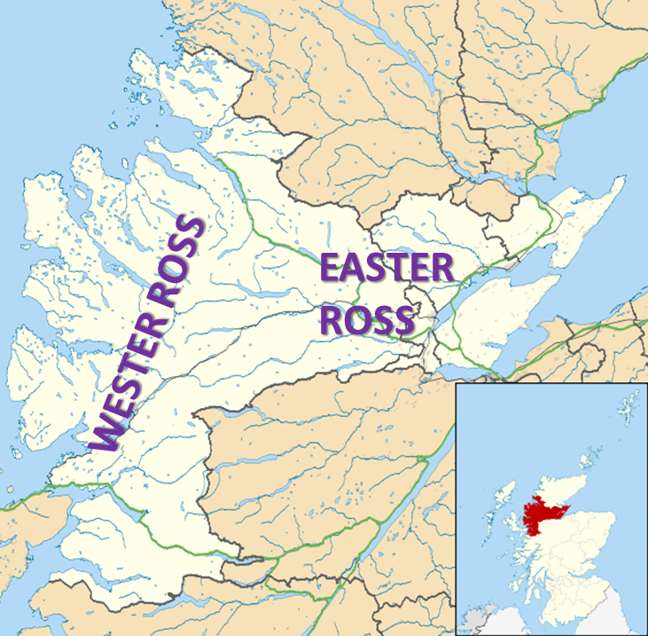
Wester Ross () is an area of the Northwest Highlands of Scotland in the council area of Highland. The area is loosely defined, and has never been used as a formal administrative region in its own right, but is generally regarded as lying to the west of the main watershed of Ross (the eastern part of Ross being Easter Ross), thus forming the western half of the county of Ross and Cromarty. The southwesternmost part of Ross and Cromarty, Lochalsh, is not considered part of Wester Ross by the local tourist organisation, ''Visit Wester Ross'', but is included within the definition used for the Wester Ross Biosphere Reserve.Wester Ross Biosphere Reserve Application. p. 2. Wester Ross has one of the lowest population densities in Europe, with just 1.6 people per km2, who live mostly in small crofting townships along the coastline of the region. The area is renowned for the scenic splendour of its mountains and coastline, and the range of wildlife that can be seen. It is a popular to ... [...More Info...] [...Related Items...] OR: [Wikipedia] [Google] [Baidu] |
Scotland
Scotland (, ) is a country that is part of the United Kingdom. Covering the northern third of the island of Great Britain, mainland Scotland has a border with England to the southeast and is otherwise surrounded by the Atlantic Ocean to the north and west, the North Sea to the northeast and east, and the Irish Sea to the south. It also contains more than 790 islands, principally in the archipelagos of the Hebrides and the Northern Isles. Most of the population, including the capital Edinburgh, is concentrated in the Central Belt‚ÄĒthe plain between the Scottish Highlands and the Southern Uplands‚ÄĒin the Scottish Lowlands. Scotland is divided into 32 administrative subdivisions or local authorities, known as council areas. Glasgow City is the largest council area in terms of population, with Highland being the largest in terms of area. Limited self-governing power, covering matters such as education, social services and roads and transportation, is devolved from the Scott ... [...More Info...] [...Related Items...] OR: [Wikipedia] [Google] [Baidu] |
Ullapool
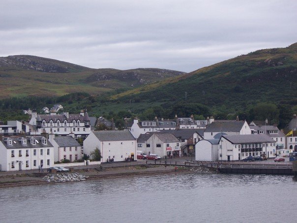
Ullapool (; gd, Ulapul ) is a village and port located in Northern Scotland. Ullapool has a population of around 1,500 inhabitants. It is located around northwest of Inverness in Ross and Cromarty, Scottish Highlands. Despite its modest size, it is the largest settlement for many miles around, and an important port and tourist destination. The North Atlantic Drift passes Ullapool, moderating the temperature. A few ''Cordyline australis'' (New Zealand cabbage trees) are grown in the town and are often mistaken for palm trees. The town lies on Loch Broom, on the A835 road from Inverness. The Ullapool River flows through the village. History On the east shore of Loch Broom, Ullapool was founded in 1788 as a herring port by the British Fisheries Society. It was designed by Thomas Telford. Prior to 1788 the town was only an insignificant hamlet made up of just over 20 households. The harbour is used as a fishing port, yachting haven, and ferry port. Ferries sail to Stornoway in the ... [...More Info...] [...Related Items...] OR: [Wikipedia] [Google] [Baidu] |
Loch
''Loch'' () is the Scottish Gaelic, Scots language, Scots and Irish language, Irish word for a lake or sea inlet. It is Cognate, cognate with the Manx language, Manx lough, Cornish language, Cornish logh, and one of the Welsh language, Welsh words for lake, llwch. In English English and Hiberno-English, the Anglicisation, anglicised spelling lough is commonly found in place names; in Lowland Scots and Scottish English, the spelling "loch" is always used. Many loughs are connected to stories of lake-bursts, signifying their mythical origin. Sea-inlet lochs are often called sea lochs or sea loughs. Some such bodies of water could also be called firths, fjords, estuary, estuaries, straits or bays. Background This name for a body of water is Insular Celtic languages, Insular CelticThe current form has currency in the following languages: Scottish Gaelic, Irish language, Irish, Manx language, Manx, and has been borrowed into Scots language, Lowland Scots, Scottish English, Iri ... [...More Info...] [...Related Items...] OR: [Wikipedia] [Google] [Baidu] |
Oligotroph
An oligotroph is an organism that can live in an environment that offers very low levels of nutrients. They may be contrasted with copiotrophs, which prefer nutritionally rich environments. Oligotrophs are characterized by slow growth, low rates of metabolism, and generally low population density. Oligotrophic environments are those that offer little to sustain life. These environments include deep oceanic sediments, caves, glacial and polar ice, deep subsurface soil, aquifers, ocean waters, and leached soils. Examples of oligotrophic organisms are the cave-dwelling olm; the bacterium " ''Candidatus'' Pelagibacter communis", which is the most abundant organism in the oceans with an estimated 2 √ó 1028 individuals in total; and the lichens with their extremely low metabolic rate. Etymologically, the word "oligotroph" is a combination of the Greek adjective ''oligos'' (ŠĹÄőĽőĮő≥őŅŌā) meaning "few" and the adjective ''trophikos'' (ŌĄŌĀőŅŌÜőĻőļŌĆŌā)) meaning "feeding". Plant adaptatio ... [...More Info...] [...Related Items...] OR: [Wikipedia] [Google] [Baidu] |


