|
Iwade Parish Council
Iwade is a village and civil parish north of the town of Sittingbourne in the English county of Kent. History Iwade was established in the late Medieval period, when it was a settlement linking Watling Street to the coast via Key Street (a street towards a Quay). A moated dwelling is believed to have existed here during the 13th to 15th centuries. According to Edward Hasted, in 1798 the manor of Warde (Iwade) was within the hundred of Teynham. It had sixteen houses, and about 60 or 70 inhabitants. The village lies on the former route of the A249 road, a major road from Maidstone to the Isle of Sheppey. A bypass was constructed in 1992, and improved again in 2006 during construction of the Sheppey Crossing. Iwade is the nearest settlement to Swale railway station. In 2014, a prehistoric henge was discovered during the development of new homes. It is believed to date from around 6000BC and is in diameter. Facilities Iwade has a village hall and a public house (The Woolpack). ... [...More Info...] [...Related Items...] OR: [Wikipedia] [Google] [Baidu] |
Borough Of Swale
Swale is a local government district with borough status in Kent, England and is bounded by Medway to the west, Canterbury to the east, Ashford to the south and Maidstone to the south west. Its council is based in Sittingbourne. The district is named after the narrow channel called The Swale, that separates the mainland of Kent from the Isle of Sheppey, and which occupies the central part of the district. The district was formed in 1974 under the Local Government Act 1972, from the Borough of Faversham; the Borough of Queenborough-in-Sheppey, which covered the whole of Sheppey; the Sittingbourne and Milton Urban District; and Swale Rural District. Most of the southern half of the Borough lies within the Kent Downs Area of Outstanding Natural Beauty, whilst Sittingbourne and the Isle of Sheppey forms the concluding part of the Thames Gateway growth area. There are four towns in the borough: Sittingbourne and Faversham on the mainland, and Sheerness and Queenborough on S ... [...More Info...] [...Related Items...] OR: [Wikipedia] [Google] [Baidu] |
Isle Of Sheppey
The Isle of Sheppey is an island off the northern coast of Kent, England, neighbouring the Thames Estuary, centred from central London. It has an area of . The island forms part of the local government district of Swale. ''Sheppey'' is derived from Old English ''Sceapig'', meaning "Sheep Island". Today's island was historically known as the "Isles of Sheppey" which were Sheppey itself, the Isle of Harty to the south east and the Isle of Elmley to the south west. Over time the channels between the islands have silted up to make one contiguous island. Sheppey, like much of north Kent, is largely formed from London Clay and is a plentiful source of fossils. The Mount near Minster rises to above sea level and is the highest point on the island. The rest of Sheppey is low-lying and the southern part of the island is marshy land criss-crossed by inlets and drains, largely used for grazing. The economy is driven by a dockyard and port, the presence of three prisons, and various c ... [...More Info...] [...Related Items...] OR: [Wikipedia] [Google] [Baidu] |
World War II
World War II or the Second World War, often abbreviated as WWII or WW2, was a world war that lasted from 1939 to 1945. It involved the vast majority of the world's countries—including all of the great powers—forming two opposing military alliances: the Allies and the Axis powers. World War II was a total war that directly involved more than 100 million personnel from more than 30 countries. The major participants in the war threw their entire economic, industrial, and scientific capabilities behind the war effort, blurring the distinction between civilian and military resources. Aircraft played a major role in the conflict, enabling the strategic bombing of population centres and deploying the only two nuclear weapons ever used in war. World War II was by far the deadliest conflict in human history; it resulted in 70 to 85 million fatalities, mostly among civilians. Tens of millions died due to genocides (including the Holocaust), starvation, ma ... [...More Info...] [...Related Items...] OR: [Wikipedia] [Google] [Baidu] |
Conference League (speedway)
The Conference League was the third and lowest division of motorcycle speedway racing in the United Kingdom governed by the Speedway Control Board (SCB), in conjunction with the British Speedway Promoters' Association (BSPA). The other leagues being the Elite League and Premier League. The League consisted of eight teams for the 2008 season. In 2009 it was replaced with the National League. History The British League Division Three had been created in 1994 as a replacement for the second-half junior leagues that were scrapped when British League matches were extended to eighteen heats. The league was renamed the British Academy League in 1995, but many of the teams that took part experienced severe financial problems. In order to reduce costs, the league was re-launched as the Conference league in 1996 and was an entirely amateur competition. The revamped competition proved to be successful, with several new teams joining and some tracks attracting crowds on par with the Premier ... [...More Info...] [...Related Items...] OR: [Wikipedia] [Google] [Baidu] |
Sittingbourne Crusaders
The Sittingbourne Crusaders were a British speedway team based in Iwade, England who raced in the Conference League. The Iwade training track was initially built in 1971 by former Hackney Hawks rider Barry Thomas whilst he was still a rider for the Canterbury Crusaders The Crusaders (formerly Canterbury Crusaders and BNZ Crusaders due to sponsorship by the Bank of New Zealand) are a New Zealand professional rugby union team based in Christchurch, who compete in the Super Rugby competition. They are the mos ..., the team whose colours and name Sittingbourne represented. The team competed in league seasons at various times from 1994 to 2008. Season summary References Speedway Conference League teams Sport in Sittingbourne {{motorcycle-speedway-team-stub ... [...More Info...] [...Related Items...] OR: [Wikipedia] [Google] [Baidu] |
Canterbury
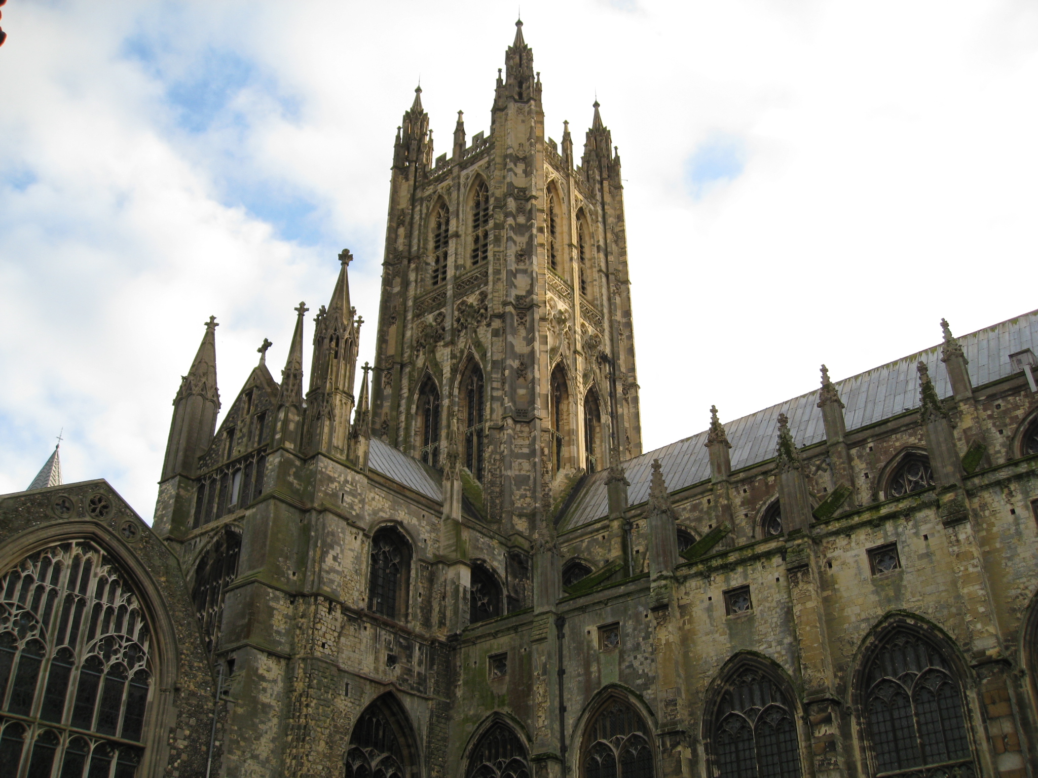
Canterbury (, ) is a City status in the United Kingdom, cathedral city and UNESCO World Heritage Site, situated in the heart of the City of Canterbury local government district of Kent, England. It lies on the River Stour, Kent, River Stour. The Archbishop of Canterbury is the primate (bishop), primate of the Church of England and the worldwide Anglican Communion owing to the importance of Augustine of Canterbury, St Augustine, who served as the apostle to the Anglo-Saxon paganism, pagan Kingdom of Kent around the turn of the 7th century. The city's Canterbury Cathedral, cathedral became a major focus of Christian pilgrimage, pilgrimage following the 1170 Martyr of the Faith, martyrdom of Thomas Becket, although it had already been a well-trodden pilgrim destination since the murder of Ælfheah of Canterbury, St Alphege by the men of cnut, King Canute in 1012. A journey of pilgrims to Becket's shrine served as the narrative frame, frame for Geoffrey Chaucer's 14th-century Wes ... [...More Info...] [...Related Items...] OR: [Wikipedia] [Google] [Baidu] |
Listed Building
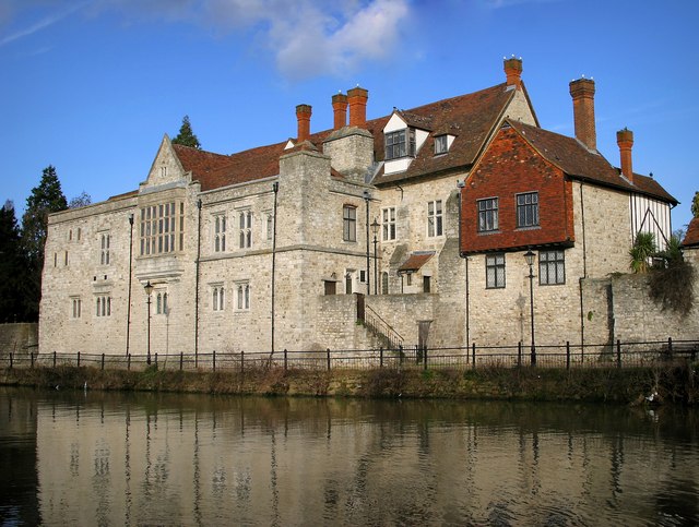
In the United Kingdom, a listed building or listed structure is one that has been placed on one of the four statutory lists maintained by Historic England in England, Historic Environment Scotland in Scotland, in Wales, and the Northern Ireland Environment Agency in Northern Ireland. The term has also been used in the Republic of Ireland, where buildings are protected under the Planning and Development Act 2000. The statutory term in Ireland is " protected structure". A listed building may not be demolished, extended, or altered without special permission from the local planning authority, which typically consults the relevant central government agency, particularly for significant alterations to the more notable listed buildings. In England and Wales, a national amenity society must be notified of any work to a listed building which involves any element of demolition. Exemption from secular listed building control is provided for some buildings in current use for worship, ... [...More Info...] [...Related Items...] OR: [Wikipedia] [Google] [Baidu] |
Henge
There are three related types of Neolithic earthwork that are all sometimes loosely called henges. The essential characteristic of all three is that they feature a ring-shaped bank and ditch, with the ditch inside the bank. Because the internal ditches would have served defensive purposes poorly, henges are not considered to have been defensive constructions (cf. circular rampart). The three henge types are as follows, with the figure in brackets being the approximate diameter of the central flat area: # Henge (> ). The word ''henge'' refers to a particular type of earthwork of the Neolithic period, typically consisting of a roughly circular or oval-shaped bank with an internal ditch surrounding a central flat area of more than in diameter. There is typically little if any evidence of occupation in a henge, although they may contain ritual structures such as stone circles, timber circles and Cove (standing stones), coves. Henge monument is sometimes used as a synonym for henge. ... [...More Info...] [...Related Items...] OR: [Wikipedia] [Google] [Baidu] |
Swale Railway Station
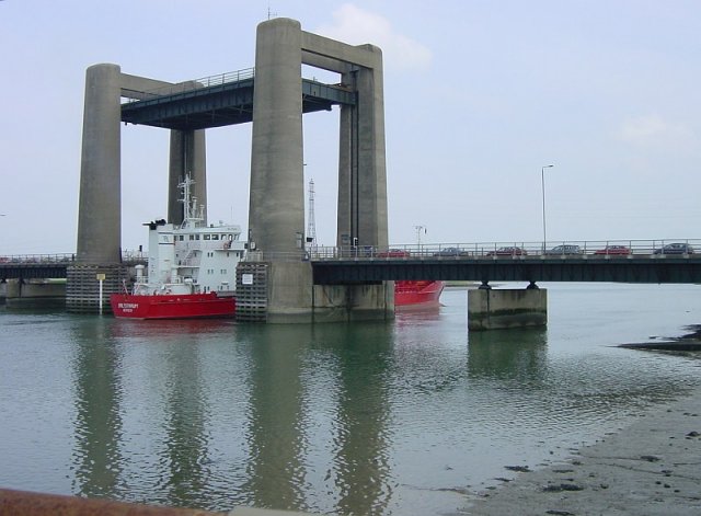
Swale railway station is in north Kent, England, on the Sheerness Line from , at the southern end of the Kingsferry Bridge which, along with the more modern Sheppey Crossing, connects the Isle of Sheppey to mainland Kent. The nearest settlement is Iwade. Train services are provided by Southeastern. Facilities Swale is a single platform station with one curving platform. It is immediately adjacent to the A249 road which is on a flyover above the station before it crosses The Swale on the Sheppey Crossing. The station is named after The Swale, the channel which separates the Isle of Sheppey from the mainland and connects with the River Medway to the west and Thames Estuary to the west. North of the station, the railway line crosses the channel on the Kingsferry Bridge. Ridham Dock lies south-east of the station. Swale Station is the least used station in Kent. History The station was opened in 1913 as a staff halt, called Kings Ferry Bridge Halt. On 17 December 1922, the ... [...More Info...] [...Related Items...] OR: [Wikipedia] [Google] [Baidu] |
Sheppey Crossing
The Sheppey Crossing is a bridge which carries the A249 road across The Swale (a tidal strait of the Thames Estuary), linking the Isle of Sheppey with the mainland of Kent. The four-lane crossing measures 21.5 m (71 feet) in width, at a height of 35 m (115 feet) over the water. The A249 links the M20 and M2 motorways to Sheppey. The bridge opened in 2006, and it provides an alternative highway to the neighbouring Kingsferry Bridge that was completed in 1959. The Sheppey Crossing is not open to pedestrians, bicycles, or horses, and these continue to use the older bridge, as does the railway line to Sheerness. Both bridges are monitored by an automatic number plate recognition (ANPR) system to detect lawbreaking vehicles. Construction The bridge was constructed as part of a £100 million plan to improve the A249 between the M2 and the port of Sheerness. The Kingsferry Bridge, which previously carried the A249, suffers from two major drawbacks: It has only one lane in each dire ... [...More Info...] [...Related Items...] OR: [Wikipedia] [Google] [Baidu] |
Maidstone
Maidstone is the largest Town status in the United Kingdom, town in Kent, England, of which it is the county town. Maidstone is historically important and lies 32 miles (51 km) east-south-east of London. The River Medway runs through the centre of the town, linking it with Rochester, Kent, Rochester and the Thames Estuary. Historically, the river carried much of the town's trade as the centre of the agricultural county of Kent, known as the Garden of England. There is evidence of settlement in the area dating back before the Stone Age. The town, part of the borough of Maidstone, had an approximate population of 100,000 in 2019. Since World War II, the town's economy has shifted from heavy industry towards light industry and services. Toponymy Anglo-Saxon period of English history, Saxon charters dating back to ca. 975 show the first recorded instances of the town's name, ''de maeides stana'' and ''maegdan stane'', possibly meaning ''stone of the maidens'' or ''stone of the ... [...More Info...] [...Related Items...] OR: [Wikipedia] [Google] [Baidu] |
Kent
Kent is a county in South East England and one of the home counties. It borders Greater London to the north-west, Surrey to the west and East Sussex to the south-west, and Essex to the north across the estuary of the River Thames; it faces the French department of Pas-de-Calais across the Strait of Dover. The county town is Maidstone. It is the fifth most populous county in England, the most populous non-Metropolitan county and the most populous of the home counties. Kent was one of the first British territories to be settled by Germanic tribes, most notably the Jutes, following the withdrawal of the Romans. Canterbury Cathedral in Kent, the oldest cathedral in England, has been the seat of the Archbishops of Canterbury since the conversion of England to Christianity that began in the 6th century with Saint Augustine. Rochester Cathedral in Medway is England's second-oldest cathedral. Located between London and the Strait of Dover, which separates England from mainla ... [...More Info...] [...Related Items...] OR: [Wikipedia] [Google] [Baidu] |


