|
Islands Of The River Thames
This article lists the islands in the River Thames, or at the mouth of a tributary (marked †), in England. It excludes human-made islands built as part of the building of forty-five two-gate locks which each accompany a weir, and islets subordinate to and forming part of the overall shape of another. The suffix ''-ey'' (pronounced today ) is common across England and Scotland and cognate with ait and meaning island, a term – as ait or eyot – unusually well-preserved on the Thames. A small minority of list entries are referred to as Island, Ait or Eyot and are vestiges, separated by a depression in the land or high-water-level gully. Most are natural; others were created by excavation of an additional or replacement navigation channel, such as to provide a shorter route, a cut. Many result from accumulation of gravel, silt, wildfowl dung and plant decay and root strengthening, particularly from willows and other large trees. Unlike other large rivers, all today are c ... [...More Info...] [...Related Items...] OR: [Wikipedia] [Google] [Baidu] |
River Thames
The River Thames ( ), known alternatively in parts as the The Isis, River Isis, is a river that flows through southern England including London. At , it is the longest river entirely in England and the Longest rivers of the United Kingdom, second-longest in the United Kingdom, after the River Severn. The river rises at Thames Head in Gloucestershire, and flows into the North Sea near Tilbury, Essex and Gravesend, Kent, via the Thames Estuary. From the west it flows through Oxford (where it is sometimes called the Isis), Reading, Berkshire, Reading, Henley-on-Thames and Windsor, Berkshire, Windsor. The Thames also drains the whole of Greater London. In August 2022, the source of the river moved five miles to beyond Somerford Keynes due to the heatwave in July 2022. The lower reaches of the river are called the Tideway, derived from its long tidal reach up to Teddington Lock. Its tidal section includes most of its London stretch and has a rise and fall of . From Oxford to th ... [...More Info...] [...Related Items...] OR: [Wikipedia] [Google] [Baidu] |
Elmley
Elmley is the local name for the Isle of Elmley, part of the Isle of Sheppey in Kent, England. It was also the name of a very late 19th century industrial village on the isle. Edward Hasted describes, in 1798, the isle as two-eighths of the Isle of Sheppey (in turn) estimated as 11 miles by 8 miles. Its present national nature reserve covers more than the easily traceable area of the former isle by extending to the east, over Windmill Creek, one of two Sheppey inlets, former internal tidal channels. History The village was a settlement and area that fluctuated between 1640 and up to 2341 acres by definition. The former civil parish at its height as recorded by decennial censuses had 219 residents at the 1891 census, falling to 50 in twenty years and to 8 in 1961, shortly before its abolition. It consisted of the Turkey Cement Works, which was the major employer for the area, as well as a school, a church, a public house and 30 dwellings. The ailing cement works closed in 1902 and ... [...More Info...] [...Related Items...] OR: [Wikipedia] [Google] [Baidu] |
Elmley Marshes
Elmley is the local name for the Isle of Elmley, part of the Isle of Sheppey in Kent, England. It was also the name of a very late 19th century industrial village on the isle. Edward Hasted Edward Hasted (20 December 1732 OS (31 December 1732 NS) – 14 January 1812) was an English antiquarian and pioneering historian of his ancestral home county of Kent. As such, he was the author of a major county history, ''The History and T ... describes, in 1798, the isle as two-eighths of the Isle of Sheppey (in turn) estimated as 11 miles by 8 miles. Its present national nature reserve covers more than the easily traceable area of the former isle by extending to the east, over Windmill Creek, one of two Sheppey inlets, former internal tidal channels. History The village was a settlement and area that fluctuated between 1640 and up to 2341 acres by definition. The former civil parish at its height as recorded by decennial censuses had 219 residents at the 1891 census, falling to 50 i ... [...More Info...] [...Related Items...] OR: [Wikipedia] [Google] [Baidu] |
Isle Of Thanet
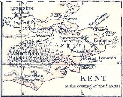
The Isle of Thanet () is a peninsula forming the easternmost part of Kent, England. While in the past it was separated from the mainland by the Wantsum Channel, it is no longer an island. Archaeological remains testify to its settlement in ancient times. Today, it is a tourist destination, and has an active agricultural base. Etymology The island of Thanet is mentioned as ''Tonetic'' (c. AD 150; the TON- of this form was misread as TOΛI-, hence it appears as ''Toliatis'' in the surviving manuscripts of Ptolemy); ''Tanat's'' (3rd C AD, Solinus); ''Tanatos'' (AD 731); ''Tenid'' in 679BEAUREPAIRE and ''Tenet'' (e.g. charters of AD 679, 689 and thereafter); and the Old Welsh forms ''Tanet'' and ''Danet'', found in the ''Historia Brittonum'' (c. AD 829/30) and Armes Prydein (c. AD 930). Standard reference works for English place-names (such as Eilert Ekwall's ''Concise Oxford Dictionary of English Place-Names'') state the name ''Tanet'' is known to be Brythonic in origin. Common ... [...More Info...] [...Related Items...] OR: [Wikipedia] [Google] [Baidu] |
North Sea
The North Sea lies between Great Britain, Norway, Denmark, Germany, the Netherlands and Belgium. An epeiric sea on the European continental shelf, it connects to the Atlantic Ocean through the English Channel in the south and the Norwegian Sea in the north. It is more than long and wide, covering . It hosts key north European shipping lanes and is a major fishery. The coast is a popular destination for recreation and tourism in bordering countries, and a rich source of energy resources, including wind and wave power. The North Sea has featured prominently in geopolitical and military affairs, particularly in Northern Europe, from the Middle Ages to the modern era. It was also important globally through the power northern Europeans projected worldwide during much of the Middle Ages and into the modern era. The North Sea was the centre of the Vikings' rise. The Hanseatic League, the Dutch Republic, and the British each sought to gain command of the North Sea and access t ... [...More Info...] [...Related Items...] OR: [Wikipedia] [Google] [Baidu] |
English Channel
The English Channel, "The Sleeve"; nrf, la Maunche, "The Sleeve" (Cotentinais) or ( Jèrriais), (Guernésiais), "The Channel"; br, Mor Breizh, "Sea of Brittany"; cy, Môr Udd, "Lord's Sea"; kw, Mor Bretannek, "British Sea"; nl, Het Kanaal, "The Channel"; german: Ärmelkanal, "Sleeve Channel" ( French: ''la Manche;'' also called the British Channel or simply the Channel) is an arm of the Atlantic Ocean that separates Southern England from northern France. It links to the southern part of the North Sea by the Strait of Dover at its northeastern end. It is the busiest shipping area in the world. It is about long and varies in width from at its widest to at its narrowest in the Strait of Dover."English Channel". ''The Columbia Encyclopedia'', 2004. It is the smallest of the shallow seas around the continental shelf of Europe, covering an area of some . The Channel was a key factor in Britain becoming a naval superpower and has been utilised by Britain as a natural def ... [...More Info...] [...Related Items...] OR: [Wikipedia] [Google] [Baidu] |
Battersea
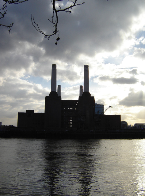
Battersea is a large district in south London, part of the London Borough of Wandsworth, England. It is centred southwest of Charing Cross and extends along the south bank of the River Thames. It includes the Battersea Park. History Battersea is mentioned in the few surviving Anglo-Saxon geographical accounts as ''Badrices īeg'' meaning "Badric's Island" and later "Patrisey". As with many former parishes beside tidal flood plains the lowest land was reclaimed for agriculture by draining marshland and building culverts for streams. Alongside this was the Heathwall tide mill in the north-east with a very long mill pond regularly draining and filling to the south. The settlement appears in the Domesday Book of 1086 as ''Patricesy'', a vast manor held by St Peter's Abbey, Westminster. Its ''Domesday'' Assets were: 18 hides and 17 ploughlands of cultivated land; 7 mills worth £42 9s 8d per year, of meadow, woodland worth 50 hogs. It rendered (in total): £75 9s 8d. The p ... [...More Info...] [...Related Items...] OR: [Wikipedia] [Google] [Baidu] |
St Saviour's Dock
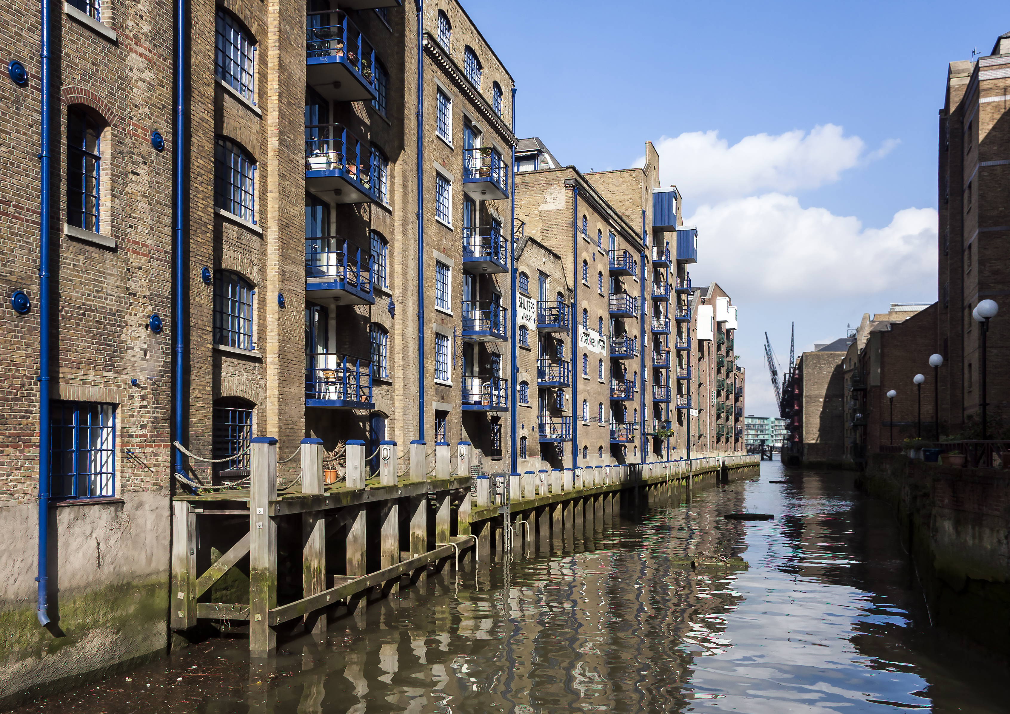
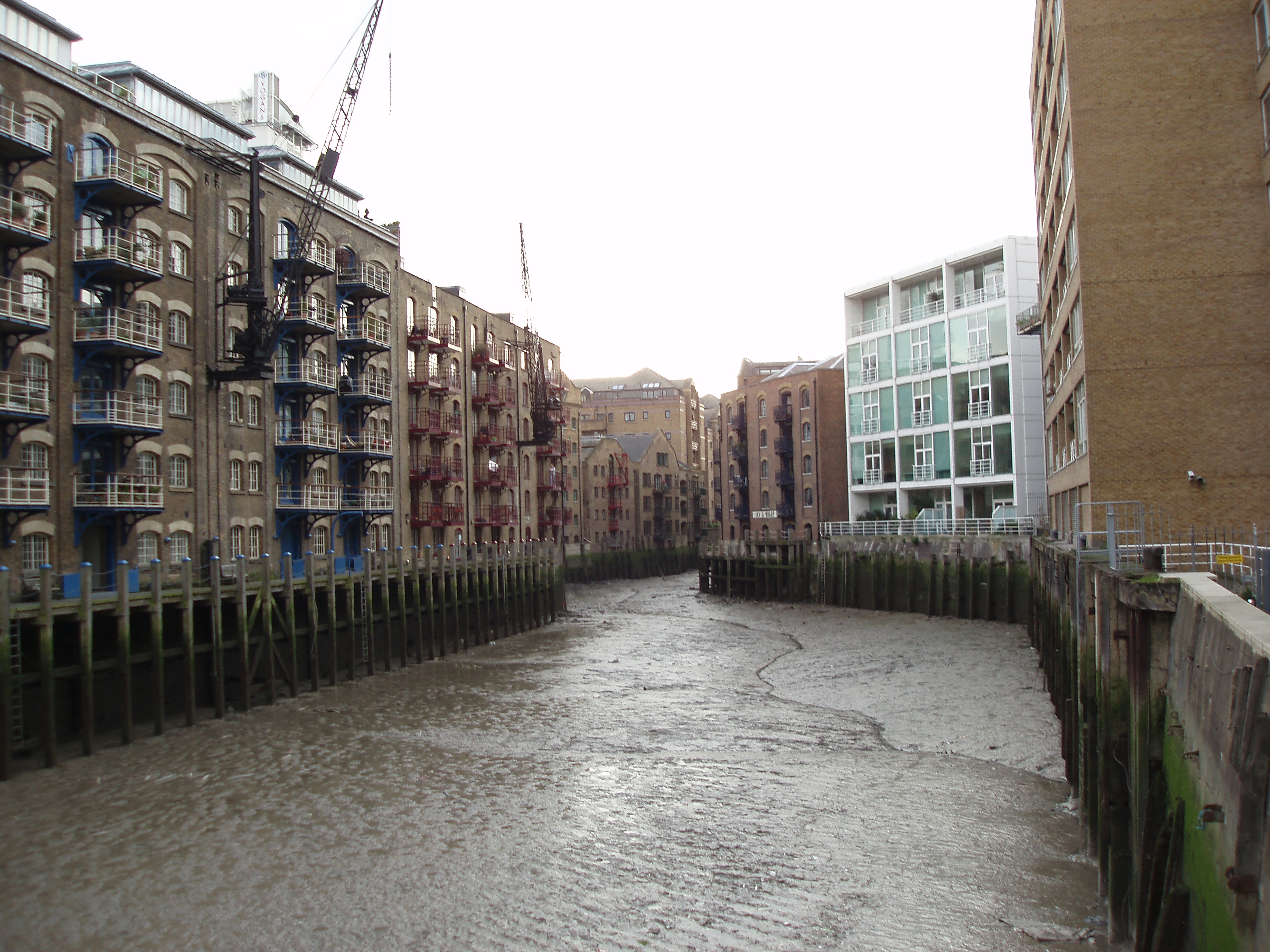
St Saviour's Dock is an inlet-style dock in London, England, on the south bank of the River Thames, 420 metres east of Tower Bridge. It forms the eastern end of the Shad Thames embankment that starts at Tower Bridge. The east side of the Dock is Jacob's Island. Geography The Thames is highly tidal at this point and the intertidal range within the dock is substantial, with a rise and fall of four metres since the construction of a system of winter flow-regulating locks and weirs on the River Thames culminating in Teddington Lock and of the Thames Barrier. During tidal surges the water level has risen just above pavement level of adjacent buildings on Shad Thames and Mill Street. The rectangular inlet opens to the river 420 metres east of Tower Bridge. St Saviour's Dock is the point where the River Neckinger enters the Thames. The Neckinger is a subterranean river that rises in the south of Southwark, near Walworth and flows to the Thames underground. History A community of C ... [...More Info...] [...Related Items...] OR: [Wikipedia] [Google] [Baidu] |
River Neckinger
The River Neckinger is a reduced subterranean river that rises in Southwark and flows approximately through that part of London to St Saviour's Dock where it enters the Thames. What remains of the river is enclosed and runs underground and most of its narrow catchment has been diverted into other combined and surface water sewers, flowing into the Southern Outfall Sewer and the Thames respectively. Course The watercourse drained first the seasonally wet (and occasionally flooded) ground at St George's Fields, now Geraldine Mary Harmsworth Park, in western Southwark. Its course was east as follows: it took the line of Brook Drive then passed by the Elephant and Castle, then passed the site of Lock Hospital, Kent Street. This upper section was also known before that hospital's closure in the early 19th century as the Lock Stream. It then passed the grounds of (since demolished) Bermondsey Abbey to the south, forming the channel north of what was the large Thames island of Bermo ... [...More Info...] [...Related Items...] OR: [Wikipedia] [Google] [Baidu] |
Anabranch
An anabranch is a section of a river or stream that diverts from the main channel or stem of the watercourse and rejoins the main stem downstream. Local anabranches can be the result of small islands in the watercourse. In larger anabranches, the flow can diverge for a distance of several kilometers before rejoining the main channel. Word usage and related terms The term ''anabranch'', in its hydrological meaning, is used more frequently in Australia than in the rest of the English-speaking world. The term ''anabranching river'' describes a river with many anabranches, whilst an anastomosing river is an organic-rich subset of this river type. The term braided river describes watercourses which are divided by small islands into multiple channel threads within a single main channel, but the term does not describe the multiple channels of an anabranching river. A distributary is a branch of a river that does not rejoin the main channel; these are common on and near river d ... [...More Info...] [...Related Items...] OR: [Wikipedia] [Google] [Baidu] |
Bermondsey Abbey
Bermondsey Abbey was an English Benedictine monastery. Most widely known as being founded in the 11th century, it had a precursor mentioned in the early eighth century, and was centred on what is now Bermondsey Square, the site of Bermondsey Market, Bermondsey, in the London Borough of Southwark, southeast London, England. Foundation A monastery is known to have existed at Bermondsey before 715 AD, when it was a Surrey colony of the important Mercian monastery of Medeshamstede, later known as Peterborough. Though surviving only in a copy written at Peterborough in the 12th century, a letter of Pope Constantine (708–715) grants privileges to a monastery at ''Vermundesei''. This monastery most likely continued, probably as a secular minster, at least until the 9th-century Viking invasions. Nothing more is heard of any church at Bermondsey until 1082, when, according to the "Annales Monasterii de Bermundeseia", a monastery was founded there by one Alwinus Child, with roya ... [...More Info...] [...Related Items...] OR: [Wikipedia] [Google] [Baidu] |
Bermondsey
Bermondsey () is a district in southeast London, part of the London Borough of Southwark, England, southeast of Charing Cross. To the west of Bermondsey lies Southwark, to the east Rotherhithe and Deptford, to the south Walworth and Peckham, and to the north is Wapping across the River Thames. It lies within the historic county boundaries of Surrey. History Toponymy Bermondsey may be understood to mean ''Beornmund''s island; but, while ''Beornmund'' represents an Old English personal name, identifying an individual once associated with the place, the element "-ey" represents Old English ''eg'', for "island", "piece of firm land in a fen", or simply a "place by a stream or river". Thus Bermondsey need not have been an island as such in the Anglo-Saxon period, and is as likely to have been a higher, drier spot in an otherwise marshy area. Though Bermondsey's earliest written appearance is in the Domesday Book of 1086, it also appears in a source which, though surviving only in ... [...More Info...] [...Related Items...] OR: [Wikipedia] [Google] [Baidu] |


