|
Ishasha River Camp Airport
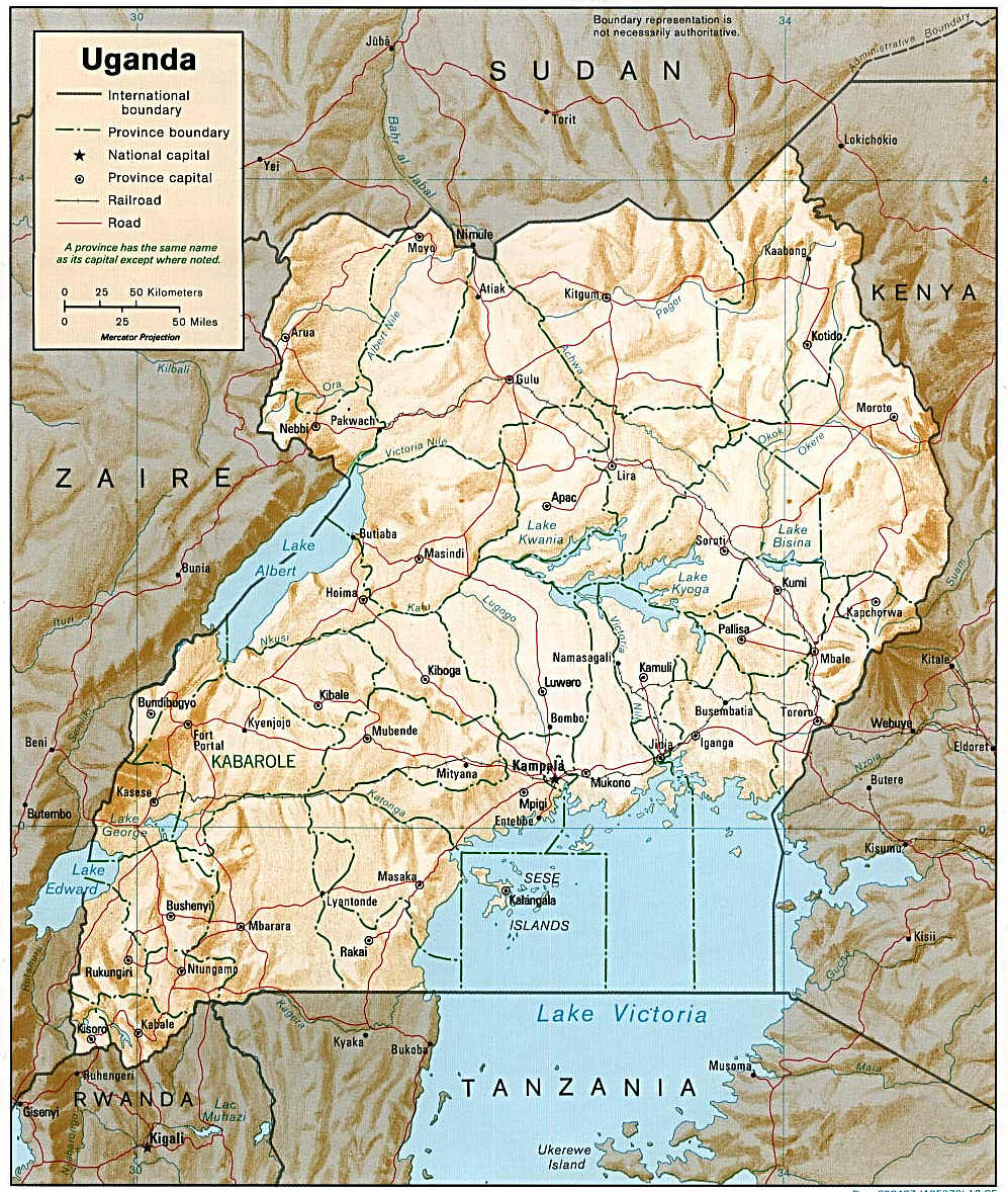
Ishasha River Camp Airport is an airport serving the Ishasha River CampQueen Elizabeth National Park,(1961) Lower left corner of map and the in . The Kisoro (Ident: KS) is located south of the airport. Ishasha River Camp is on the Ugandan side of the |
Queen Elizabeth National Park
Queen Elizabeth National Park is a national park in Uganda. Location Queen Elizabeth National Park (QENP) is in the Western Region of Uganda, spanning the districts of Kasese, Kamwenge, Rubirizi, and Rukungiri. The park is approximately by road south-west of Kampala, Uganda's capital and largest city. The city of Kasese lies to the northeast of the park, while the town of Rubirizi is to the southeast. The park adjoins Kyambura Game Reserve to the east, which itself adjoins the Kigezi Game Reserve (including the Maramagambo Forest) and thus the Kibale National Park to the northeast. The Virunga National Park in the Democratic Republic of the Congo lies across the border to the west. Together, these protected places completely encircle Lake Edward. The Rwenzori Mountains National Park in Uganda lies not far to the northwest. Confusingly, during the 1970s and 1980s, Western conservationists usually referred to the park as Rwenzori National Park. History In 1921, a rinderpest ... [...More Info...] [...Related Items...] OR: [Wikipedia] [Google] [Baidu] |
Uganda
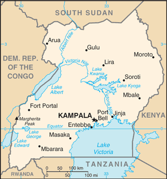
}), is a landlocked country in East Africa East Africa, Eastern Africa, or East of Africa, is the eastern subregion of the African continent. In the United Nations Statistics Division scheme of geographic regions, 10-11-(16*) territories make up Eastern Africa: Due to the historical .... The country is bordered to the east by Kenya, to the north by South Sudan, to the west by the Democratic Republic of the Congo, to the south-west by Rwanda, and to the south by Tanzania. The southern part of the country includes a substantial portion of Lake Victoria, shared with Kenya and Tanzania. Uganda is in the African Great Lakes region. Uganda also lies within the Nile, Nile basin and has a varied but generally a modified equatorial climate. It has a population of around 49 million, of which 8.5 million live in the Capital city, capital and largest city of Kampala. Uganda is named after the Buganda kingdom, which encompasses a large portion of the south of the country, includi ... [...More Info...] [...Related Items...] OR: [Wikipedia] [Google] [Baidu] |
Non-directional Beacon
A non-directional beacon (NDB) or non-directional radio beacon is a radio beacon which does not include directional information. Radio beacons are radio transmitters at a known location, used as an aviation or marine navigational aid. NDB are in contrast to directional radio beacons and other navigational aids, such as low-frequency radio range, VHF omnidirectional range (VOR) and tactical air navigation system (TACAN). NDB signals follow the curvature of the Earth, so they can be received at much greater distances at lower altitudes, a major advantage over VOR. However, NDB signals are also affected more by atmospheric conditions, mountainous terrain, coastal refraction and electrical storms, particularly at long range. The system, developed by United States Air Force (USAF) Captain Albert Francis Hegenberger, was used to fly the world's first instrument approach on May 9, 1932. Types of NDBs NDBs used for aviation are standardised by International Civil Aviation Organizat ... [...More Info...] [...Related Items...] OR: [Wikipedia] [Google] [Baidu] |
Ishasha River
The Ishasha is a river in southwest Uganda, forming part of the border with the Democratic Republic of the Congo. It runs from its source north of Kabale to its mouth at Lake Edward. Its length is very roughly ignoring the many small meanders. Description The river arises from drainage channels in farmland some northwest of Kabale. It runs northwest through mountain valleys to its entrance into the northern lobe of Bwindi Impenetrable National Park. From there, it continues northwest under the heavy forest canopy to the Kanungu dam, part of the Kanungu Hydroelectric Power Station, also known as the Ishasha Power Station. Leaving the power station, it meanders northwest through hilly terrain until it joins and becomes part of the Uganda-Democratic Republic of the Congo (DRC) border. After turning north, it continues past the DRC town of Ishasha at the southern tip of Queen Elizabeth National Park (QENP). It remains the western border of QENP until it enters the marshlands on th ... [...More Info...] [...Related Items...] OR: [Wikipedia] [Google] [Baidu] |
Democratic Republic Of The Congo
The Democratic Republic of the Congo (french: République démocratique du Congo (RDC), colloquially "La RDC" ), informally Congo-Kinshasa, DR Congo, the DRC, the DROC, or the Congo, and formerly and also colloquially Zaire, is a country in Central Africa. It is bordered to the northwest by the Republic of the Congo, to the north by the Central African Republic, to the northeast by South Sudan, to the east by Uganda, Rwanda, and Burundi, and by Tanzania (across Lake Tanganyika), to the south and southeast by Zambia, to the southwest by Angola, and to the west by the South Atlantic Ocean and the Cabinda exclave of Angola. By area, it is the second-largest country in Africa and the 11th-largest in the world. With a population of around 108 million, the Democratic Republic of the Congo is the most populous officially Francophone country in the world. The national capital and largest city is Kinshasa, which is also the nation's economic center. Centered on the Cong ... [...More Info...] [...Related Items...] OR: [Wikipedia] [Google] [Baidu] |
Transport In Uganda
Transport in Uganda refers to the transportation structure in Uganda. The country has an extensive network of paved and unpaved roads. Roadways As of 2017, according to the Uganda Ministry of Works and Transport, Uganda had about of roads, with approximately (4 percent) paved. Most paved roads radiate from Kampala, the country's capital and largest city. International highways The Lagos-Mombasa Highway, part of the Trans-Africa Highway and aiming to link East Africa and West Africa, passes through Uganda. This is complete only eastwards from the Uganda– DR Congo border to Mombasa, linking the African Great Lakes region to the sea. In East Africa, this roadway is part of the Northern Corridor. It cannot be used to reach West Africa because the route westwards across DR Congo to Bangui in the Central African Republic (CAR) is impassable after the Second Congo War and requires reconstruction. An alternative route (not part of the Trans-African network) to Bangui base ... [...More Info...] [...Related Items...] OR: [Wikipedia] [Google] [Baidu] |
List Of Airports In Uganda
This is a list of airports in Uganda, sorted by location. Uganda is a landlocked country in East Africa. It is bordered on the east by Kenya, on the north by South Sudan, on the west by the Democratic Republic of the Congo, on the southwest by Rwanda, and on the south by Tanzania. The southern part of the country includes a substantial portion of Lake Victoria, which is also bordered by Kenya and Tanzania. Uganda's capital and largest city is Kampala. __TOC__ Airports Names shown in bold indicate the airport has scheduled passenger service on commercial airlines. These include Entebbe International Airport, plus three domestic airports where Kampala-based Eagle Air (Uganda), Eagle Air provides service: Arua Airport, Gulu Airport, and Moyo Airport. See also * Transport in Uganda * List of airports by ICAO code: H#HU - Uganda * Wikipedia: WikiProject Aviation/Airline destination lists: Africa#Uganda References Great Circle Mapper: Airports in Uganda- IATA and ICAO cod ... [...More Info...] [...Related Items...] OR: [Wikipedia] [Google] [Baidu] |


