|
Indian Famine Of 1896–1897
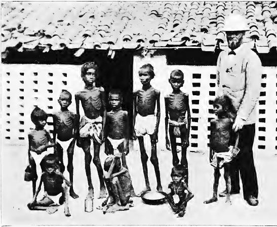
The Indian famine of 1896–1897 was a famine that began in Bundelkhand, India, early in 1896 and spread to many parts of the country, including the United Provinces, the Central Provinces and Berar, Bihar, parts of the Bombay and Madras presidencies, and parts of the Punjab; in addition, the princely states of Rajputana, Central India Agency, and Hyderabad were affected.C.A.H. TownsendFinal repor of thirds revised revenue settlement of Hisar district from 1905-1910 Gazetteer of Department of Revenue and Disaster Management, Haryana, point 22, page 11. All in all, during the two years, the famine affected an area of and a population of 69.5 million. Although relief was offered throughout the famine-stricken regions in accordance with the Provisional Famine Code of 1883, the mortality, both from starvation and accompanying epidemics, was very high: approximately one million people are thought to have died. Course The Bundelkhand district of Agra Province experienced dr ... [...More Info...] [...Related Items...] OR: [Wikipedia] [Google] [Baidu] |
British Raj
The British Raj (; from Hindi ''rāj'': kingdom, realm, state, or empire) was the rule of the British Crown on the Indian subcontinent; * * it is also called Crown rule in India, * * * * or Direct rule in India, * Quote: "Mill, who was himself employed by the British East India company from the age of seventeen until the British government assumed direct rule over India in 1858." * * and lasted from 1858 to 1947. * * The region under British control was commonly called India in contemporaneous usage and included areas directly administered by the United Kingdom, which were collectively called British India, and areas ruled by indigenous rulers, but under British paramountcy, called the princely states. The region was sometimes called the Indian Empire, though not officially. As ''India'', it was a founding member of the League of Nations, a participating nation in the Summer Olympics in 1900, 1920, 1928, 1932, and 1936, and a founding member of the United Nations in San F ... [...More Info...] [...Related Items...] OR: [Wikipedia] [Google] [Baidu] |
Manbhum
Manbhum District was one of the districts of the East India during the British Raj. After India's independence, the district became a part of Bihar State. Upon re-organisation of the Indian states in the mid-1950s, present Purulia district was carved out of the district of Manbhum and became a part of the West Bengal; the remaining part of Manbhum district was kept with Bihar state and became part of Dhanbad district. Etymology Manbhum gets its name from the 16th century military general Man Singh 1 who is known for his conquests Of Bihar, Odisha and parts of Bengal. He later also served as the governor ( Subahdar) of this region during the reign of King Akbar. The district name derived from Manbazar or Manbhum Khas parganas. The headquarters of Jangal mahal region from around 1833 to 1838, when the district was formed. History See also *Jungle Mahals *Bengali Language Movement (Manbhum) The Language Movement in Manbhum was a movement in Manbhum district, present day Puruli ... [...More Info...] [...Related Items...] OR: [Wikipedia] [Google] [Baidu] |
East India
East India is a region of India consisting of the Indian states of Bihar, Jharkhand, Odisha and West Bengal and also the union territory of the Andaman and Nicobar Islands. The region roughly corresponds to the historical region of Magadha from which it inherits its various Eastern Indo-Aryan languages. The states of Bihar and West Bengal lie on the Indo-Gangetic plain. Jharkhand is situated on the Chota Nagpur Plateau. Odisha lies on the Eastern Ghats and the Deccan Plateau. West Bengal's capital Kolkata is the largest city of this region. The Kolkata Metropolitan Area is the country's third largest. The region is bounded by Bhutan, Nepal and the state of Sikkim in the north, the states of Uttar Pradesh and Chhattisgarh on the west, the state of Andhra Pradesh in the south and the country of Bangladesh in the east. It is also bounded by the Bay of Bengal in the south-east. It is connected to the Seven Sister States of Northeast India by the narrow Siliguri Corrido ... [...More Info...] [...Related Items...] OR: [Wikipedia] [Google] [Baidu] |
Chota Nagpur Plateau
The Chota Nagpur Plateau is a plateau in eastern India, which covers much of Jharkhand state as well as adjacent parts of Chhattisgarh, Odisha, West Bengal and Bihar. The Indo-Gangetic plain lies to the north and east of the plateau, and the basin of the Mahanadi river lies to the south. The total area of the Chota Nagpur Plateau is approximately . Etymology The name ''Nagpur'' is probably taken from Nagavanshis, who ruled in this part of the country. ''Chhota'' (''small'' in Hindi) is the misunderstood name of "Chuita" village in the outskirts of Ranchi, which has the remains of an old fort belonging to the Nagavanshis.Sir John Houlton, ''Bihar, the Heart of India'', pp. 127-128, Orient Longmans, 1949. Formation The Chota Nagpur Plateau is a continental plateau—an extensive area of land thrust above the general land. The plateau has been formed by continental uplift from forces acting deep inside the earth. The Gondwana substrates attest to the plateau's ancient origin. ... [...More Info...] [...Related Items...] OR: [Wikipedia] [Google] [Baidu] |
Central Provinces
The Central Provinces was a province of British India. It comprised British conquests from the Mughals and Marathas in central India, and covered parts of present-day Madhya Pradesh, Chhattisgarh and Maharashtra states. Its capital was Nagpur. Its Summer Capital was Pachmarhi. It became the Central Provinces and Berar in 1903. The Central Provinces was formed in 1861 by the merger of the Saugor and Nerbudda Territories and Nagpur Province. The district of Nimar which was administered by the Central India Agency was added in 1864. It was almost an island encircled by a sea of "native States" such as Bhopal State and Rewa State to the north, the Chota Nagpur States and Kalahandi State to the east, and the Nizam's territories of Hyderabad to the south and Berar to the west. Geography The Central Provinces was landlocked, occupying the mountain ranges, plateaus, and river valleys in the centre of the Indian Subcontinent. The northernmost portion of the state extended onto the Bun ... [...More Info...] [...Related Items...] OR: [Wikipedia] [Google] [Baidu] |
Pound Sterling
Sterling (abbreviation: stg; Other spelling styles, such as STG and Stg, are also seen. ISO code: GBP) is the currency of the United Kingdom and nine of its associated territories. The pound ( sign: £) is the main unit of sterling, and the word "pound" is also used to refer to the British currency generally, often qualified in international contexts as the British pound or the pound sterling. Sterling is the world's oldest currency that is still in use and that has been in continuous use since its inception. It is currently the fourth most-traded currency in the foreign exchange market, after the United States dollar, the euro, and the Japanese yen. Together with those three currencies and Renminbi, it forms the basket of currencies which calculate the value of IMF special drawing rights. As of mid-2021, sterling is also the fourth most-held reserve currency in global reserves. The Bank of England is the central bank for sterling, issuing its own banknotes, and ... [...More Info...] [...Related Items...] OR: [Wikipedia] [Google] [Baidu] |
Bubonic Plague
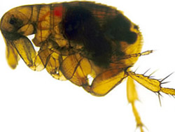
Bubonic plague is one of three types of plague caused by the plague bacterium (''Yersinia pestis''). One to seven days after exposure to the bacteria, flu-like symptoms develop. These symptoms include fever, headaches, and vomiting, as well as swollen and painful lymph nodes occurring in the area closest to where the bacteria entered the skin. Acral necrosis, the dark discoloration of skin, is another symptom. Occasionally, swollen lymph nodes, known as "buboes," may break open. The three types of plague are the result of the route of infection: bubonic plague, septicemic plague, and pneumonic plague. Bubonic plague is mainly spread by infected fleas from small animals. It may also result from exposure to the body fluids from a dead plague-infected animal. Mammals such as rabbits, hares, and some cat species are susceptible to bubonic plague, and typically die upon contraction. In the bubonic form of plague, the bacteria enter through the skin through a flea bite and travel ... [...More Info...] [...Related Items...] OR: [Wikipedia] [Google] [Baidu] |
Malaria
Malaria is a mosquito-borne infectious disease that affects humans and other animals. Malaria causes symptoms that typically include fever, tiredness, vomiting, and headaches. In severe cases, it can cause jaundice, seizures, coma, or death. Symptoms usually begin ten to fifteen days after being bitten by an infected mosquito. If not properly treated, people may have recurrences of the disease months later. In those who have recently survived an infection, reinfection usually causes milder symptoms. This partial resistance disappears over months to years if the person has no continuing exposure to malaria. Malaria is caused by single-celled microorganisms of the ''Plasmodium'' group. It is spread exclusively through bites of infected ''Anopheles'' mosquitoes. The mosquito bite introduces the parasites from the mosquito's saliva into a person's blood. The parasites travel to the liver where they mature and reproduce. Five species of ''Plasmodium'' can infect and be spread by h ... [...More Info...] [...Related Items...] OR: [Wikipedia] [Google] [Baidu] |
British India
The provinces of India, earlier presidencies of British India and still earlier, presidency towns, were the administrative divisions of British governance on the Indian subcontinent. Collectively, they have been called British India. In one form or another, they existed between 1612 and 1947, conventionally divided into three historical periods: *Between 1612 and 1757 the East India Company set up Factory (trading post), factories (trading posts) in several locations, mostly in coastal India, with the consent of the Mughal emperors, Maratha Empire or local rulers. Its rivals were the merchant trading companies of Portugal, Denmark, the Netherlands, and France. By the mid-18th century, three ''presidency towns'': Madras, Bombay and Calcutta, had grown in size. *During the period of Company rule in India (1757–1858), the company gradually acquired sovereignty over large parts of India, now called "presidencies". However, it also increasingly came under British government over ... [...More Info...] [...Related Items...] OR: [Wikipedia] [Google] [Baidu] |
Native States
A princely state (also called native state or Indian state) was a nominally sovereign entity of the British Raj, British Indian Empire that was not directly governed by the British, but rather by an Indian ruler under a form of indirect rule, subject to a subsidiary alliance and the suzerainty or paramountcy of the the Crown, British crown. There were officially 565 princely states when India and Pakistan became independent in 1947, but the great majority had contracted with the viceroy to provide public services and tax collection. Only 21 had actual state governments, and only four were large (Hyderabad State, Mysore State, Kashmir and Jammu (princely state), Jammu and Kashmir State, and Baroda State). They Instrument of accession, acceded to one of the two new independent nations between 1947 and 1949. All the princes were eventually pensioned off. At the time of the British withdrawal, 565 princely states were officially recognised in the Indian subcontinent, apart from t ... [...More Info...] [...Related Items...] OR: [Wikipedia] [Google] [Baidu] |


