|
Imotsko Polje
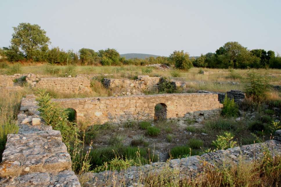
Imotsko Polje () is a polje (karstic field) located on the border of Croatia and Bosnia and Herzegovina Bosnia and Herzegovina ( sh, / , ), abbreviated BiH () or B&H, sometimes called Bosnia–Herzegovina and often known informally as Bosnia, is a country at the crossroads of south and southeast Europe, located in the Balkans. Bosnia and H ... near the city of Imotski. The larger part is in Herzegovina, while the Croatian part is in the inner Dalmatia region, and is the second largest in the country, covering an area of . References {{Dinaric Alps' karst fields Plains of Croatia Geology of Croatia Geology of Bosnia and Herzegovina ... [...More Info...] [...Related Items...] OR: [Wikipedia] [Google] [Baidu] |
Split-Dalmatia County
Split-Dalmatia County ( hr, Splitsko-dalmatinska županija ) is a central-southern Dalmatian county in Croatia. The administrative center is Split. The population of the county is 455,242 (2011). The land area is 14.106,40 km2. Split-Dalmatia County is Croatia's most rapidly urbanising and developing region, as economic opportunities and living standards are among the highest alongside capital Zagreb and Istria County. Physically, the county is divided into three main parts: an elevated hinterland (''Dalmatinska zagora'') with numerous karst fields; a narrow coastal strip with high population density; and the islands. Parts of the Dinaric Alps, including Dinara itself, form the border with Bosnia and Herzegovina while the Kozjak, Mosor and Biokovo mountains separate the coastal strip from the hinterland. Important economic activities include agriculture, manufacturing and fishing, though the most important one is tourism. Split-Dalmatia County is Croatia's biggest county ... [...More Info...] [...Related Items...] OR: [Wikipedia] [Google] [Baidu] |
West Herzegovina
The West Herzegovina Canton ( hr, Županija Zapadnohercegovačka, bs, Zapadnohercegovački kanton) is one of the cantons of the Federation of Bosnia and Herzegovina. The West Herzegovina Canton is in the Herzegovina region in the southwest of Bosnia and Herzegovina. Its seat of government is in Široki Brijeg, while other municipalities within the Canton are Grude, Ljubuški and Posušje. It has 94,898 inhabitants, of whom more than 98% are ethnic Croats. History The majority of the present-day West Herzegovina Canton was part of Zachlumia, the medieval South Slavic principality. In the 15th century it became part of the Duchy of Saint Sava under Stjepan Vukčić Kosača, who proclaimed himself the herzog (duke), thus giving the name for the whole region - Herzegovina. The Ottomans conquered Herzegovina in 1483, when the territory of the West Herzegovina Canton became part of the Sanjak of Herzegovina. In 1833 the Sanjak of Herzegovina became more autonomous under Ali-paša R ... [...More Info...] [...Related Items...] OR: [Wikipedia] [Google] [Baidu] |
Imotski
Imotski (; it, Imoschi; lat, Emotha, later ''Imota'') is a small town on the northern side of the Biokovo massif in the Dalmatian Hinterland of southern Croatia, near the border with Bosnia and Herzegovina. Imotski, like the surrounding inland Dalmatia, has a generally mild Mediterranean climate which makes it a popular tourist destination. Geography The town is located close to the border with Bosnia and Herzegovina, 10 km away from Posušje and 18 km from Grude. It is located 29 km away from the coast (Baška Voda). The nearest coastal town is Makarska, on the other side of the Biokovo massif. The town is located on the crossroad of D60 and D76 state roads and 20 km from the Sveti Ilija Tunnel. The A1 motorway is accessed at the Zagvozd Interchange, next to the D76 expressway. Imotski is known for its medieval fortress on the rocks of Blue Lake. Another phenomenon is the Red Lake which looks like an eye in the scenery. Both lakes are said to be connec ... [...More Info...] [...Related Items...] OR: [Wikipedia] [Google] [Baidu] |
Vrljika
The Vrljika is short sinking river in Croatia and Bosnia and Herzegovina, belonging to Neretva River basin. Its source is located on the outskirts of village Proložac near town of Imotski, Croatia. The Vrljika River is home of endangered endemic ''Softmouth'' trout, also known as Adriatic trout. Rare hydrogeology The Vrljika River is a sinking river, typical of diverse karstic hydrology of Dinaric Alps in Croatia and Bosnia and Herzegovina. Rising from a strong karstic spring, it flows often short stretches before it sinks again. Nine names of the Trebižat River Because the Trebižat (river) disappears and reappears at resurgences various times, the people used to call it different names. Exactly nine names are known (every time it resurfaced, the river got a new name): Vrlika - Matica - Tihaljina - Mlade - Suvaja (Posušje) - Culuša - Ričina - Brina - Trebižat. Endemic and endangered trout Dinaric karst water systems support 25% of the total of 546 fish species ... [...More Info...] [...Related Items...] OR: [Wikipedia] [Google] [Baidu] |
Polje
A polje, also karst polje or karst field, is a large flat plain found in karstic geological regions of the world, with areas usually . The name derives from the Slavic languages and literally means 'field', whereas in English ''polje'' specifically refers to a karst plain or karst field. In geology A polje, in geological terminology, is a large, flat-floored depression within karst limestone, whose long axis develops in parallel with major structural trends and can become several miles (tens of kilometers) long. Superficial deposits tend to accumulate along the floor. Drainage may be either by surface watercourses (as an ''open polje'') or by swallow holes (as a ''closed polje'') or ponors. Usually, the ponors cannot transmit entire flood flows, so many poljes become wet-season lakes. The structure of some poljes is related to the geological structure, but others are purely the result of lateral dissolution and planation. The development of poljes is fostered by any blockage i ... [...More Info...] [...Related Items...] OR: [Wikipedia] [Google] [Baidu] |
Croatia
, image_flag = Flag of Croatia.svg , image_coat = Coat of arms of Croatia.svg , anthem = "Lijepa naša domovino"("Our Beautiful Homeland") , image_map = , map_caption = , capital = Zagreb , coordinates = , largest_city = capital , official_languages = Croatian , languages_type = Writing system , languages = Latin , ethnic_groups = , ethnic_groups_year = 2021 , religion = , religion_year = 2021 , demonym = , government_type = Unitary parliamentary republic , leader_title1 = President , leader_name1 = Zoran Milanović , leader_title2 = Prime Minister , leader_name2 = Andrej Plenković , leader_title3 = Speaker of Parliament , leader_name3 = Gordan Jandroković , legislature = Sabor , sovereignty_type ... [...More Info...] [...Related Items...] OR: [Wikipedia] [Google] [Baidu] |
Bosnia And Herzegovina
Bosnia and Herzegovina ( sh, / , ), abbreviated BiH () or B&H, sometimes called Bosnia–Herzegovina and often known informally as Bosnia, is a country at the crossroads of south and southeast Europe, located in the Balkans. Bosnia and Herzegovina borders Serbia to the east, Montenegro to the southeast, and Croatia to the north and southwest. In the south it has a narrow coast on the Adriatic Sea within the Mediterranean, which is about long and surrounds the town of Neum. Bosnia, which is the inland region of the country, has a moderate continental climate with hot summers and cold, snowy winters. In the central and eastern regions of the country, the geography is mountainous, in the northwest it is moderately hilly, and in the northeast it is predominantly flat. Herzegovina, which is the smaller, southern region of the country, has a Mediterranean climate and is mostly mountainous. Sarajevo is the capital and the largest city of the country followed by Banja Luka, Tu ... [...More Info...] [...Related Items...] OR: [Wikipedia] [Google] [Baidu] |
Herzegovina
Herzegovina ( or ; sh-Latn-Cyrl, Hercegovina, separator=" / ", Херцеговина, ) is the southern and smaller of two main geographical region of Bosnia and Herzegovina, the other being Bosnia. It has never had strictly defined geographical or cultural-historical borders, nor has it ever been defined as an administrative whole in the geopolitical and economic subdivision of Bosnia and Herzegovina. Bosnia, the larger of the two regions, lies to the north of Herzegovina; the Croatian region of Dalmatia lies to the southwest; the Montenegrin region of Old Herzegovina lies to the southeast. The land area of Herzegovina is around , or around 23–24% of the country. The largest city is Mostar, in the center of the region. Other large settlements include Trebinje, Široki Brijeg, Ljubuški, Čapljina, Konjic and Posušje. Etymology The name (or ''Herzegovina'' in English) stems from German (the German term for a duke; sh, vojvoda), and means a land ruled and/or owned ... [...More Info...] [...Related Items...] OR: [Wikipedia] [Google] [Baidu] |
Dalmatia
Dalmatia (; hr, Dalmacija ; it, Dalmazia; see #Name, names in other languages) is one of the four historical region, historical regions of Croatia, alongside Croatia proper, Slavonia, and Istria. Dalmatia is a narrow belt of the east shore of the Adriatic Sea, stretching from the island of Rab in the north to the Bay of Kotor in the south. The Dalmatian Hinterland ranges in width from fifty kilometres in the north, to just a few kilometres in the south; it is mostly covered by the rugged Dinaric Alps. List of islands of Croatia, Seventy-nine islands (and about 500 islets) run parallel to the coast, the largest (in Dalmatia) being Brač, Pag (island), Pag, and Hvar. The largest city is Split, Croatia, Split, followed by Zadar and Šibenik. The name of the region stems from an Illyrians, Illyrian tribe called the Dalmatae, who lived in the area in classical antiquity. Later it became a Dalmatia (Roman province), Roman province, and as result a Romance languages, Romance culture ... [...More Info...] [...Related Items...] OR: [Wikipedia] [Google] [Baidu] |
Plains Of Croatia
In geography, a plain is a flat expanse of land that generally does not change much in elevation, and is primarily treeless. Plains occur as lowlands along valleys or at the base of mountains, as coastal plains, and as plateaus or uplands. In a valley, a plain is enclosed on two sides, but in other cases a plain may be delineated by a complete or partial ring of hills, by mountains, or by cliffs. Where a geological region contains more than one plain, they may be connected by a pass (sometimes termed a gap). Coastal plains mostly rise from sea level until they run into elevated features such as mountains or plateaus. Plains are one of the major landforms on earth, where they are present on all continents, and cover more than one-third of the world's land area. Plains can be formed from flowing lava; from deposition of sediment by water, ice, or wind; or formed by erosion by the agents from hills and mountains. Biomes on plains include grassland (temperate or subtropical), ste ... [...More Info...] [...Related Items...] OR: [Wikipedia] [Google] [Baidu] |
Geology Of Croatia
The geology of Croatia has some Precambrian rocks mostly covered by younger sedimentary rocks and deformed or superimposed by tectonic activity. The country is split into two main onshore provinces, a smaller part of the Pannonian Basin and the larger Dinarides. These areas are very different. The carbonate platform karst landscape of Croatia helped to create the weathering conditions to form bauxite, gypsum, clay, spilite, and limestone. Geography The territory covers , consisting of of land and of water. Elevation ranges from the mountains of the Dinaric Alps with the highest point of the Dinara peak at near the border with Bosnia and Herzegovina in the south to the shore of the Adriatic Sea which makes up its entire southwest border. Insular Croatia consists of over a thousand islands and islets varying in size, 48 of which permanently inhabited. The largest islands are Cres and Krk, each of them having an area of around . Karst topography makes up about half of Croat ... [...More Info...] [...Related Items...] OR: [Wikipedia] [Google] [Baidu] |


